| NAD83 COORDINATES (1986 adj.): |
|---|
| X= 577246.377 Y= 149622.956 Z= 000.00 LSQ 12/06/1991 S FIX |
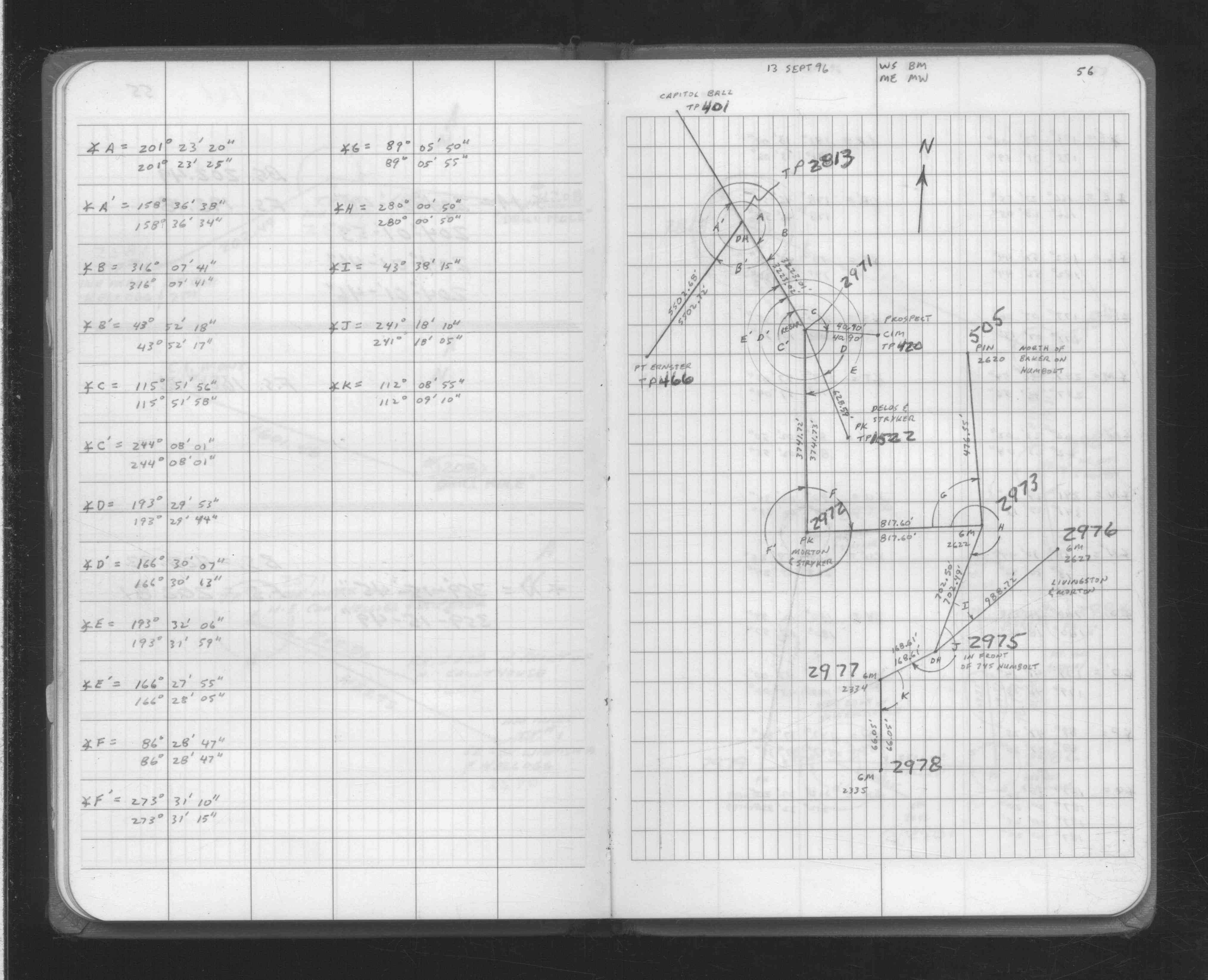
| 9/13/1996 | Recovered pin. See FB 1708A p.56 |
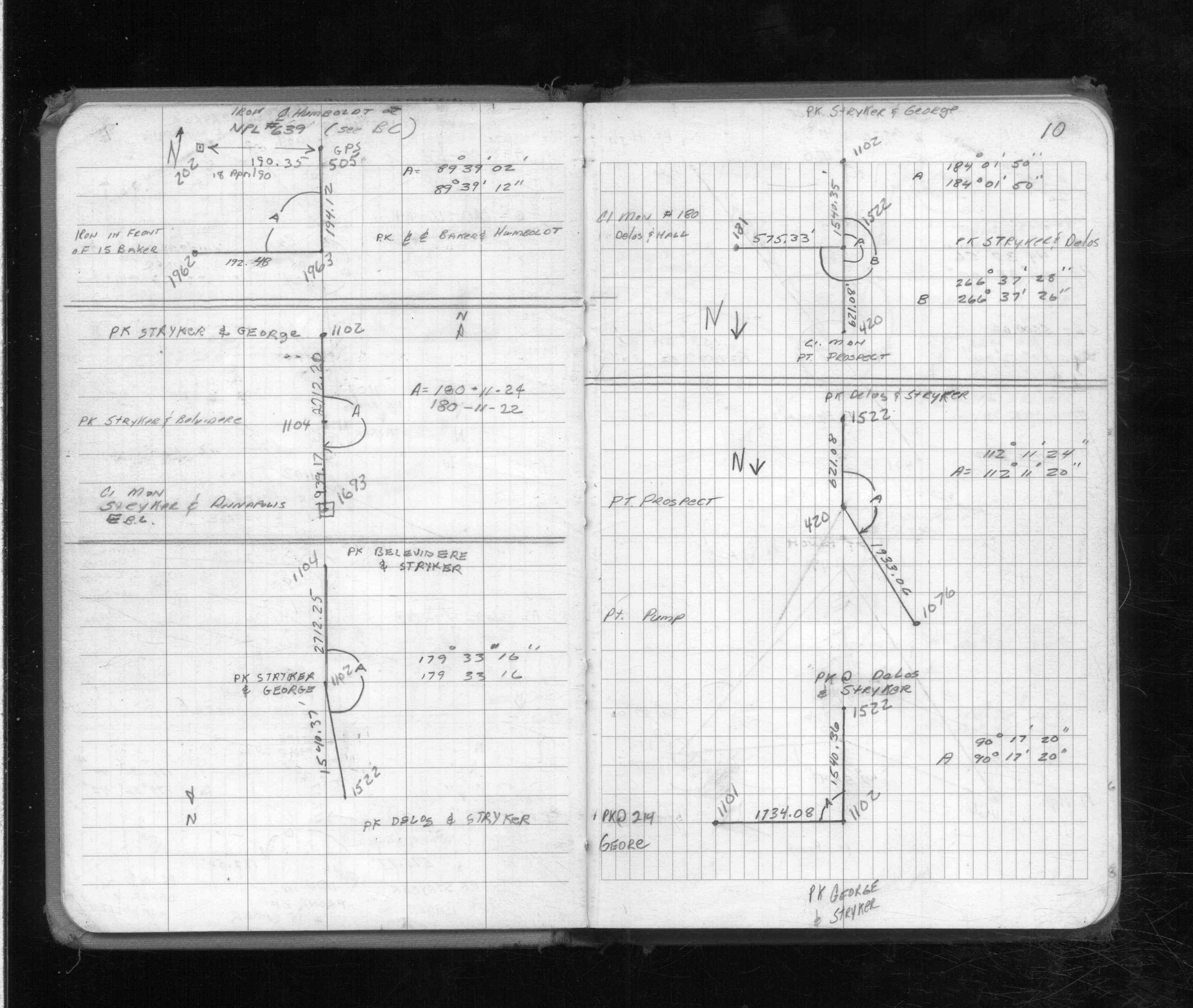
| 4/18/1990 | Recovered iron. See FB 1713 p.10 |
| 3/16/1989 | Located iron by traverse (single stub). See FB 1713 p.10 |
| 1/1/1989 | (Unknown date ___ __,1989 ) Historic, one time only GPS survey = S653 |
| 12/1/1977 | (Unknown date Dec __, 1977 ) Placed ties. See CS 3934 p.7 |
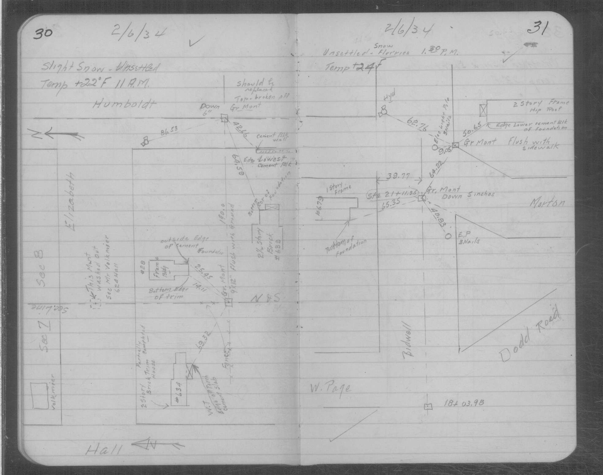
| 2/6/1934 | Placed ties on GM six inches below surface, top broken off. See MSX 1 p.30-31 |
| 11/28/1892 | Monument set by J B Irvine |
Above is NOT an all inclusive history of this point. Please review all the links below.
| PLS NOTES | Field | Cross Section | Sewer | J.B. Irvine | Monument | River Survey |
|---|---|---|---|---|---|---|
| FB 1708Ap.56 | CS 3934p. 05 ,07 | MSX 0001 p.030-031 | ||||
| FB 1713p.10 | CS 3934p.07 | |||||
| FB 1713p.10 |