| NAD83 COORDINATES (1986 adj.): |
|---|
| X= 546779.265 Y= 167912.725 Z= 000.00 LSQ 12/06/1991 S FLT |
| NAD83 COORDINATES (1996 adj.): |
|---|
| X= 546778.9016 Y= 167913.4547 Z= 888.069 2/28/2008 MnDot |
| 3/11/2008 | Position on GM established by GPS RTK-VRS. base line with total station measurements. See FB |
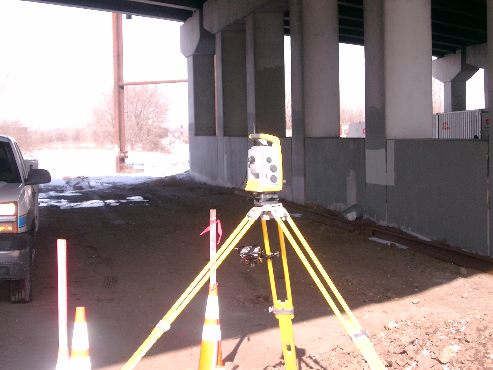
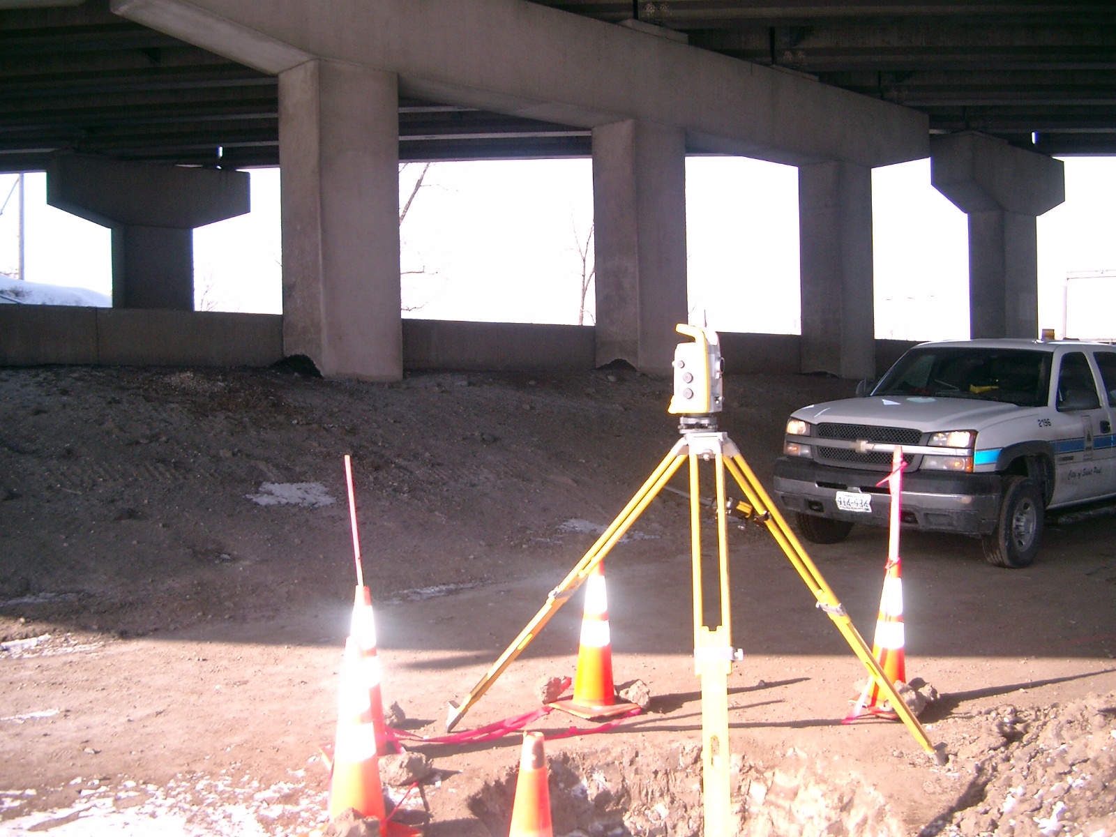
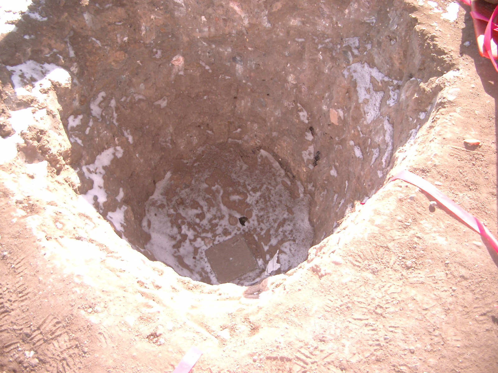
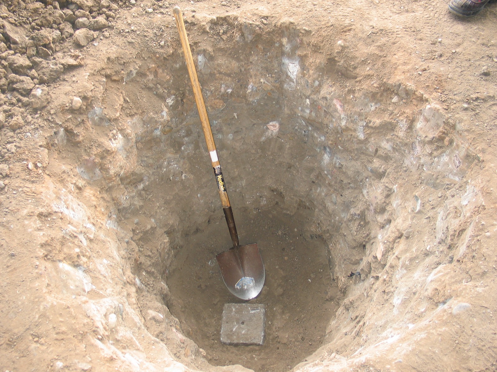
| 3/6/2008 | Fd GM aprox. 4.0 ft below grade. Photos taken. |
| 2/28/2008 | MnDot Fd STONE MONT. under Hwy 280 bridge. GPS taken and ties placed. See tie sheet 0658-__fk-A |
| 2/6/2008 | Found a GM 4' below grade, placed magnet in center hole and placed ties. See 0658-__fk-B. |
| 1/1/1980 | (Unknown date ___ __, 198? ) Placed ties on iron. See FB 1689B p.13 |
| 1/1/1970 | (Unknown date ___ __, 197? ) Placed ties on iron. See FB 1634A p.66 |
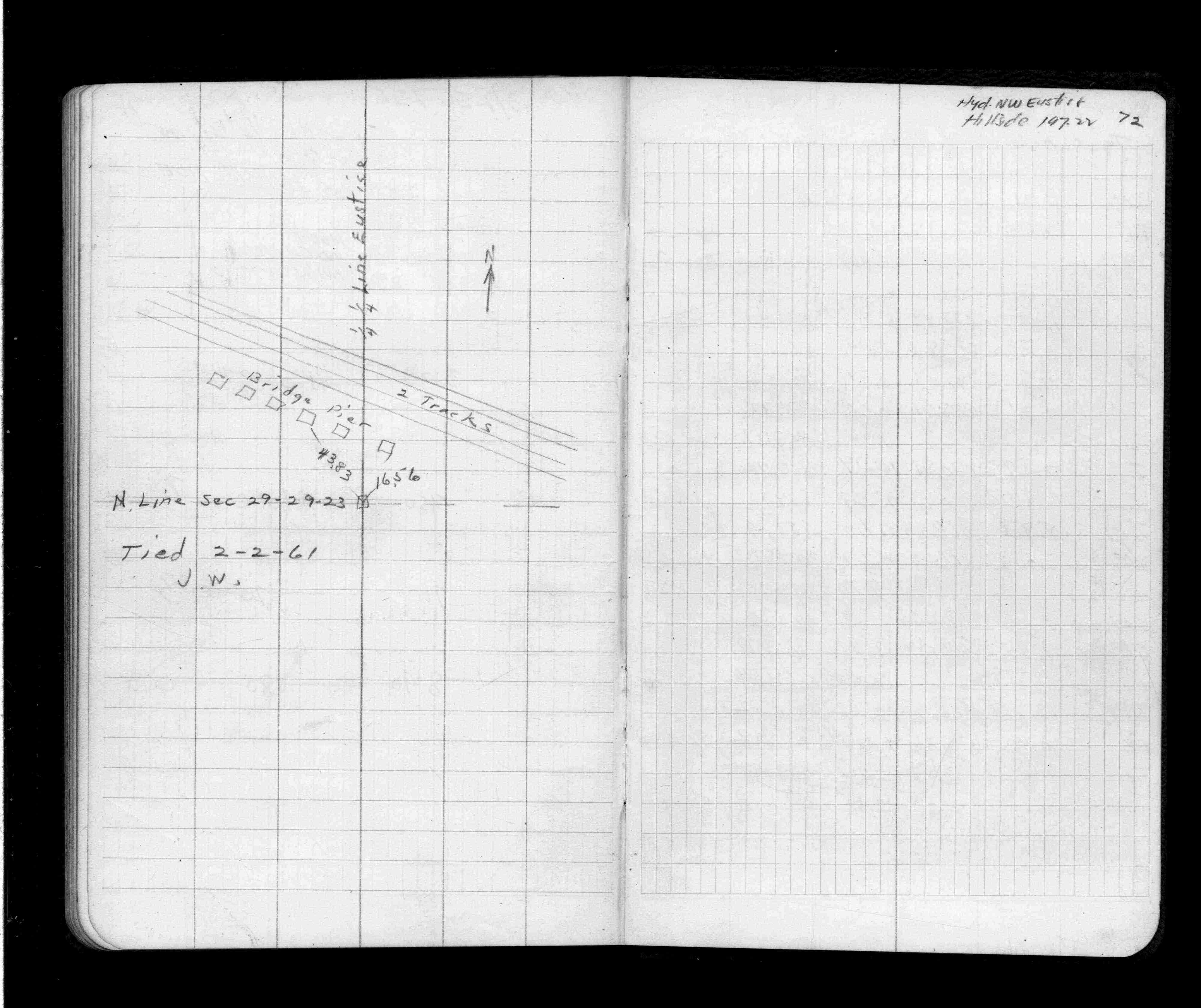
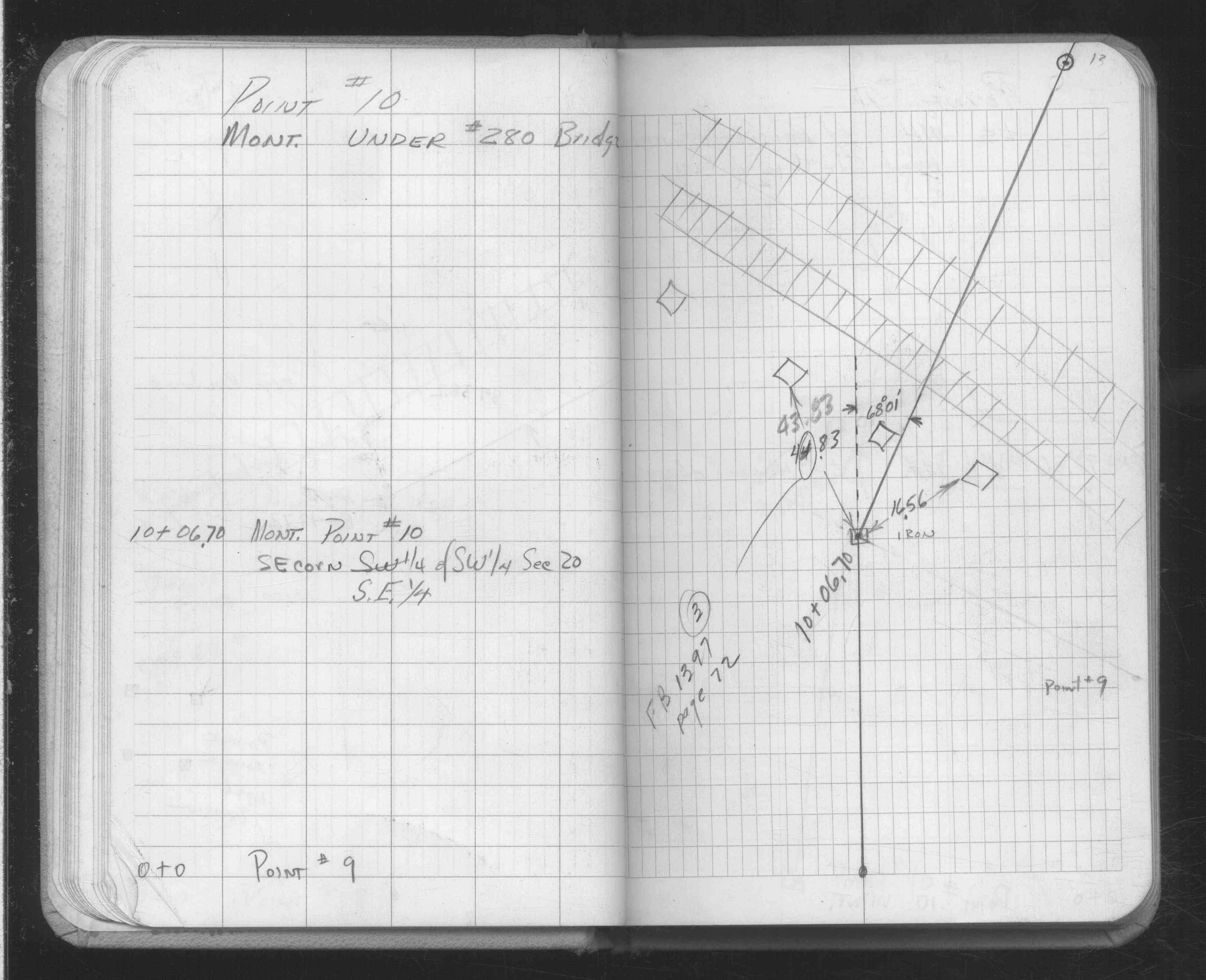
| 2/2/1961 | Placed ties. See FB 1397 p.72 |
| 1/1/1800 | (Unknown date ___ __, ____ ) Placed ties on iron. See SB 601 p.12 |
Above is NOT an all inclusive history of this point. Please review all the links below.
| PLS NOTES | Field | Cross Section | Sewer | J.B. Irvine | Monument | River Survey |
|---|---|---|---|---|---|---|
| FB 1397p.72 | SB 0601p.12 | |||||
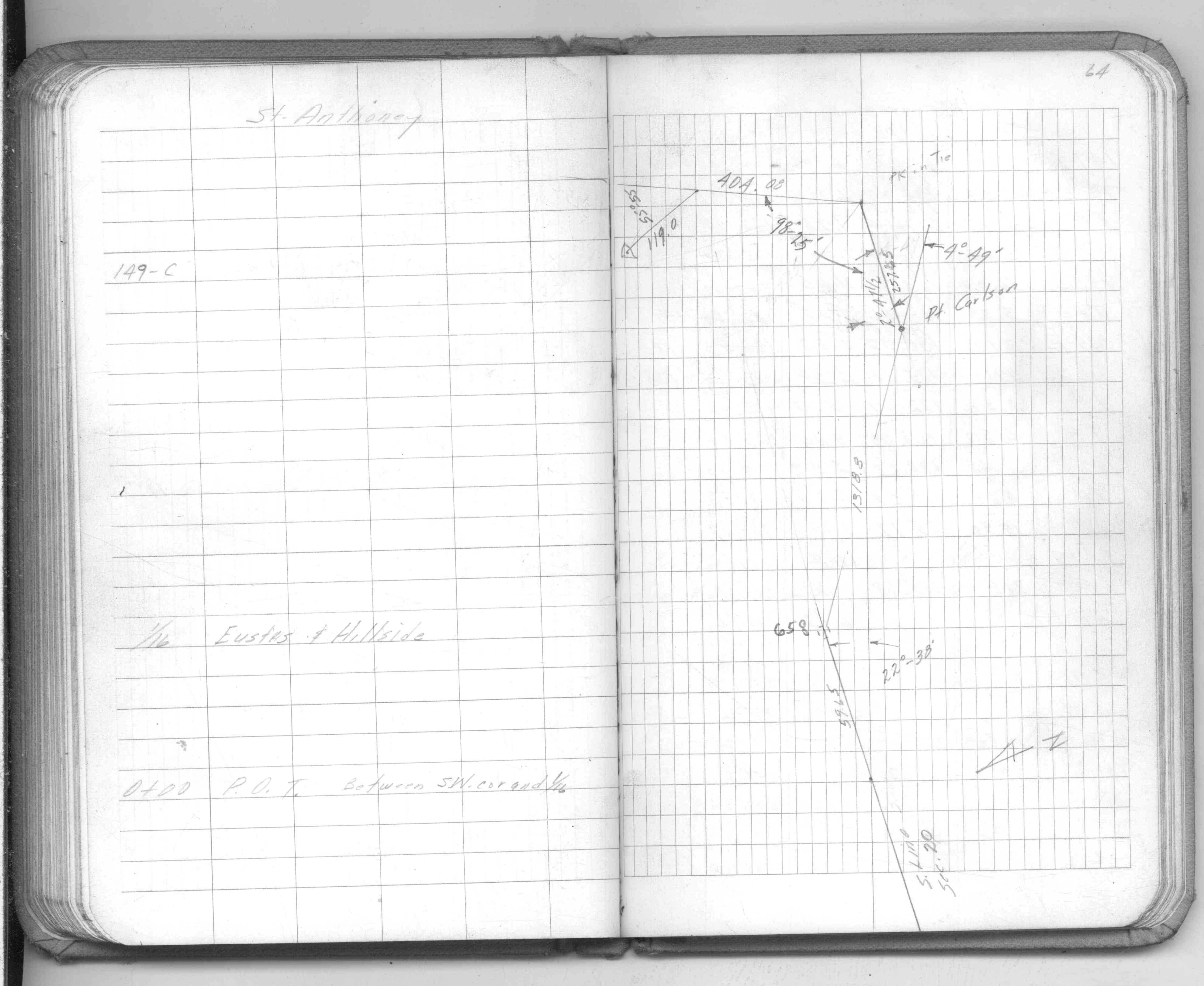
| FB 1549Ep.64 | SB 0601p.12 | |||||
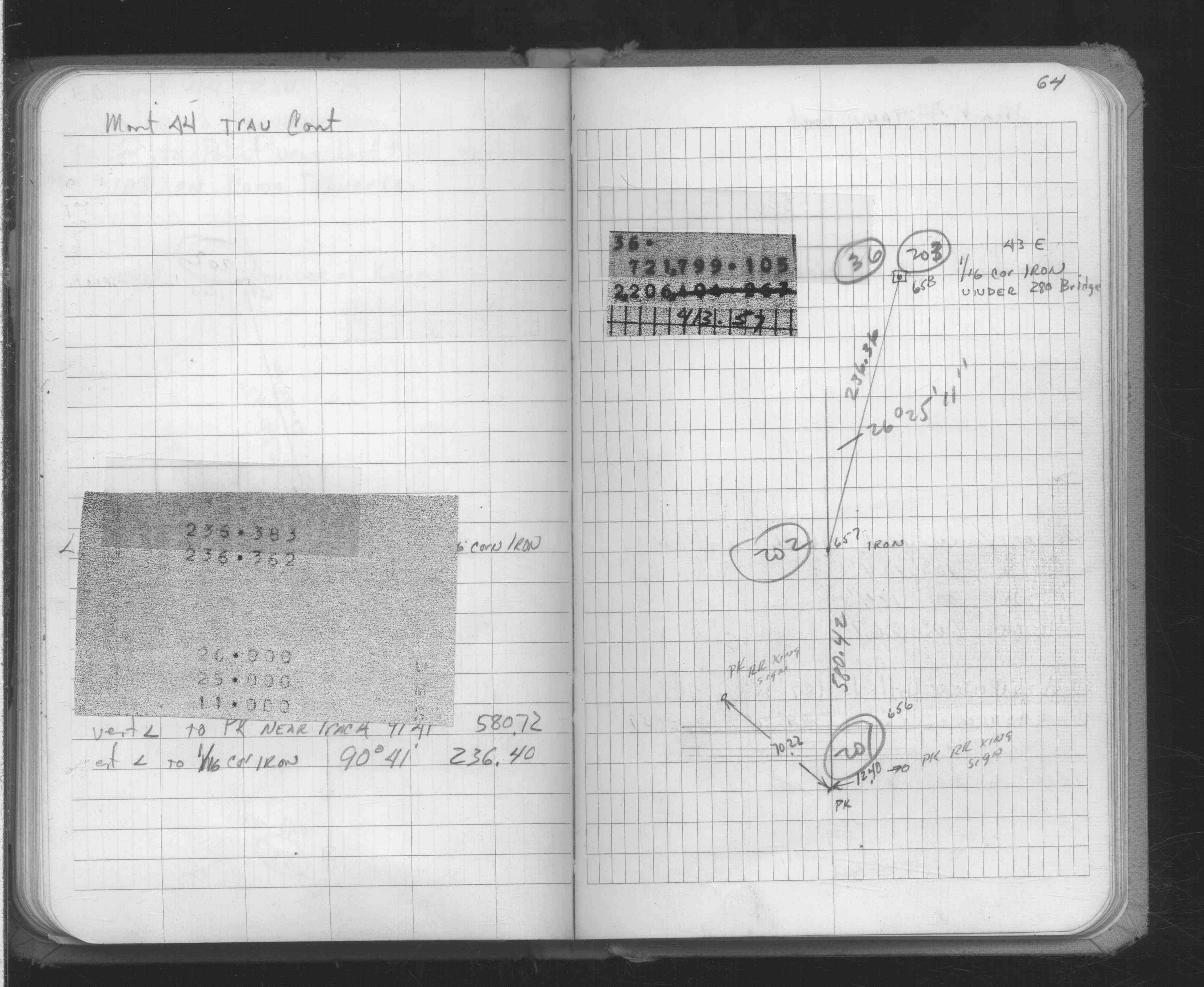
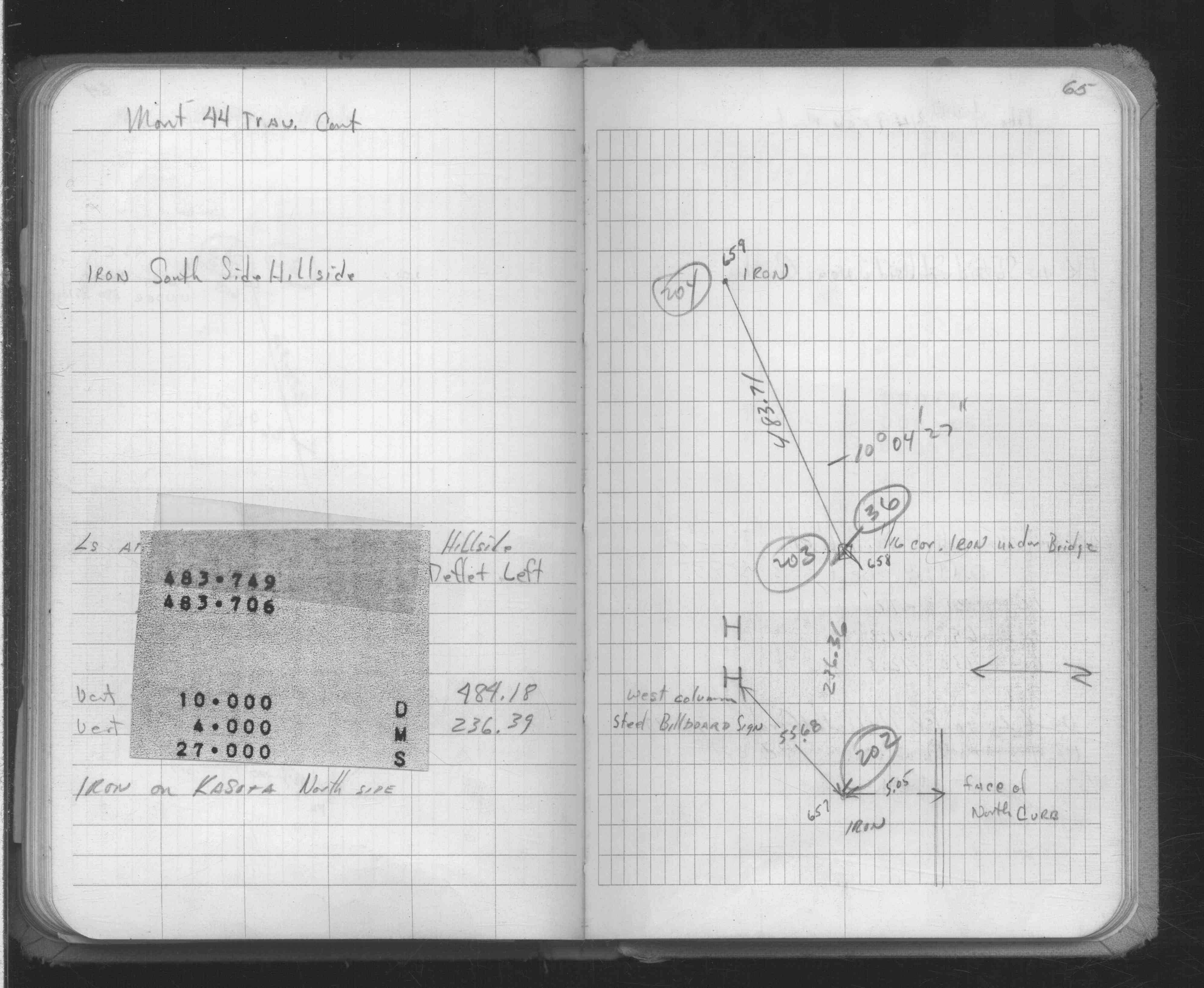
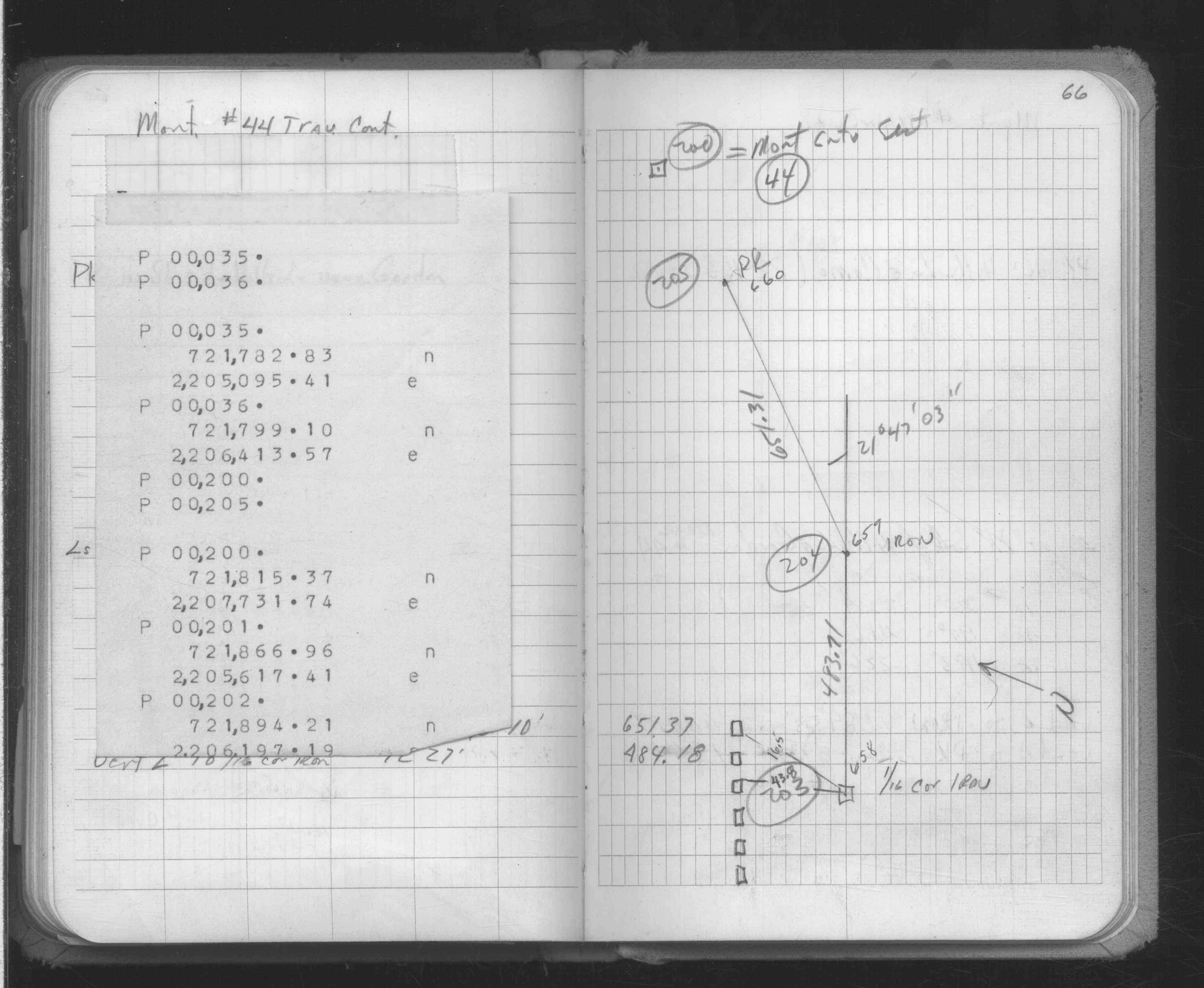
| FB 1634Ap. 64 ,65 ,66 | ||||||
| FB 1634Ap.66 | ||||||
| FB 1689Bp.13 |
| FILE | SURVEYOR | LIC. NO. | DATE SIGNED | DATE TIED |
|---|---|---|---|---|
| 0658-__fk-A.pdf | MnDOT | none | February 28, 2008 | February 28, 2008 |
| 0658-__fk-B.pdf | Samuel D. Gibson | 44880 | June 5, 2008 | February 6, 2008 |
| FILE | PHOTO DATE | COMMENTS |
|---|---|---|
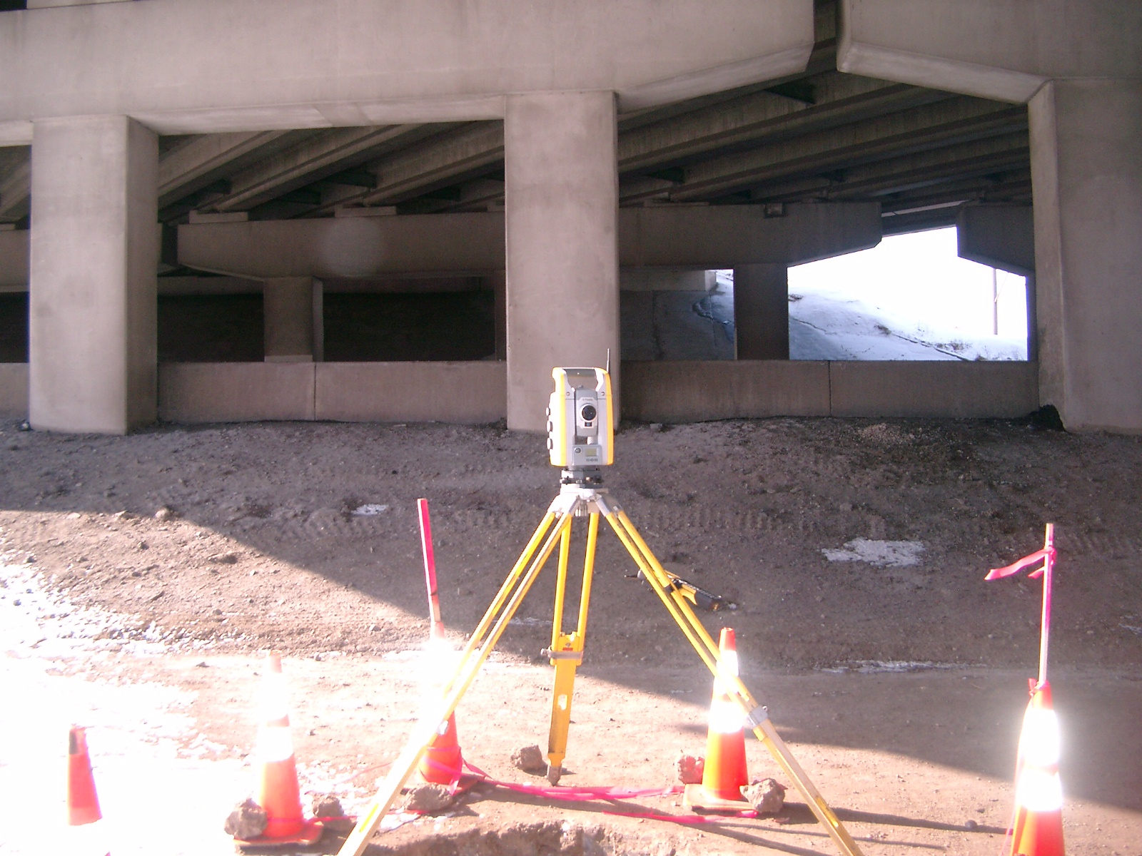
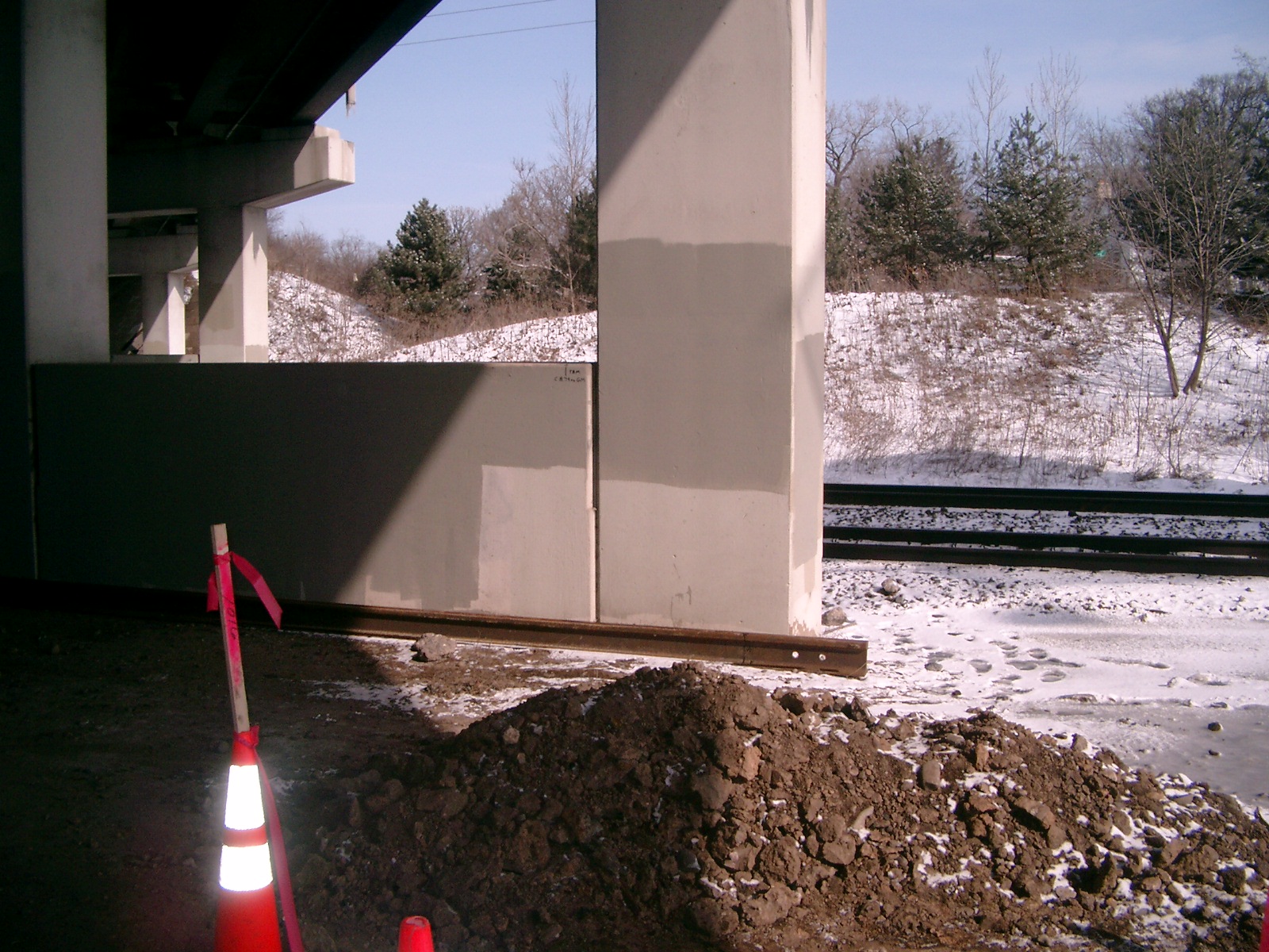
| 0658-__fk-9.jpg | March 6, 2008 | Looking Northwest under Hwy. 280 bridge. |
| 0658-__fk-8.jpg | March 6, 2008 | Looking West under Hwy. 280 bridge towards Energy Park Drive. |
| 0658-__fk-7.jpg | March 6, 2008 | Looking Southwest under Hwy. 280 bridge towards Energy Park Drive. |
| 0658-__fk-6.jpg | March 6, 2008 | Looking South under Hwy. 280 bridge towards Energy Park Drive. |
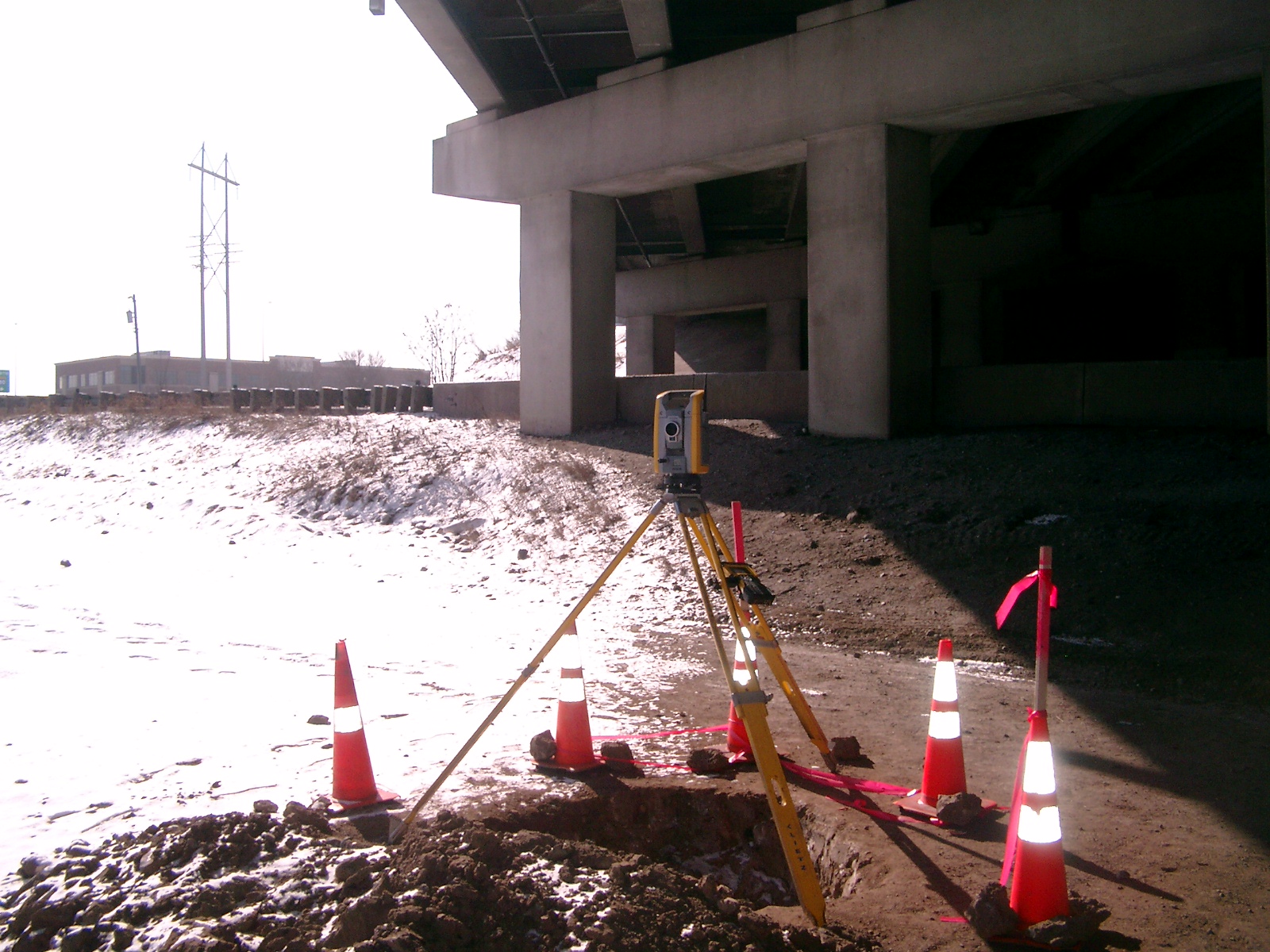
| 0658-__fk-5.jpg | March 6, 2008 | Looking Southeast between tracks and Energy Park Drive. |
| 0658-__fk-4.jpg | March 6, 2008 | Looking East along tracks. |
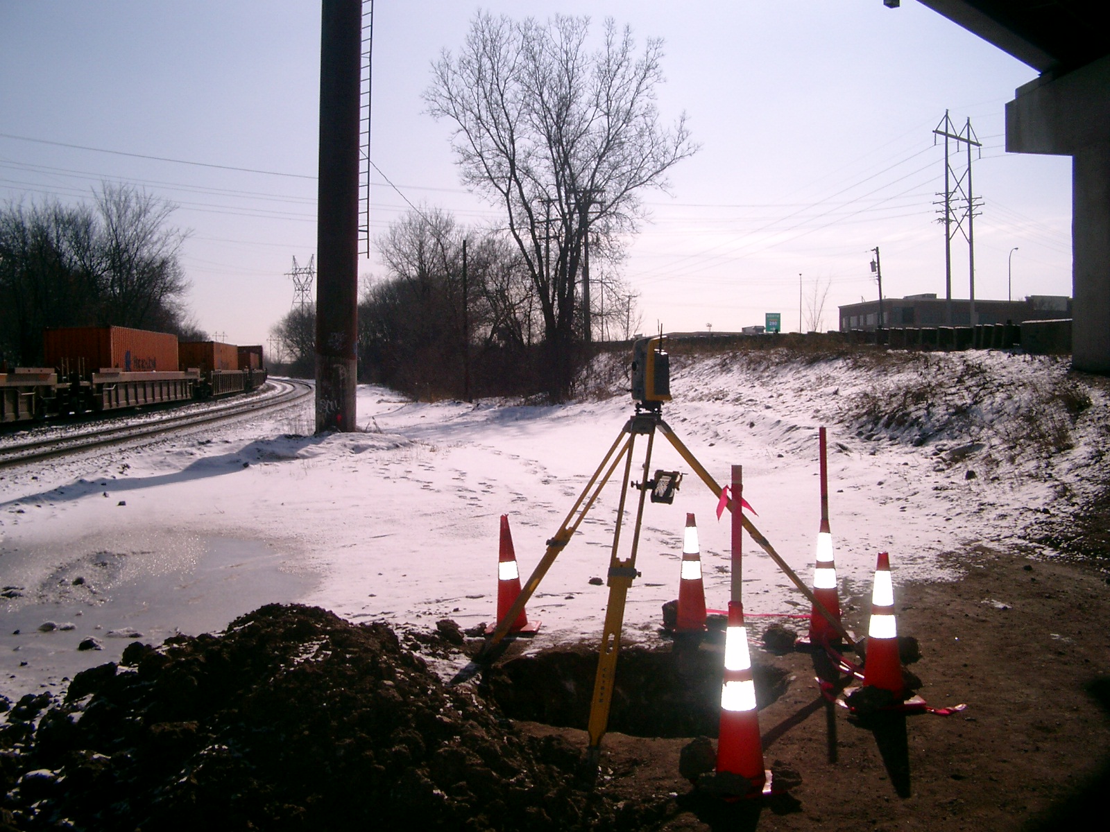
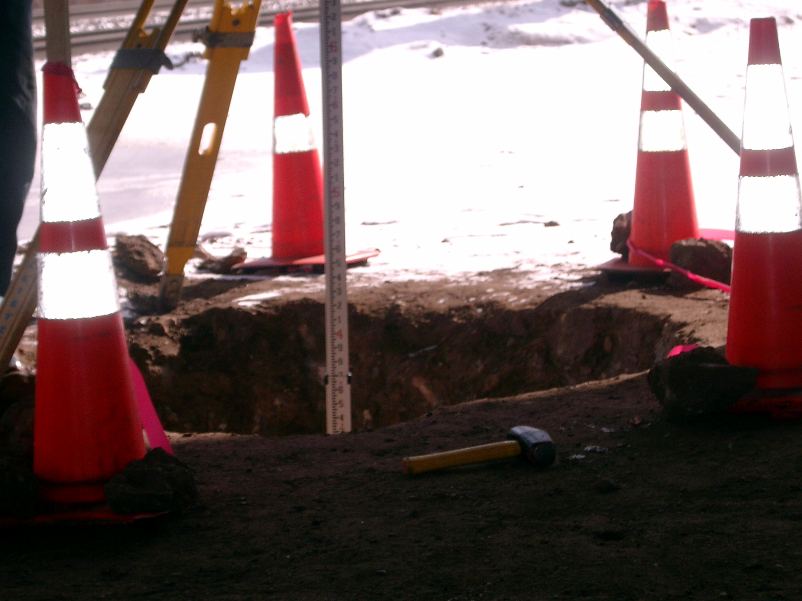
| 0658-__fk-3.jpg | March 6, 2008 | Looking Northerly from GM/hole; note tie on wall. |
| 0658-__fk-2.jpg | March 6, 2008 | Close-up of hole with elevation rod in it. |
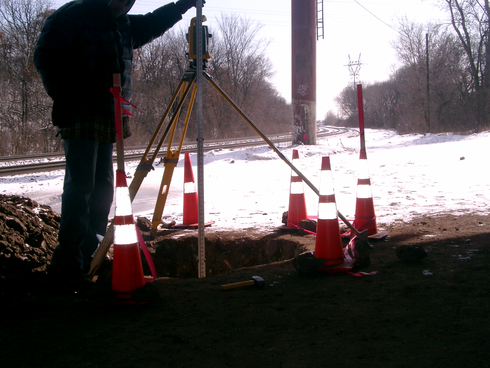
| 0658-__fk-1.jpg | March 6, 2008 | Close-up of GM in hole aprx. 4' below existing grade along tracks. |
| 0658-__fk-10.jpg | February 28, 2008 | Close up of monument. |