| NAD83 COORDINATES (1986 adj.): |
|---|
| X= 593968.853 Y= 168171.363 Z= 000.00 LSQ 12/06/1991 S FLT |
| 9/18/2012 | Ties placed on iron pin using steel tape. |
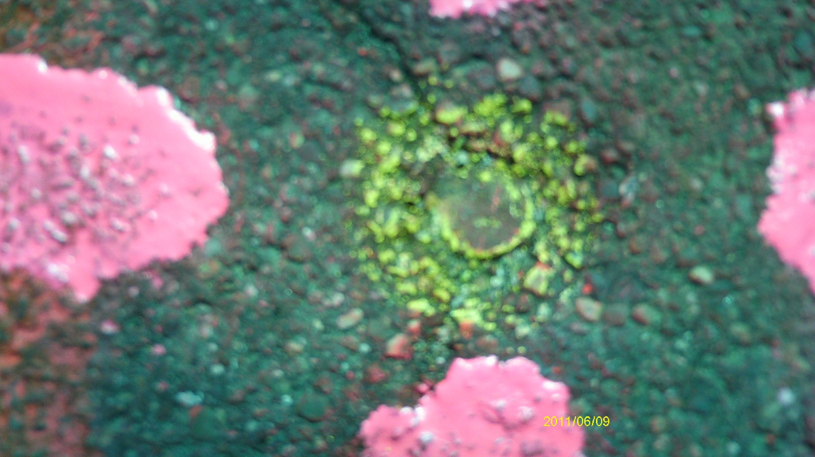
| 6/17/2011 | Found iron pin at grade. Photos taken. |
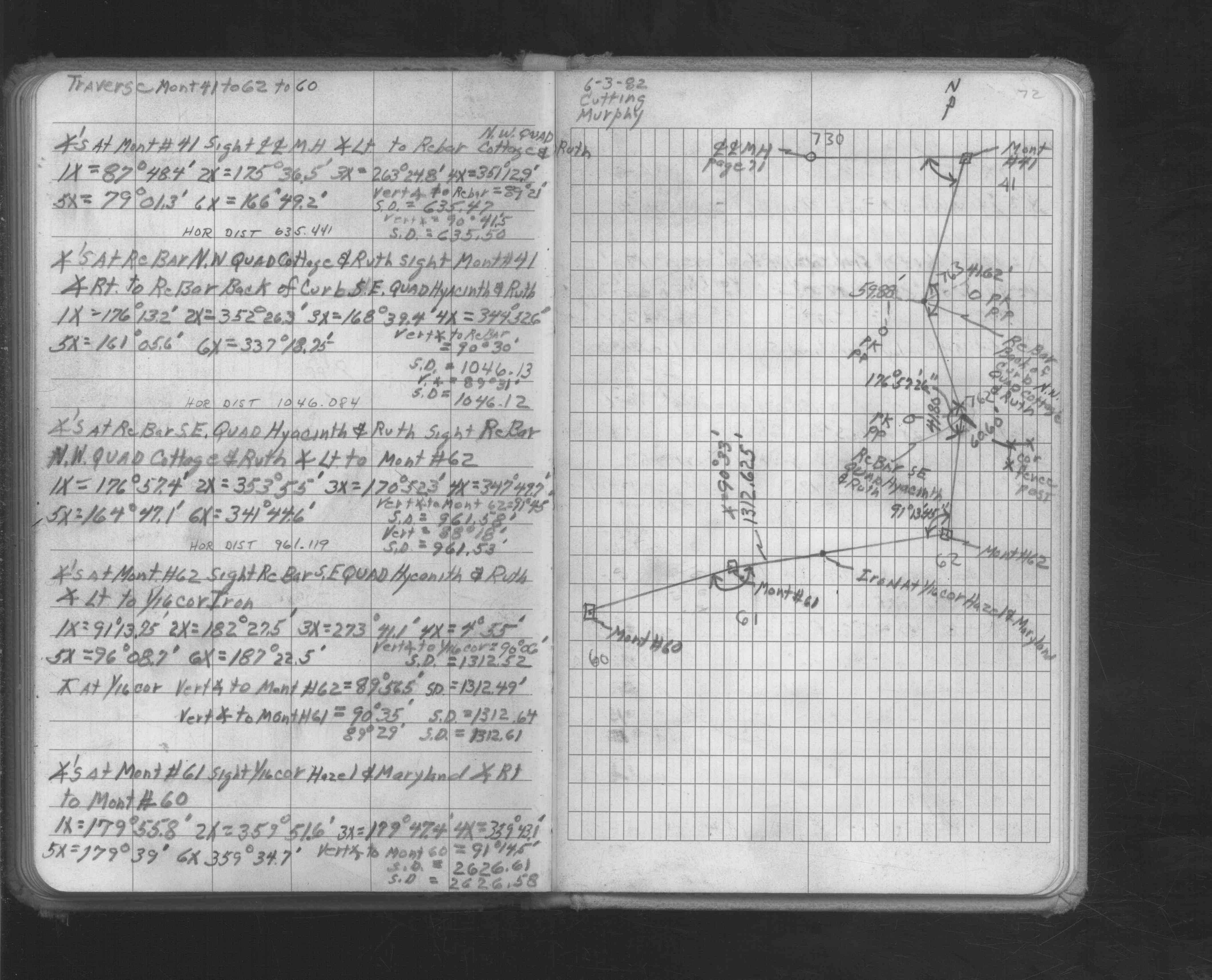
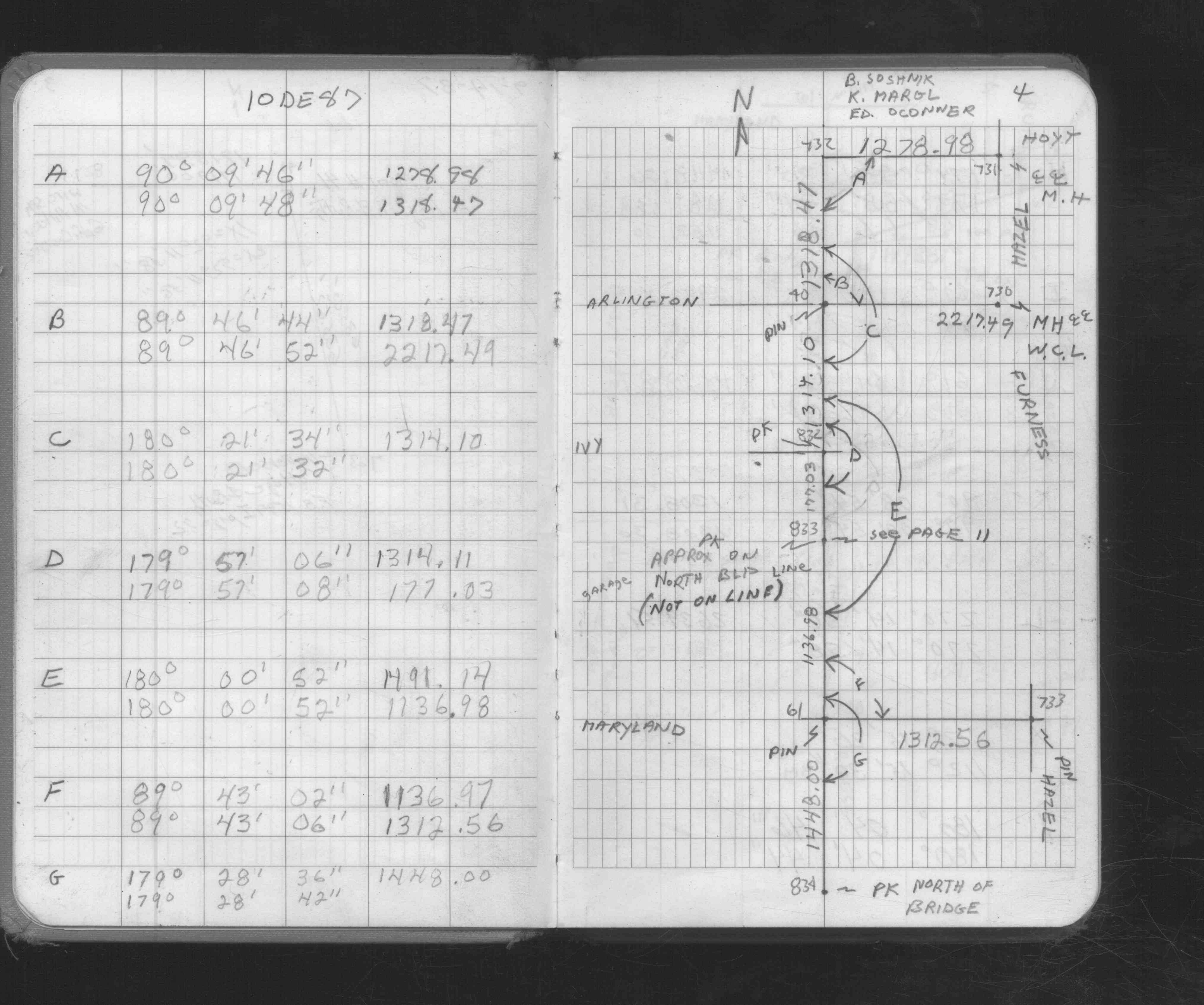
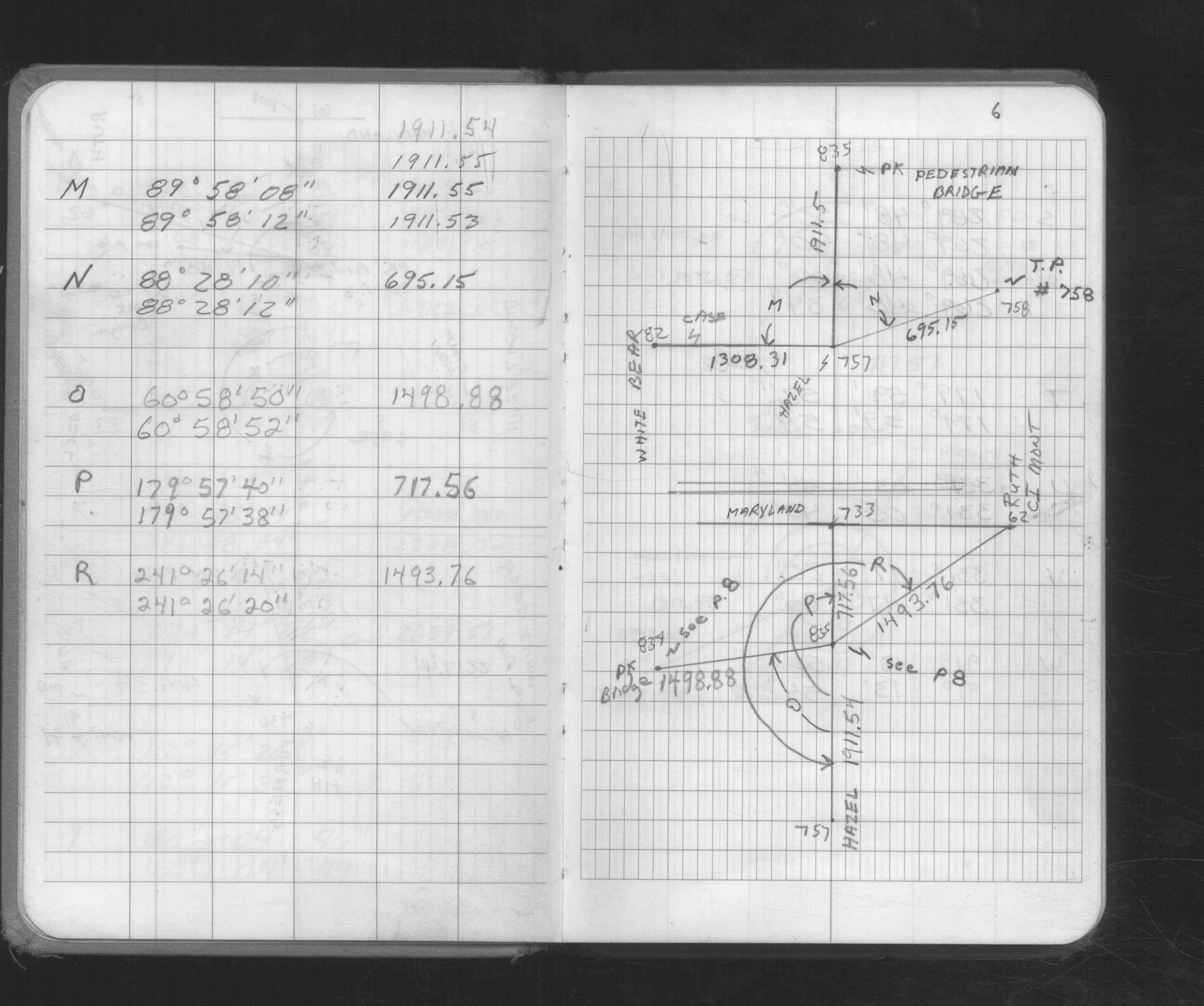
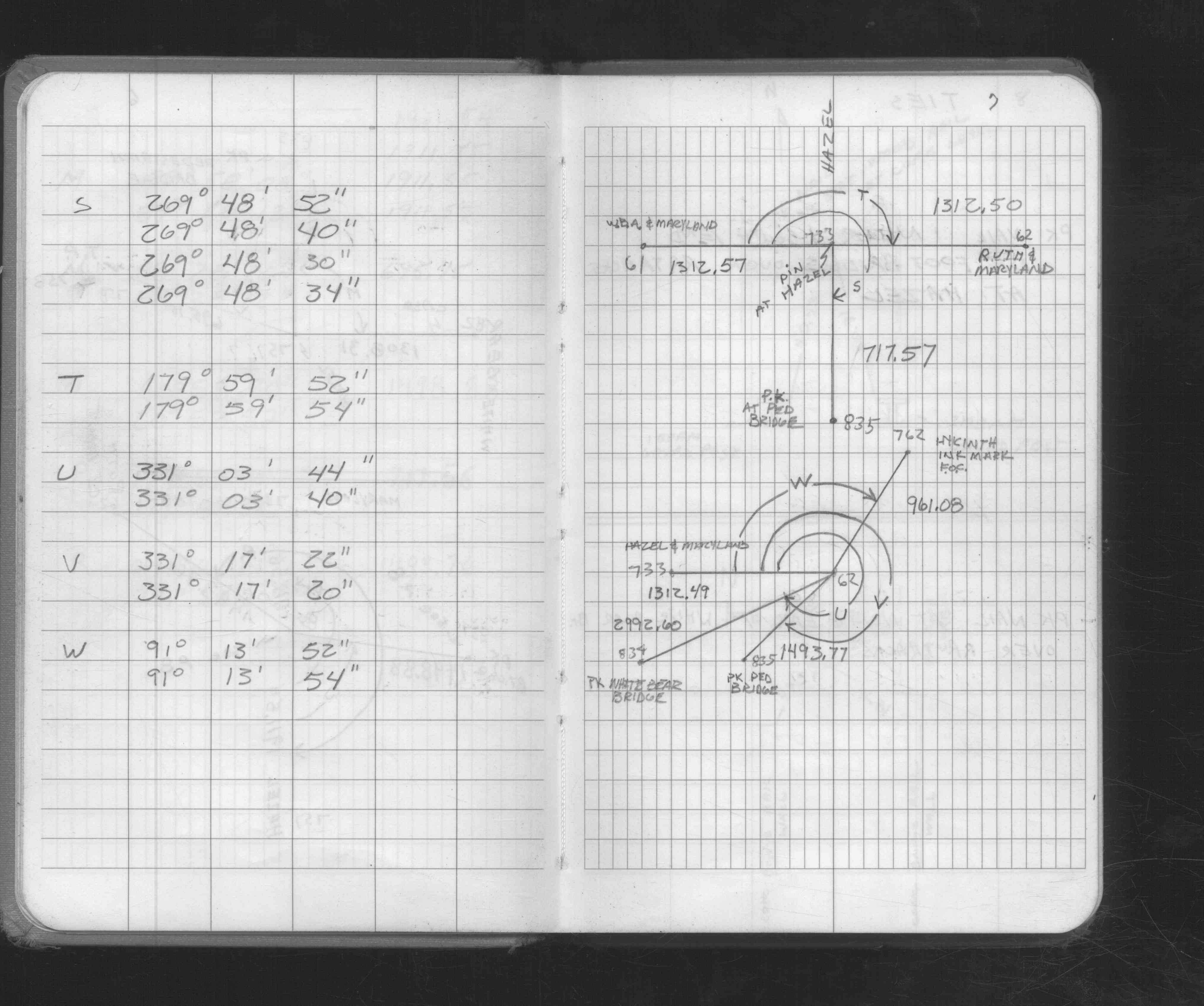
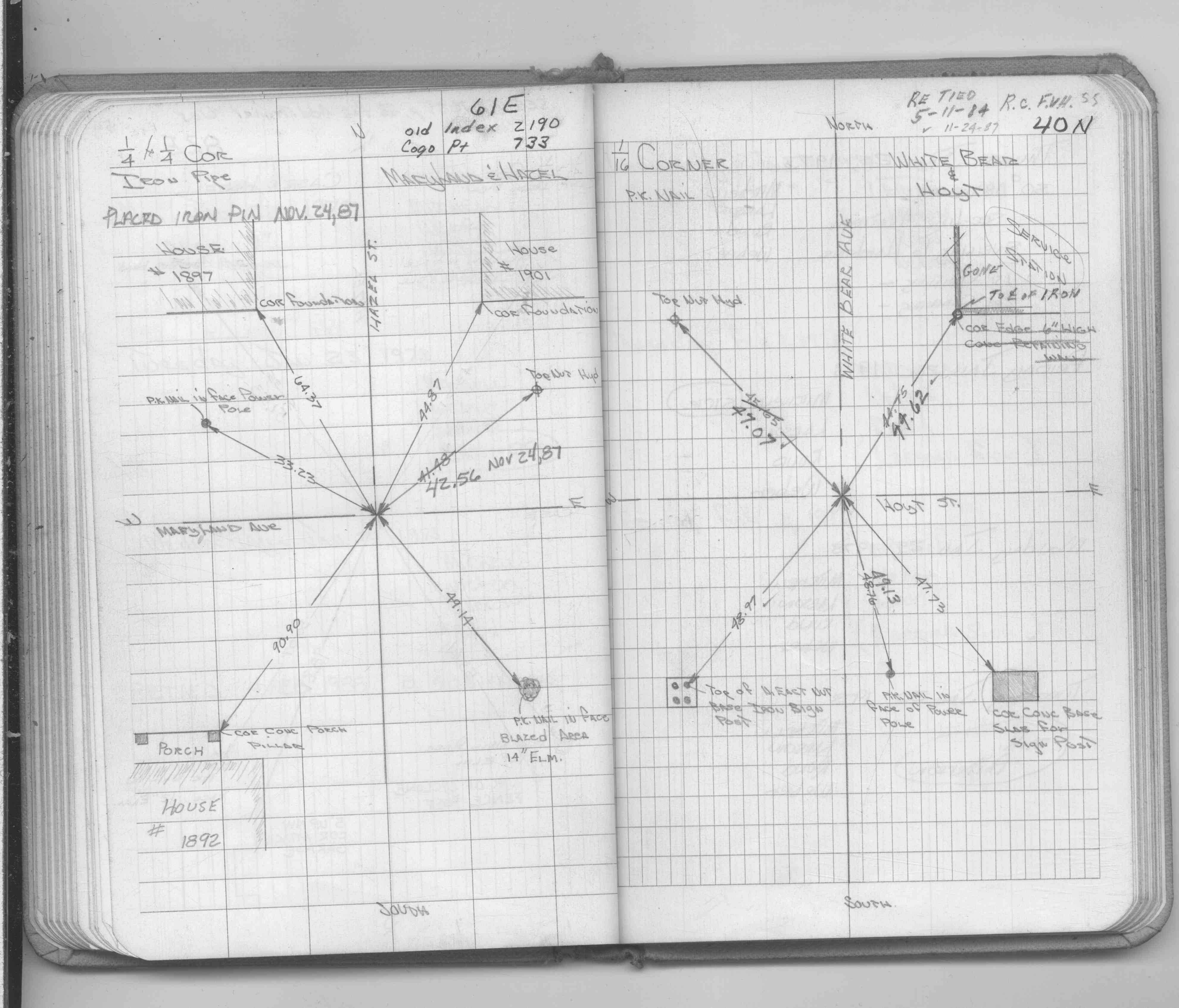
| 11/24/1987 | Set iron pin, placed ties. See FB 1689A p.55 |
| 11/24/1987 | Set iron pin, placed ties. See CofL 0733-2190-A, copied from FB 1689A p.55 |
| 11/1/1890 | (Unknown date Nov __, 1890 ) Monument set by J H Armstrong |
Above is NOT an all inclusive history of this point. Please review all the links below.
| PLS NOTES | Field | Cross Section | Sewer | J.B. Irvine | Monument | River Survey |
|---|---|---|---|---|---|---|
| FB 1549Ip.72 | ||||||
| FB 1676Cp. 04 ,06 ,07 | ||||||
| FB 1689Ap.55 |
| FILE | SURVEYOR | LIC. NO. | DATE SIGNED | DATE TIED |
|---|---|---|---|---|
| 0733-2190-B.pdf | Samuel D. Gibson | 44880 | December 24, 2012 | September 18, 2012 |
| 0733-2190-A.tif | none | none | none | November 24, 1987 |
| FILE | PHOTO DATE | COMMENTS |
|---|---|---|
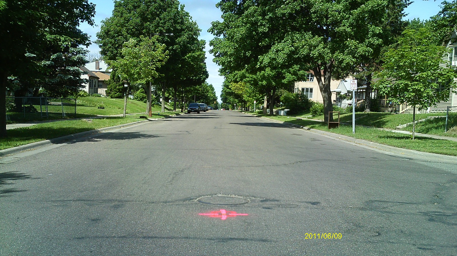
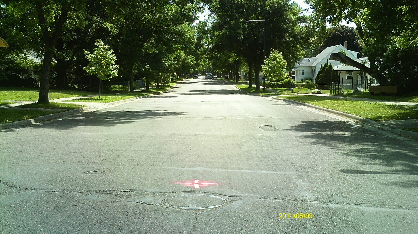
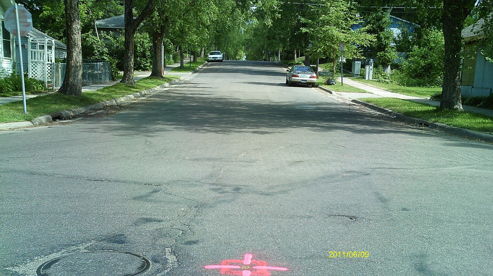
| 0733-2190-5.jpg | June 17, 2011 | Looking west along Maryland Ave. |
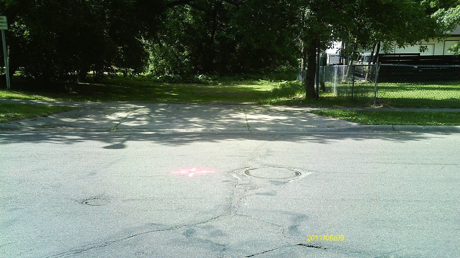
| 0733-2190-4.jpg | June 17, 2011 | Looking south along Hazel St. |
| 0733-2190-3.jpg | June 17, 2011 | Looking east along Maryland Ave. |
| 0733-2190-2.jpg | June 17, 2011 | Looking north along Hazel St. |
| 0733-2190-1.jpg | June 17, 2011 | Close up of iron pin. |