| NAD83 COORDINATES (1986 adj.): |
|---|
| X= 590035.409 Y= 164219.514 Z= 000.00 UAJ 01/20/1994 DBL |
| X= 590035.311 Y= 164219.444 Z= 908.993 5/16/2012 RTK-VRS |
| 5/16/2012 | Position on concrete monument established using RTK-VRS GPS. Elev 214.89 ft. EDM ties placed using Trimble S6. |
| 5/4/2012 | Found concrete monument at street grade. Photos taken. |
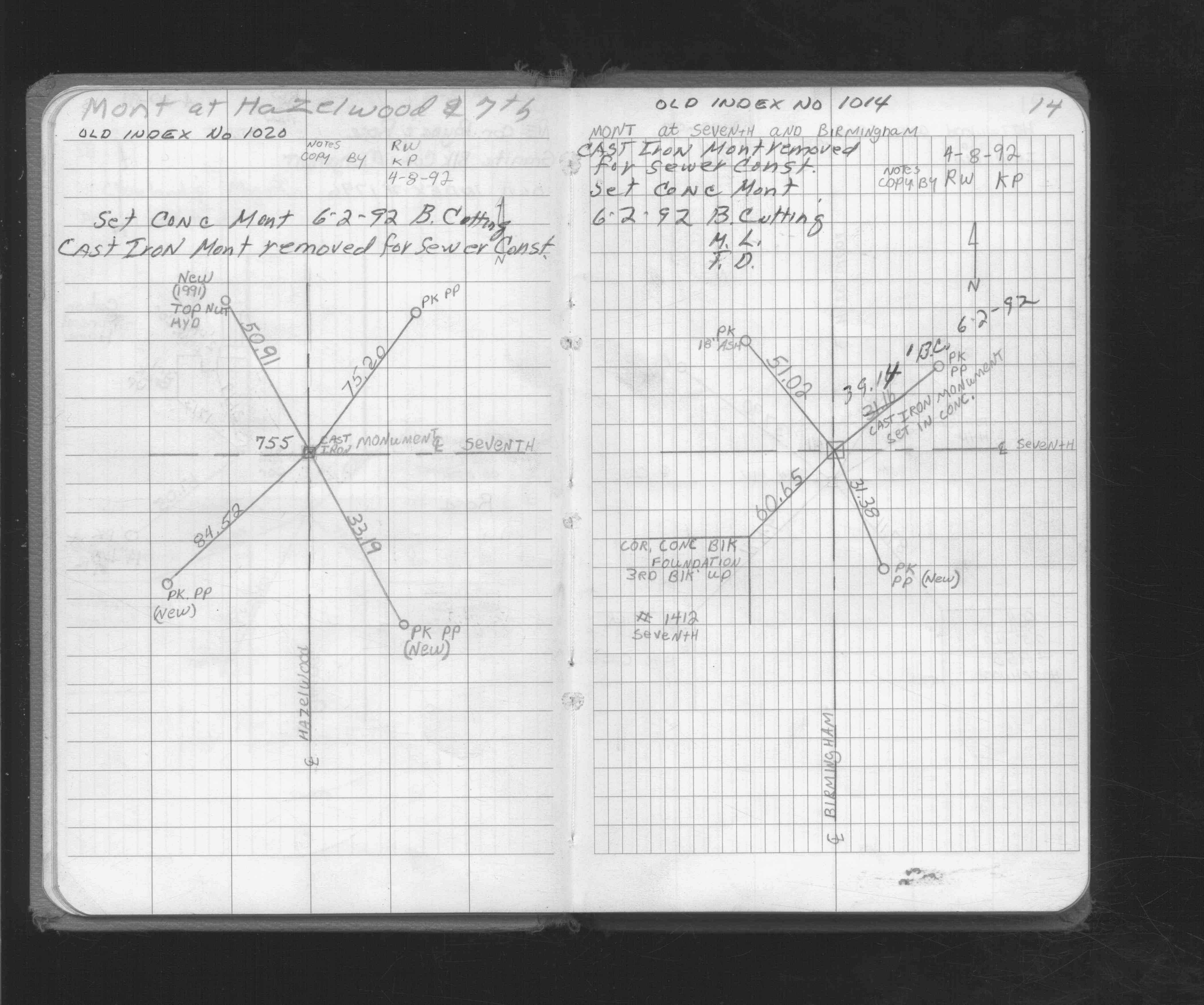
| 6/2/1992 | CIM removed for sewer, set concrete monument. See FB 1716 p.14 |
| 4/8/1992 | Found CIM, placed ties. See FB 1716 p.14 |
| 1/28/1889 | Monument reset by Chas Hunt after grading |
Above is NOT an all inclusive history of this point. Please review all the links below.
| PLS NOTES | Field | Cross Section | Sewer | J.B. Irvine | Monument | River Survey |
|---|---|---|---|---|---|---|
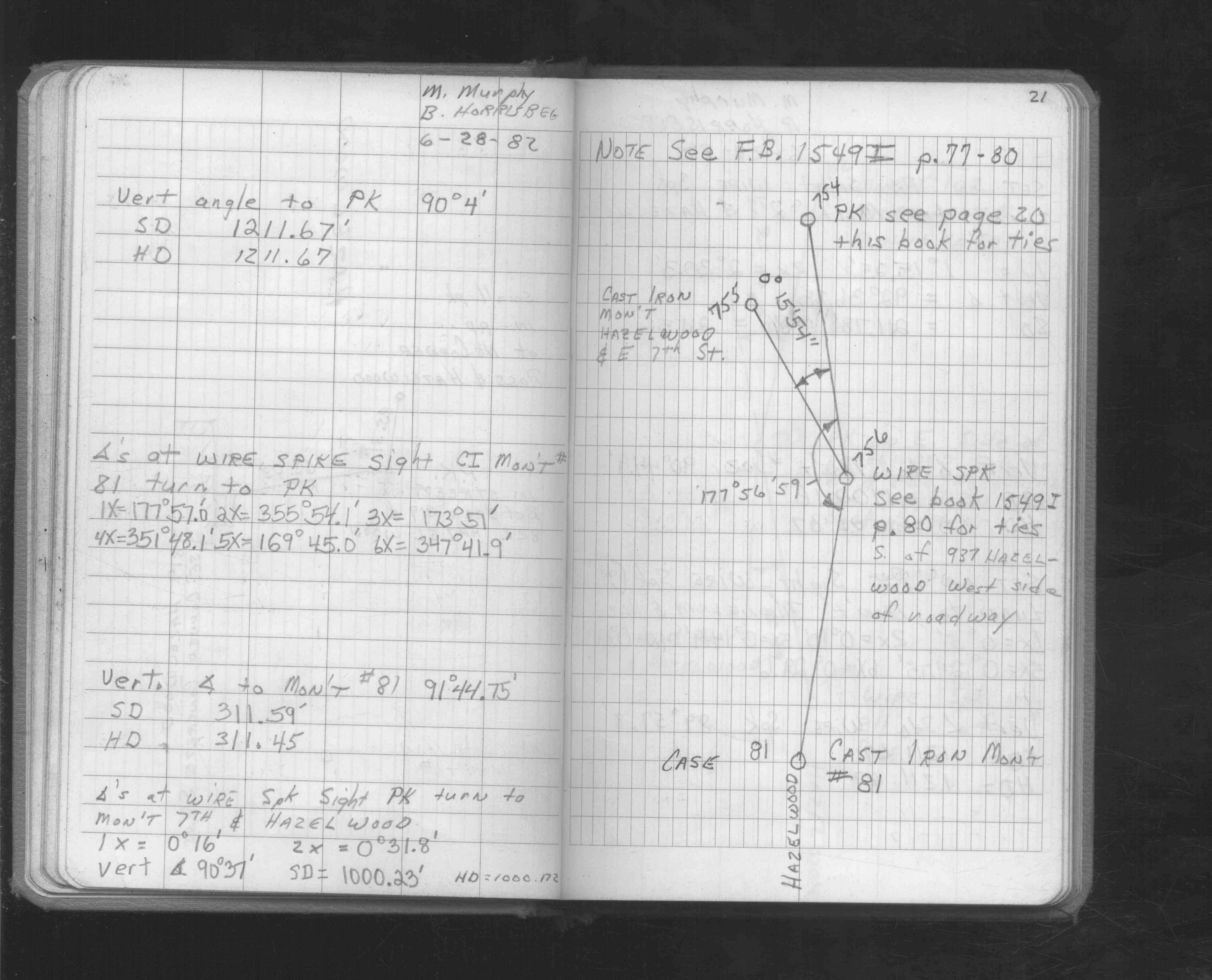
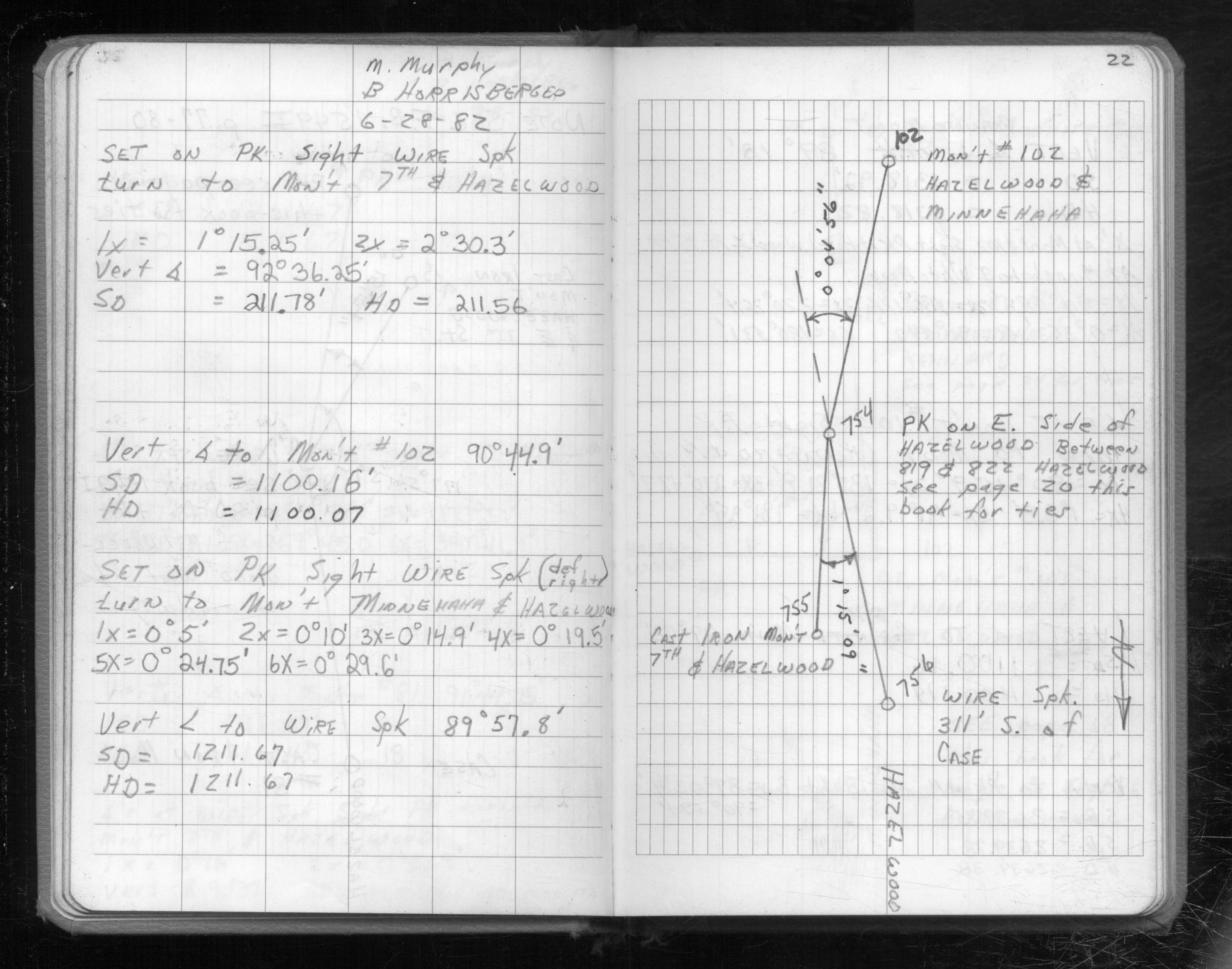
| FB 1549Jp. 21 ,22 | ||||||
| FB 1716p.14 | ||||||
| FB 1716p.14 |
| FILE | SURVEYOR | LIC. NO. | DATE SIGNED | DATE TIED |
|---|---|---|---|---|
| 0755-1020-A.pdf | Samuel D. Gibson | 44880 | August 31, 2012 | May 15, 2012 |
| FILE | PHOTO DATE | COMMENTS |
|---|---|---|
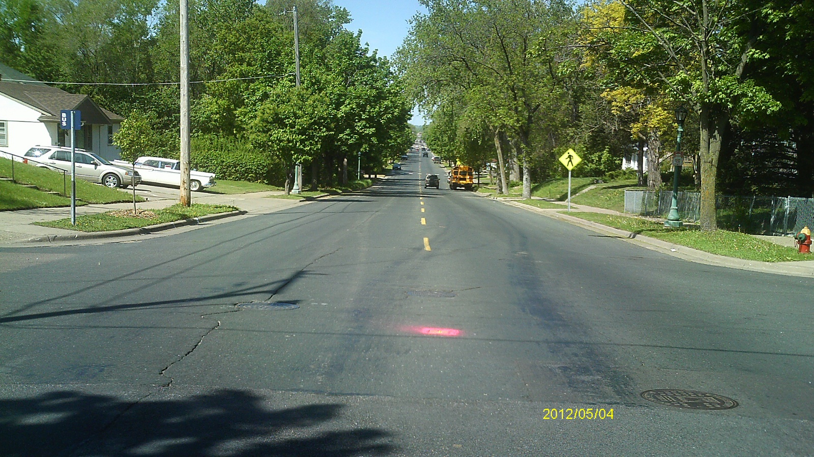
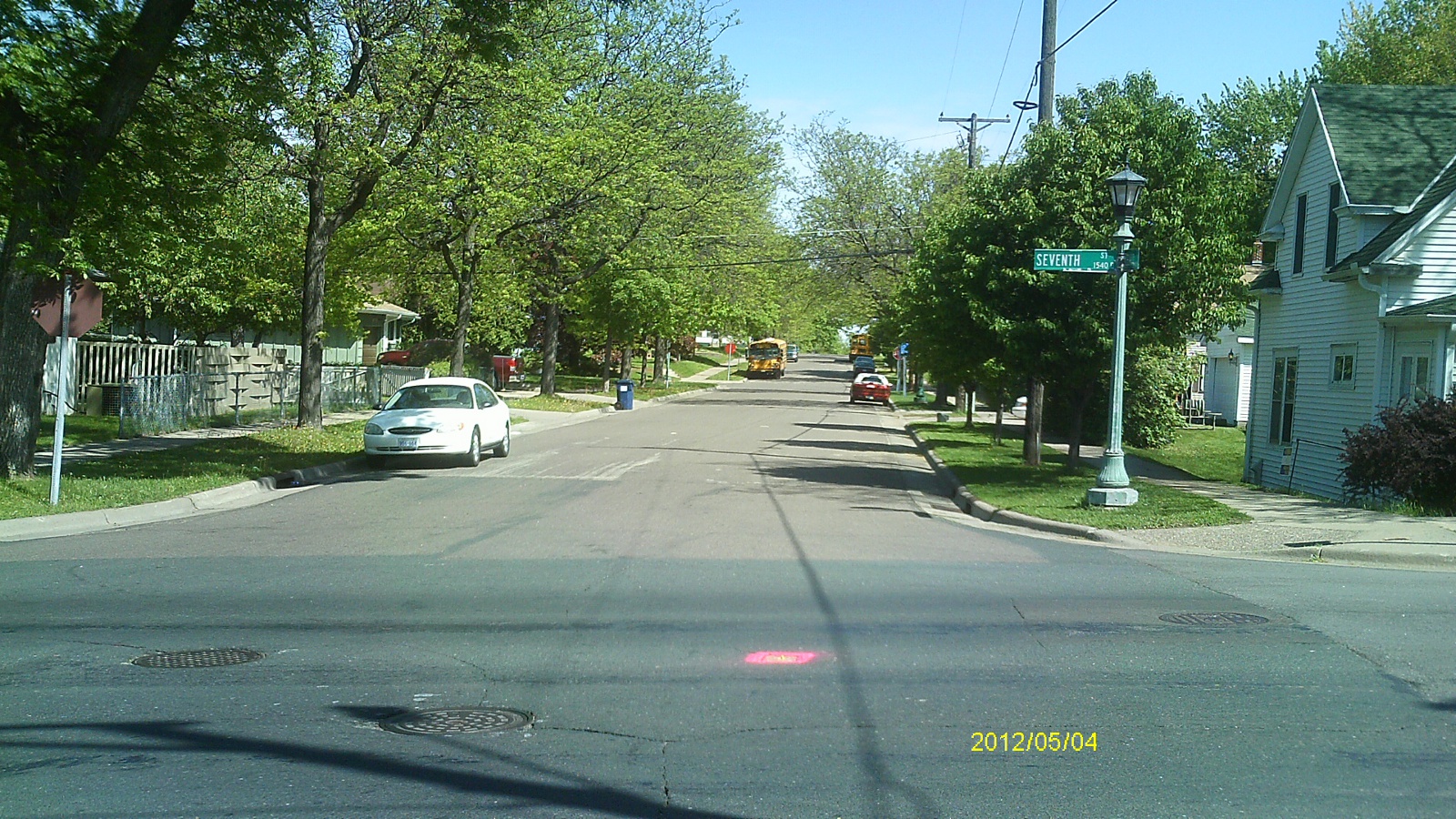
| 0755-1020-5.jpg | May 4, 2012 | Looking west along Seventh St. |
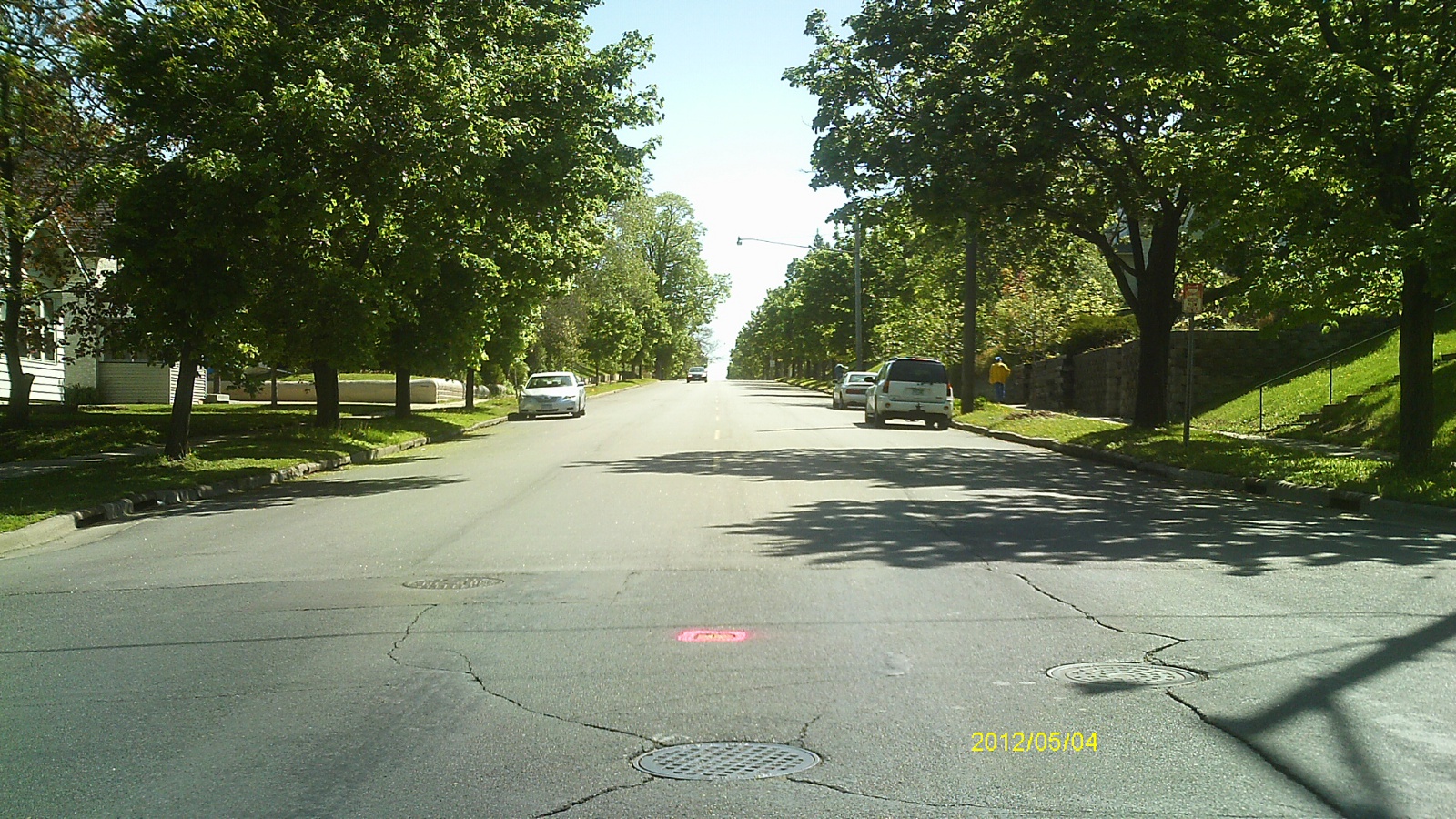
| 0755-1020-4.jpg | May 4, 2012 | Looking south along Hazelwood St. |
| 0755-1020-3.jpg | May 4, 2012 | Looking east along Seventh St. |
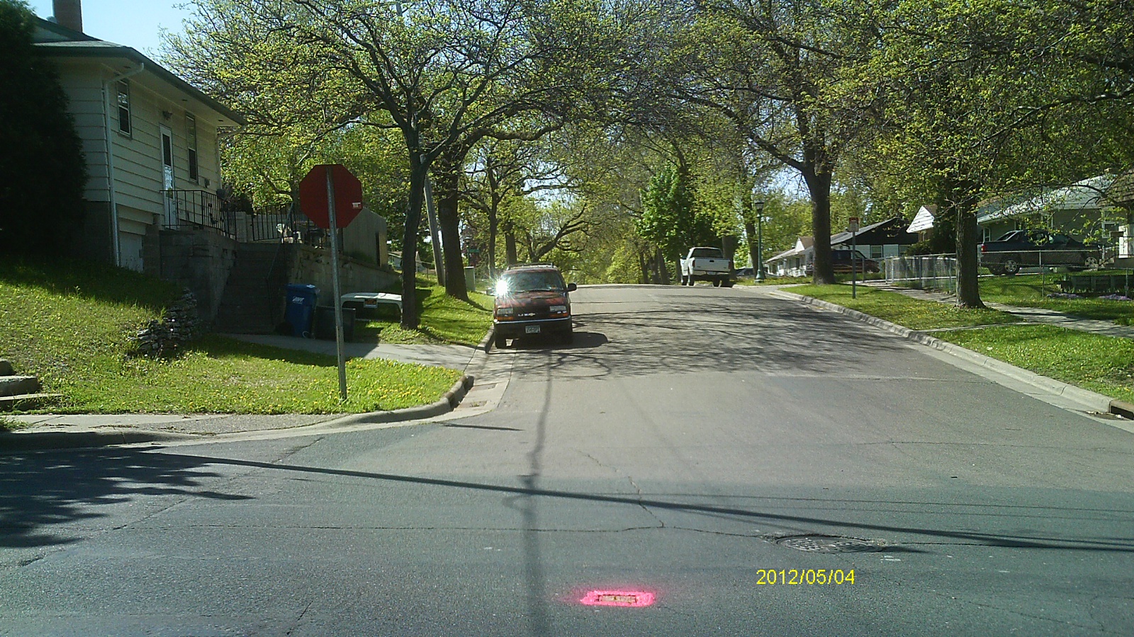
| 0755-1020-2.jpg | May 4, 2012 | Looking north along Hazelwood St. |
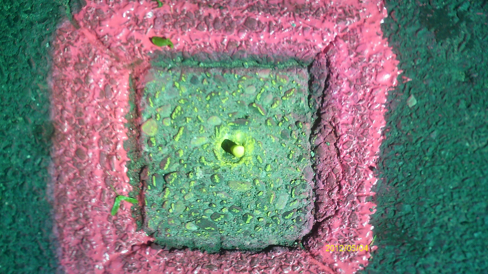
| 0755-1020-1.jpg | May 4, 2012 | Close up of monument. |