| NAD83 COORDINATES (1986 adj.): |
|---|
| X= 598193.725 Y= 140477.699 Z= 000.00 LSQ 12/06/1991 S FLT |
| 2/29/2008 | Monument not found. |
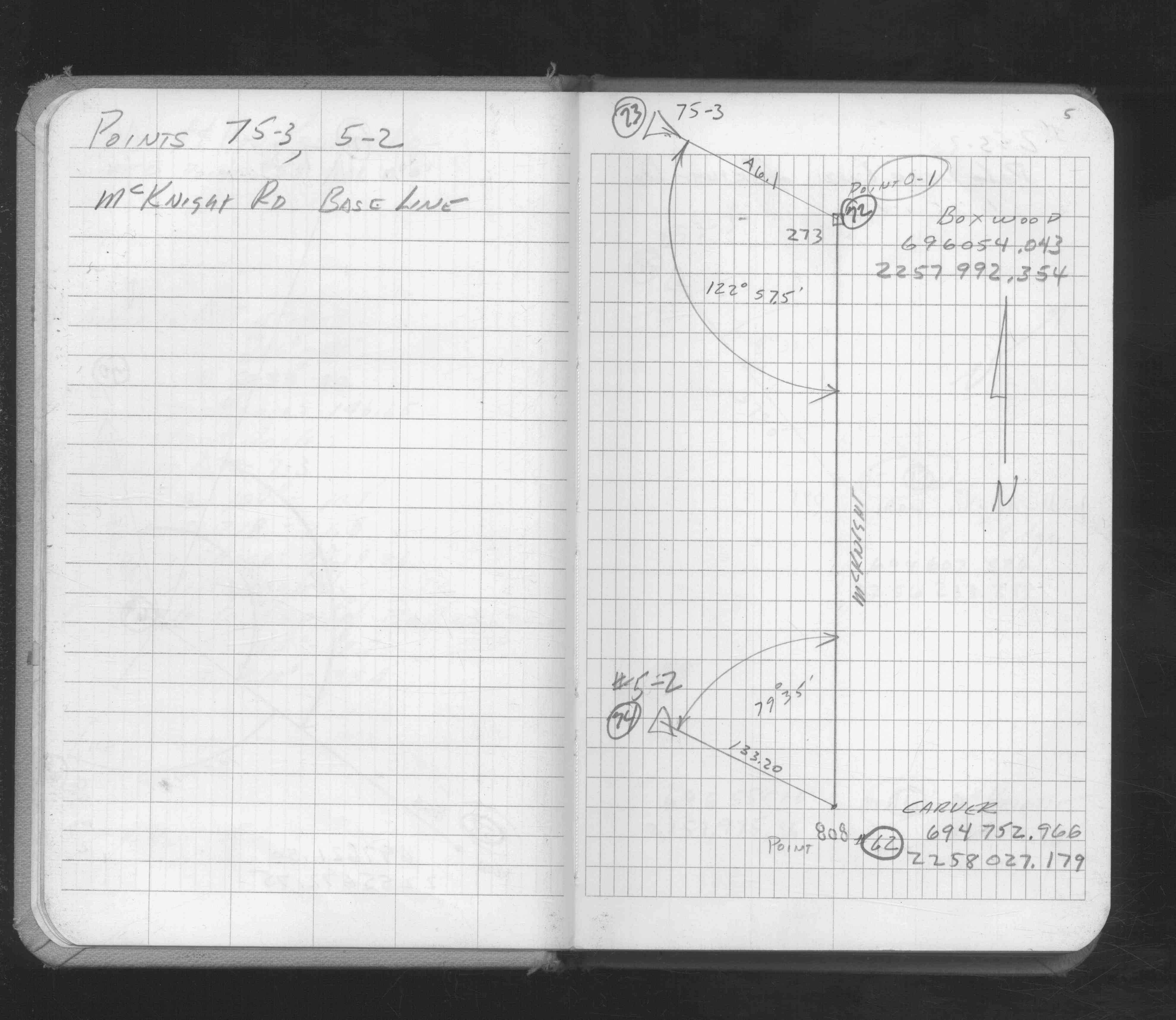
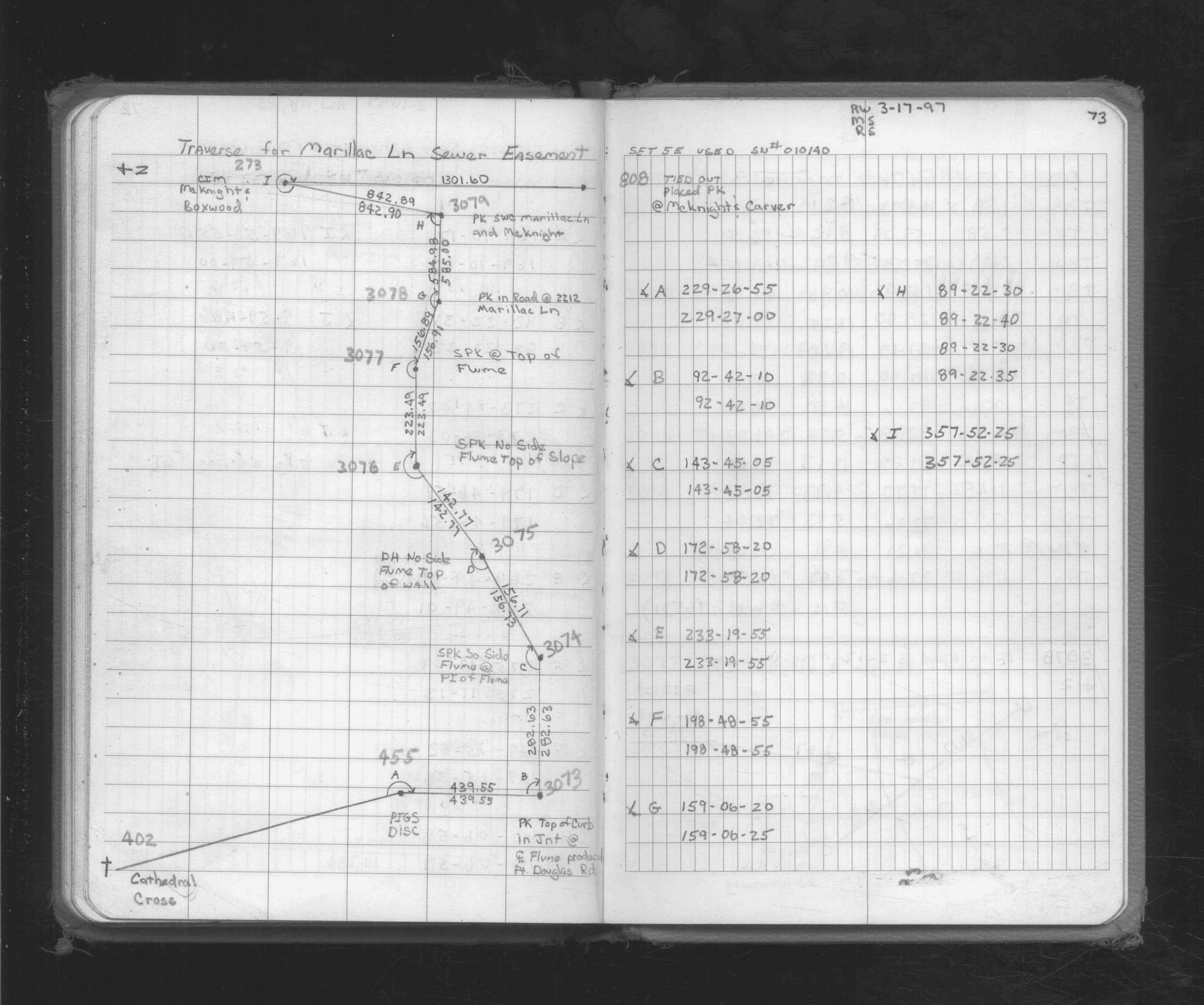
| 3/17/1997 | Set pk nail from ties. Used for traverse control. See FB 1719A p.73 |
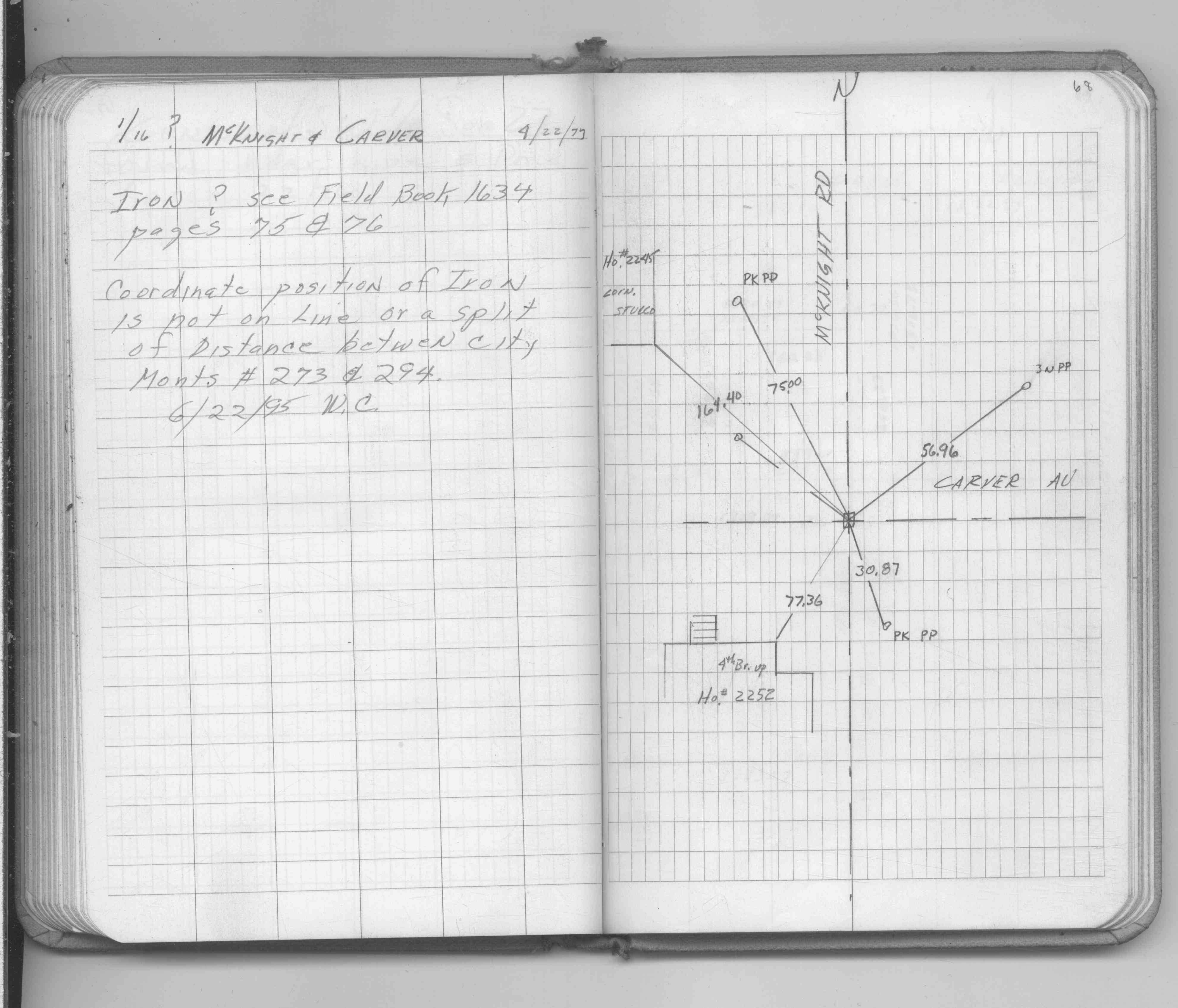
| 6/22/1995 | Coordinate position of iron is not on line or a split of distance between Monuments #0273 and #0294. |
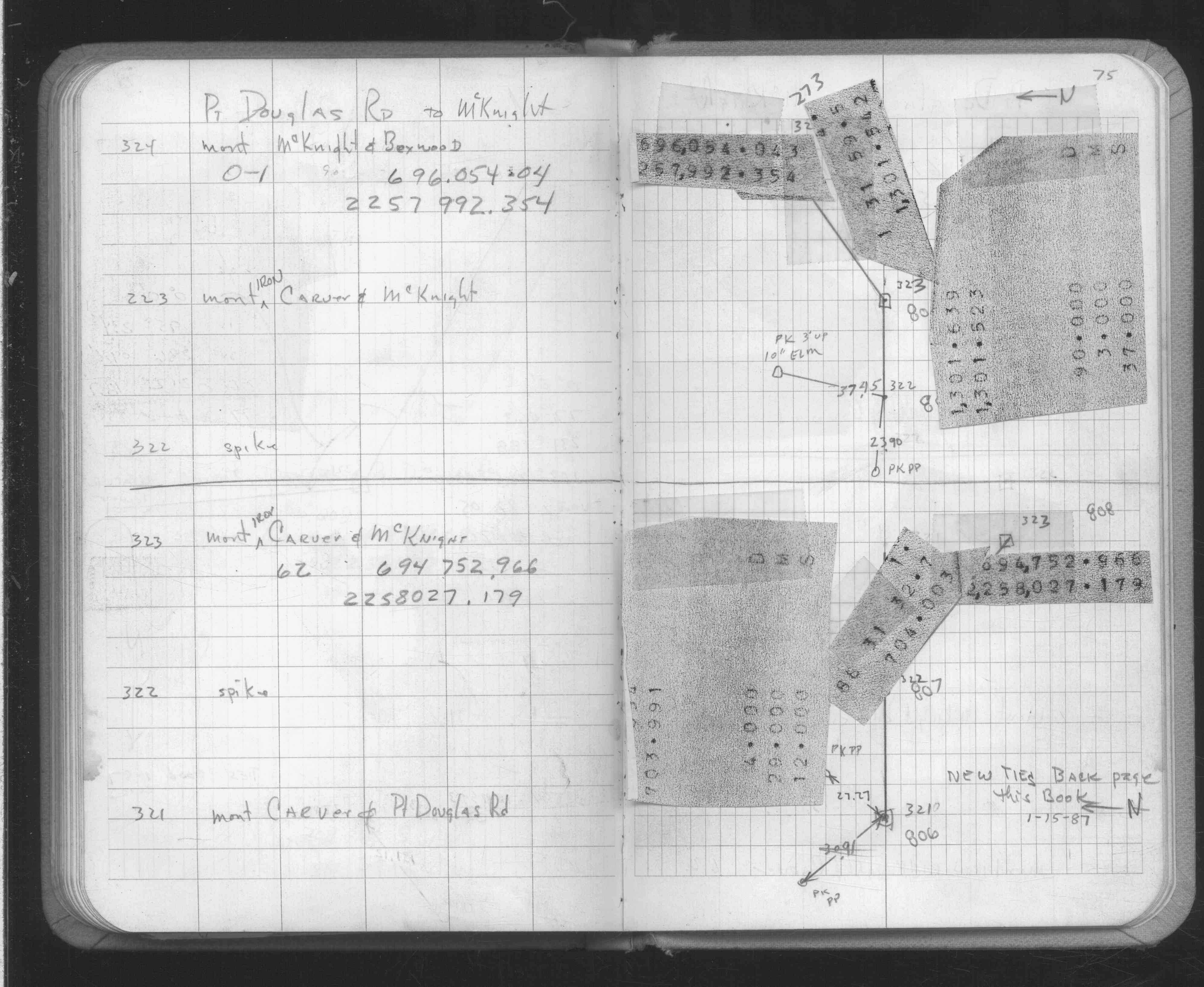
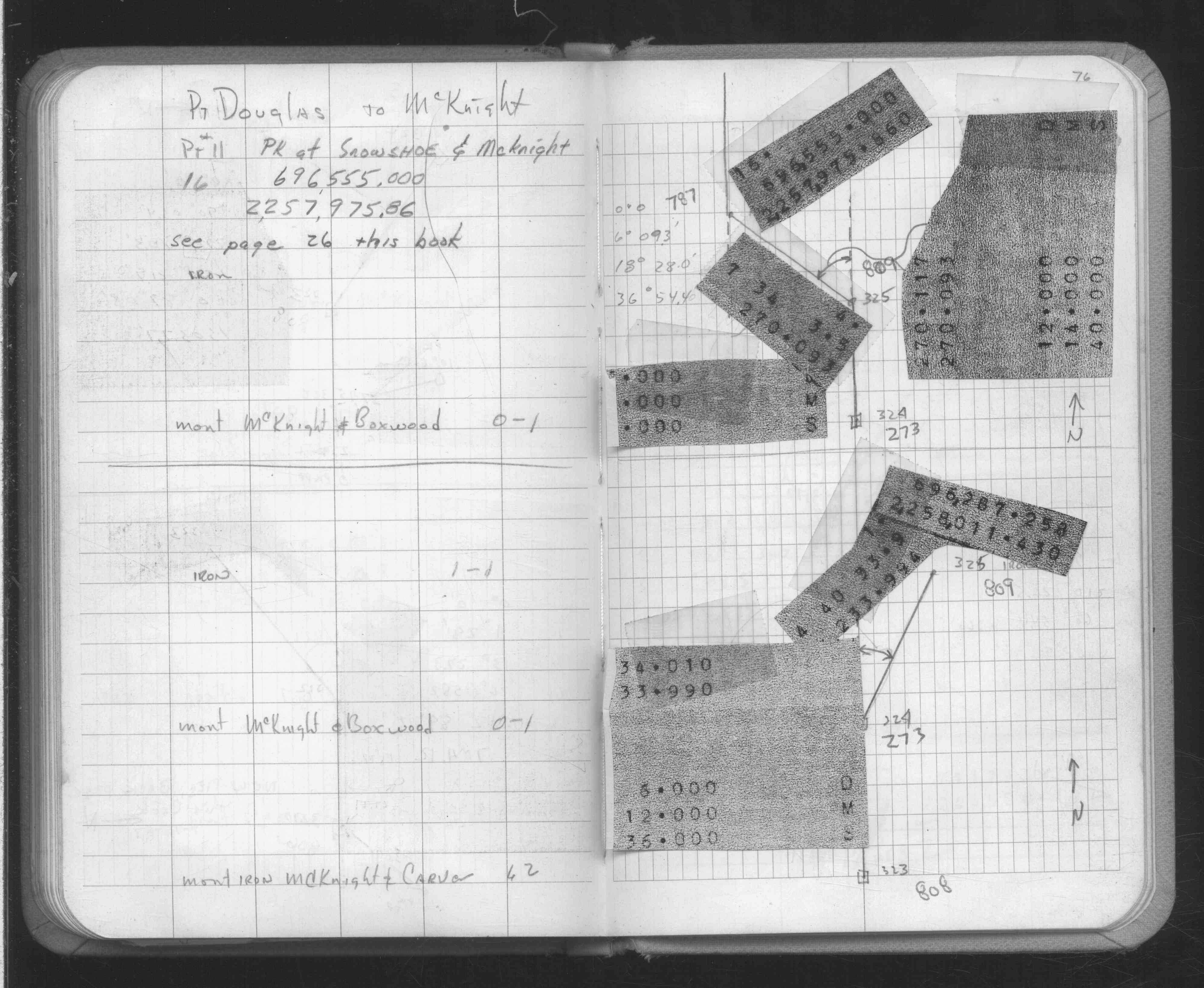
| 4/1/1977 | (Unknown date Apr __, 1977 ) Placed ties. See FB 1689A p.68 |
| 4/1/1977 | (Unknown date Apr __, 1977 ) Placed ties. See CofL 0808-xxxx-A, copied from FB 1689A p.68 |
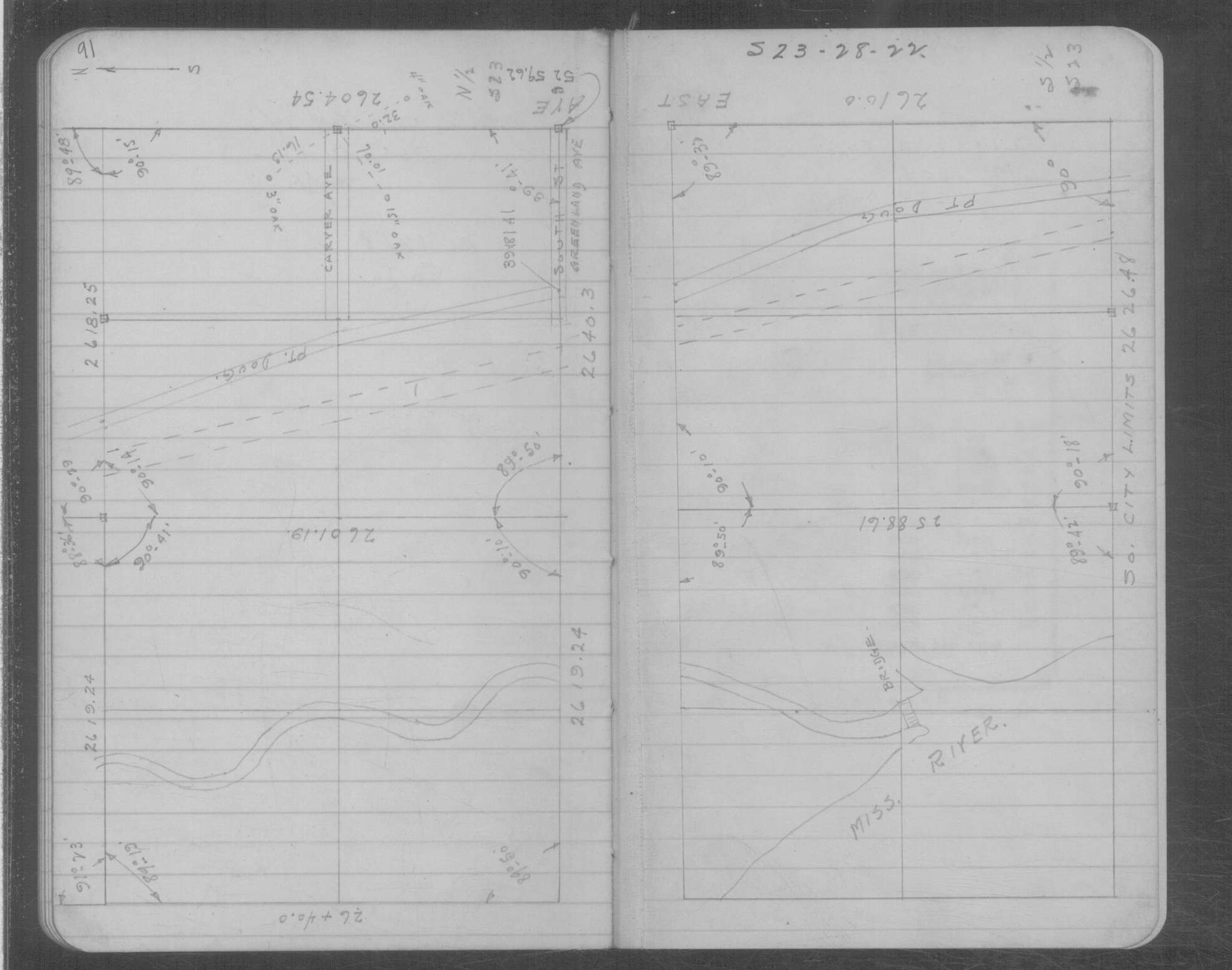
| 3/29/1934 | Placed ties on the monument. See book MSX 5 p.91 |
| 1/1/1800 | (Unknown date ___ __, ____ ) Placed ties on iron. See 1689B p.49 |
Above is NOT an all inclusive history of this point. Please review all the links below.
| PLS NOTES | Field | Cross Section | Sewer | J.B. Irvine | Monument | River Survey |
|---|---|---|---|---|---|---|
| FB 1549Hp.05 | MSX 0005 p.091 | |||||
| FB 1634p. 75 ,76 | ||||||
| FB 1689Ap.68 | ||||||
| FB 1719Ap.73 |
| FILE | SURVEYOR | LIC. NO. | DATE SIGNED | DATE TIED |
|---|---|---|---|---|
| 0808-xxxx-A.tif | none | none | none | none |