| NAD83 COORDINATES (1986 adj.): |
|---|
| X= 565261.989 Y= 154886.124 Z= 000.00 LSQ 12/06/1991 S FLT |
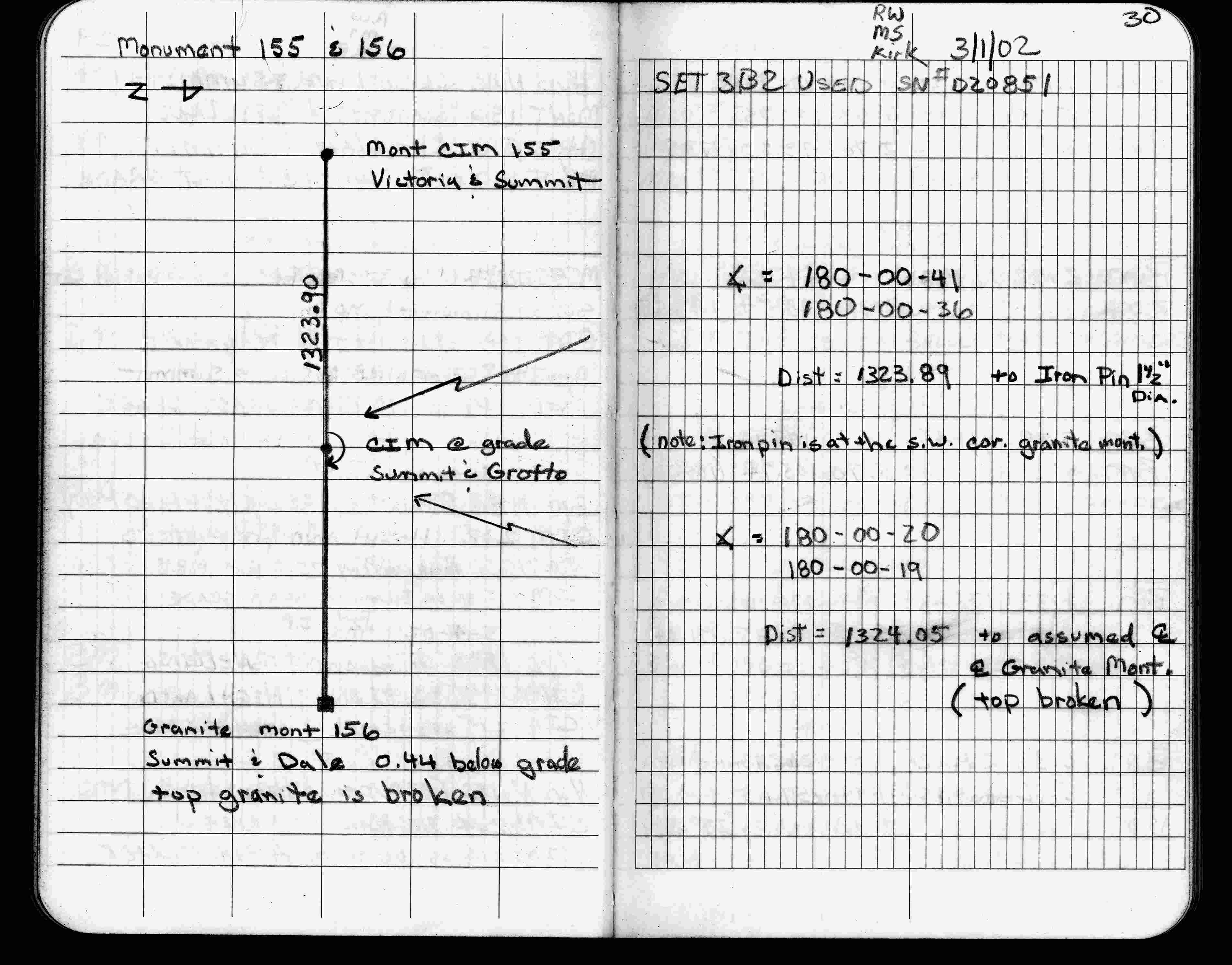
| 3/1/2002 | Fd CIM at grade, made measurements to monuments 155 (CIM) & 156 (GM). See FB 1736 p.30 |
| 7/1/1994 | Set CIM & placed ties. See CofL 1066-0881-A |
| 7/13/1989 | Placed pin in GM, GM 0.3 ft below grade, placed ties. See FB 1539 p.56 |
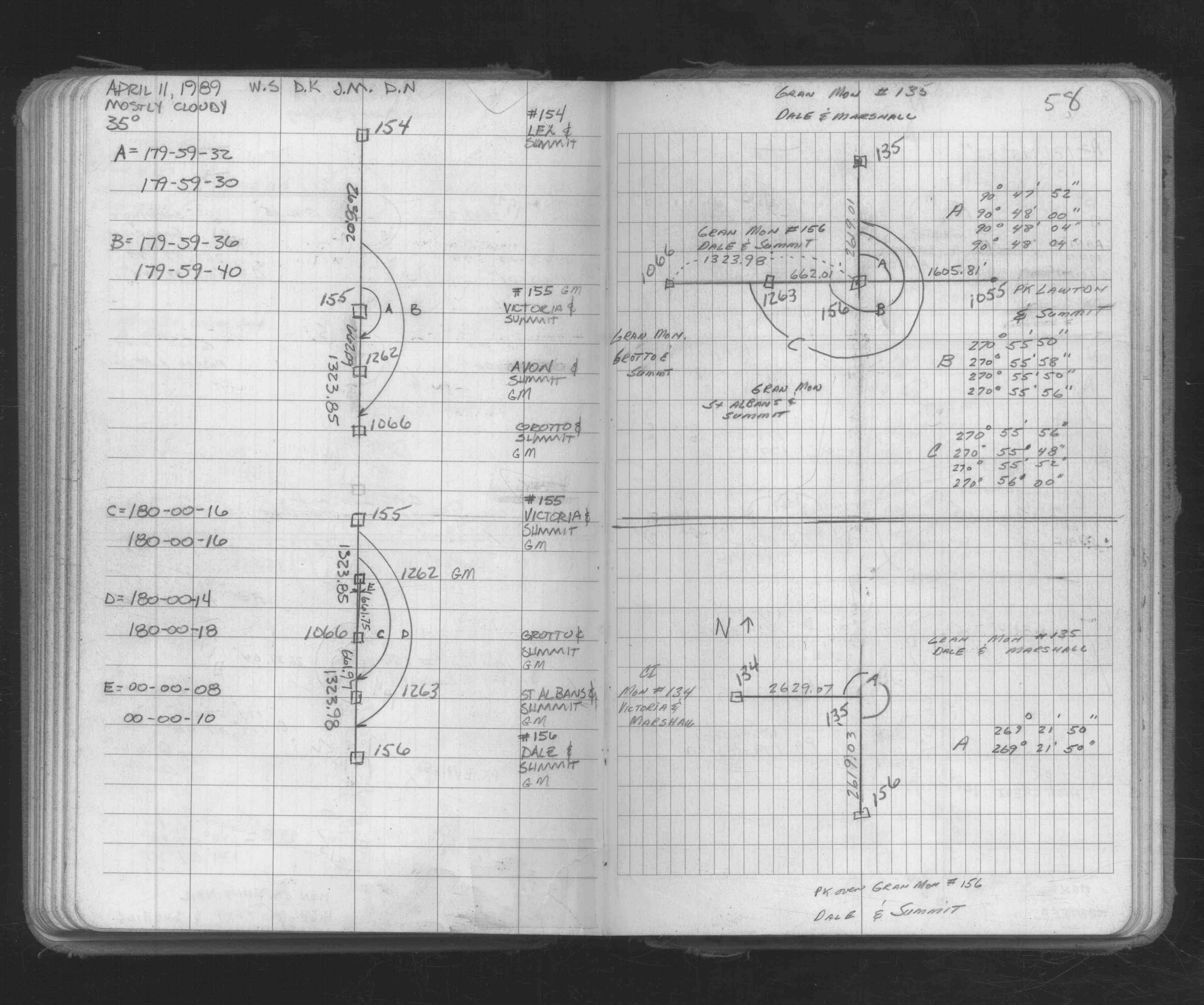
| 4/11/1989 | Recovered & located GM by field measurements. See FB 1673A p.58 |
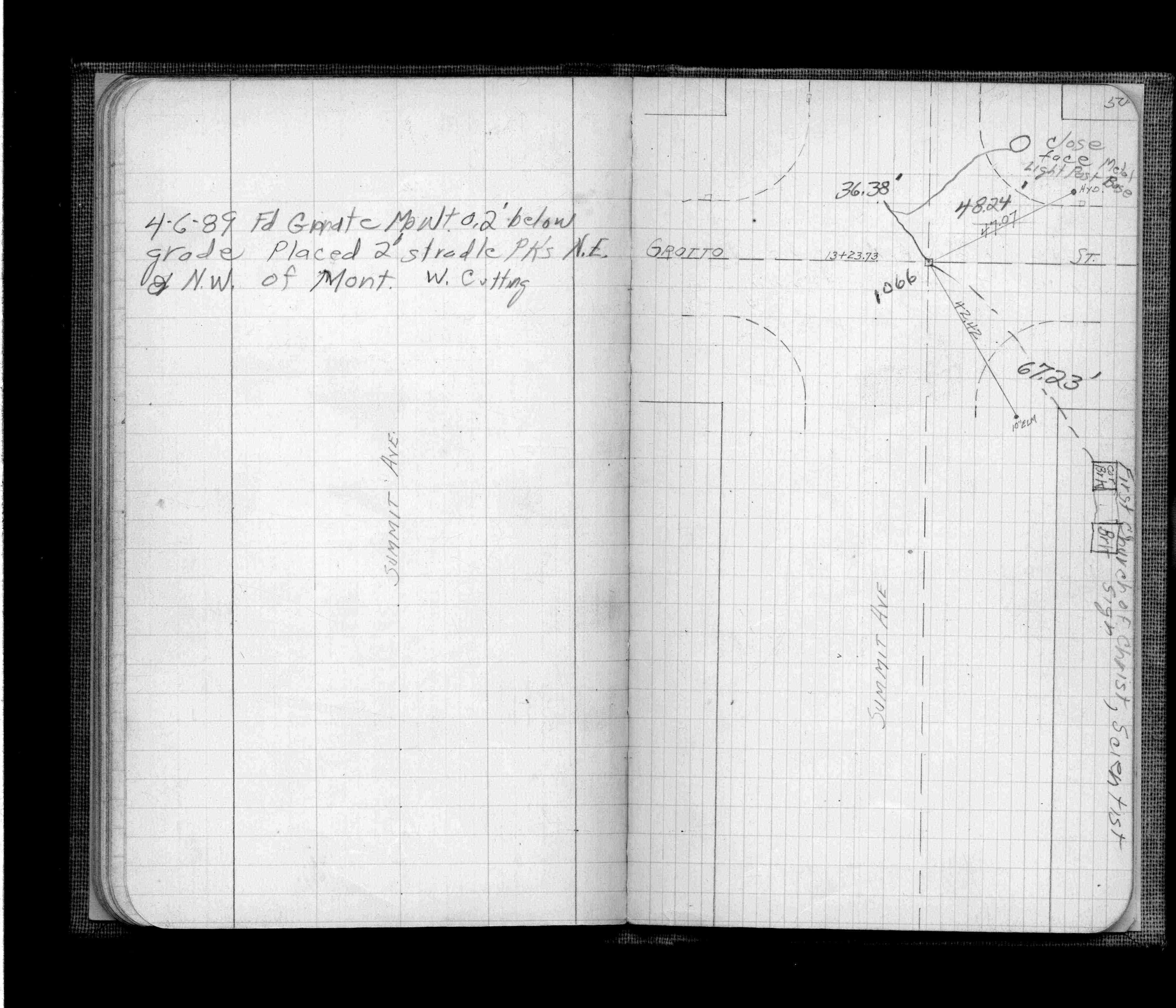
| 4/6/1989 | Fd GM 0.2 ft below grade. Placed 2 ft stradles NE & NW of GM. See FB 705 p.50 |
| 11/26/1887 | Monument set by J H Armstrong from survey at 1/16 corner |
Above is NOT an all inclusive history of this point. Please review all the links below.
| PLS NOTES | Field | Cross Section | Sewer | J.B. Irvine | Monument | River Survey |
|---|---|---|---|---|---|---|
| FB 0705p.50 | CS 1253p.36 | |||||
| FB 0705p.50 | ||||||
| FB 1539p.56 | ||||||
| FB 1673Ap.58 | ||||||
| FB 1736p.30 | ||||||
| FB 1736p.30 |
| FILE | SURVEYOR | LIC. NO. | DATE SIGNED | DATE TIED |
|---|---|---|---|---|
| 1066-0881-A.tif | none | none | none | July 1, 1994 |