| NAD83 COORDINATES (1986 adj.): |
|---|
| X= 574407.955 Y= 149540.690 Z= 900.1 06/28/2005 RTK-VRS |
| X= 574408.097 Y= 149540.633 Z= 000.00 LSQ 12/06/1991 S FLT |
| X= 574408.067 Y= 149540.525 Z= 000.00 TOT 11/28/1995 FLT |
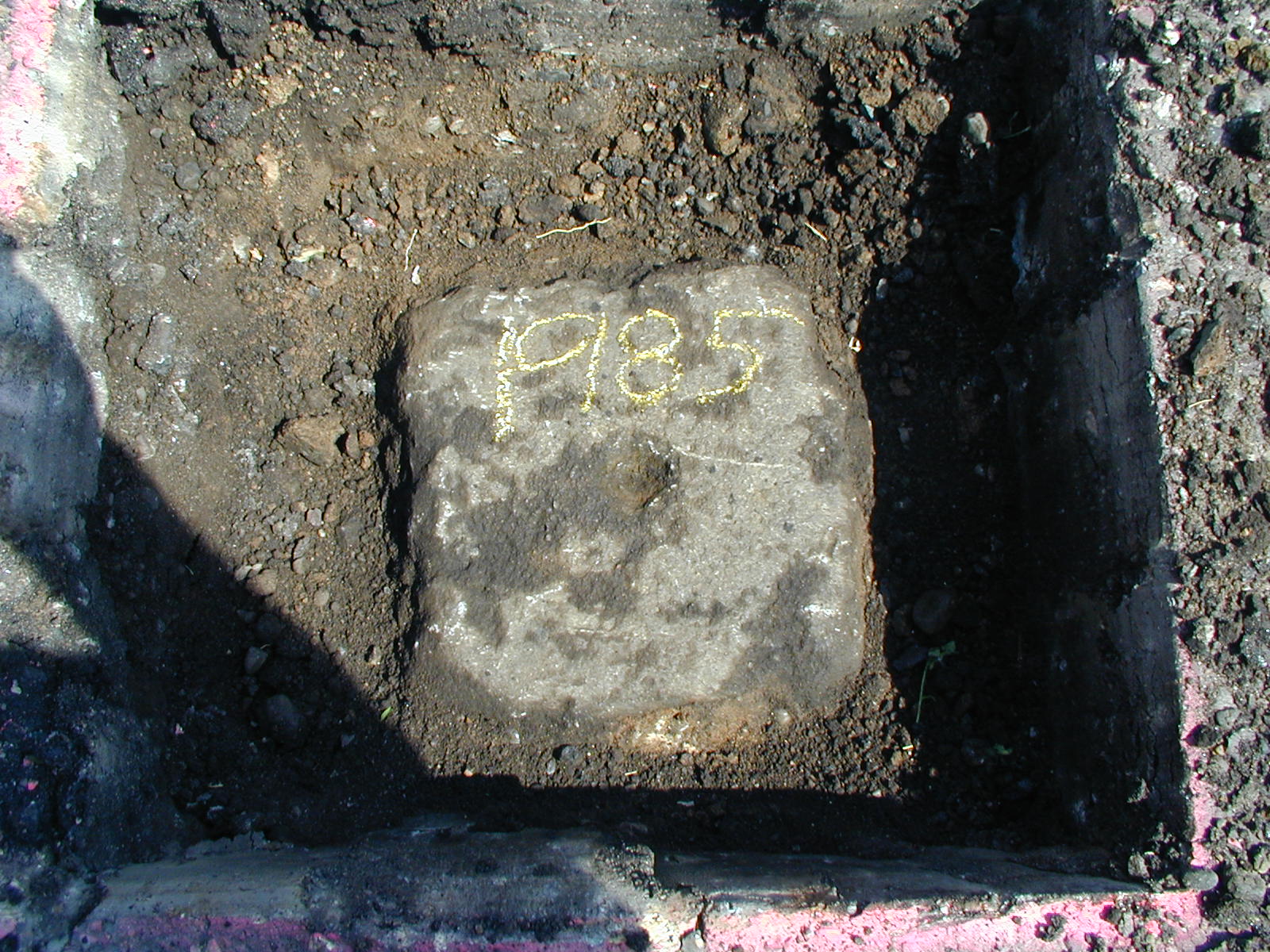
| 7/12/2006 | Set CIM to grade. Placed ties. See CofL 1097-1985-B |
| 7/12/2006 | Photos taken. |
| 6/28/2005 | Position on GM established by GPS RTK-VRS. |
| 6/23/2005 | Photos taken of GM. |
| 6/3/2005 | Recovered GM 0.75 ft below grade and placed ties. See CofL 1097-1985-A |
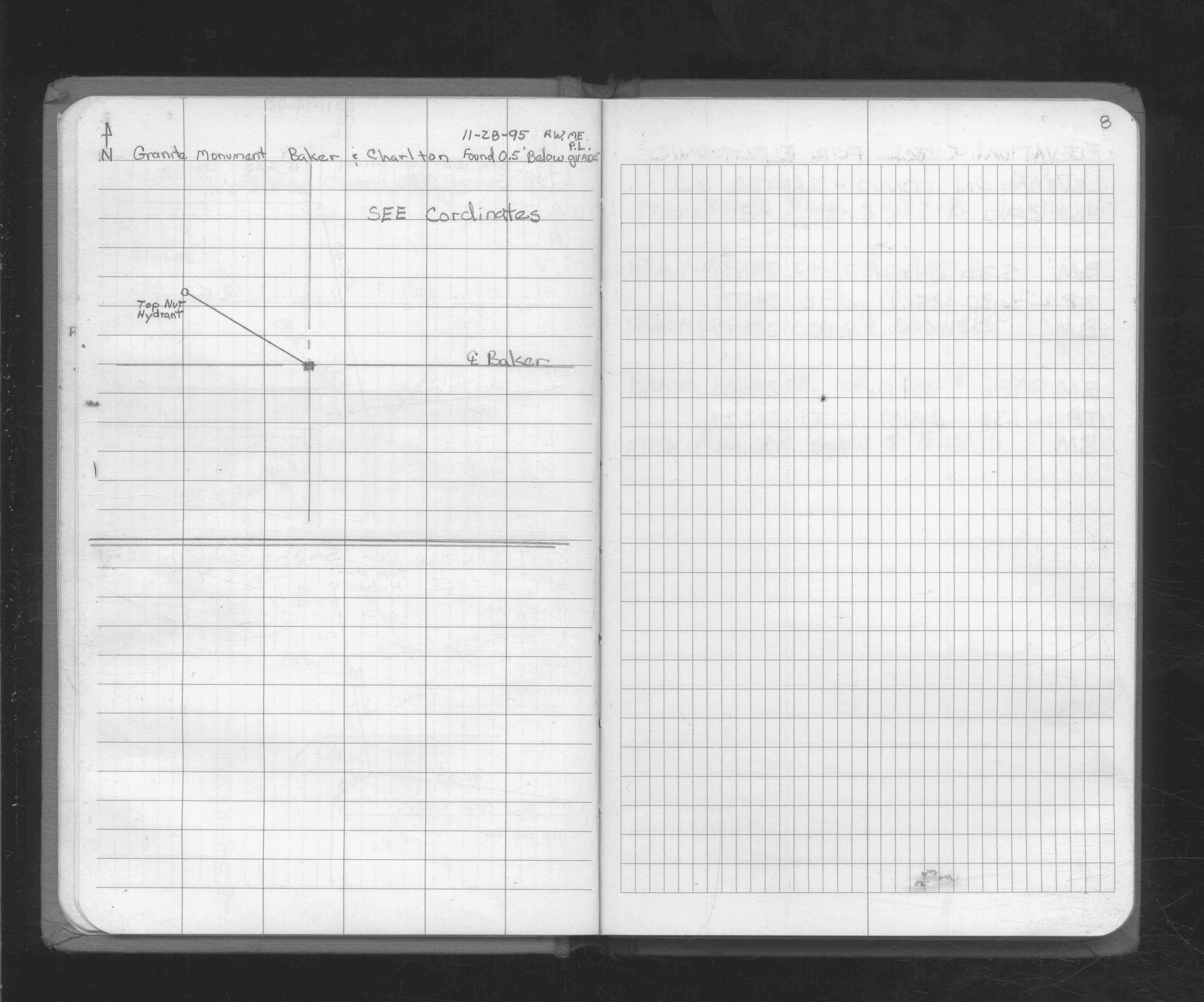
| 11/28/1995 | Recovered GM 0.5 ft below grade. See FB 1730 p.8 |
| 11/1/1995 | (Unknown date Nov __, 1995 ) Elev 206.09 ft on GM. from total station. |
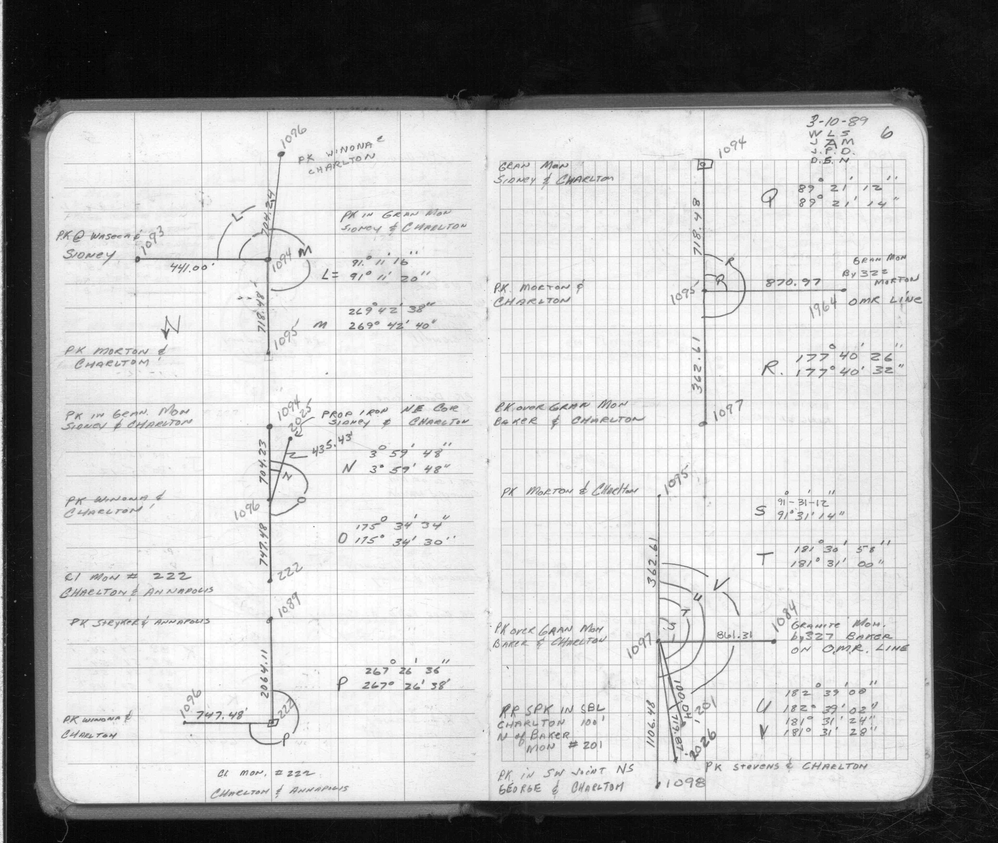
| 3/10/1989 | Traversed through pk over GM. See FB 1713 p.6,7 |
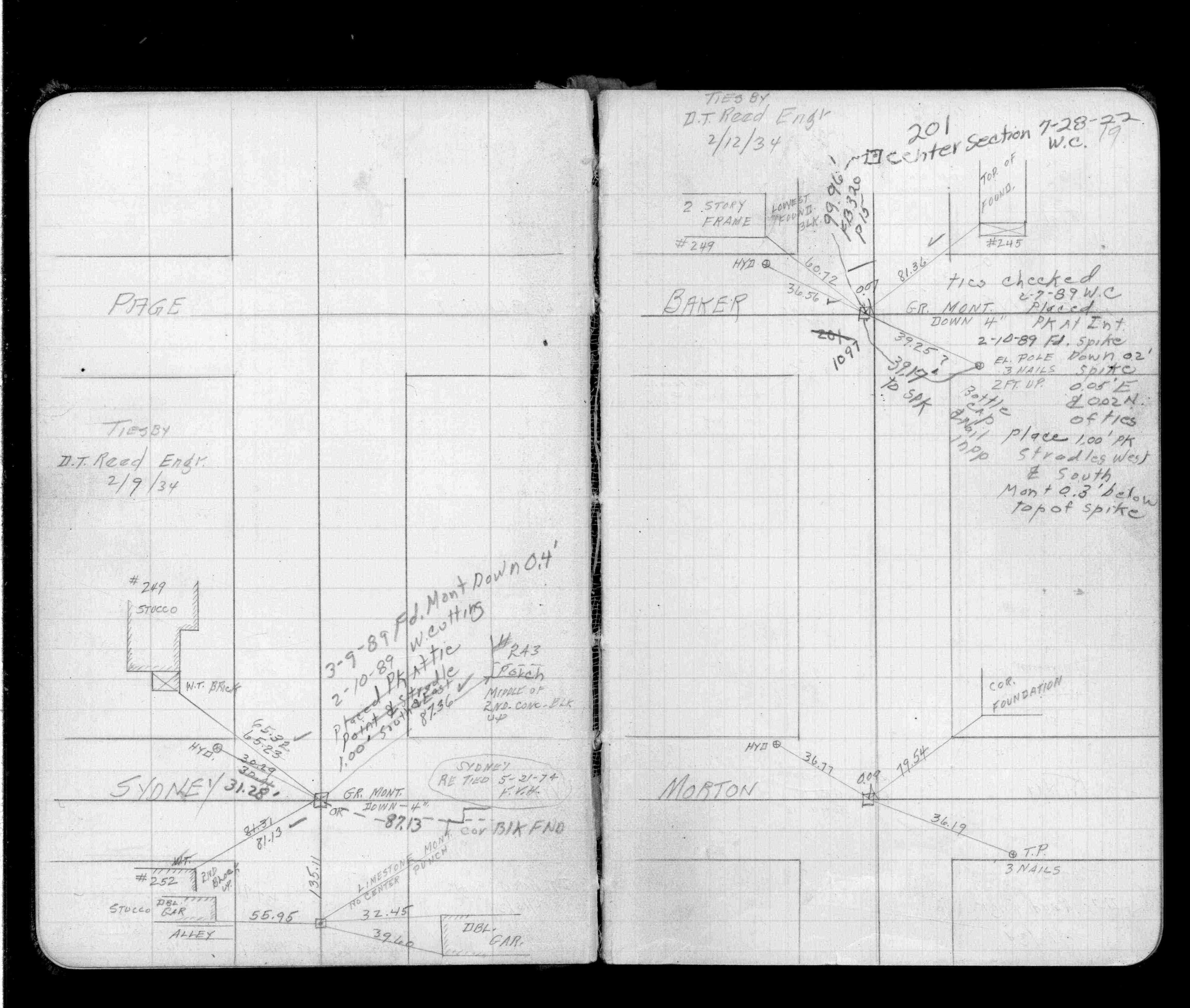
| 2/1/1989 | (Unknown date Feb __, 1989 ) Placed ties. See FB 1504 p.19 |
| 2/12/1934 | Placed ties. See FB 1504 p.19 |
| 2/12/1934 | Placed ties on GM four inches below grade. See MSX 1 p.44-45 |
| 11/1/1890 | Monument set by J H Armstrong. |
Above is NOT an all inclusive history of this point. Please review all the links below.
| PLS NOTES | Field | Cross Section | Sewer | J.B. Irvine | Monument | River Survey |
|---|---|---|---|---|---|---|
| FB 1504p.19 | MSX 0001 p.044-045 | |||||
| FB 1504p.19 | ||||||
| FB 1713p. 06 ,07 | ||||||
| FB 1716p.21 | ||||||
| FB 1730p.08 |
| FILE | SURVEYOR | LIC. NO. | DATE SIGNED | DATE TIED |
|---|---|---|---|---|
| 1097-1985-B.tif | Michael P. Murphy | 41001 | July 19, 2006 | July 12, 2006 |
| 1097-1985-A.tif | Michael P. Murphy | 41001 | June 9, 2005 | June 3, 2005 |
| FILE | PHOTO DATE | COMMENTS |
|---|---|---|
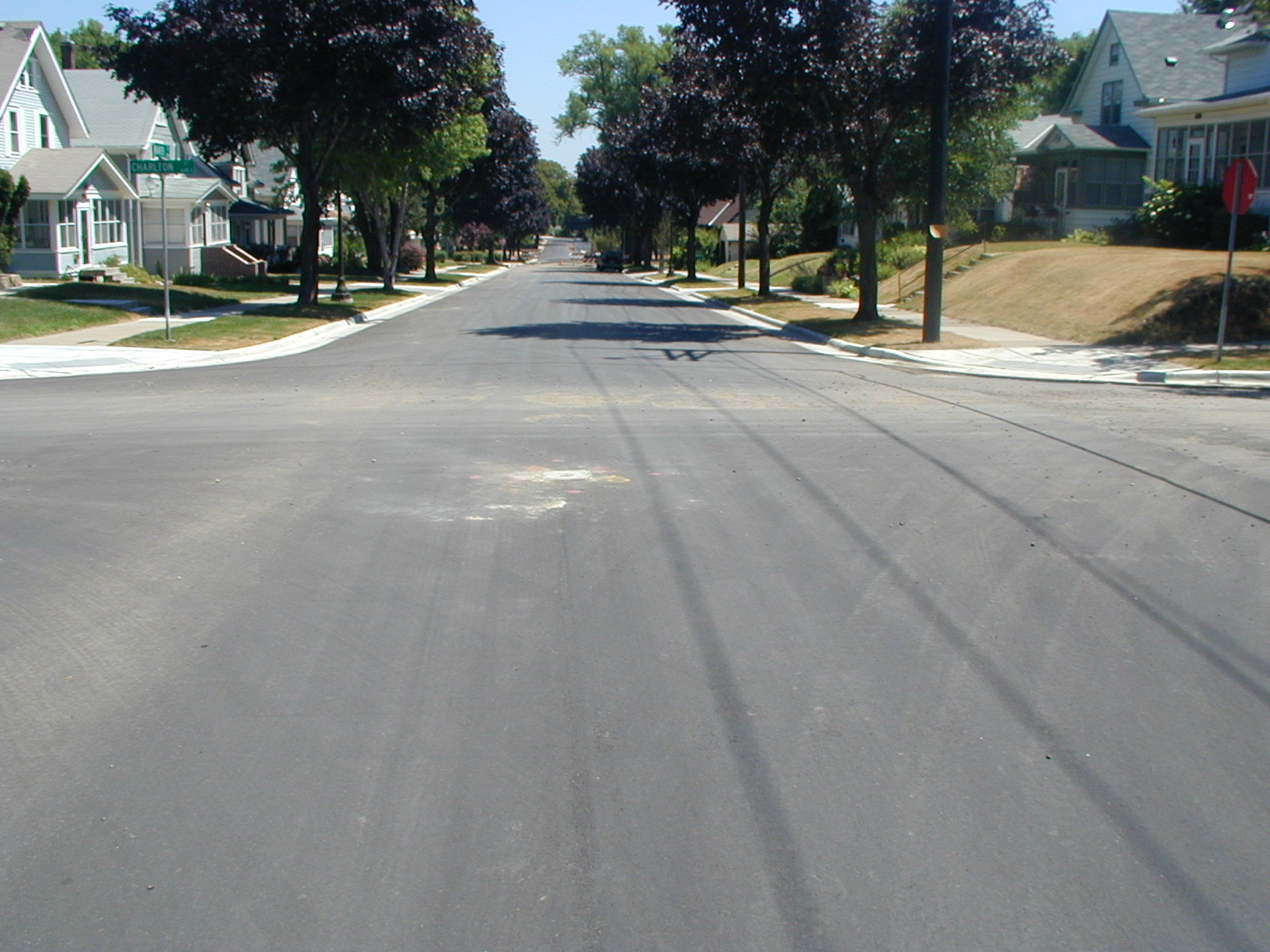
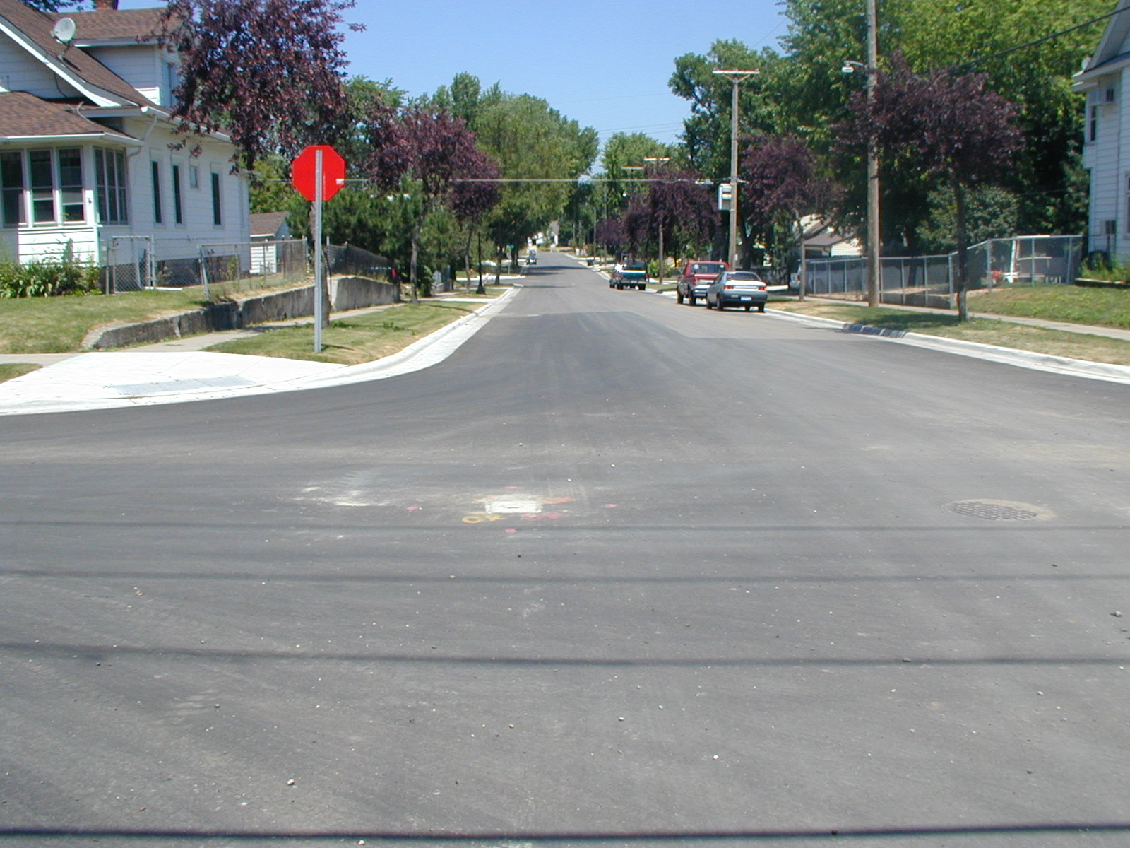
| 1097-1985-7.jpg | July 12, 2006 | Looking West along Baker St. |
| 1097-1985-6.jpg | July 12, 2006 | Looking South along Charlton St. |
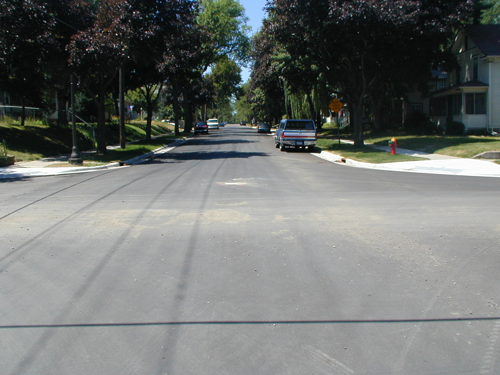
| 1097-1985-5.jpg | July 12, 2006 | Looking East along Baker St. |
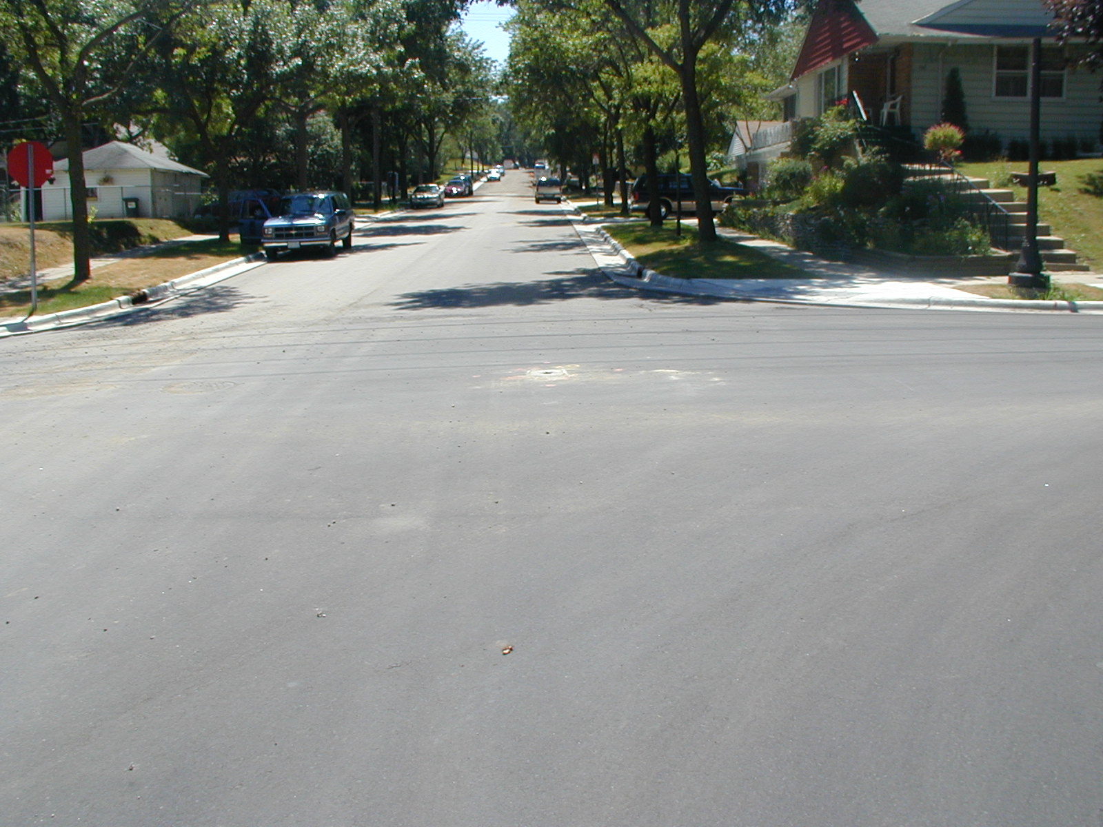
| 1097-1985-4.jpg | July 12, 2006 | Looking North along Charlton St. |
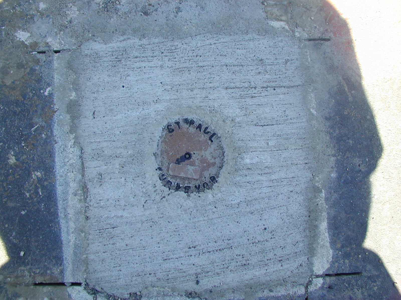
| 1097-1985-3.jpg | July 12, 2006 | Close up of the CIM. |
| 1097-1985-1.jpg | June 23, 2005 | Close up of the GM. |