| NAD83 COORDINATES (1986 adj.): |
|---|
| * X= 583837.806 Y= 173414.230 Z= 000.00 CMP 12/17/1991 |
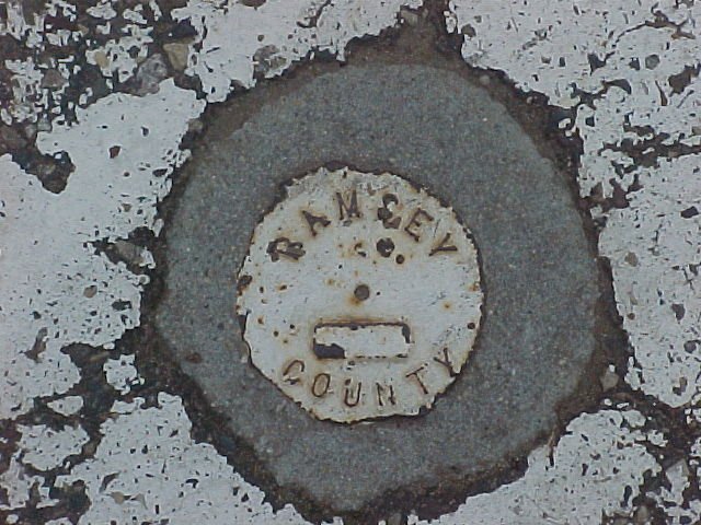
| 4/16/2002 | Recovered CIM labeled "RAMSEY COUNTY" in pedestrian asphalt path at grade. Photos taken. |
| 8/1/1989 | (Unknown date Aug __, 1989 ) The exavation was filled back to the present grade, leaving the GM as found. |
| 8/1/1989 | (Unknown date Aug __, 1989 ) GM found tipped over & approx 7 ft below grade of an asphalt path & 2 ft above lake. |
| 8/1/1989 | (Unknown date Aug __, 1989 ) A Ramsey County Cast Iron monument was placed over the granite. |
| 9/1/1887 | (Unknown date Sep __, 1887 ) Monument set by J H Armstrong |
| 11/1/1847 | (Unknown date Nov __, 1847 ) Isaac N Higbee deputy surveyor set post. Tied to 1 BT. See IH p.202-203 2922 |
Above is NOT an all inclusive history of this point. Please review all the links below.
| PLS NOTES | Field | Cross Section | Sewer | J.B. Irvine | Monument | River Survey |
|---|---|---|---|---|---|---|
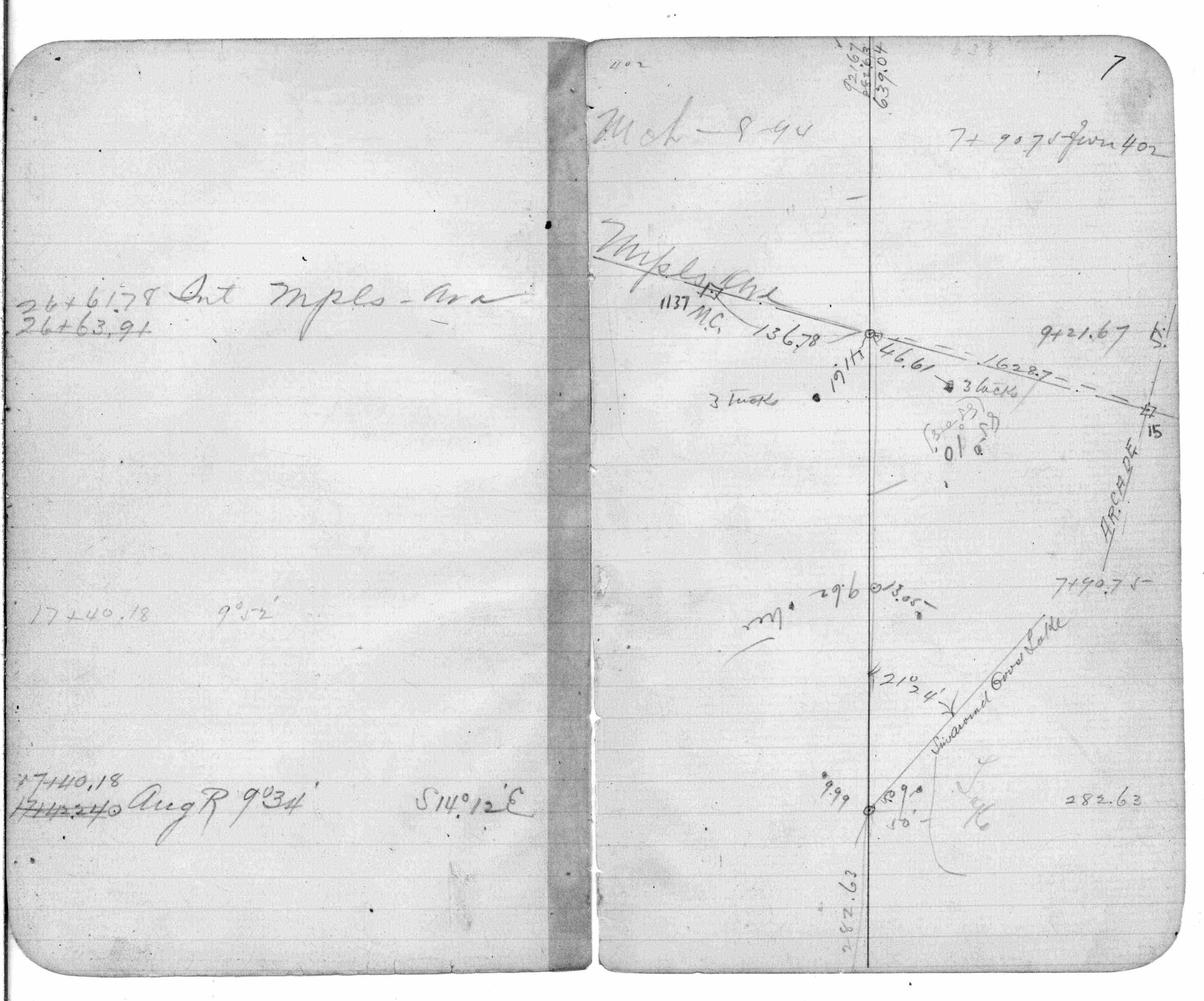
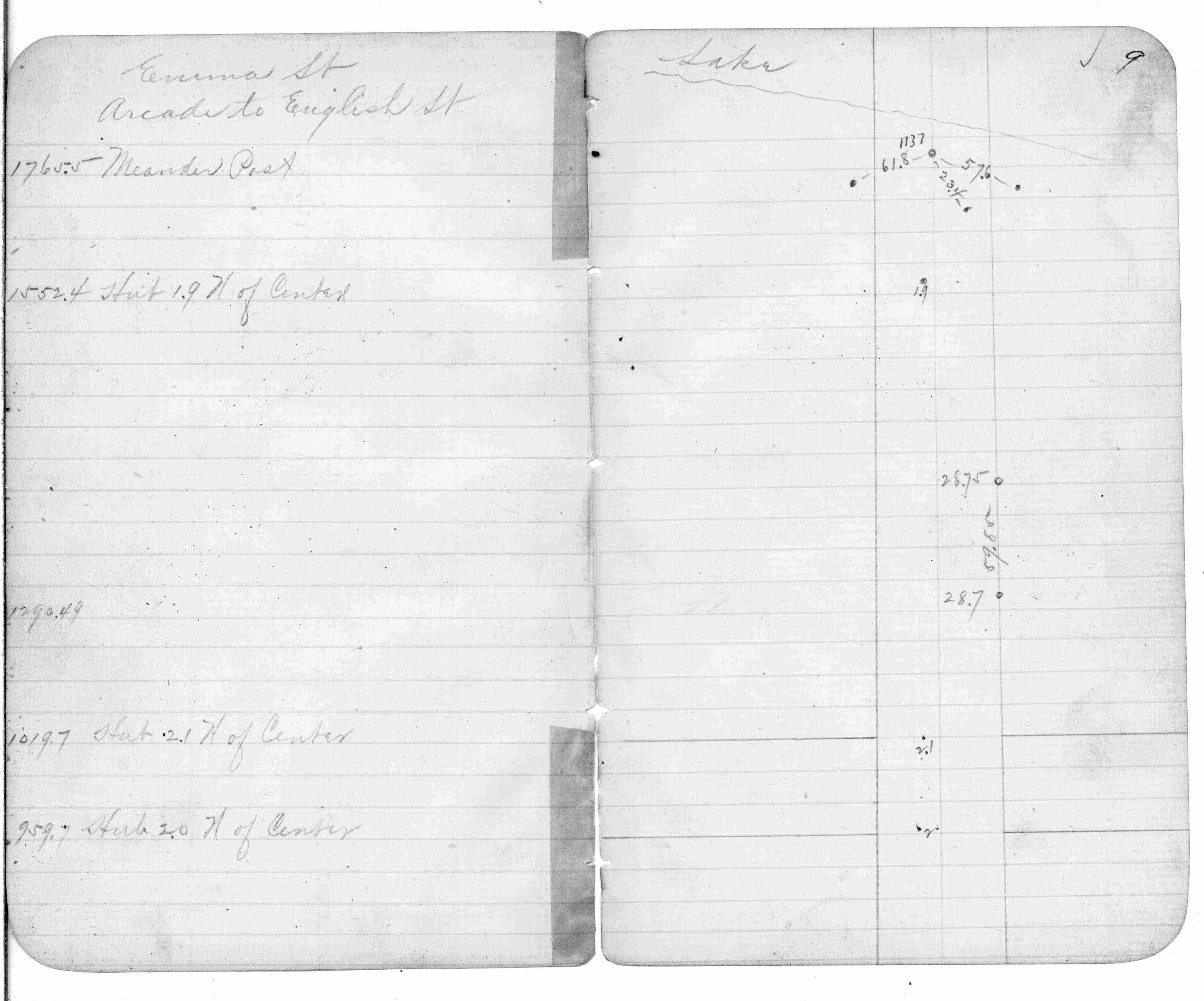
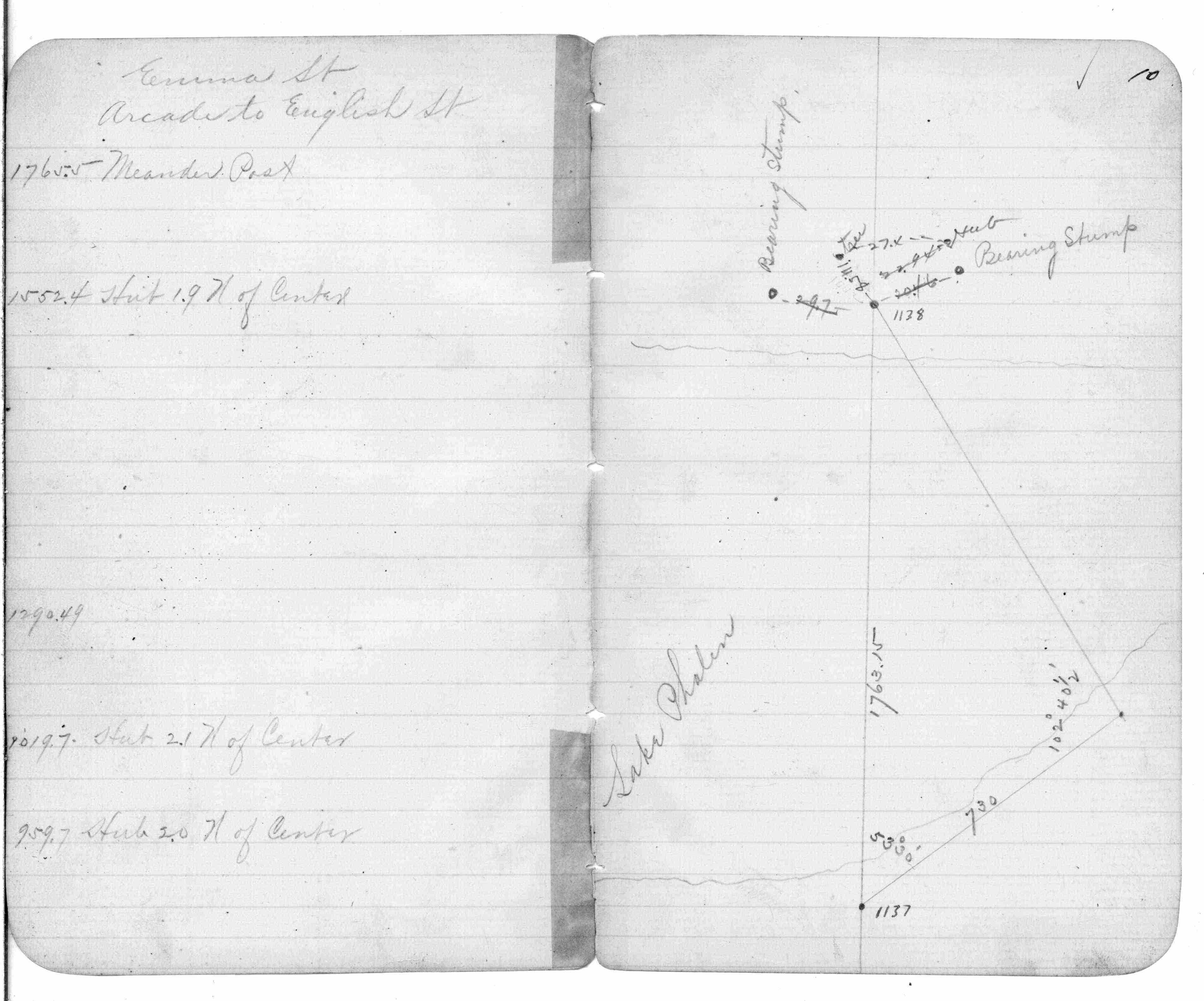
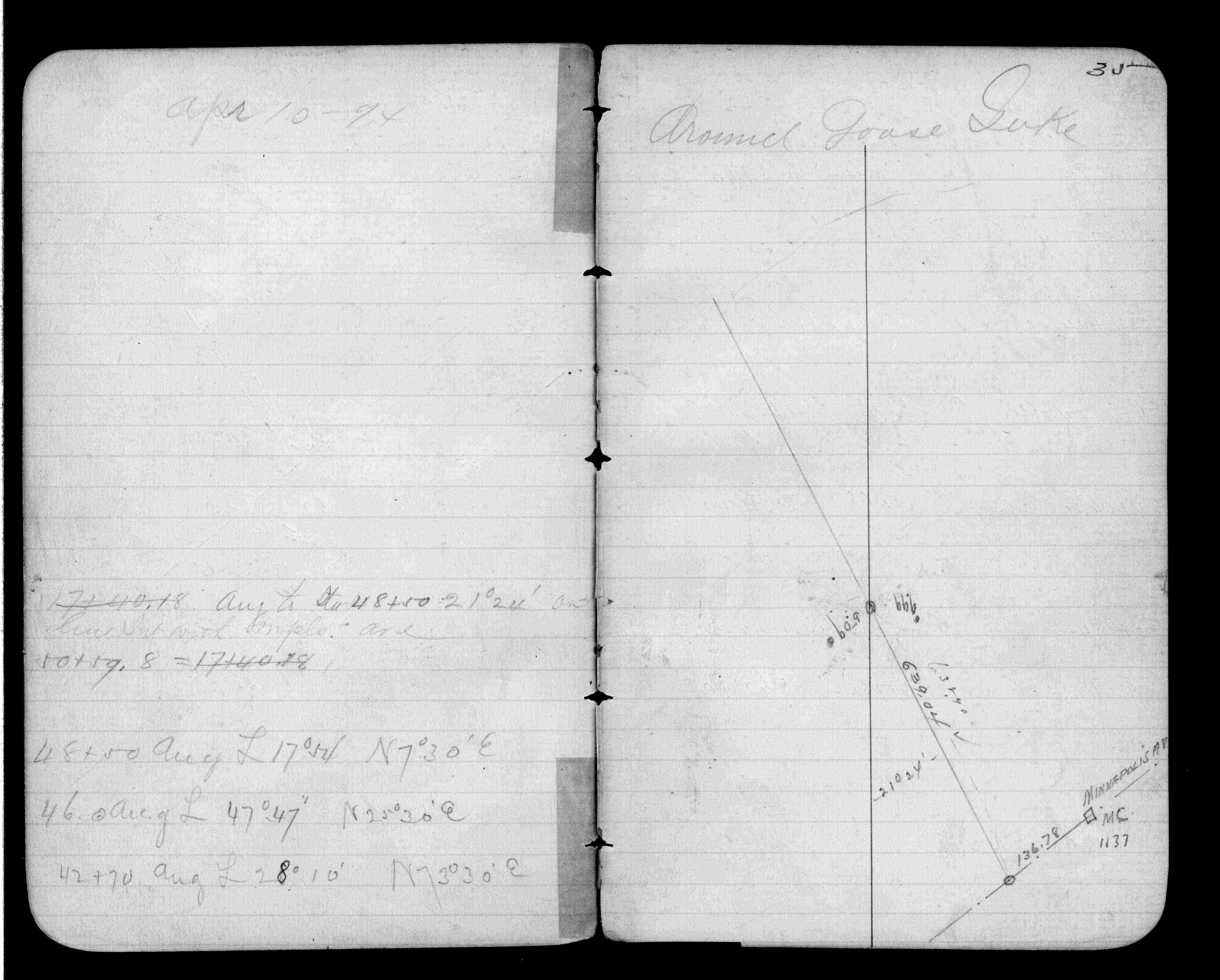
| IH p.202-203 | FB 0214p. 02 ,03 | |||||
| FB 0227p.01 | ||||||
| FB 0310p.09 | ||||||
| FB 0376.5p. 02 ,07 ,09 ,10 ,35 |
| FILE | PHOTO DATE | COMMENTS |
|---|---|---|
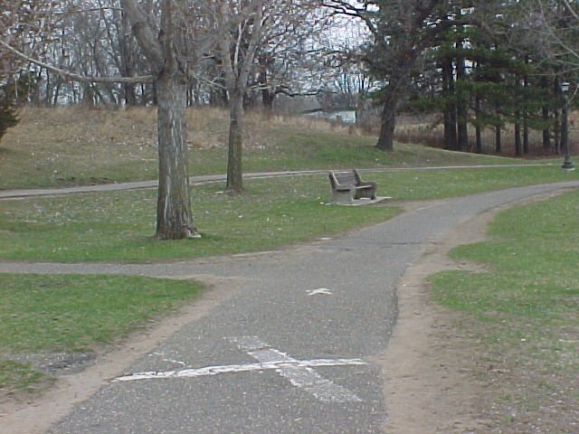
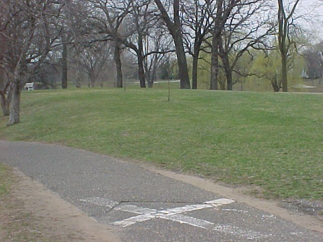
| 1137-1072-4.jpg | April 16, 2002 | Looking north. |
| 1137-1072-3.jpg | April 16, 2002 | Looking south. |
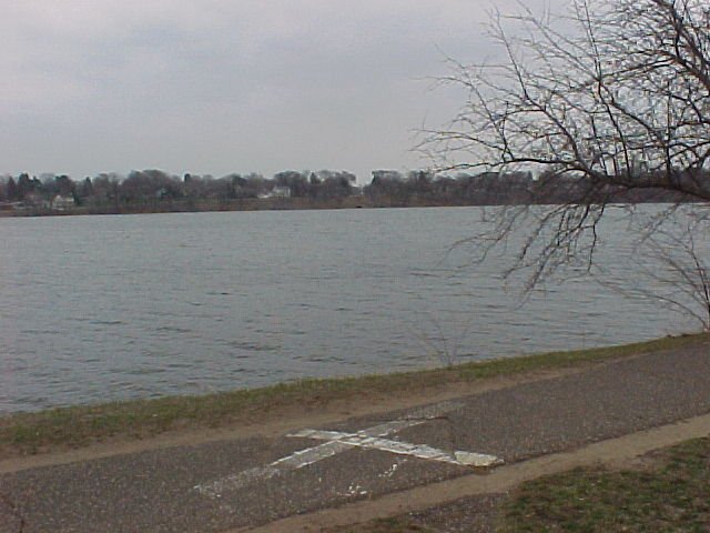
| 1137-1072-2.jpg | April 16, 2002 | Looking east across Lake Phalen at center of Larpenter Ave. |
| 1137-1072-1.jpg | April 16, 2002 | Close up of 'RAMSEY COUNTY' CIM |