| NAD83 COORDINATES (1986 adj.): |
|---|
| * X= 566723.303 Y= 146973.001 Z= 000.00 LSQ 12/06/1991 S FLT |
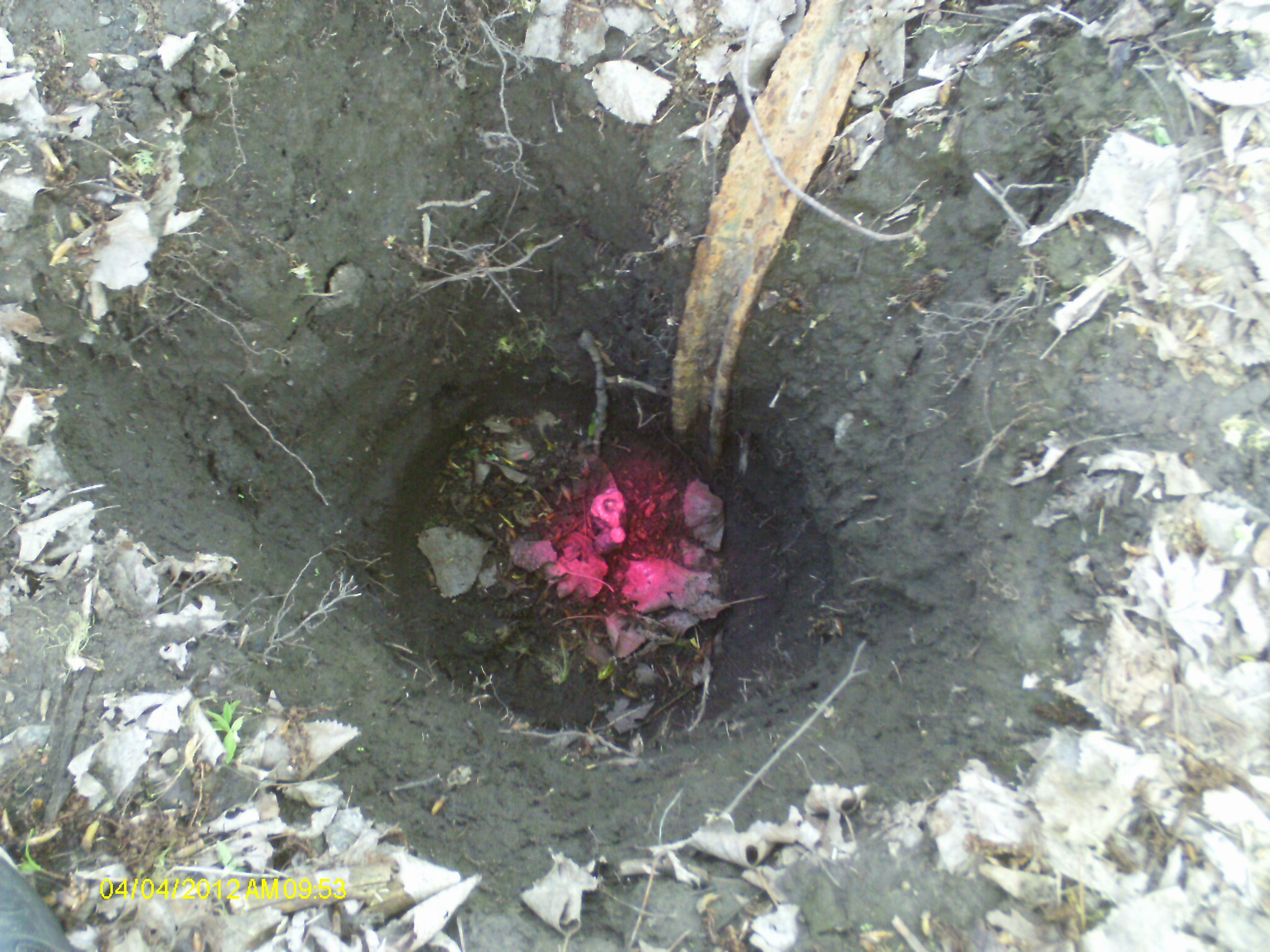
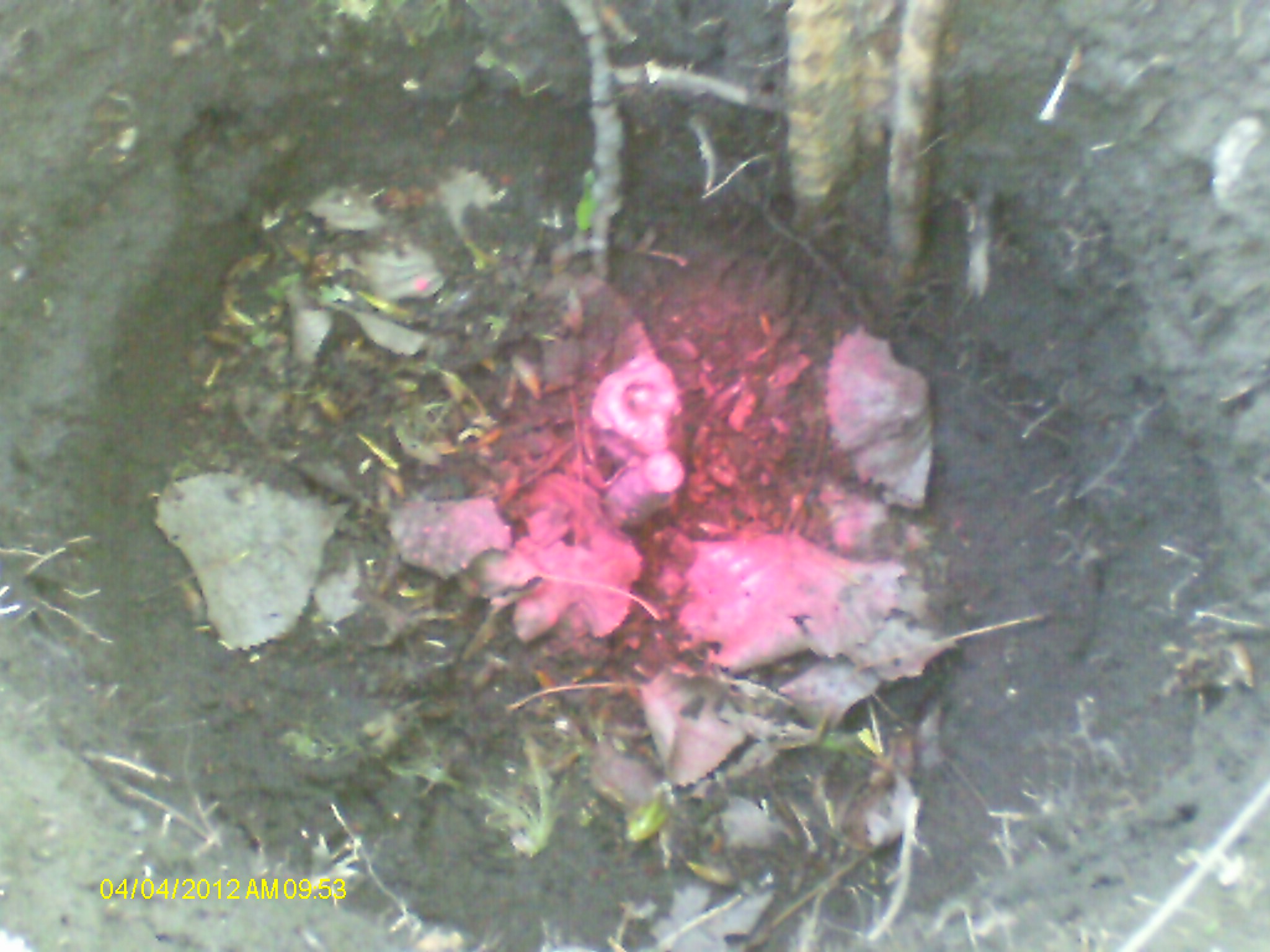
| 4/4/2012 | Found IP 18" beneath surface. A piece of rebar is directly adjacent, and there is an old marker sign post nearby. Monument is 52.7 ft east of Monument #0219. Photos taken. Marker sign placed 54.1 ft west of monument, next to #0219. |
| 1/10/1968 | Located iron 1 ft below grade by survey. See FB 1329 p.77 |
| 2/1/1934 | Placed ties on 12" GM eight inches above grade. See MSX 1 p.26-27 |
| 8/1/1853 | (Unknown date Aug __, 1853 ) Jesse T Jarrett deputy surveyor set post. Tied to 2 BTs. See JJ p.009-010 2823 |
Above is NOT an all inclusive history of this point. Please review all the links below.
| PLS NOTES | Field | Cross Section | Sewer | J.B. Irvine | Monument | River Survey |
|---|---|---|---|---|---|---|
| JJ p.009-010 | FB 0236p.13 | MSX 0001 p.026-027 | 1885 p.120-121 | |||
| FB 0263CPYp. 53 ,54 | ||||||
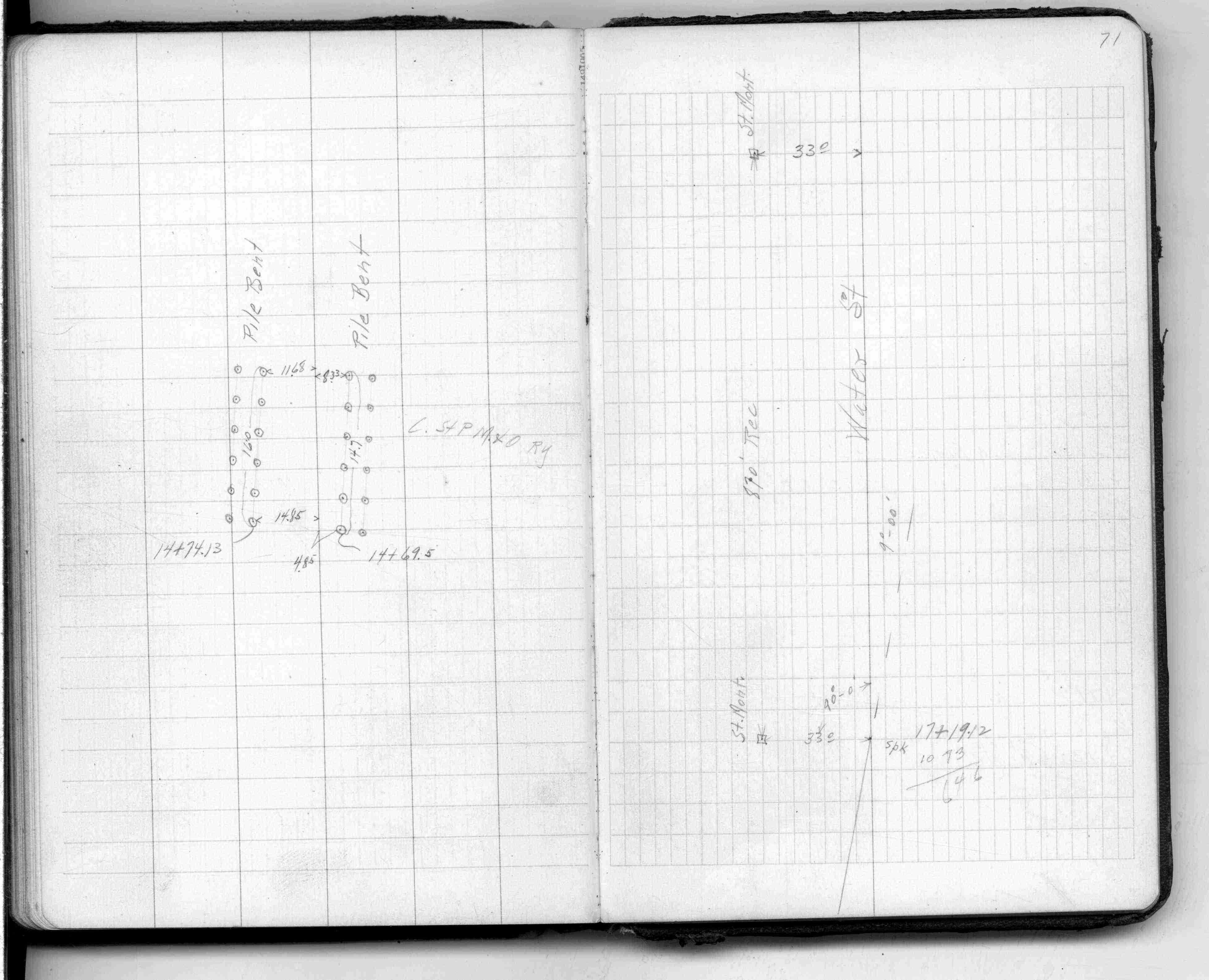
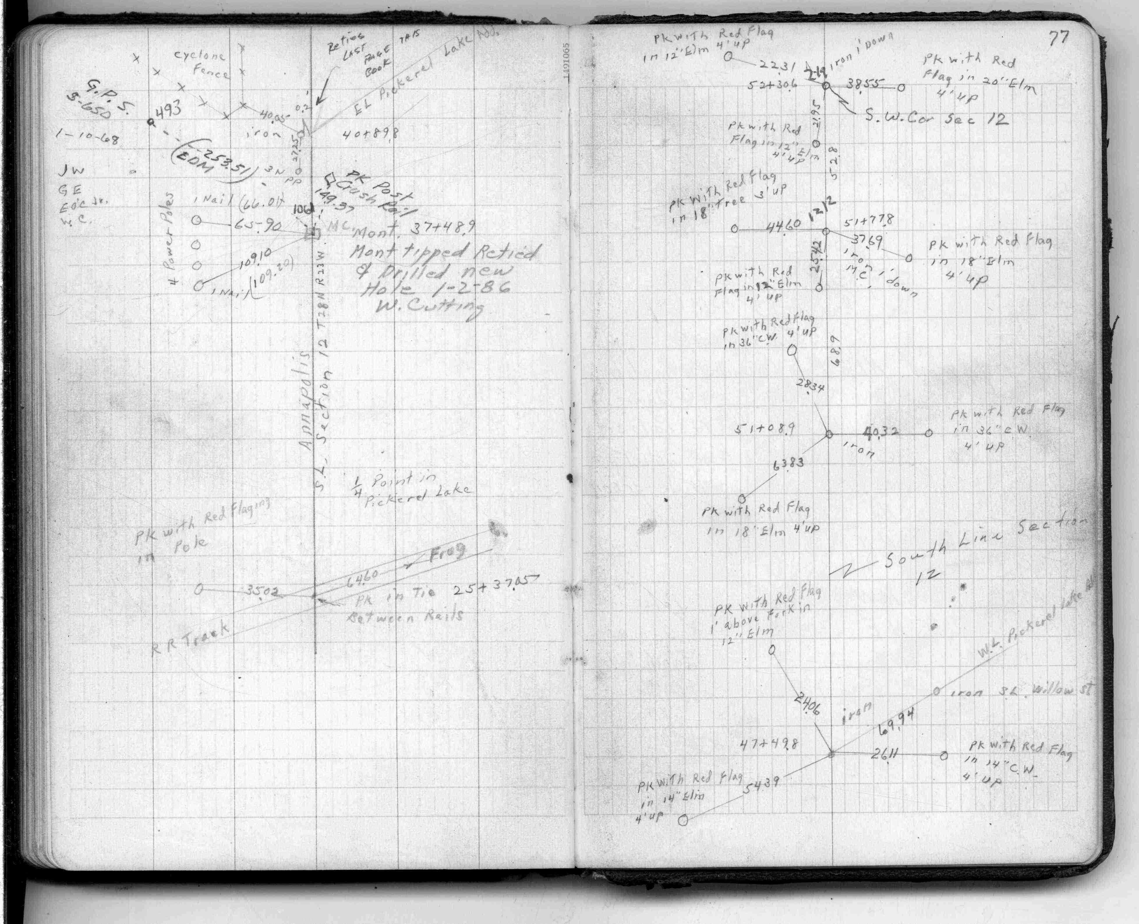
| FB 1329p. 71 ,77 | ||||||
| FB 1329p.77 | ||||||
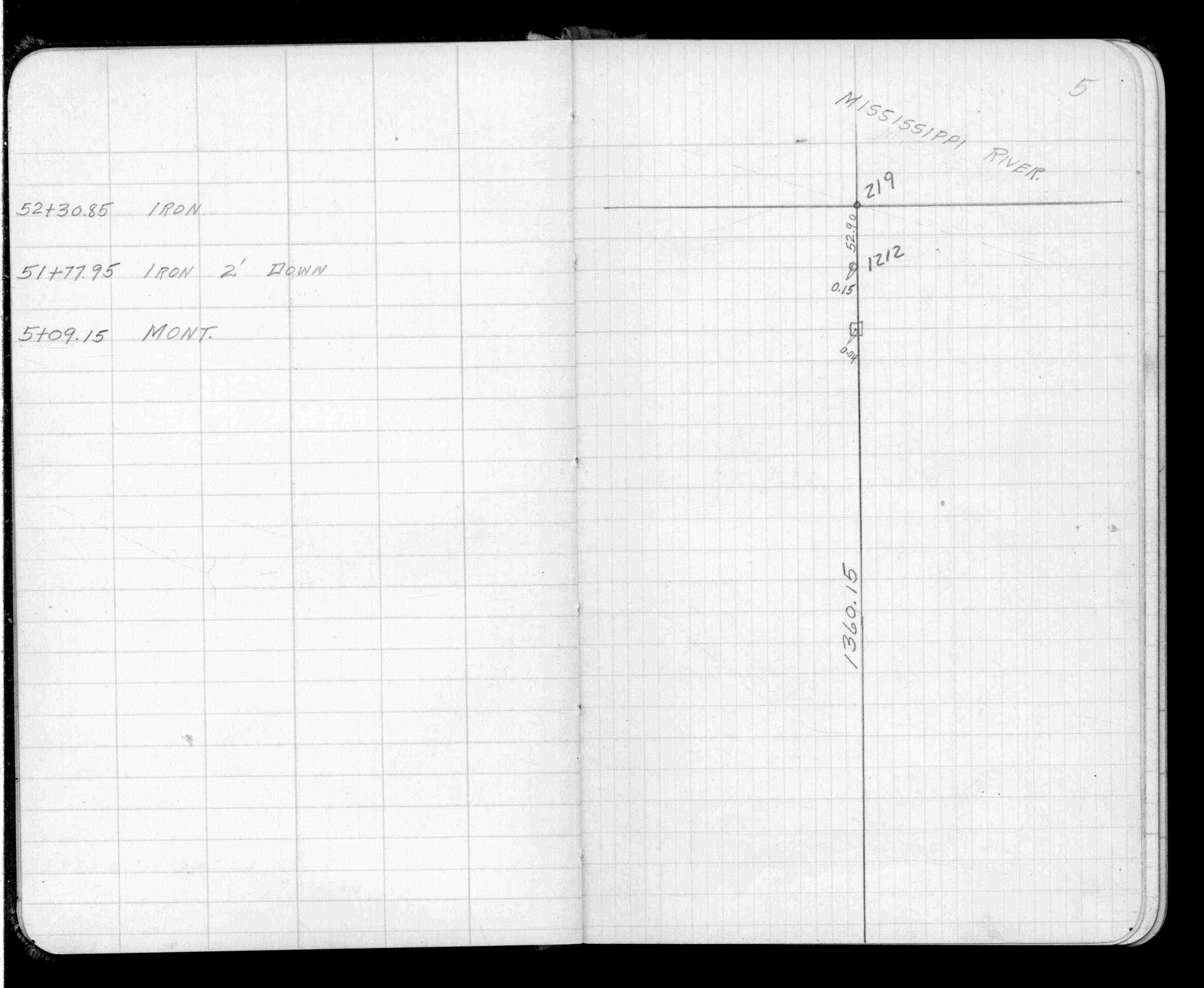
| FB 1504p.05 | ||||||
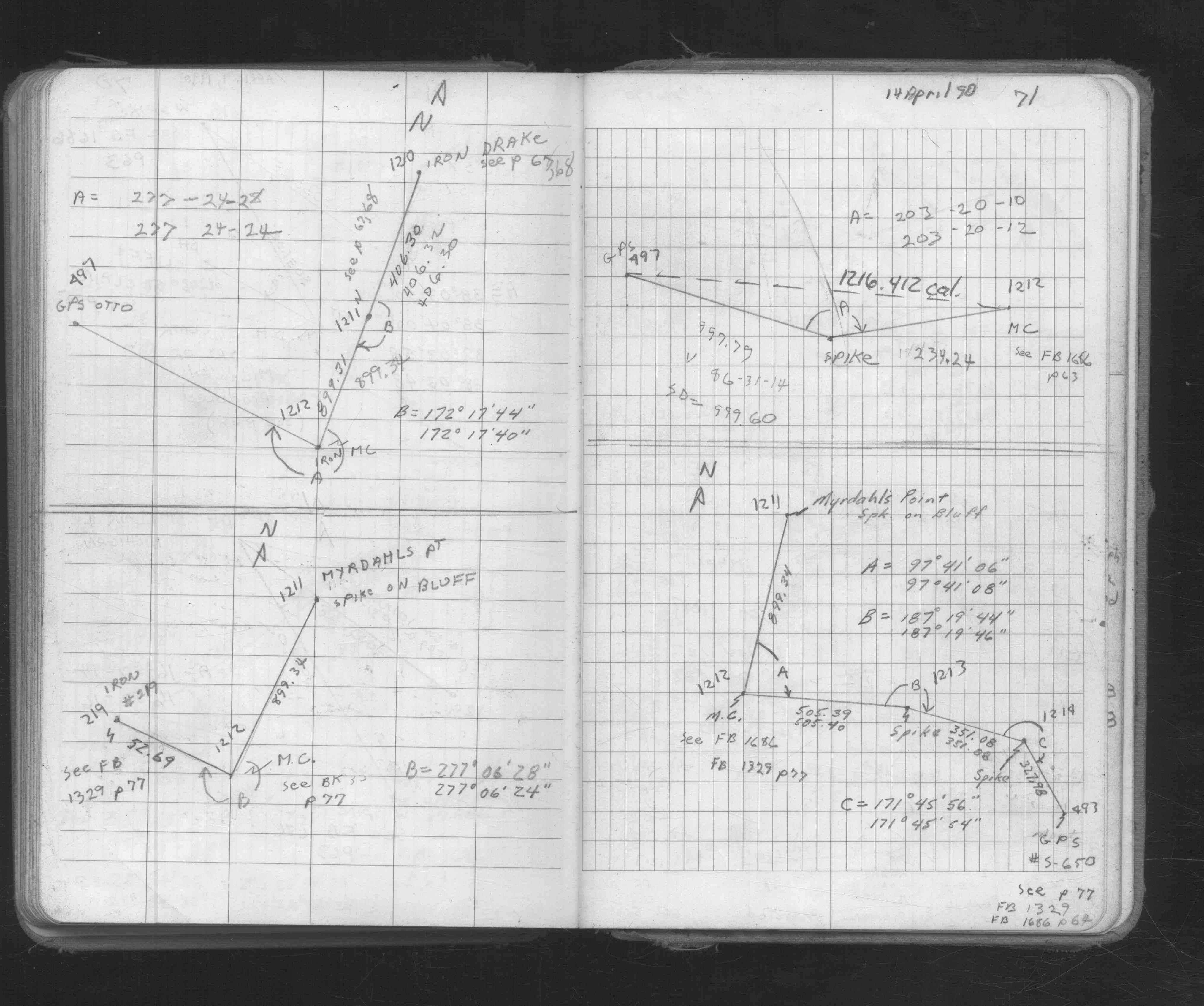
| FB 1673Ap.71 |
| FILE | PHOTO DATE | COMMENTS |
|---|---|---|
| 1212-__jw-2.jpg | April 4, 2012 | Close up of monument. |
| 1212-__jw-1.jpg | April 4, 2012 | Close up of monument. |