| NAD83 COORDINATES (1986 adj.): |
|---|
| * X= 562342.998 Y= 141682.323 Z= 000.00 LSQ 12/06/1991 S FLT |
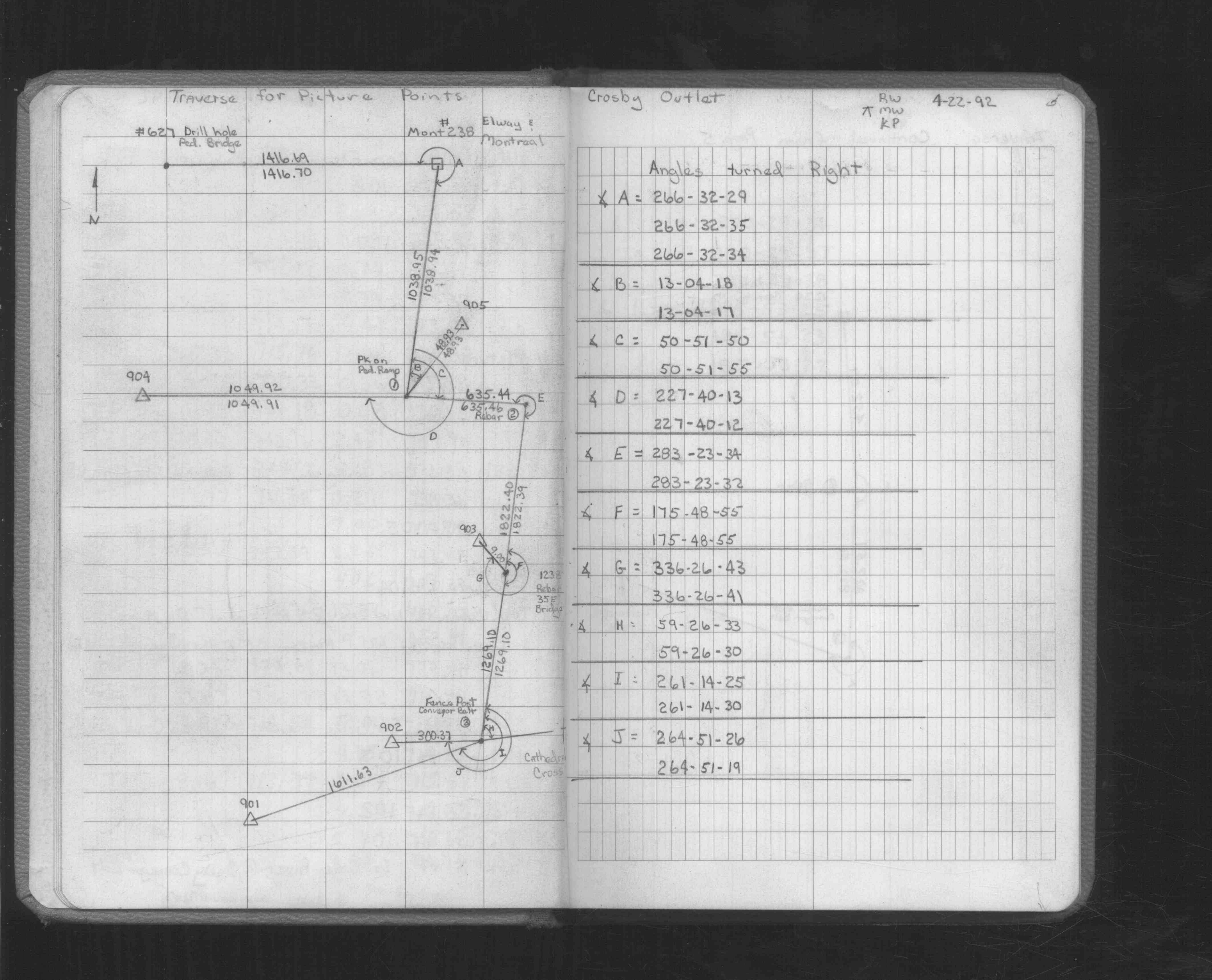
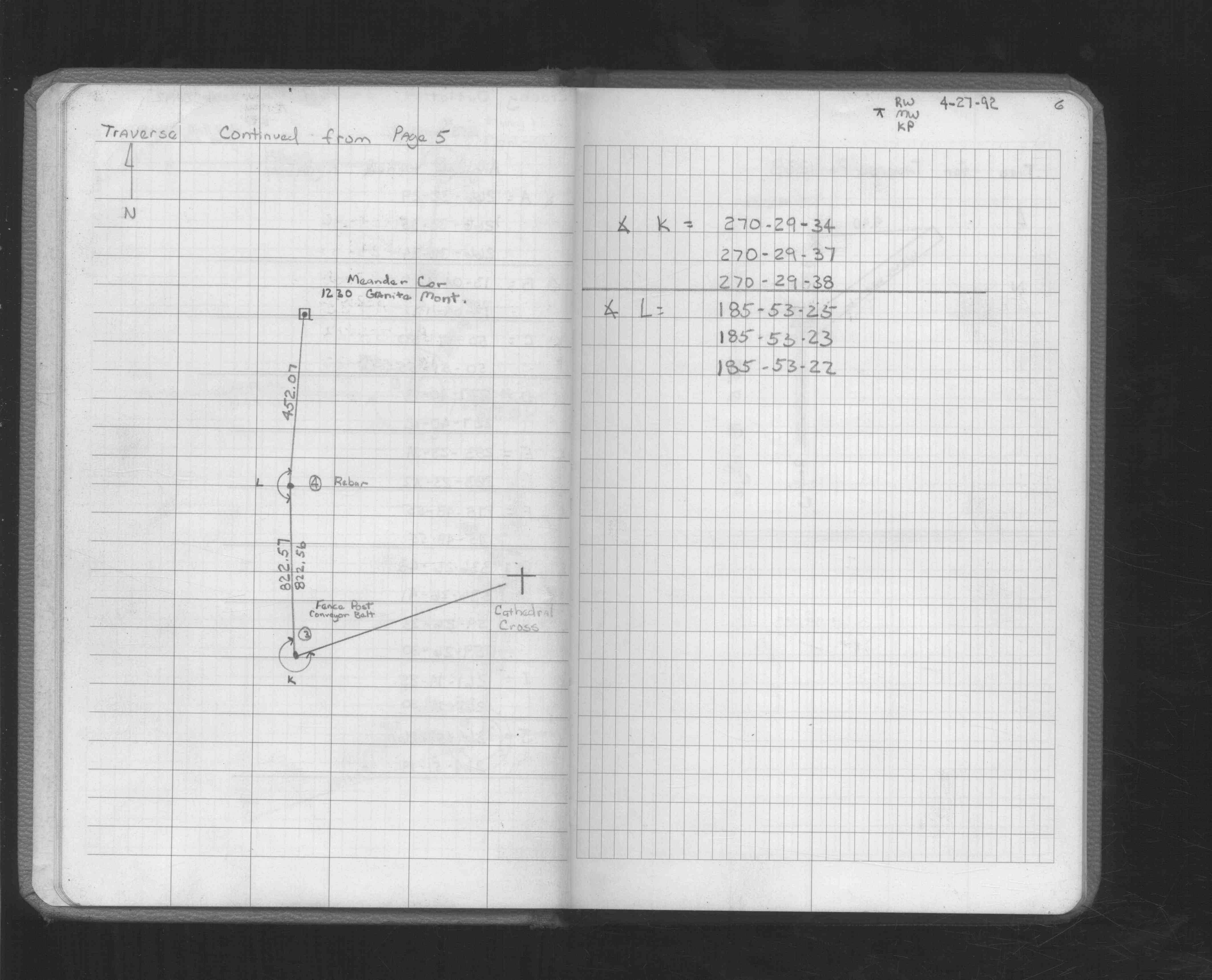
| 4/27/1992 | Traversed into GM. See FB 1549L p.6 |
| 4/30/1990 | Fd GM. See FB 1673A p.74 |
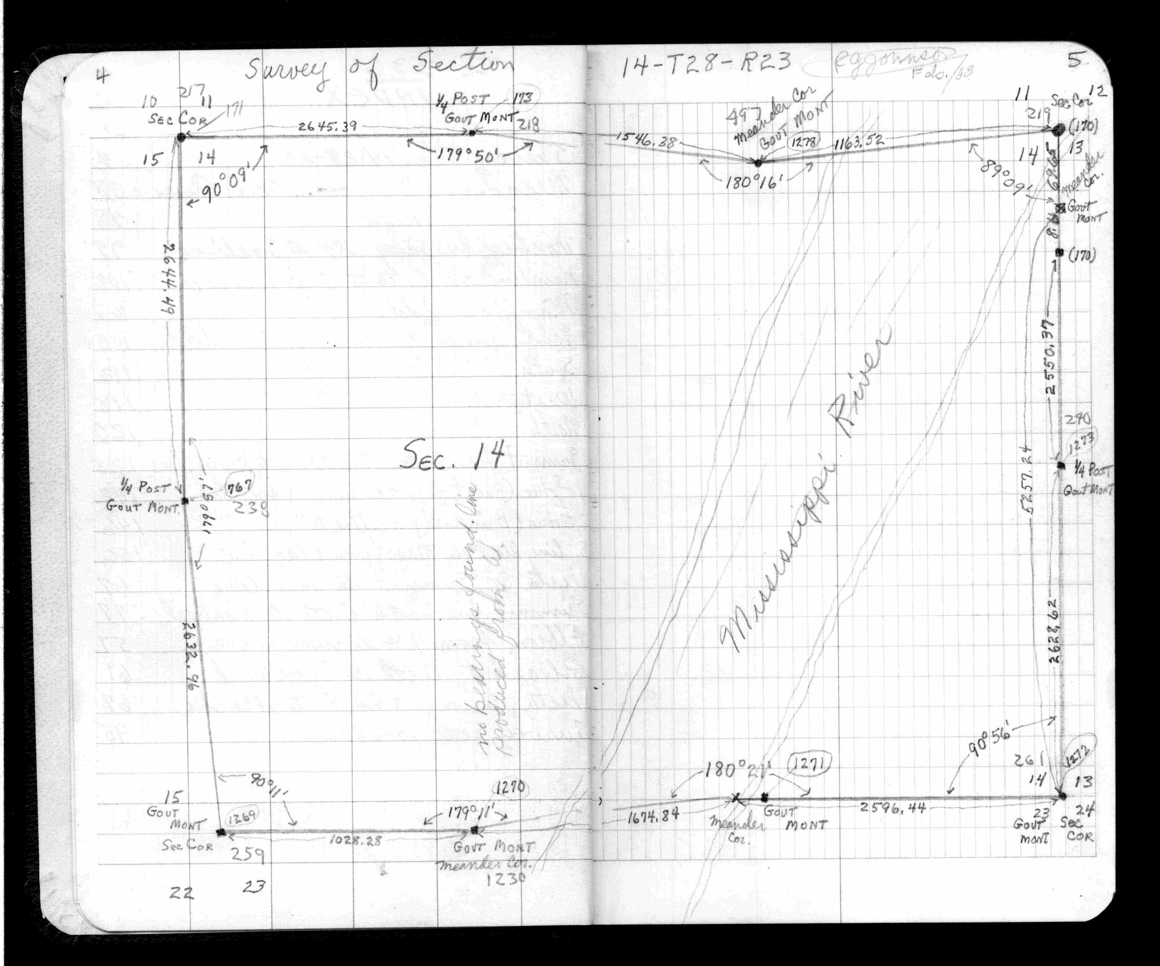
| 2/1/1888 | (Unknown date Feb __, 1888 ) Survey of Section 14-28-23. See JBI 01 p.01-02,09-10 |
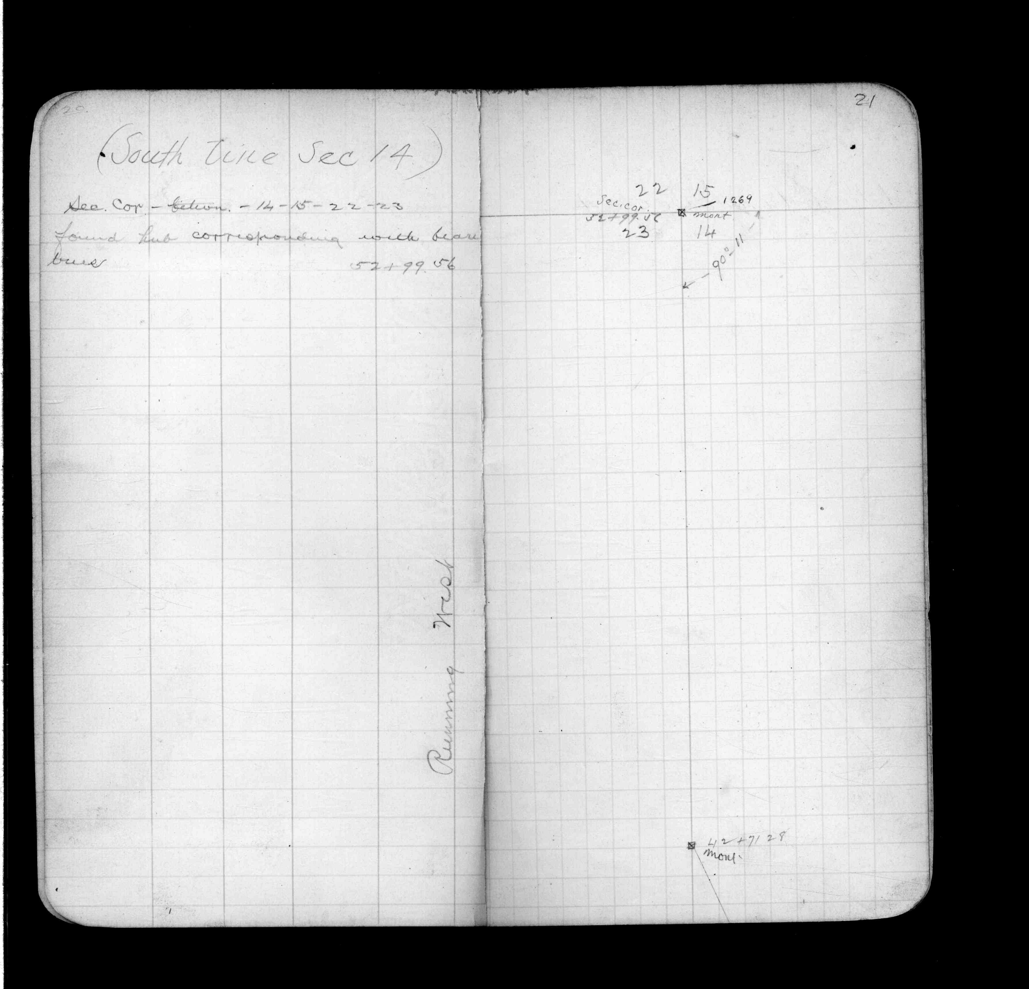
| 2/1/1888 | (Unknown date Feb __, 1888 ) Monument set at MC from survey by R J Johnson. See FB 236 p.018-019 |
| 10/1/1847 | (Unknown date Oct __, 1847 ) Isaac N Higbee deputy surveyor set post. Tied to 2 BTs. See IH p.008-009 2823 |
Above is NOT an all inclusive history of this point. Please review all the links below.
| PLS NOTES | Field | Cross Section | Sewer | J.B. Irvine | Monument | River Survey |
|---|---|---|---|---|---|---|
| IH p.008-009 | FB 0236p.018-019 | JBI 01 p.01-02 JBI 01 p.09-10 | 1885 p.146-147 p.164-165 | |||
| FB 0236p. 018-019 ,020-021 | JBI 01 p.01-02 | |||||
| FB 0236CPYp.004-005 | ||||||
| FB 1549Lp. 05 ,06 | ||||||
| FB 1549Lp.06 | ||||||
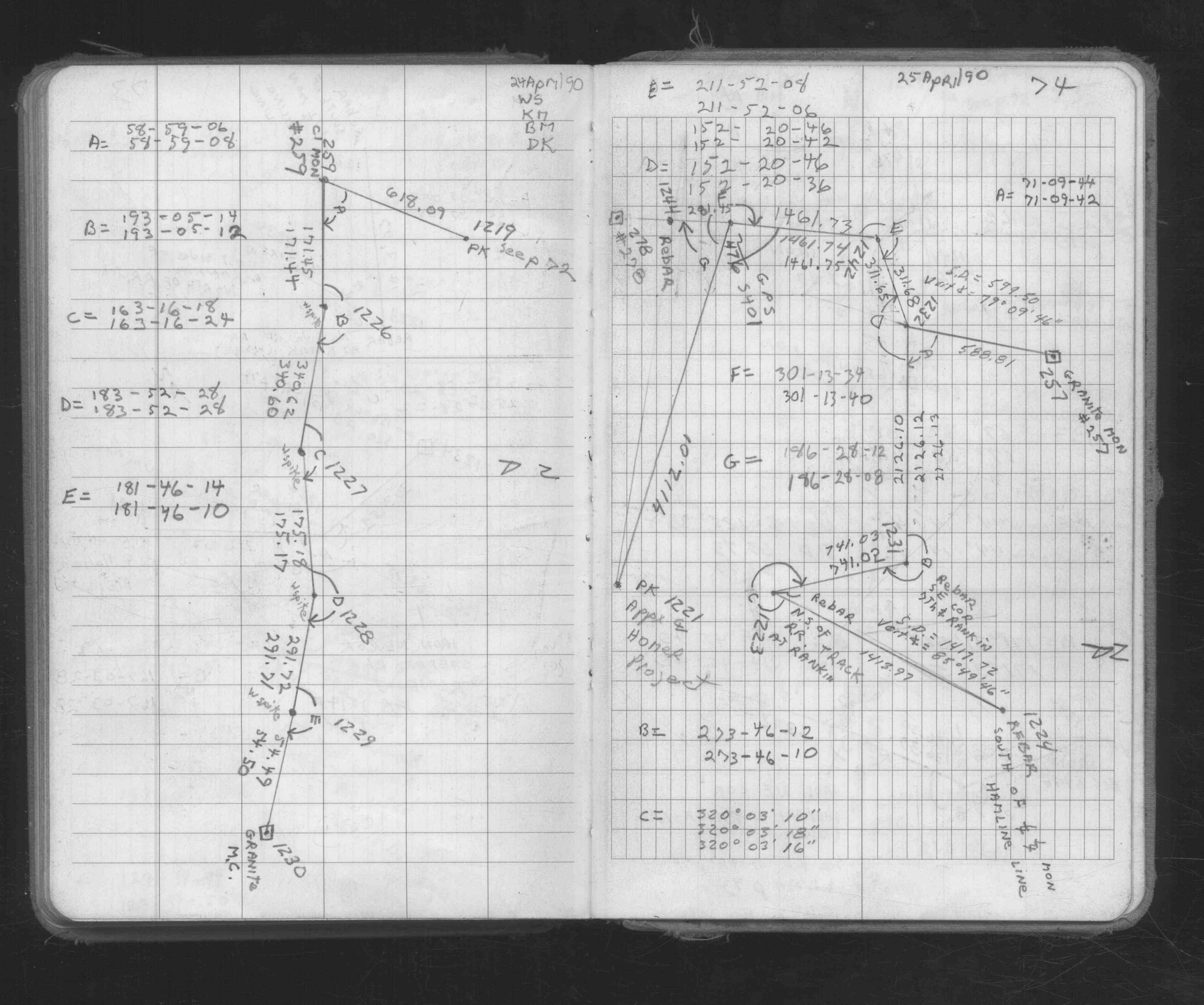
| FB 1673Ap.74 | ||||||
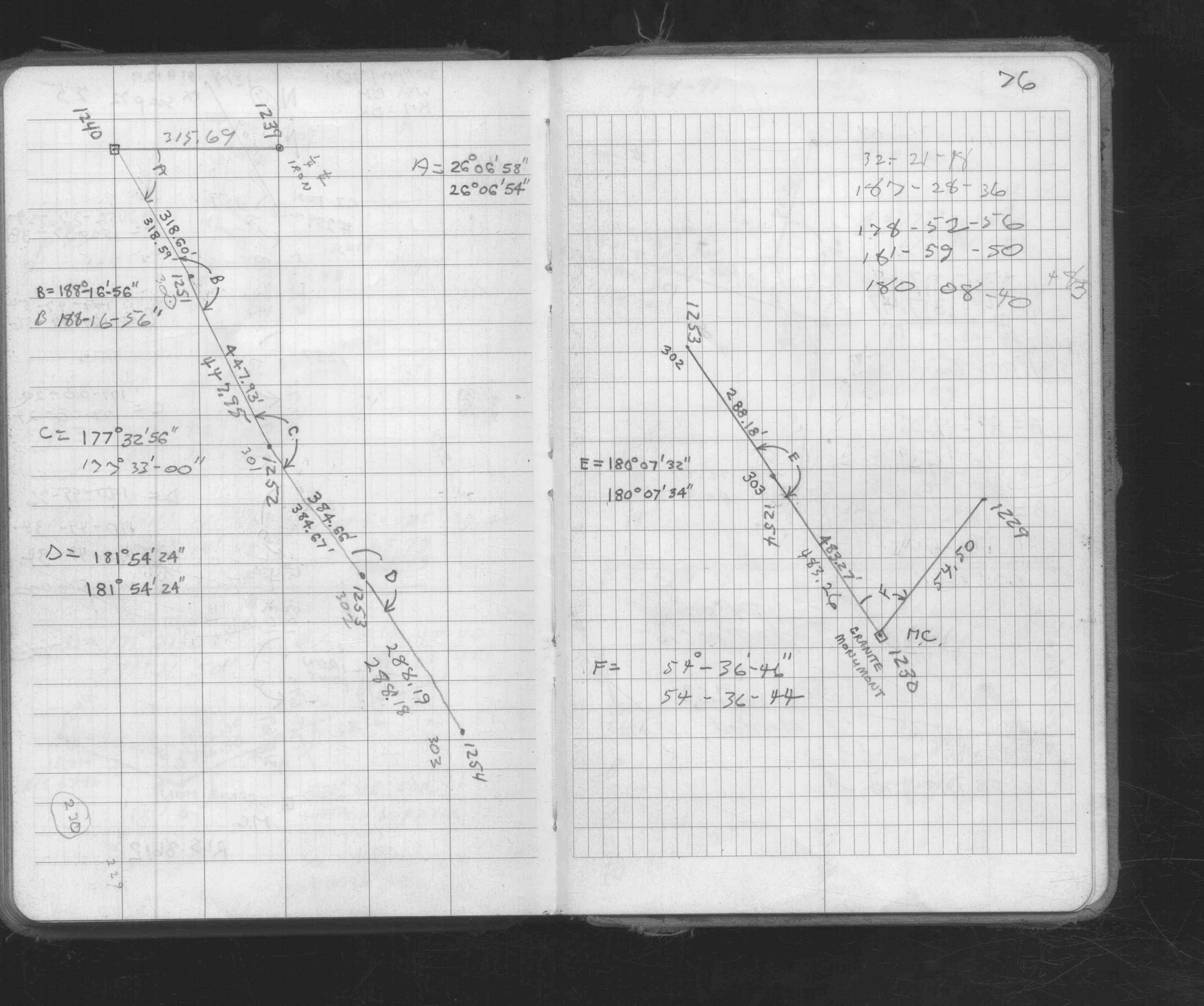
| FB 1673Ap. 74 ,76 |