| NAD83 COORDINATES (1986 adj.): |
|---|
| X= 565923.957 Y= 154884.440 Z= 000.00 CMP 12/17/1991 |
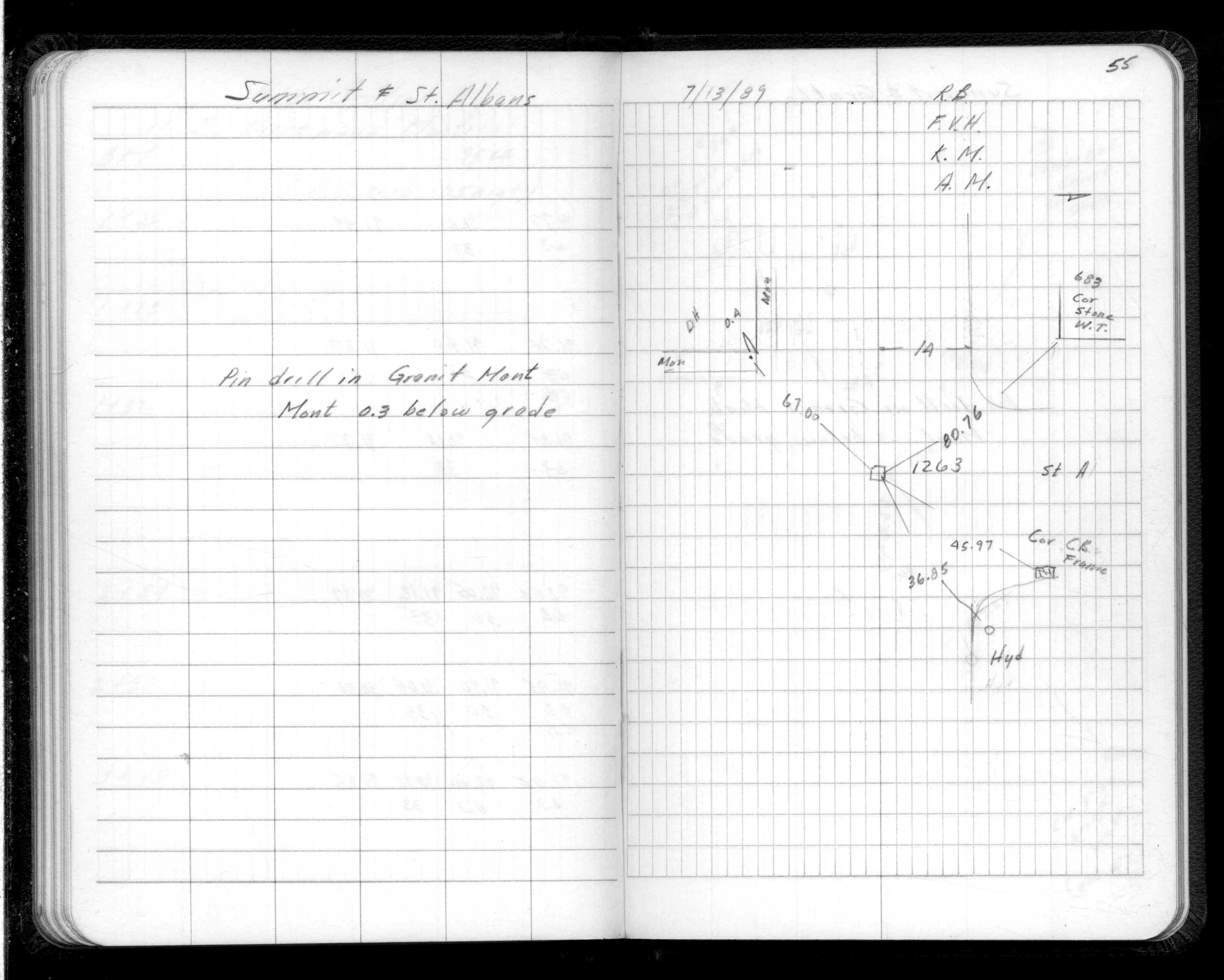
| 7/13/1989 | Place pin in GM, GM 0.3 ft below grade, placed ties. See FB 1539 p.55 |
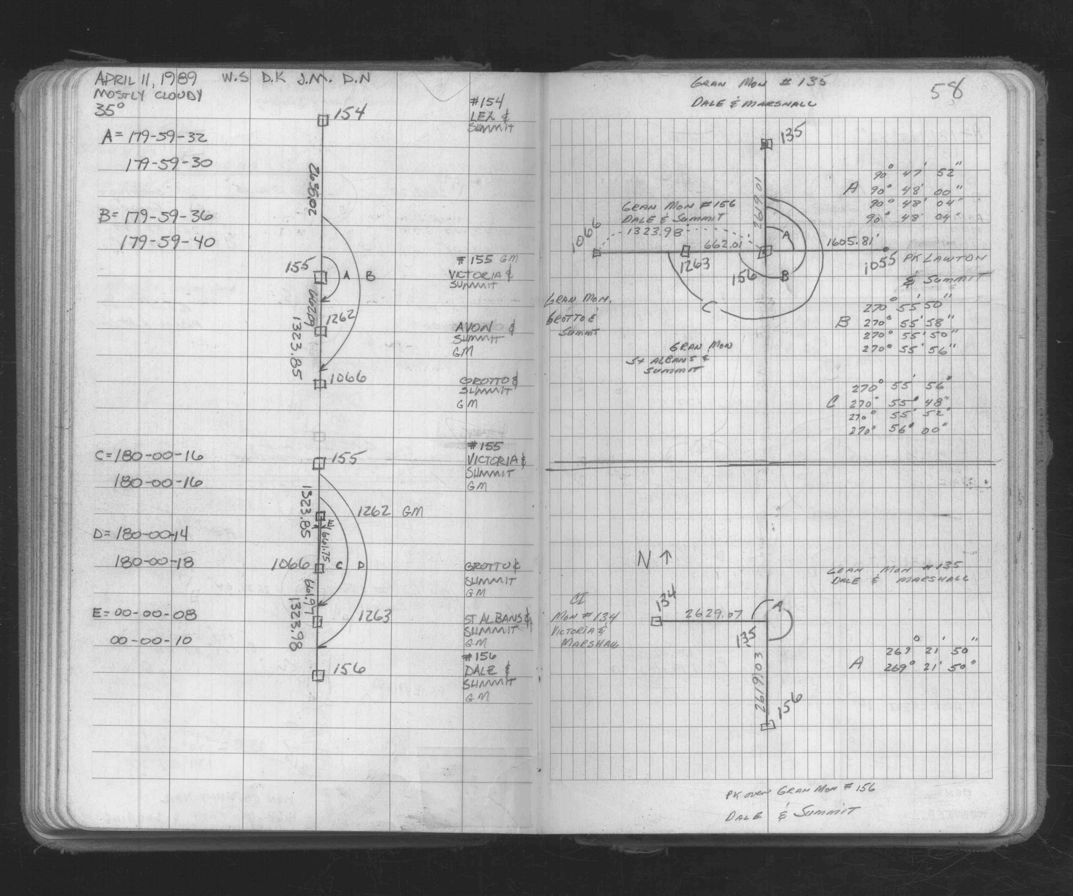
| 4/11/1989 | Recovered & located GM by traverse. See FB 1673A p.58 |
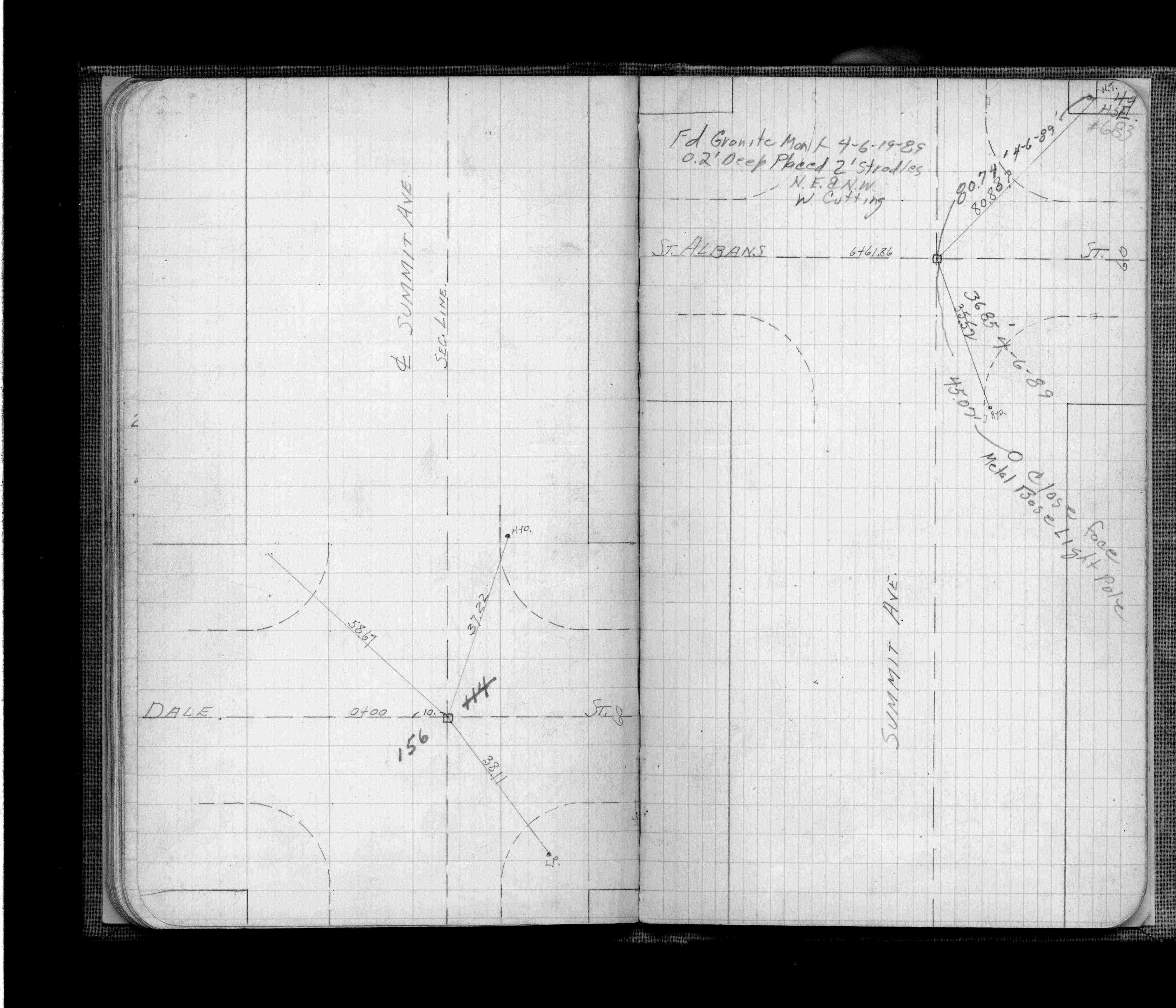
| 4/6/1989 | Fd GM 0.2 ft below grade, placed 2 ft stradles NE & NW of GM. See FB 705 p.49 |
| 1/1/1890 | (Unknown date ___ __, 1890 ) Monument set by J H Armstrong |
Above is NOT an all inclusive history of this point. Please review all the links below.
| PLS NOTES | Field | Cross Section | Sewer | J.B. Irvine | Monument | River Survey |
|---|---|---|---|---|---|---|
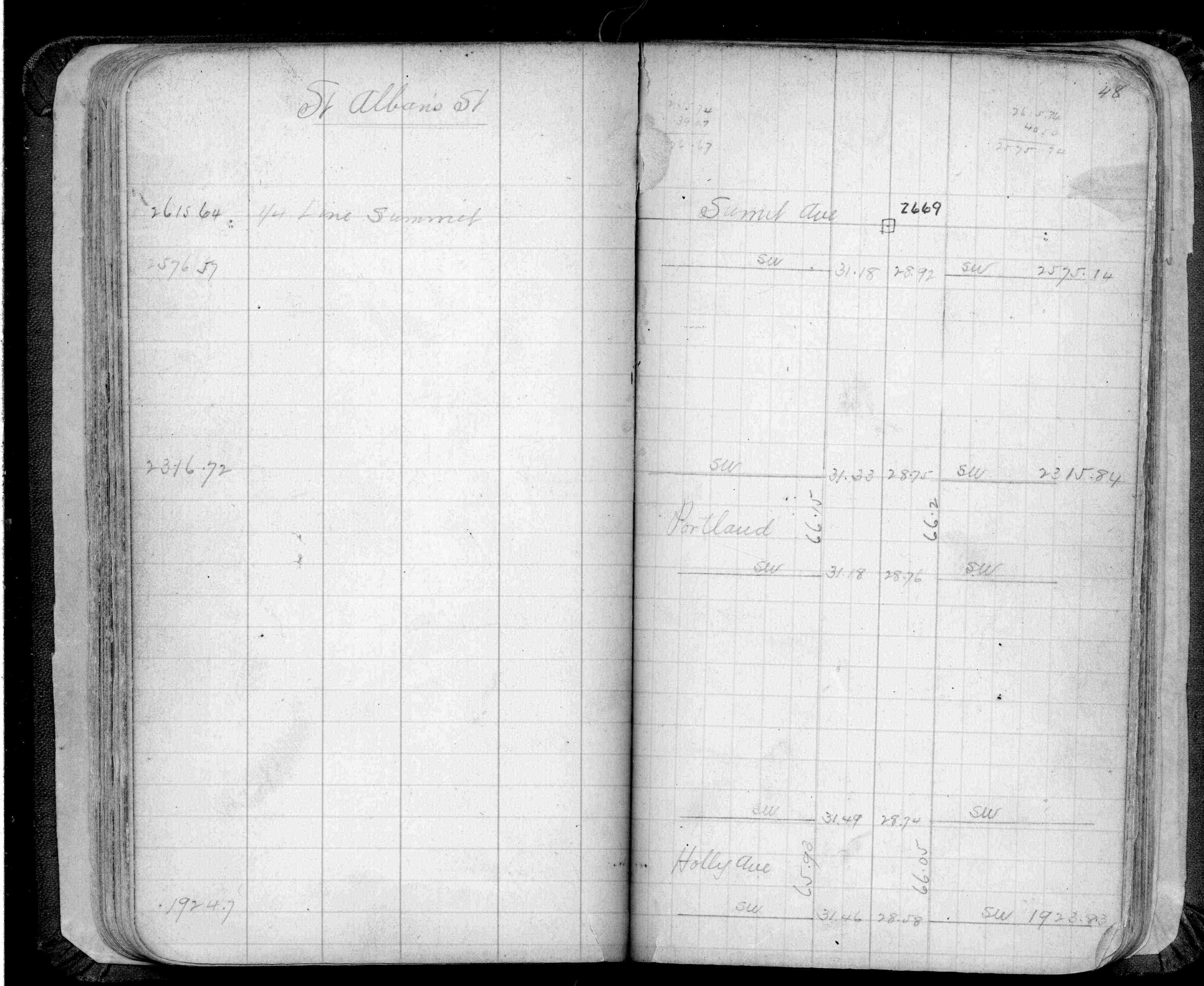
| FB 0220p.48 | ||||||
| FB 0705p.49 | ||||||
| FB 1539p.55 | ||||||
| FB 1673Ap.58 |