| NAD83 COORDINATES (1986 adj.): |
|---|
| X= 561319.847 Y= 146169.244 Z= 000.00 CMP 12/17/1991 |
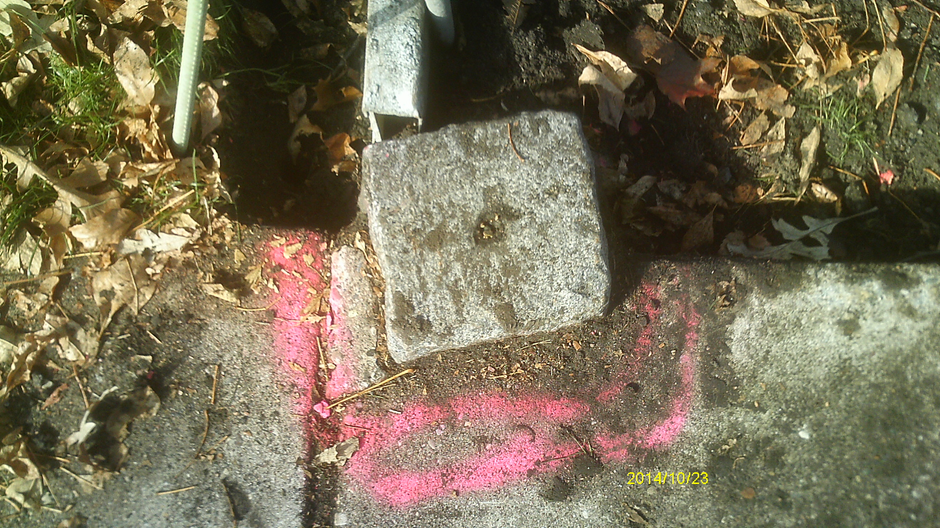
| 10/23/2014 | Found GM 0.1 ft above sidewalk grade. Photos taken and ties placed. |
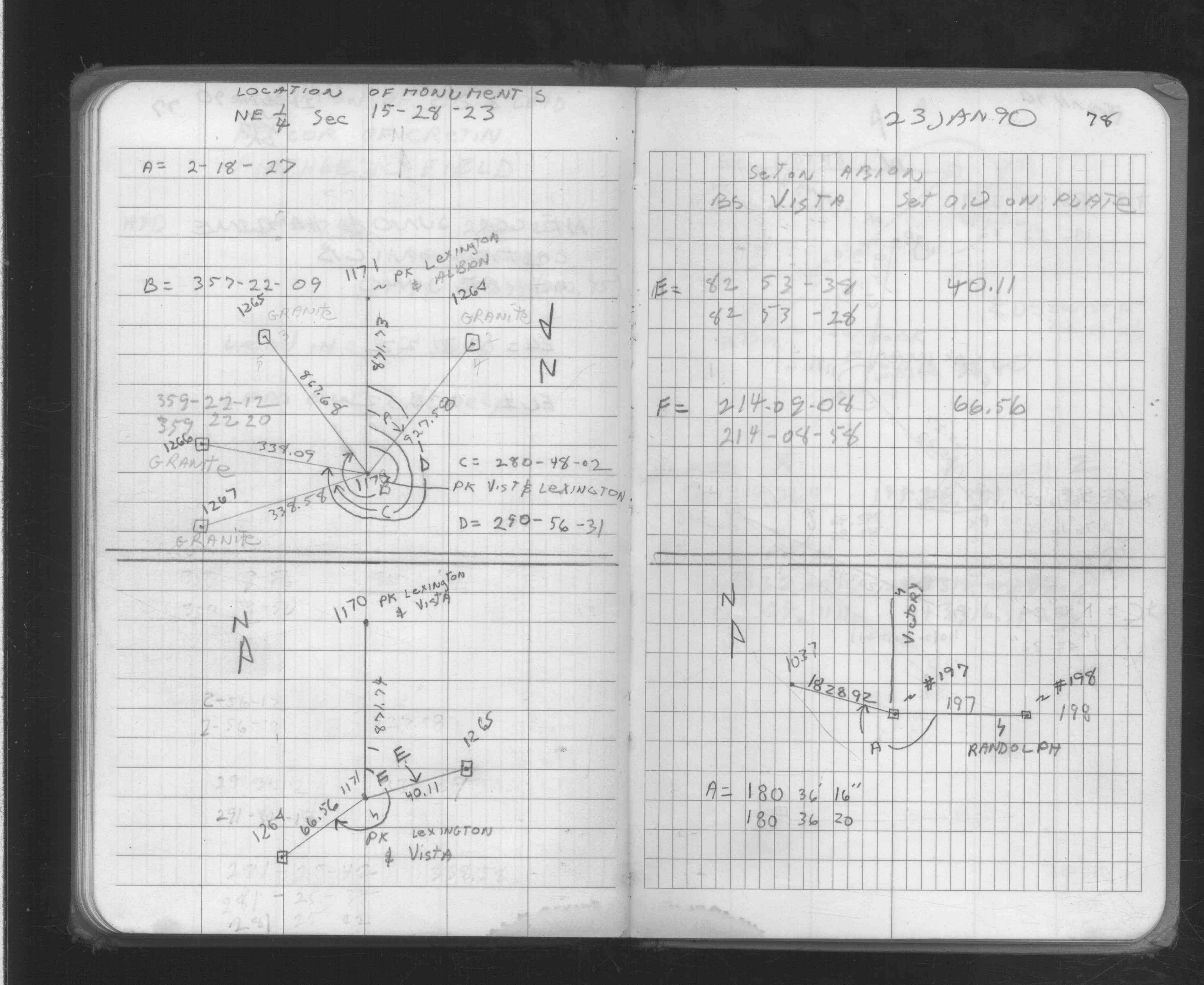
| 1/23/1990 | Recovered & located GM by traverse (single stub). See FB 1704 p.78 |
Above is NOT an all inclusive history of this point. Please review all the links below.
| PLS NOTES | Field | Cross Section | Sewer | J.B. Irvine | Monument | River Survey |
|---|---|---|---|---|---|---|
| FB 1704p.78 |
| FILE | SURVEYOR | LIC. NO. | DATE SIGNED | DATE TIED |
|---|---|---|---|---|
| 1266-__fu-A.pdf | Samuel Gibson | 44880 | May 21, 2015 | October 23, 2014 |
| FILE | PHOTO DATE | COMMENTS |
|---|---|---|
| 1266-__fu-2.jpg | October 23, 2014 | Close up of monument location. |
| 1266-__fu-1.jpg | October 23, 2014 | Close up of monument. |