| NAD83 COORDINATES (1986 adj.): |
|---|
| * X= 550777.397 Y= 139175.959 Z= 000.00 CMP 12/17/1991 |
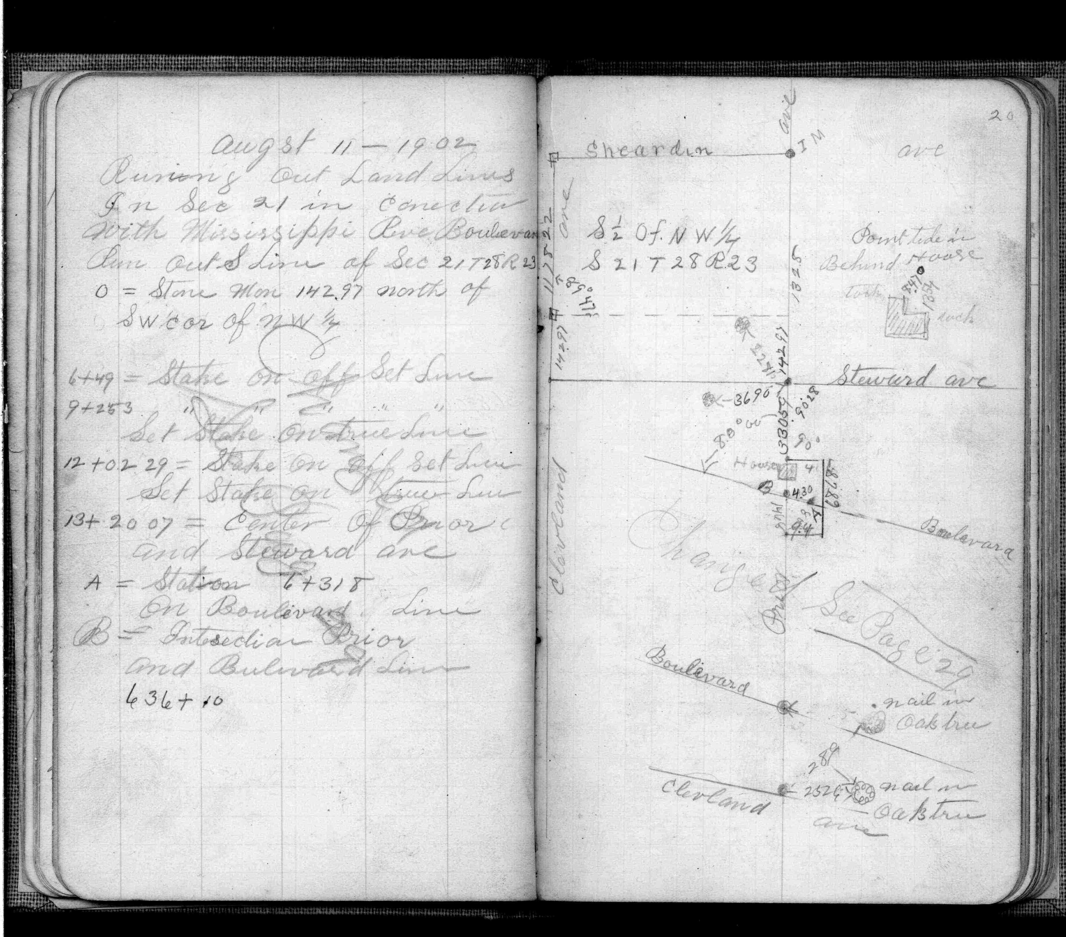
| 8/12/1902 | F OHara running out land lines in connection with Mississippi River Blvd. See FB 474 p.20 |
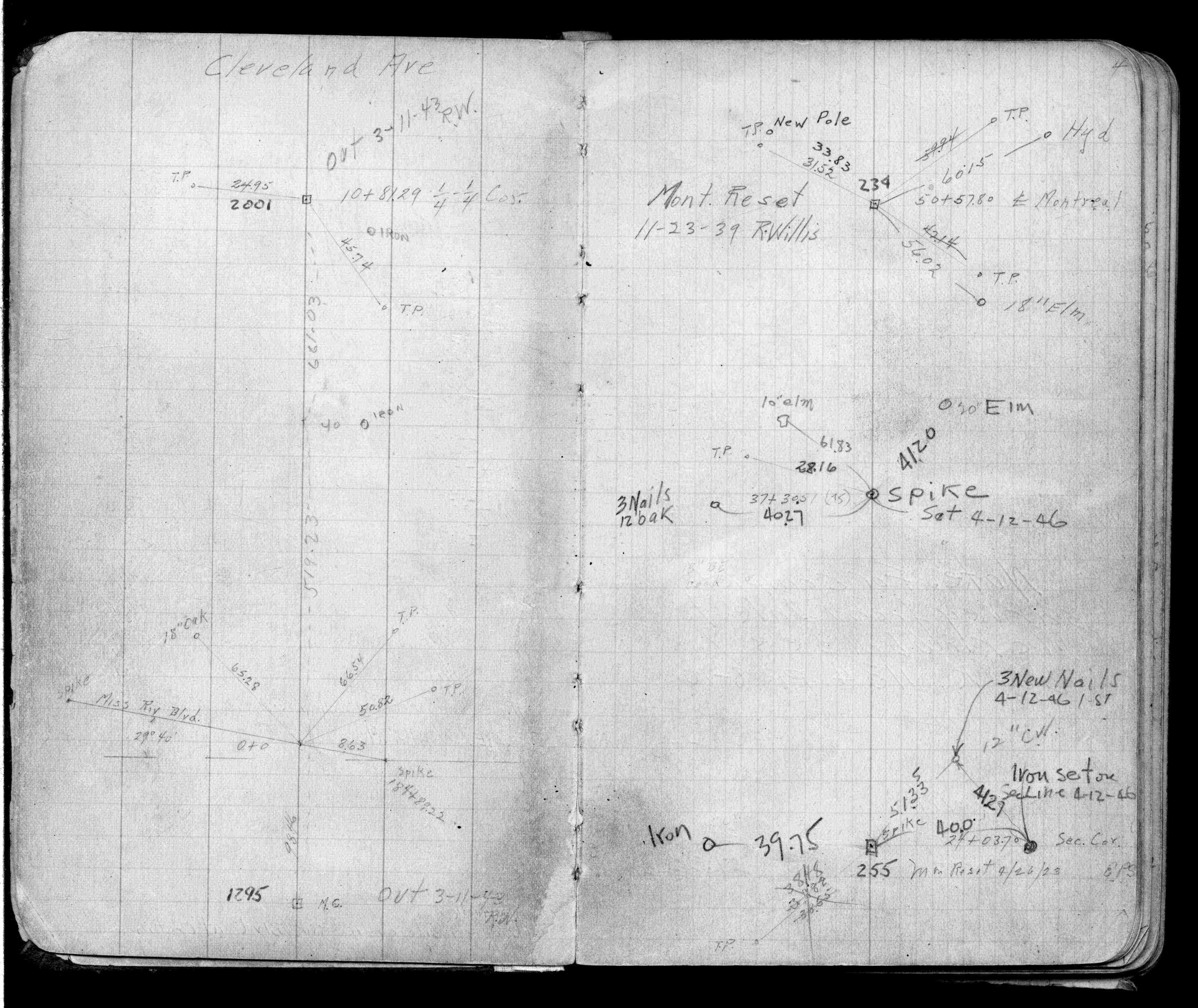
| 6/1/1888 | (Unknown date Jun __, 1888 ) Monument set by J H Armstrong See 1885 River Survey |
| 10/1/1847 | (Unknown date Oct __, 1847 ) Isaac N Higbee deputy surveyor set post. Tied to 2 BTs. See IH p.018-019 2823 |
Above is NOT an all inclusive history of this point. Please review all the links below.
| PLS NOTES | Field | Cross Section | Sewer | J.B. Irvine | Monument | River Survey |
|---|---|---|---|---|---|---|
| IH p.018-019 | FB 0253p. 17 ,46 | MS 0007 p.044-045 | 1885 p.156-157 | |||
| FB 0474p.20 | ||||||
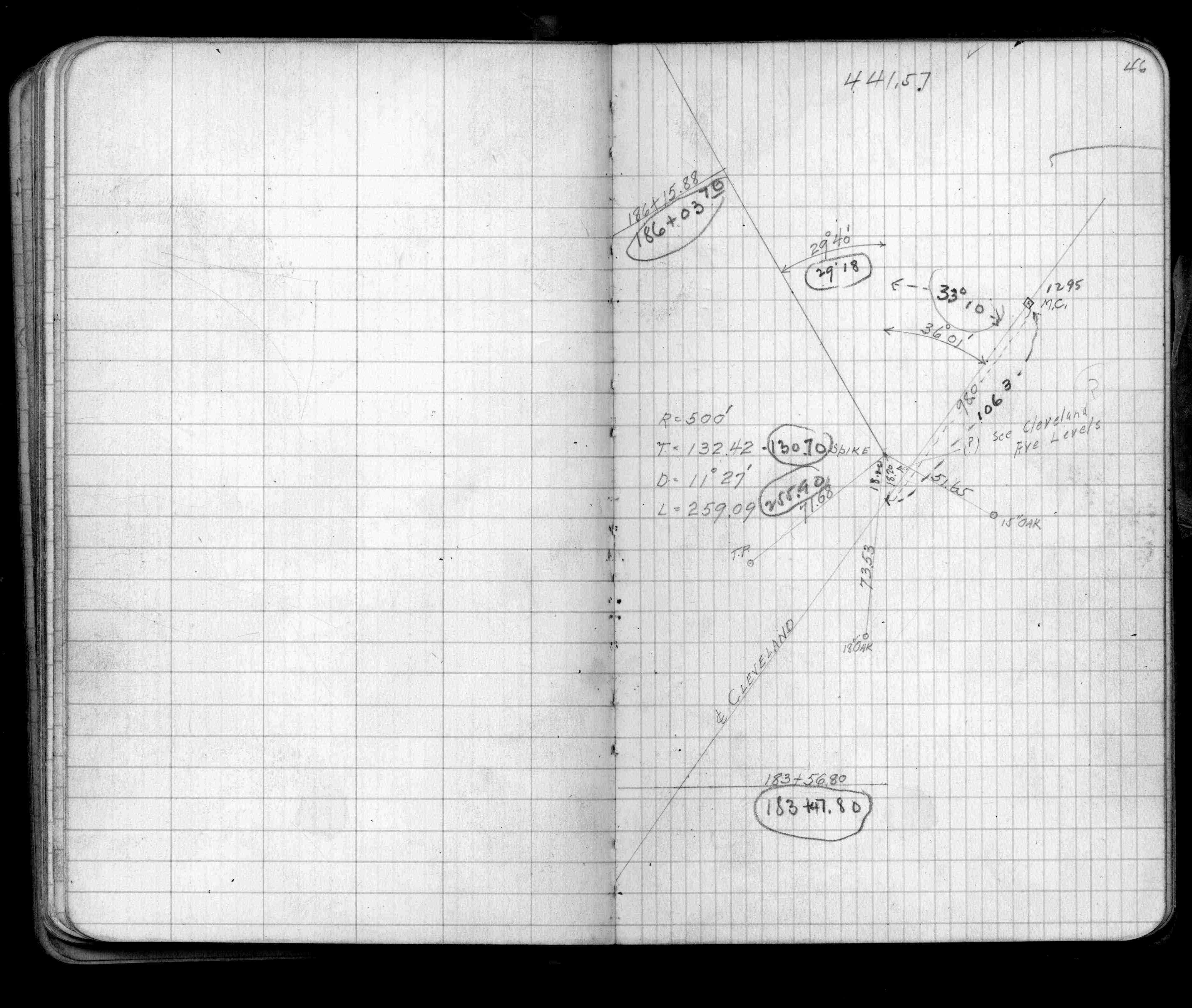
| FB 0854p.46 | ||||||
| FB 1059p.04 |