| NAD83 COORDINATES (1986 adj.): |
|---|
| * X= 584729.087 Y= 152258.429 Z= 000.00 CMP 12/17/1991 |
| 8/1/1927 | (Unknown date Aug __, 1927 ) Recovered SM. See FB 1179A p.3 |
| 3/1/1880 | (Unknown date Mar __, 1880 ) Stake replaced by Monument. See Old Index Book, Entry 148 |
| 3/1/1877 | (Unknown date Mar __, 1877 ) Both bearings in. See Old Index Book, Entry 148 |
| 9/1/1853 | (Unknown date Sep __, 1853 ) Jesse T Jarrett deputy surveyor set post. Tied to 2 BTs. See JJ p.024-025 2822 |
Above is NOT an all inclusive history of this point. Please review all the links below.
| PLS NOTES | Field | Cross Section | Sewer | J.B. Irvine | Monument | River Survey |
|---|---|---|---|---|---|---|
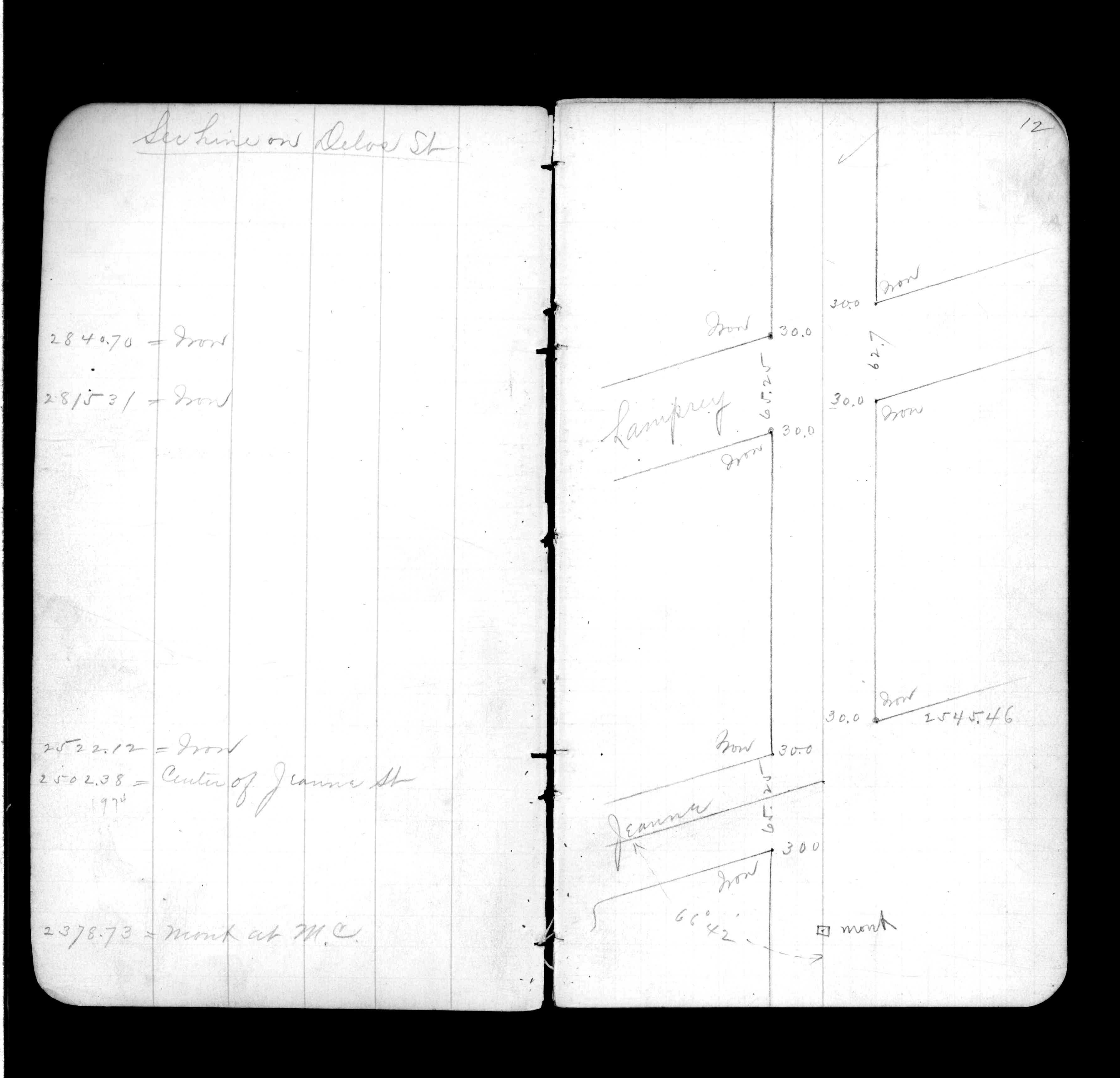
| JJ p.024-025 | FB 0324CPYp.12 | |||||
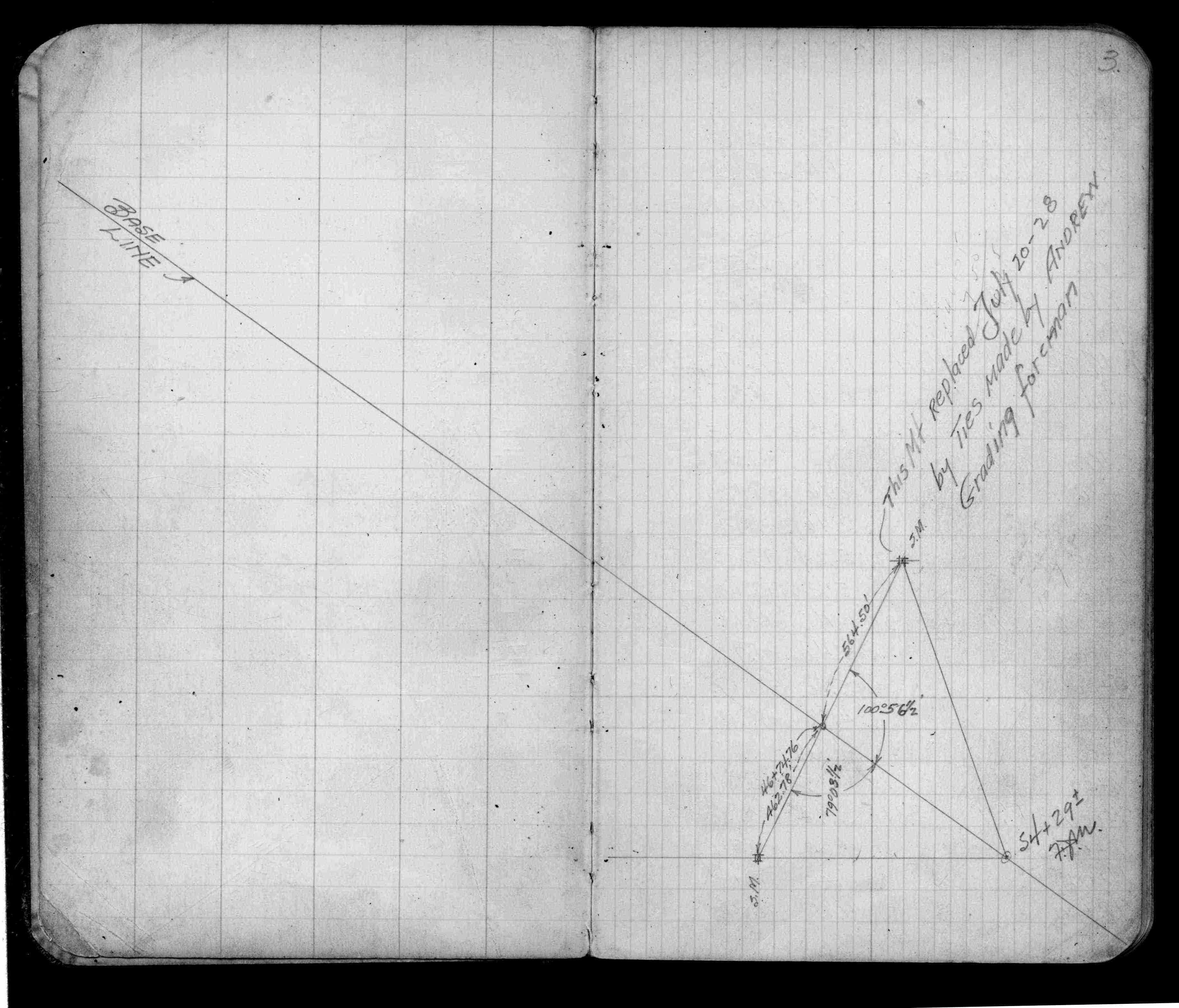
| FB 1179Ap.03 |