| NAD83 COORDINATES (1986 adj.): |
|---|
| * X= 547571.360 Y= 146956.900 Z= 000.00 CMP 12/17/1991 |
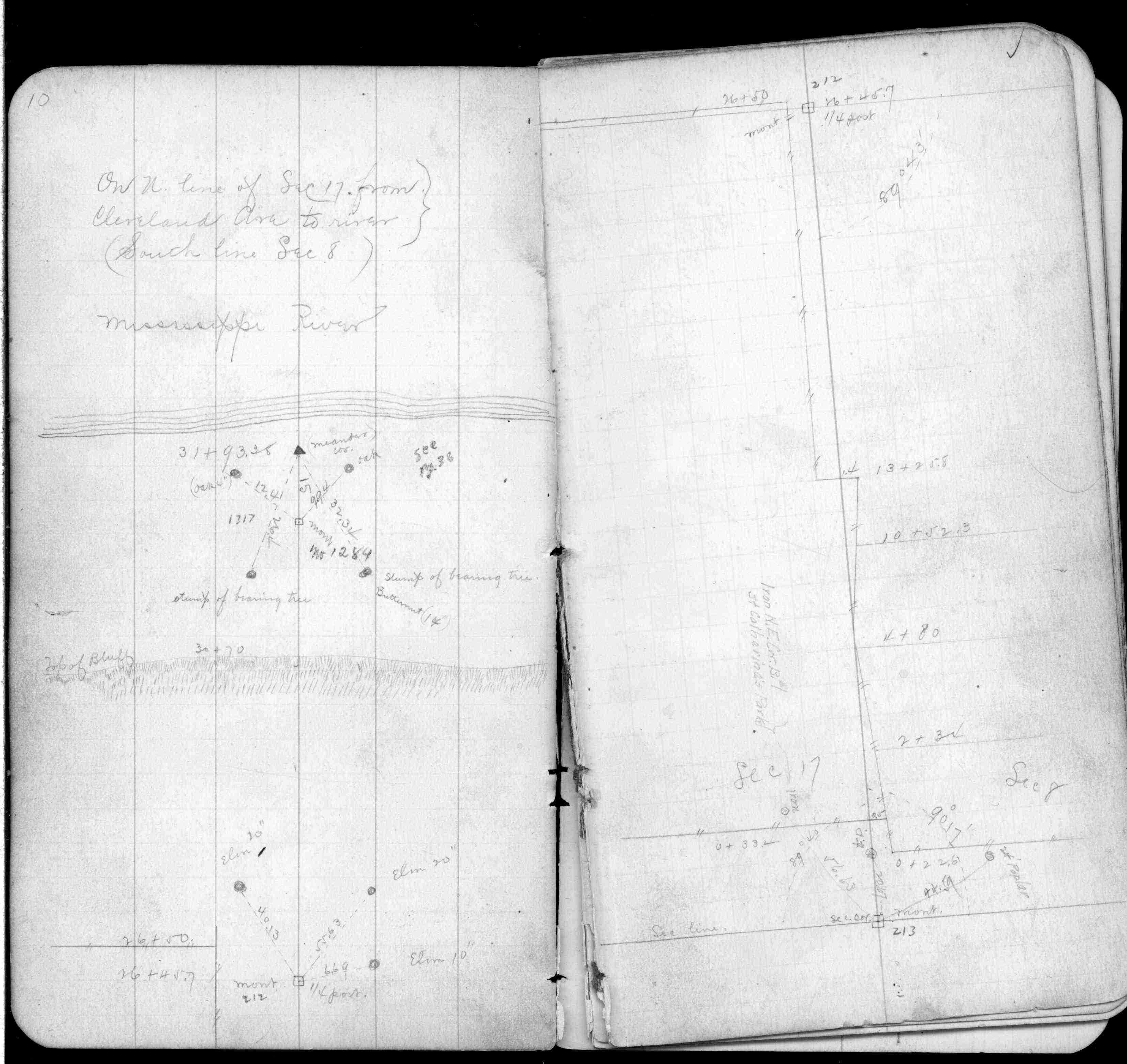
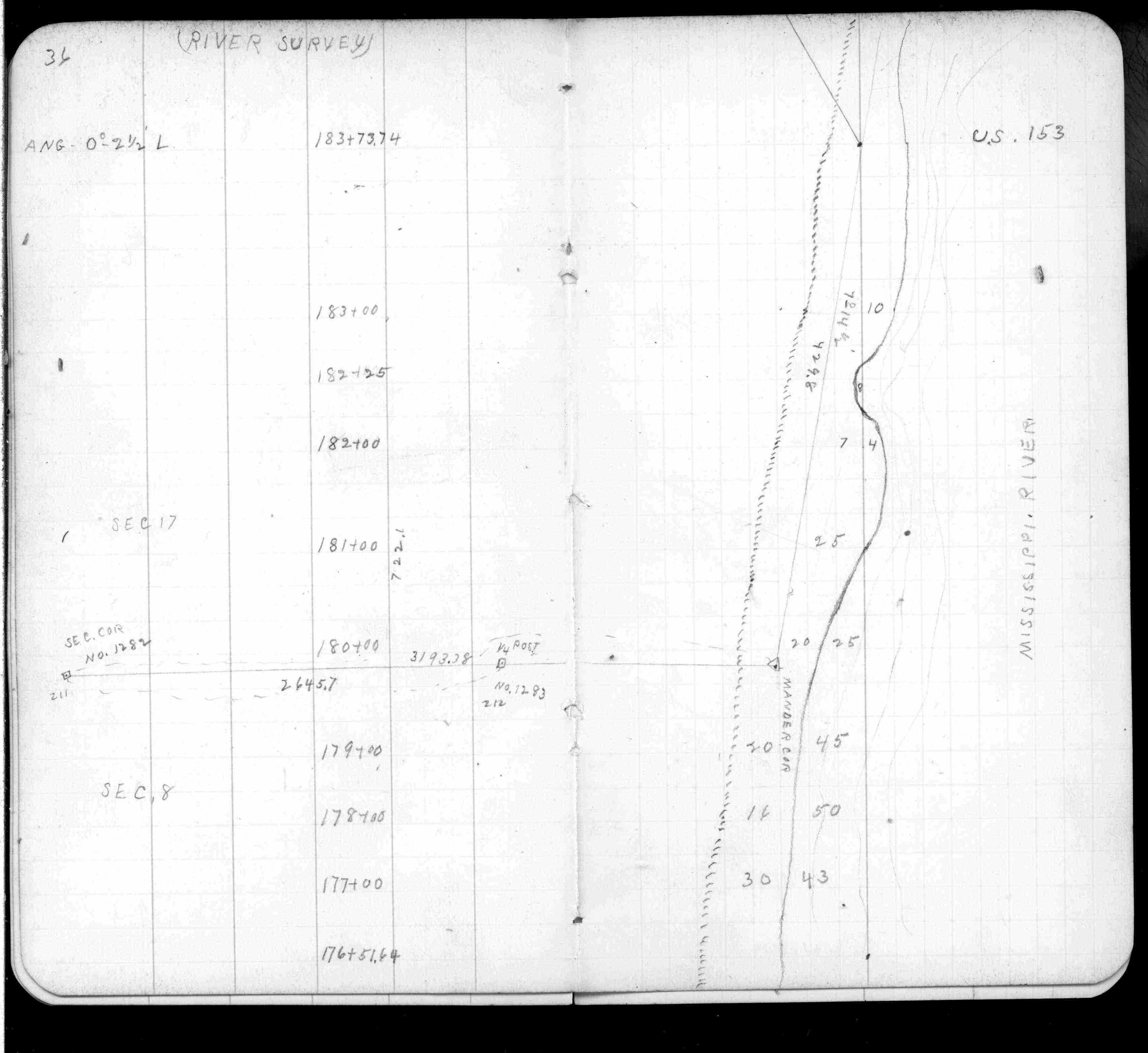
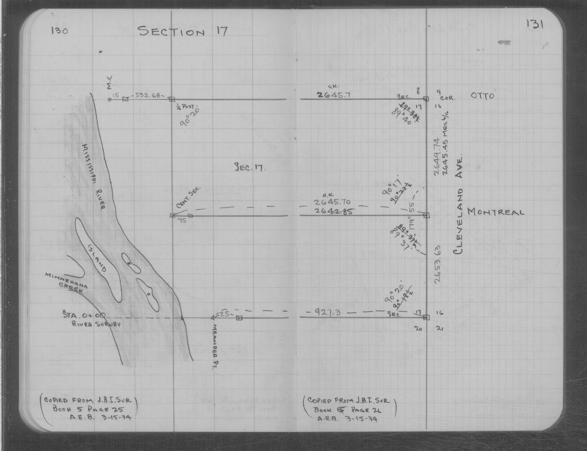
| 10/1/1847 | (Unknown date Oct __, 1847 ) Isaac N Higbee deputy surveyor set post. Tied to 2 BTs. See IH p.026-027 2823 |
Above is NOT an all inclusive history of this point. Please review all the links below.
| PLS NOTES | Field | Cross Section | Sewer | J.B. Irvine | Monument | River Survey |
|---|---|---|---|---|---|---|
| IH p.026-027 | FB 0249p. 10 ,36 | MS 0007 p.130-131 | ||||
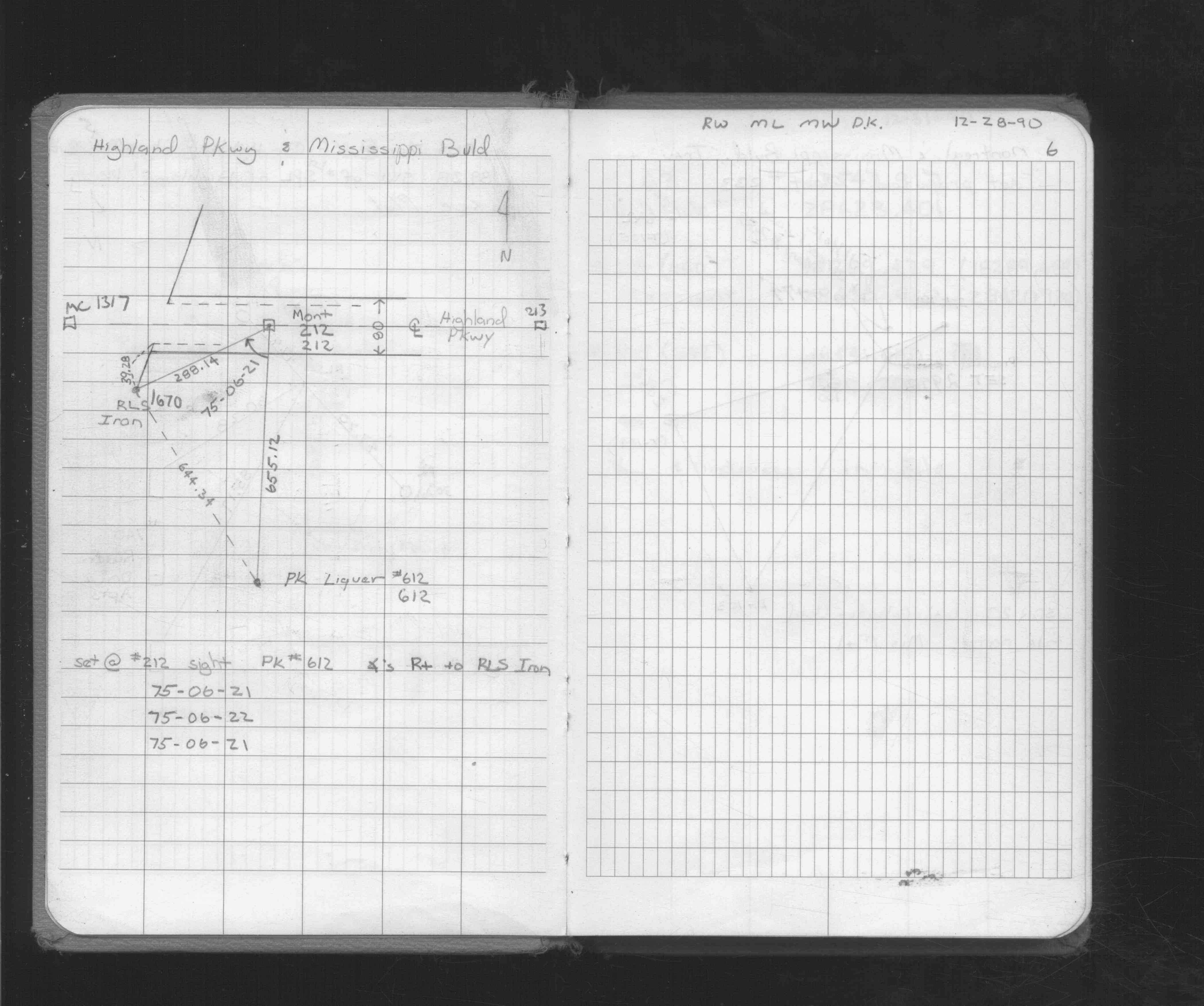
| FB 1716p.06 |