| NAD83 COORDINATES (1986 adj.): |
|---|
| * X= 547343.312 Y= 157382.255 Z= 000.00 CMP 12/17/1991 |
| 10/7/1847 | James M Marsh deputy surveyor set post. Tied to 1 BT. See JM p.072-000 border |
Above is NOT an all inclusive history of this point. Please review all the links below.
| PLS NOTES | Field | Cross Section | Sewer | J.B. Irvine | Monument | River Survey |
|---|---|---|---|---|---|---|
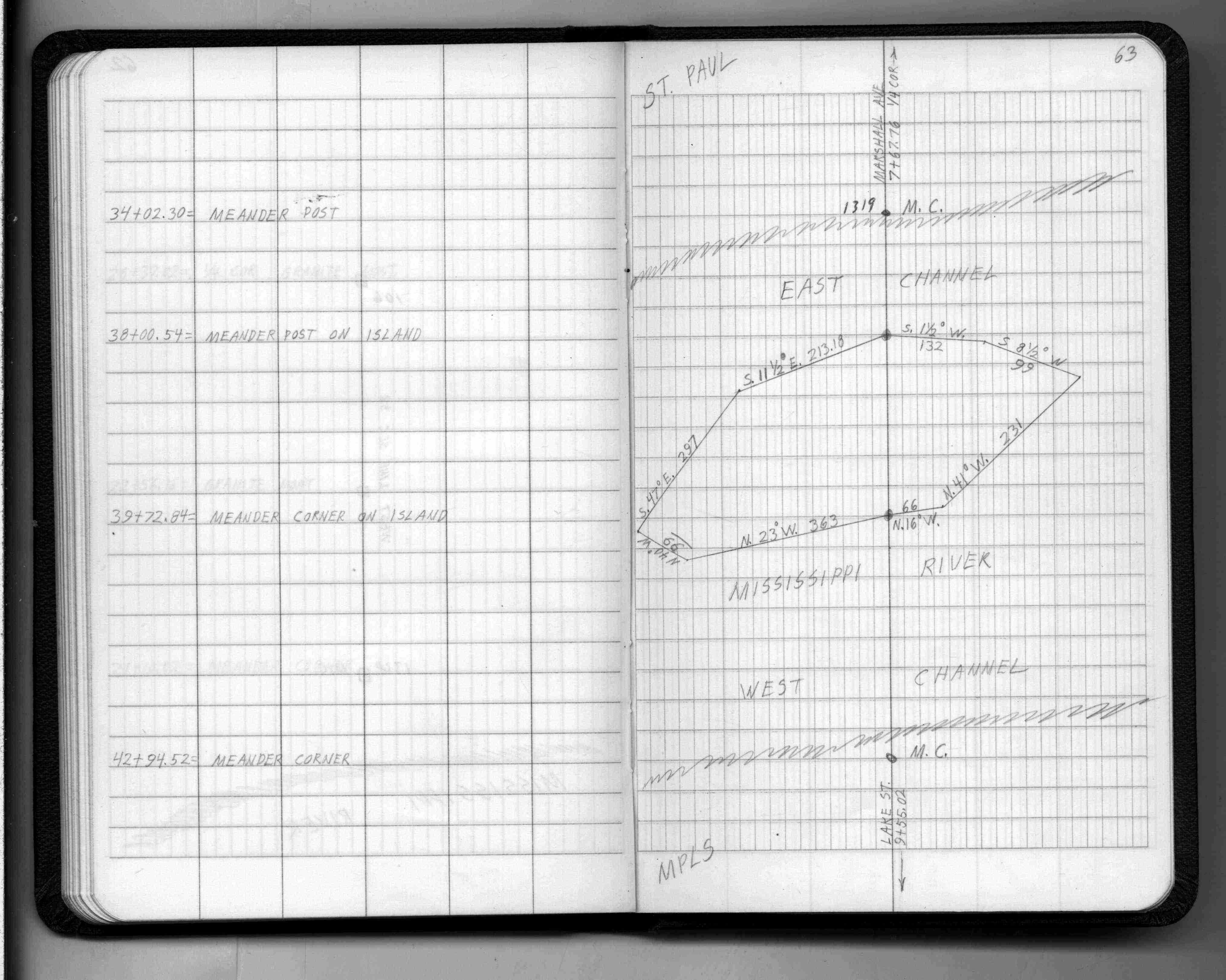
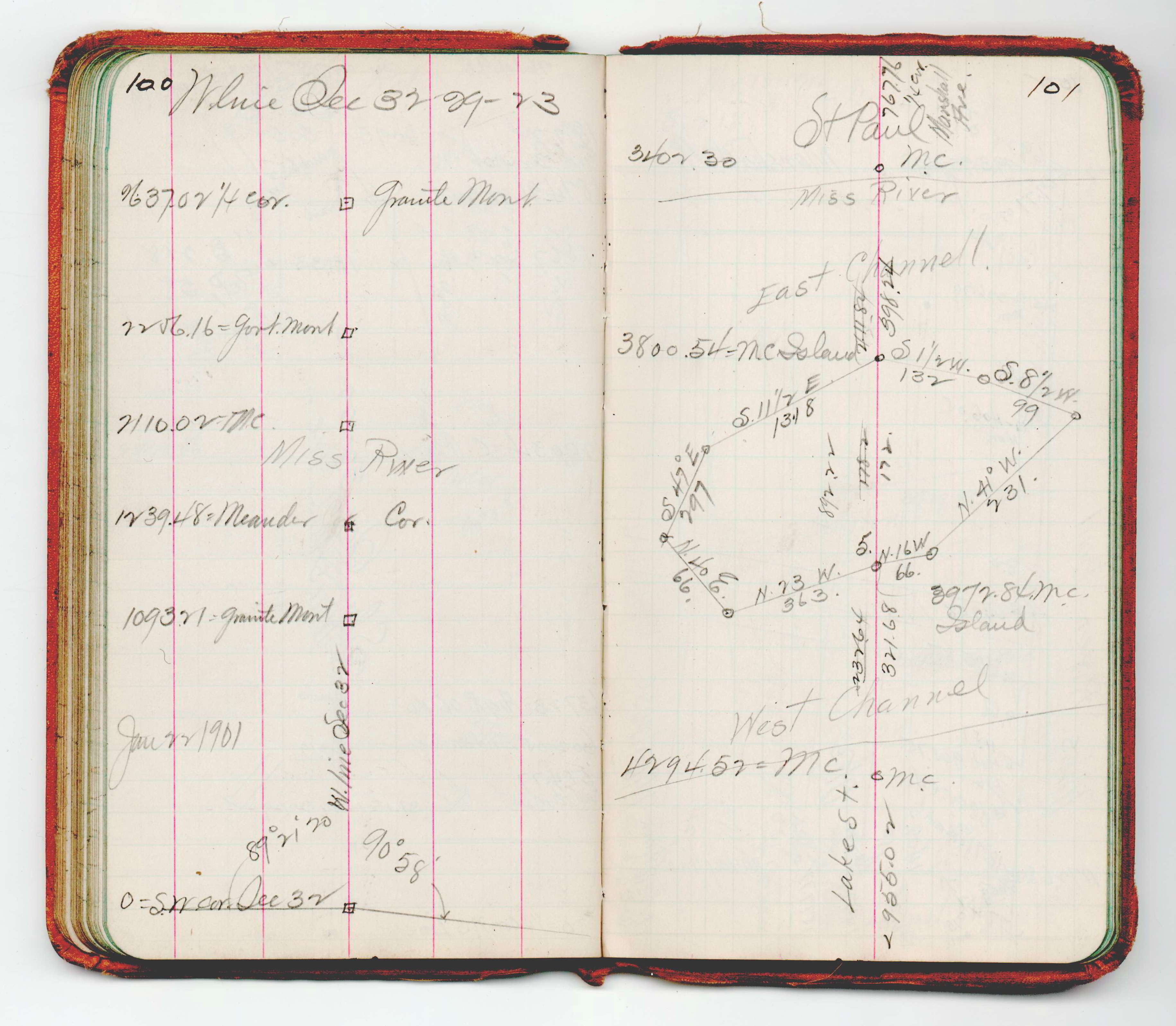
| JM p.072-000 | FB 0218CPYp.63 | JBI 15 p.100-101 | ||||
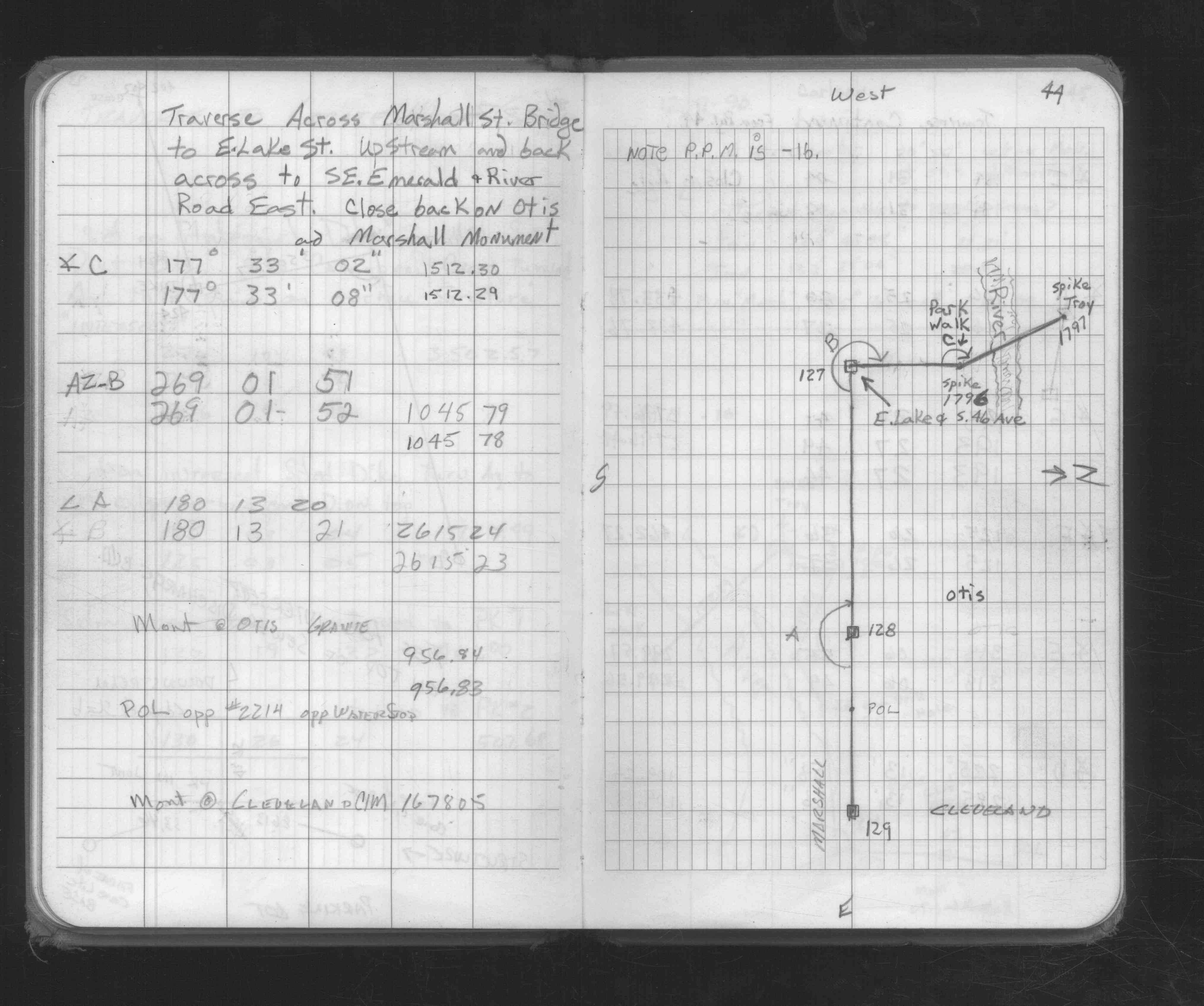
| FB 1676Cp.44 |