| NAD83 COORDINATES (1986 adj.): |
|---|
| X= 575080.258 Y= 158823.730 Z= 000.00 LSQ 12/06/1991 S FLT |
| 11/19/2013 | Record maintenance: ID #1601 was originally associated with Old Index #1140, but that location is slightly diffrerent. Old Index #1140 has been reassigned to ID #6792. |
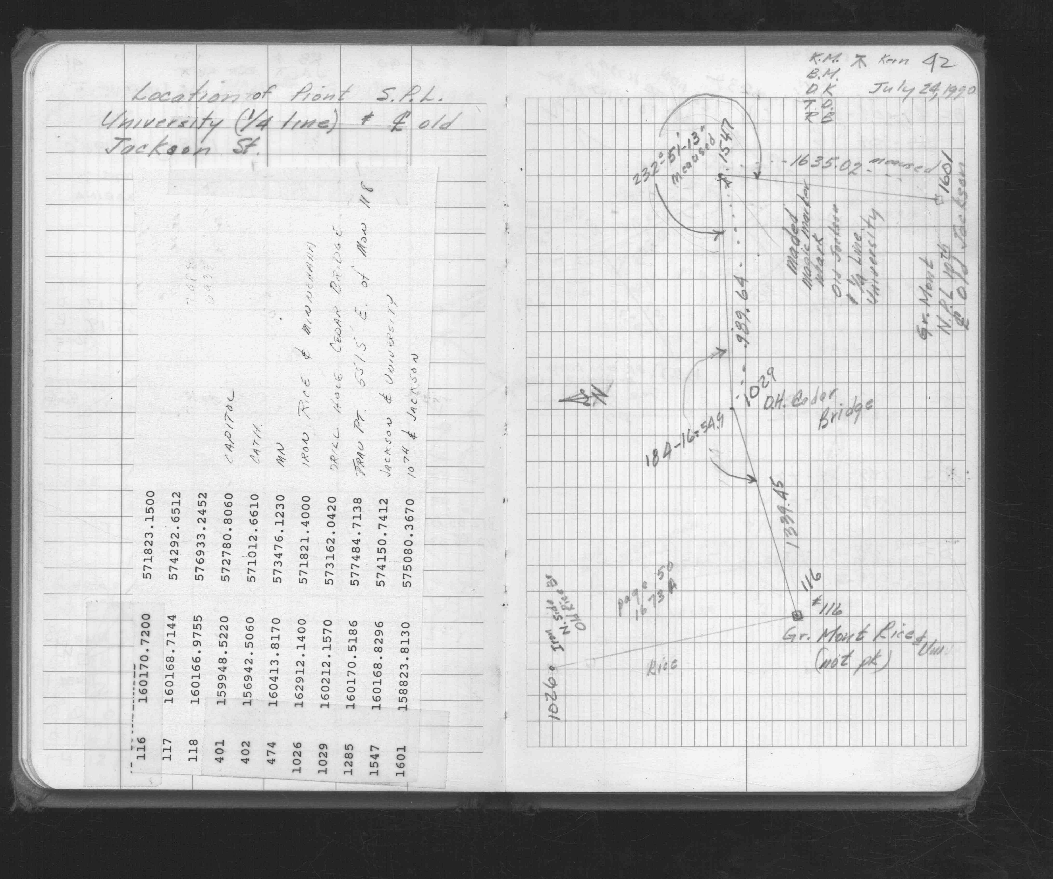
| 7/24/1990 | Located by traverse (stubbed). See FB 1676D p.42 |
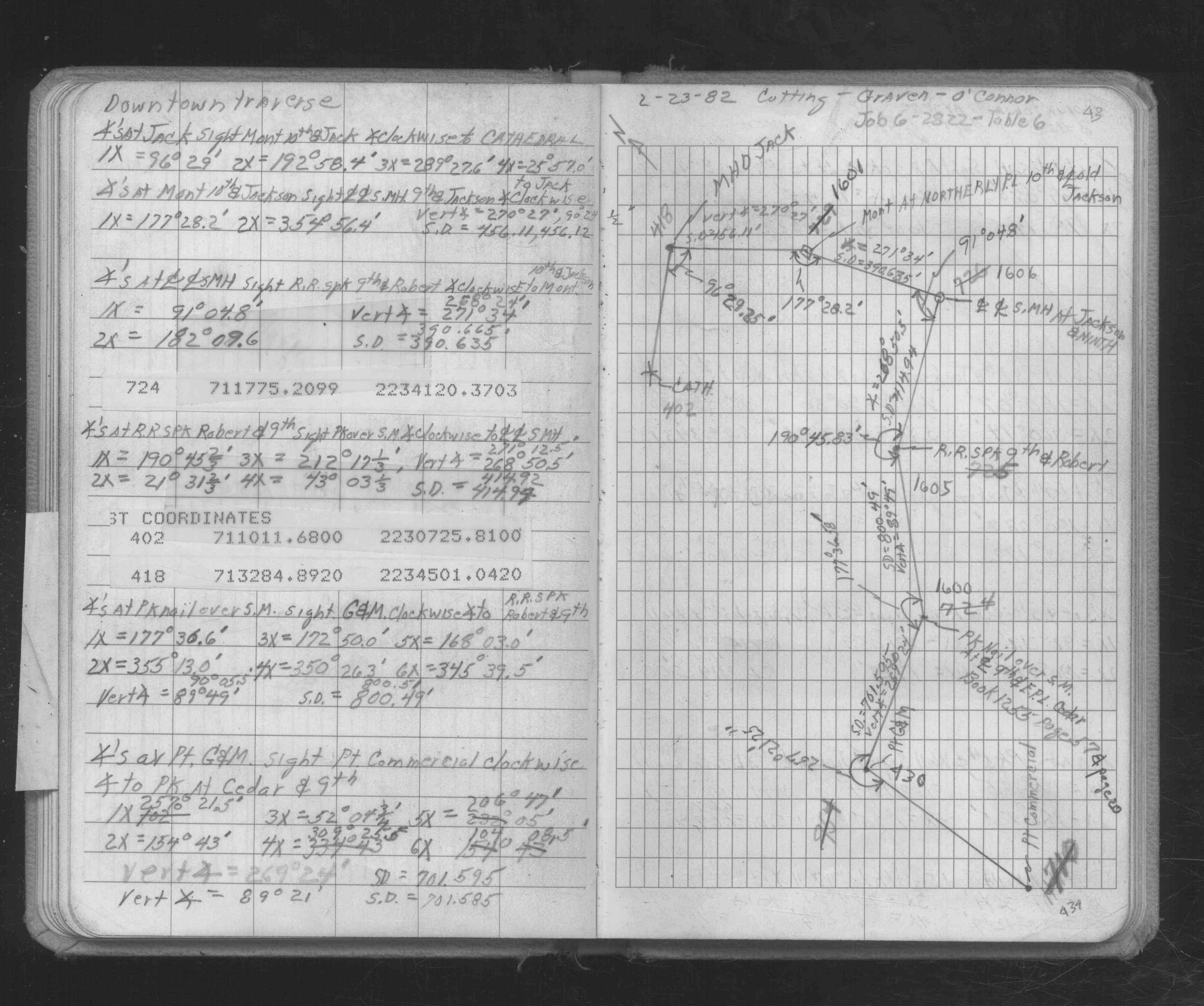
| 2/23/1982 | Traversed through monument. See FB 1686 p.43 |
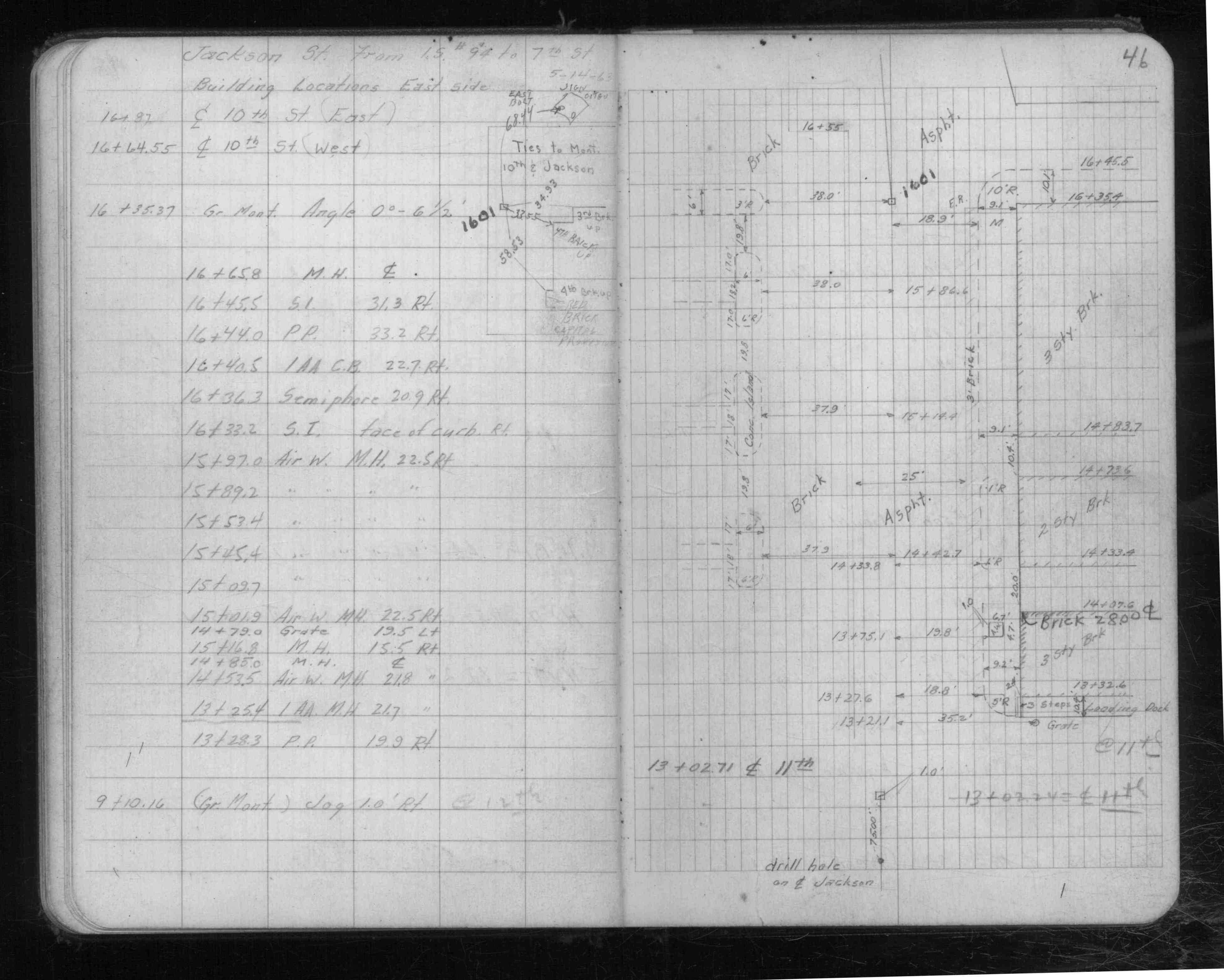
| 5/1/1963 | (Unknown date May __, 1963 ) Fd GM, placed ties. See FB 1502 p.46 |
| 1/1/1887 | (Unknown date ___ __, 1887 ) Monument set by Johnson as paved |
Above is NOT an all inclusive history of this point. Please review all the links below.
| PLS NOTES | Field | Cross Section | Sewer | J.B. Irvine | Monument | River Survey |
|---|---|---|---|---|---|---|
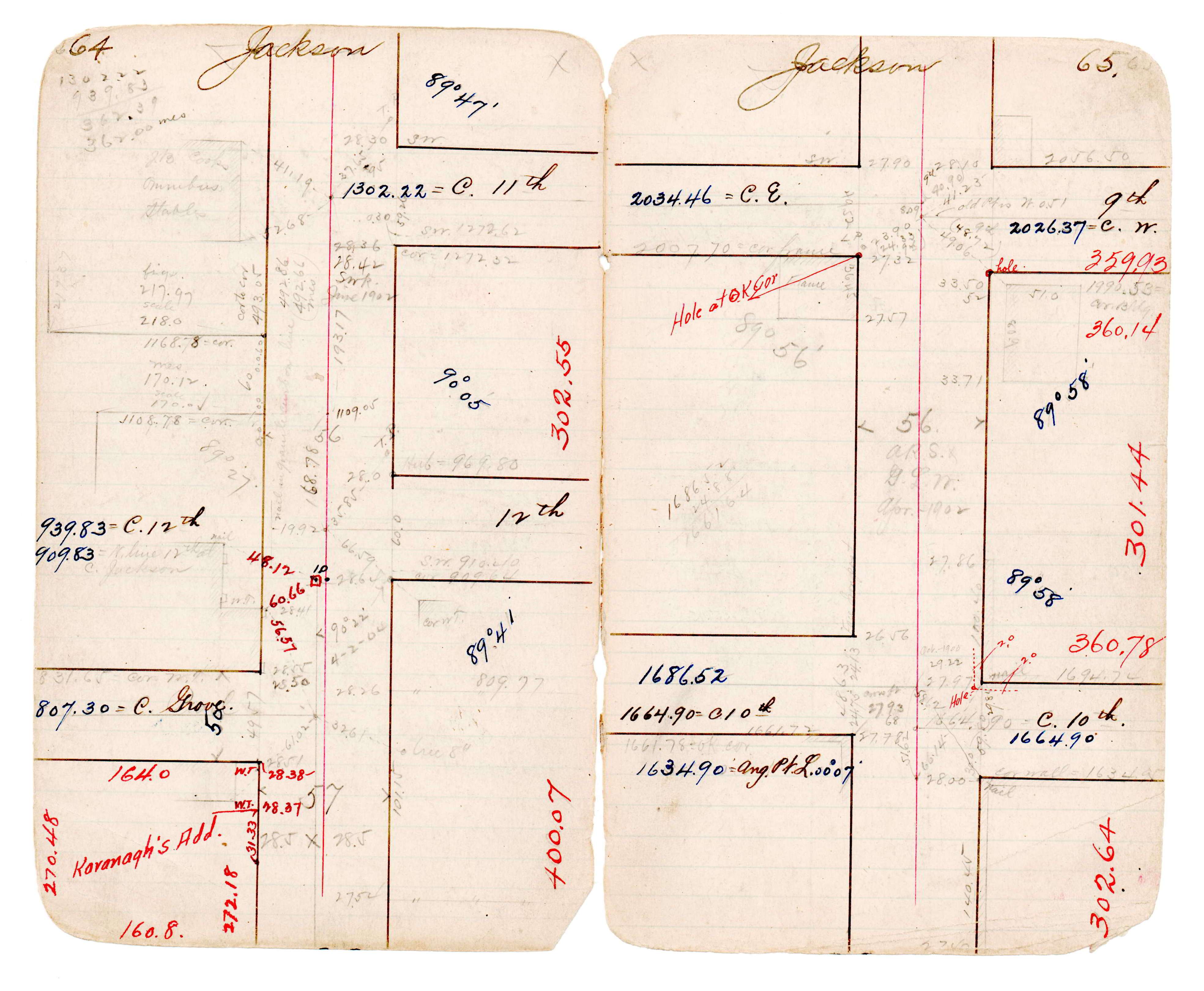
| FB 0287p.57 | JBI 22 p.64-65 | |||||
| FB 0453p.42 | ||||||
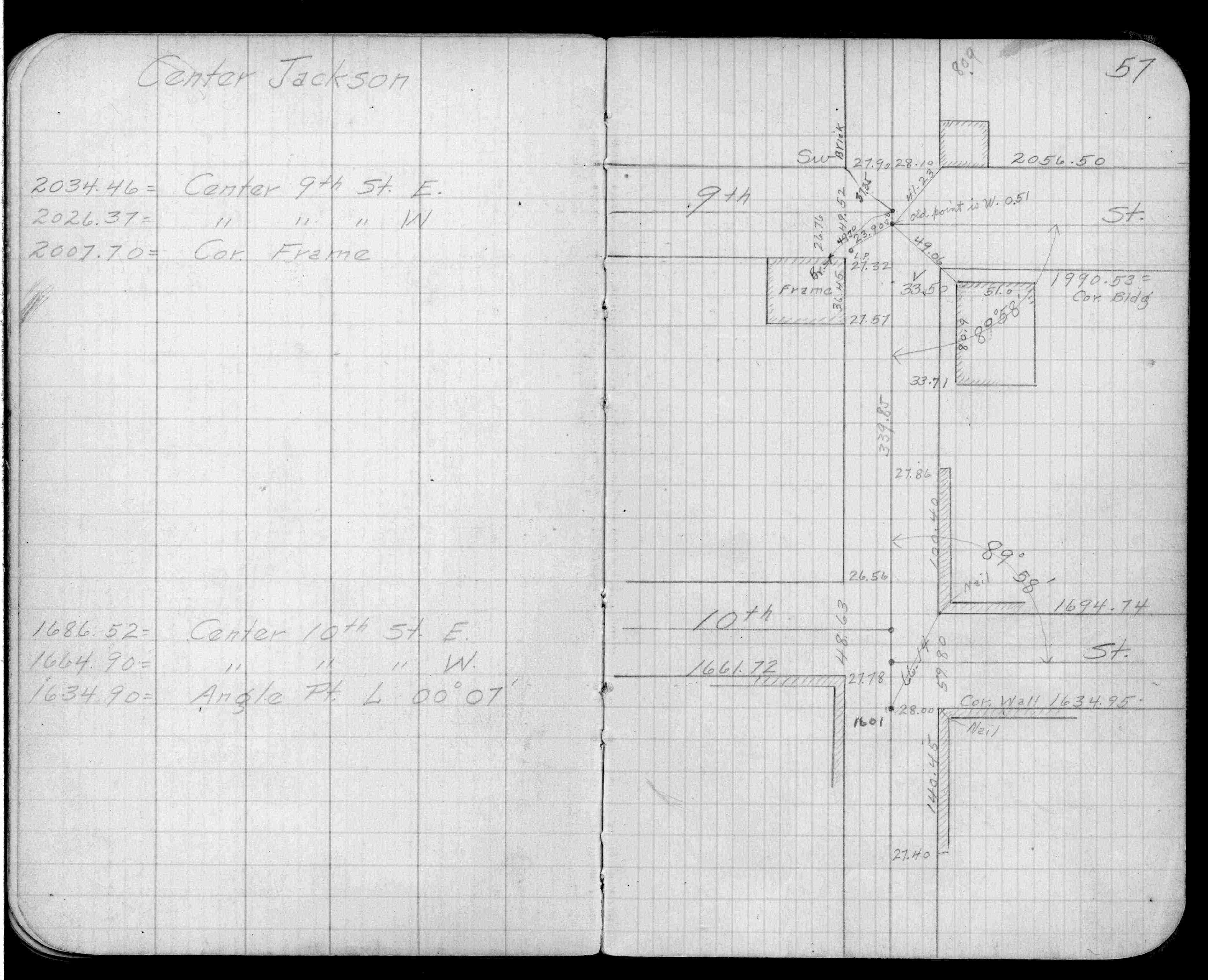
| FB 1502p.46 | ||||||
| FB 1502p.46 | ||||||
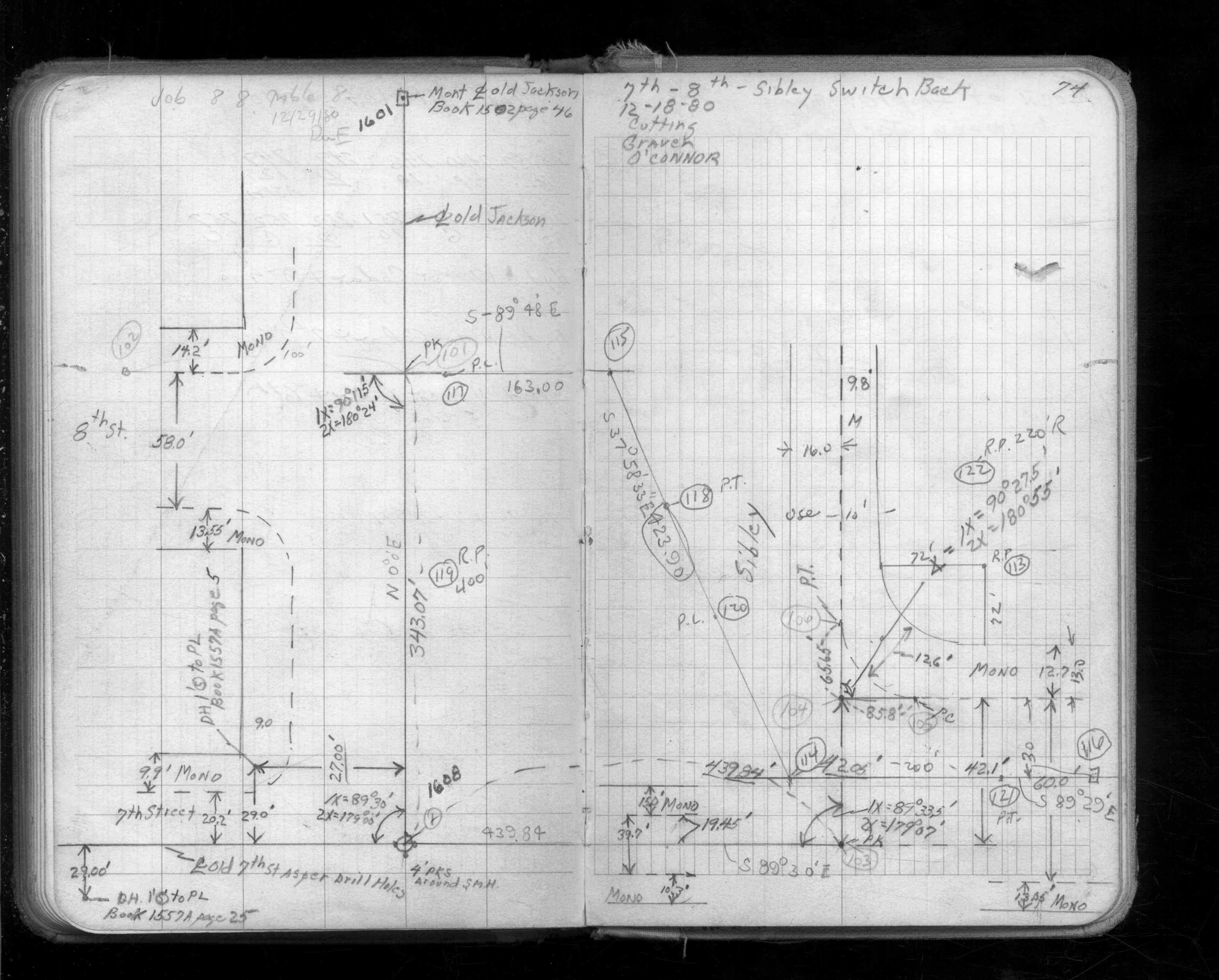
| FB 1562p.74 | ||||||
| FB 1676Cp.39 | ||||||
| FB 1676Dp.42 | ||||||
| FB 1686p.43 | ||||||
| FB 1686p.43 |