| NAD83 COORDINATES (1986 adj.): |
|---|
| X= 574855.368 Y= 155779.043 Z= 000.00 CMP 09/26/1994 |
| X= 574855.147 Y= 155779.086 Z= 000.00 LSQ 11/20/1992 FLT |
| X= 574855.144 Y= 155779.146 Z= 788.34 5/7/2012 TOPO |
| 5/7/2012 | Position established during topo for Market St Bridge using Trimble S6. Elev 94.245 ft. |
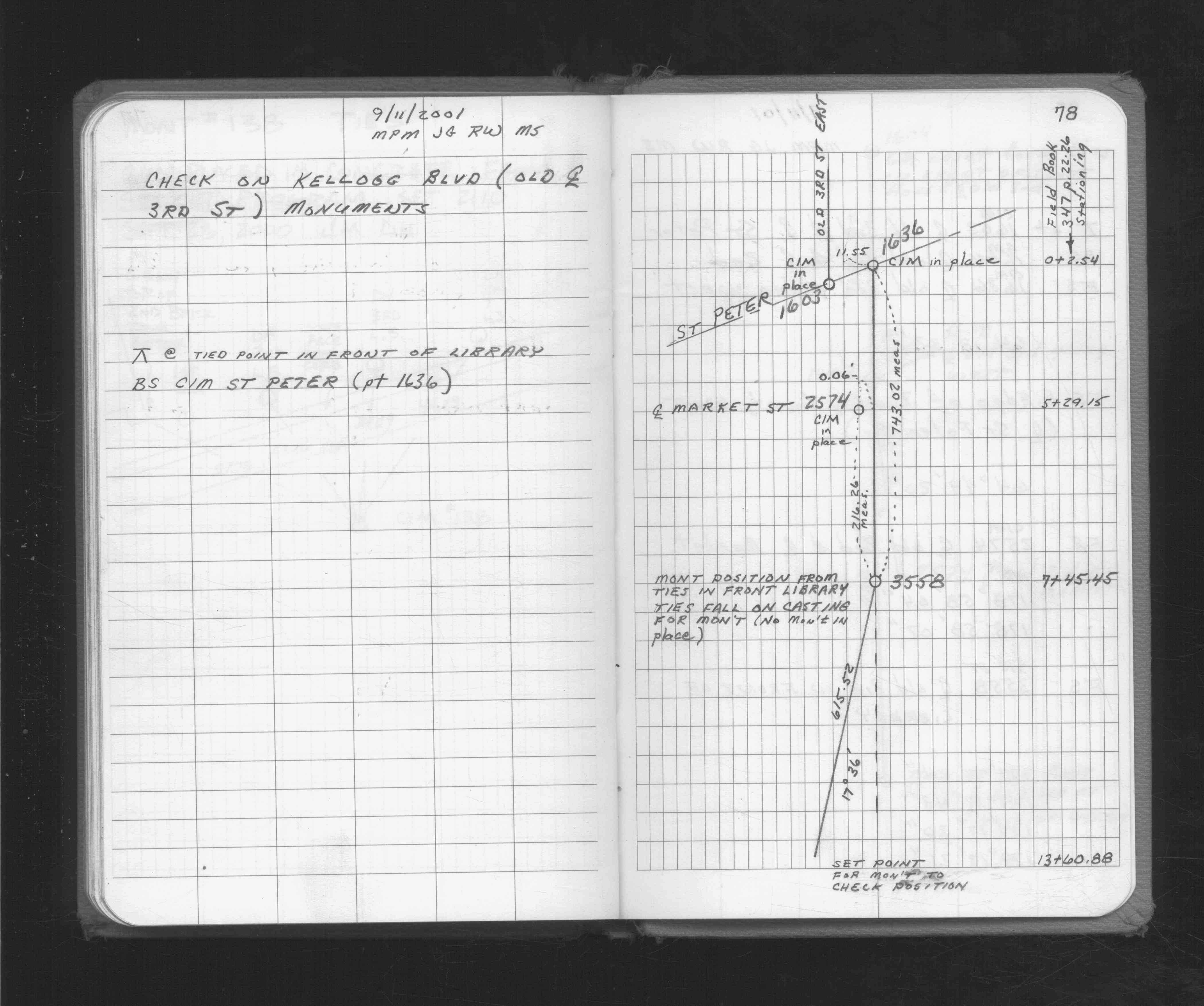
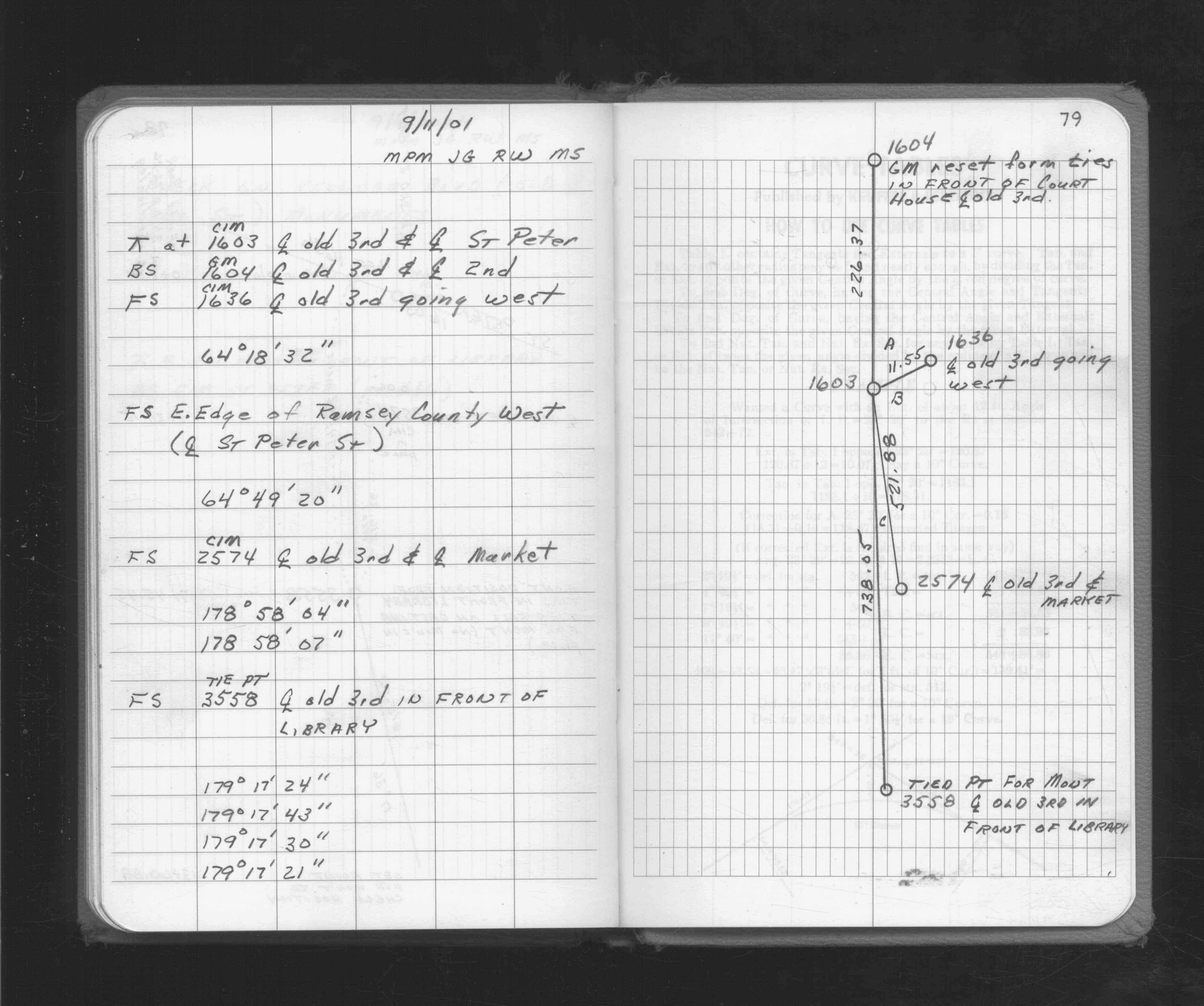
| 9/10/2001 | Set CIM in concrete base, 0.04 ft below brick surface. See CofL 1603-xxxx-A |
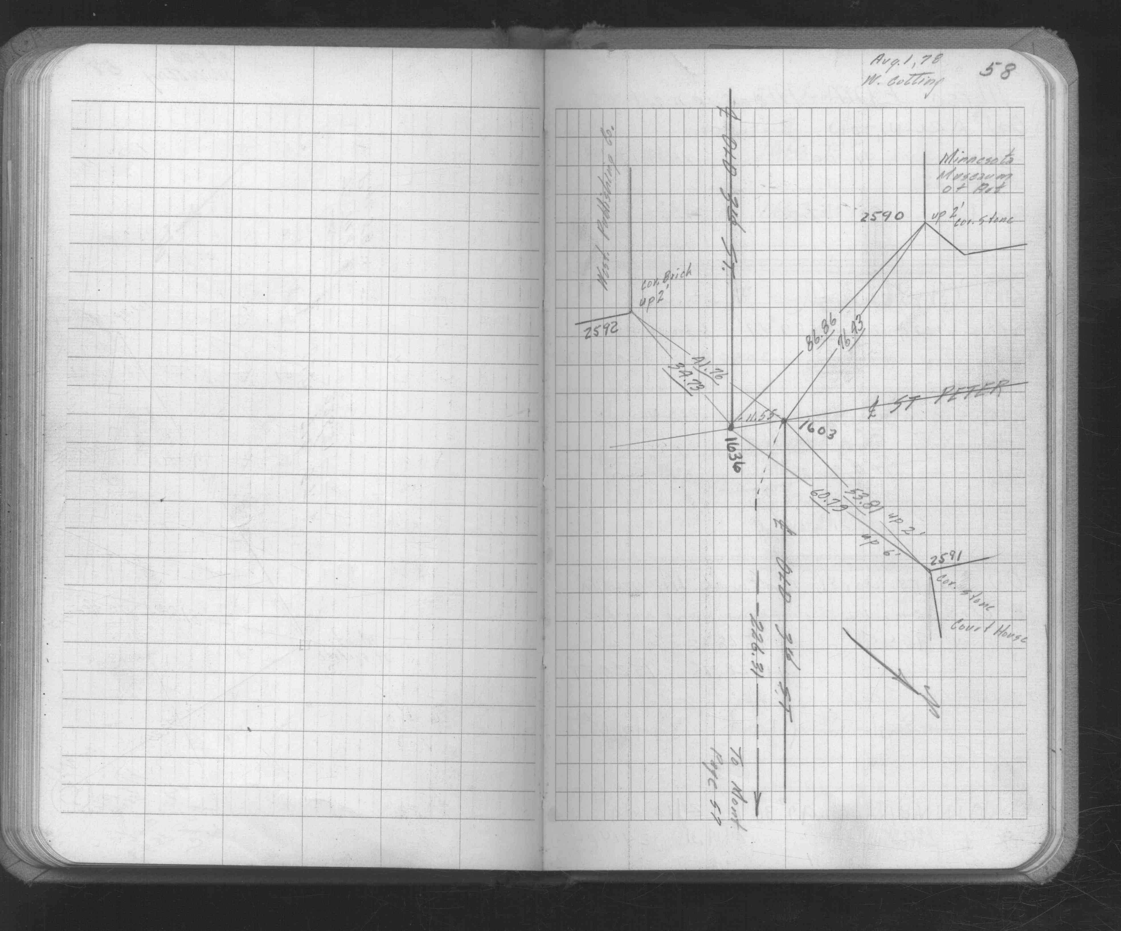
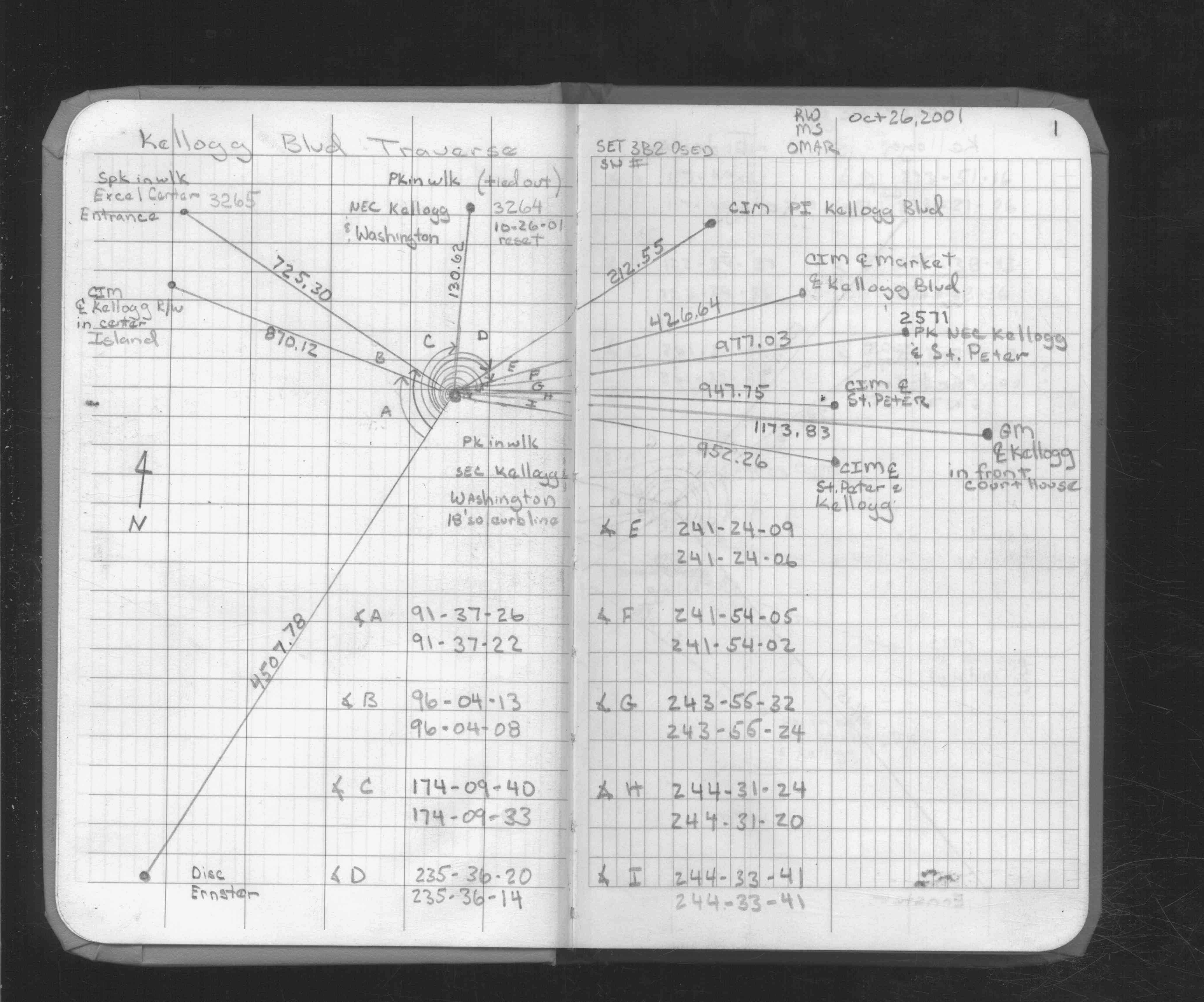
| 9/10/2001 | Set CIM in concrete base from ties in FB 1649 p.58 |
| 8/1/1978 | (Unknown date Aug __, 1978 ) Placed ties. See FB 1649 p.58 |
Above is NOT an all inclusive history of this point. Please review all the links below.
| PLS NOTES | Field | Cross Section | Sewer | J.B. Irvine | Monument | River Survey |
|---|---|---|---|---|---|---|
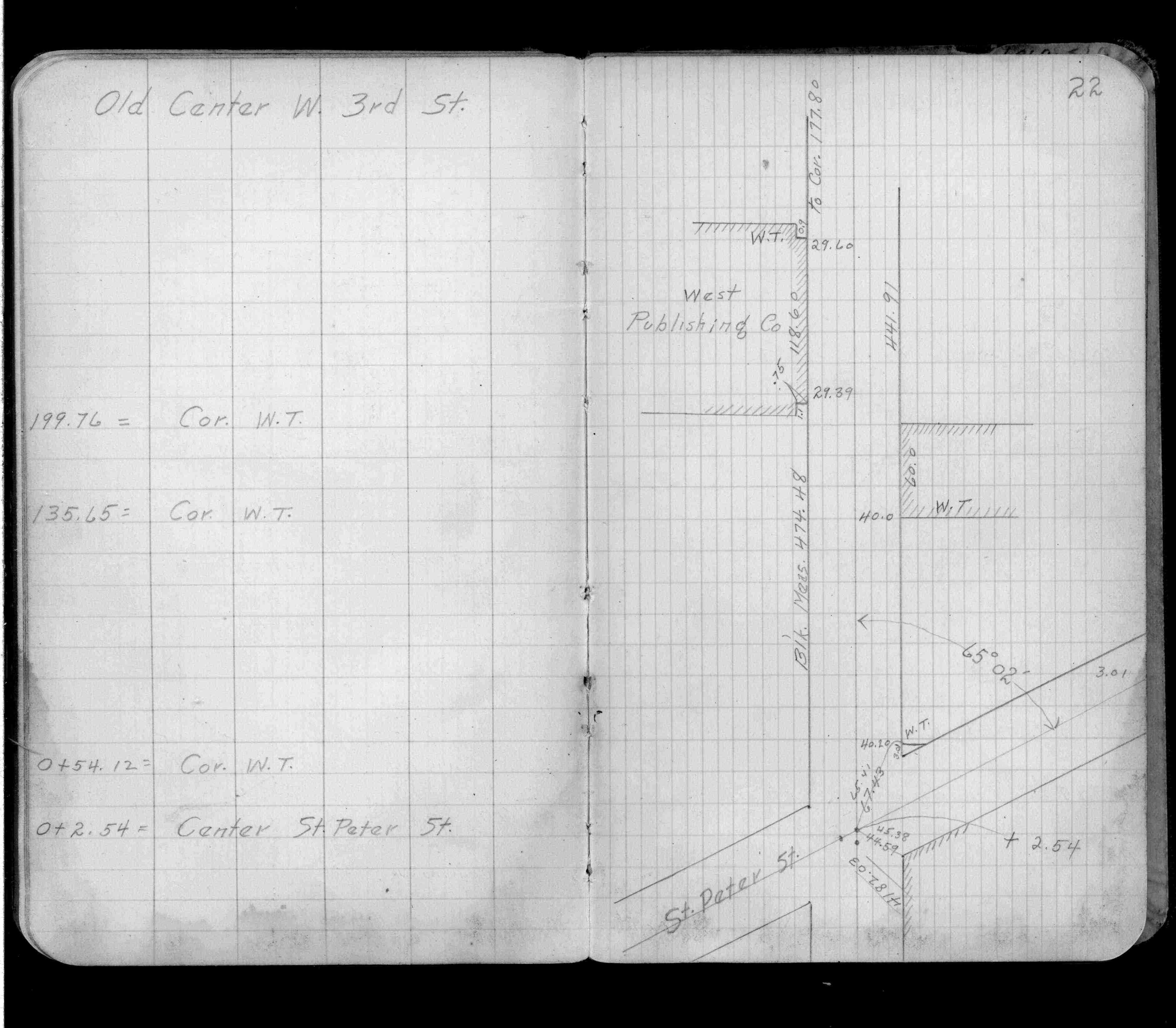
| FB 0347p.22 | ||||||
| FB 1649p.58 | ||||||
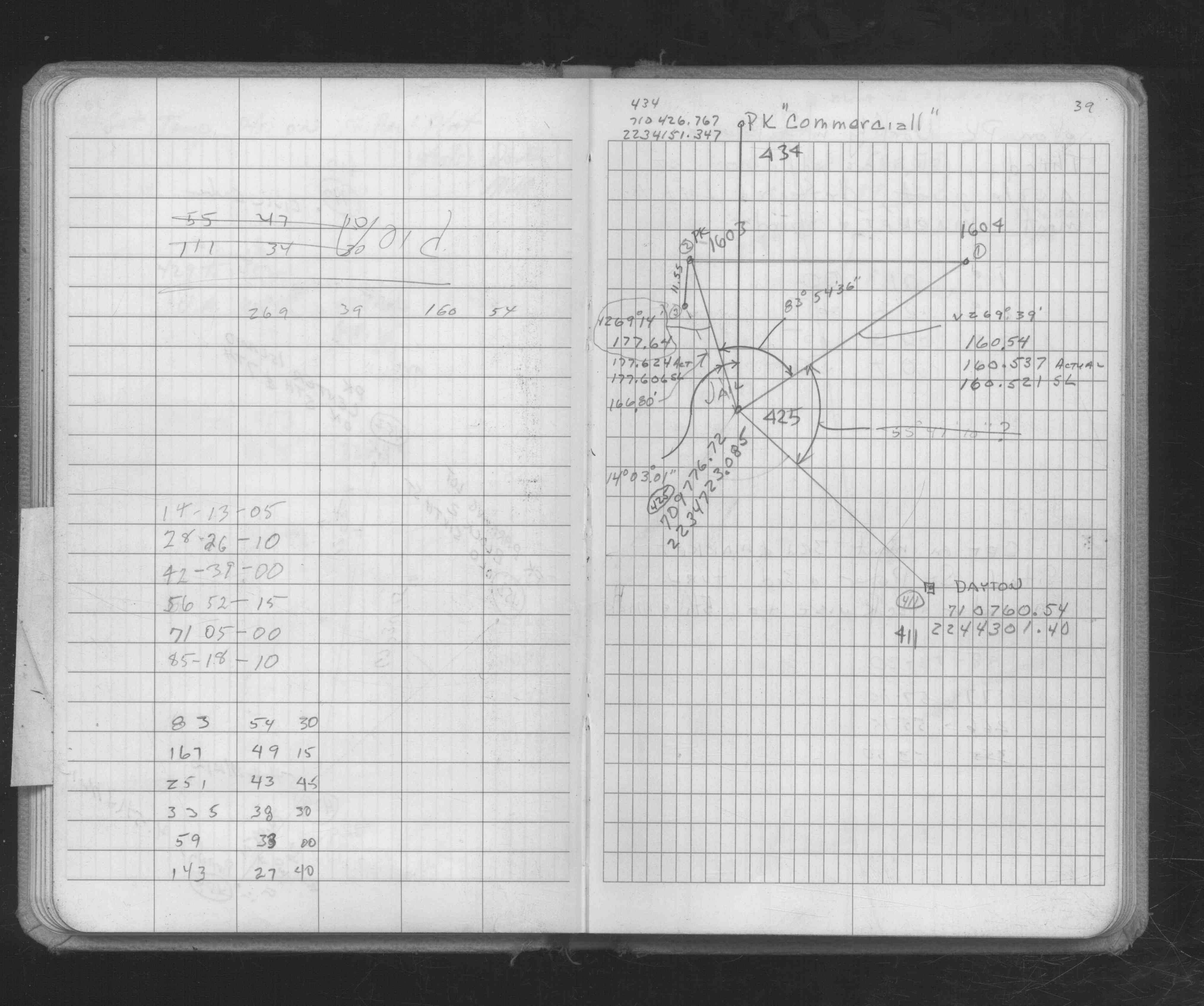
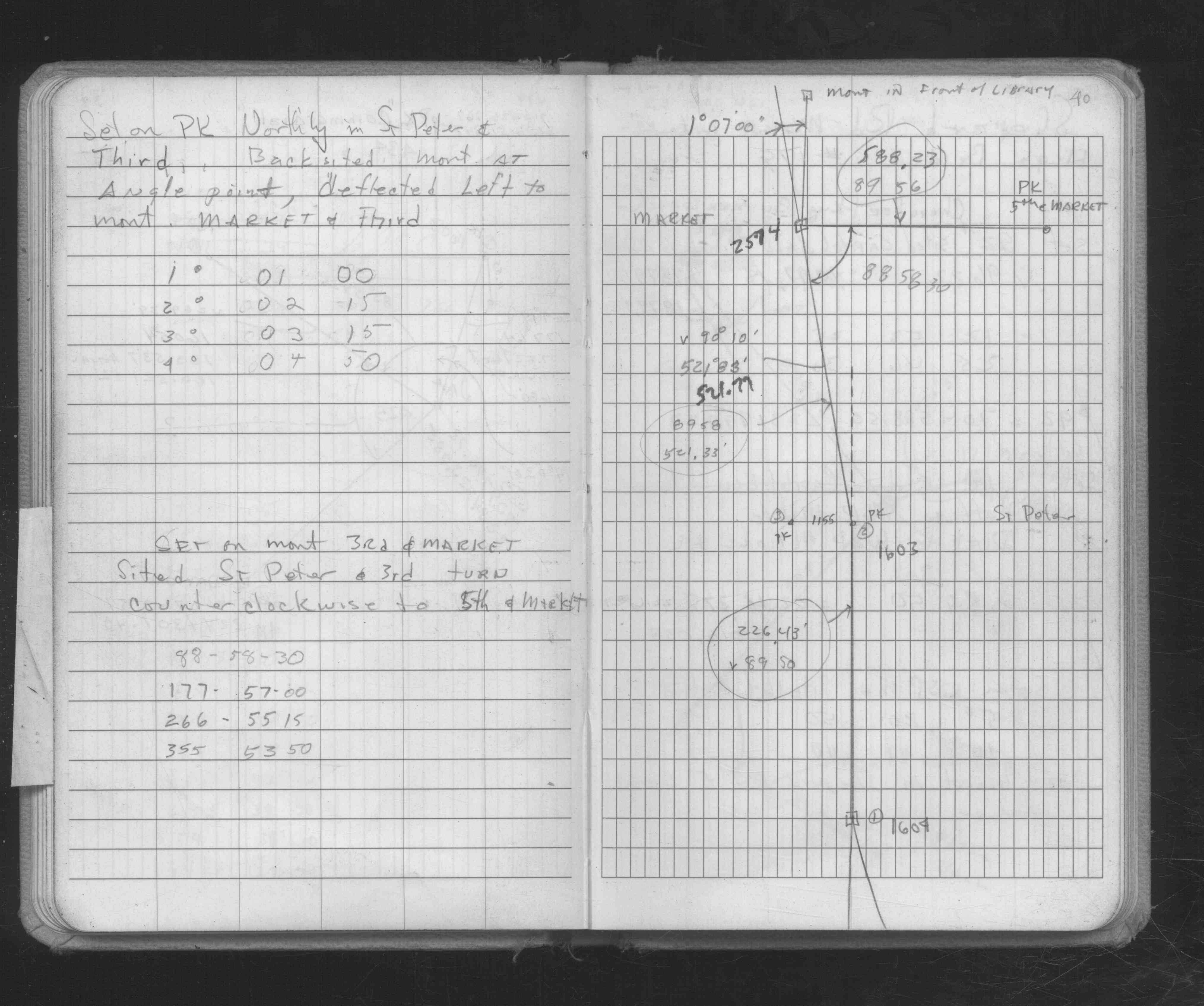
| FB 1686p. 39 ,40 | ||||||
| FB 1716p. 78 ,79 | ||||||
| FB 1735p.01 |
| FILE | SURVEYOR | LIC. NO. | DATE SIGNED | DATE TIED |
|---|---|---|---|---|
| 1603-xxxx-A.tif | Jeffery L. Grosso | 13144 | October 29, 2001 | September 10, 2001 |
| FILE | PHOTO DATE | COMMENTS |
|---|---|---|
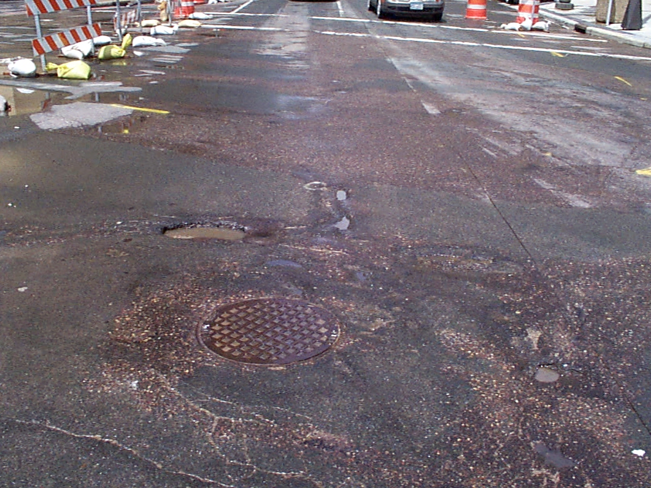
| 1603-__gb-1.jpg | May 24, 2001 | Close up of monument location. |