| NAD83 COORDINATES (1986 adj.): |
|---|
| X= 573882.790 Y= 154739.665 Z= 000.00 CMP 12/17/1991 |
| 1/1/1952 | (Unknown date ___ __, 1952 ) Corps of Engs recovered 8"x8" GM with hole in center, 0.5 ft below grade. |
| 3/1/1927 | (Unknown date Mar __, 1927 ) Placed ties. See FB 1170 p.66 Monument at Eagle St. & N. Levee Line |
| 11/1/1899 | (Unknown date Nov __, 1899 ) Placed ties. See FB 325 p.59 |
Above is NOT an all inclusive history of this point. Please review all the links below.
| PLS NOTES | Field | Cross Section | Sewer | J.B. Irvine | Monument | River Survey |
|---|---|---|---|---|---|---|
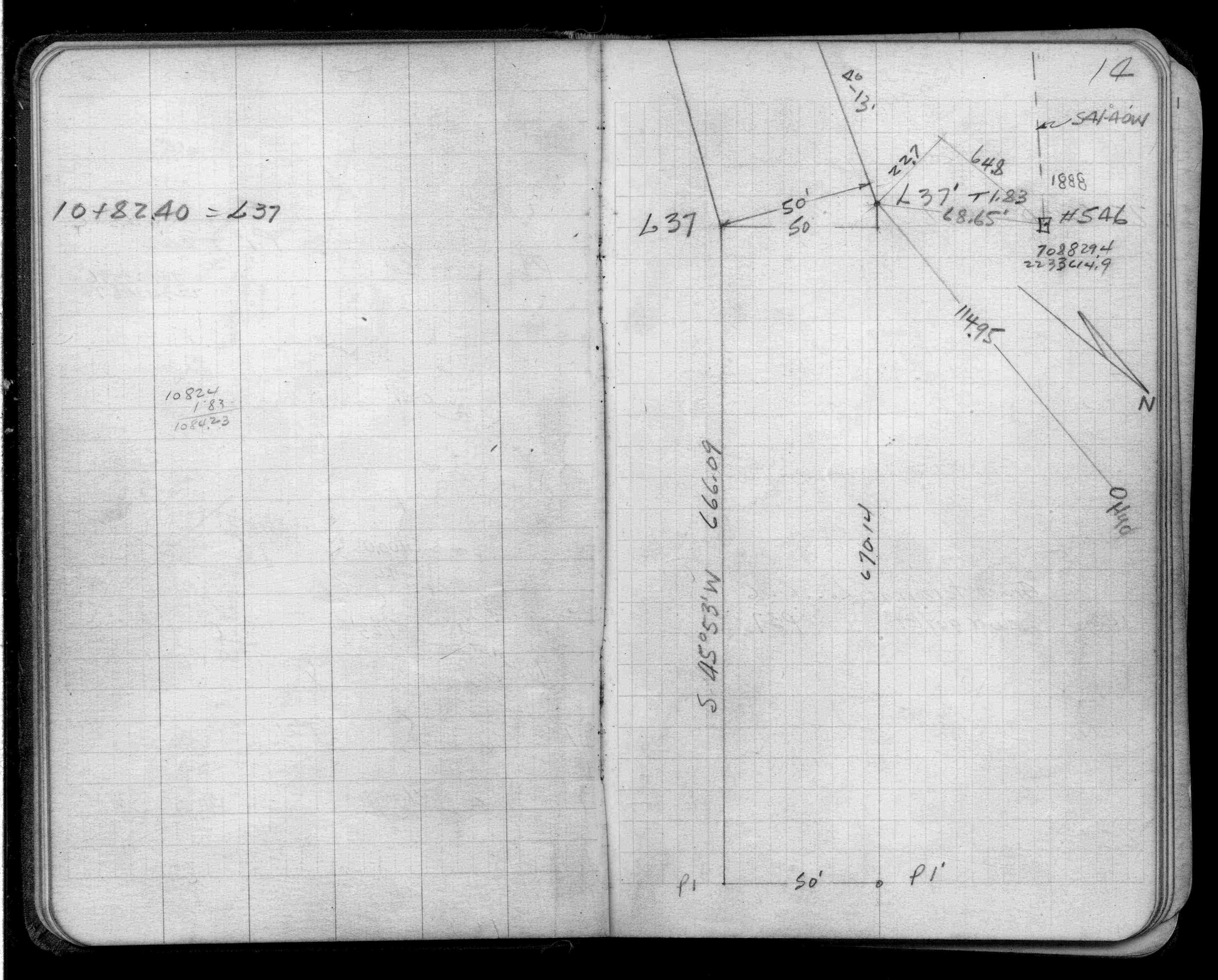
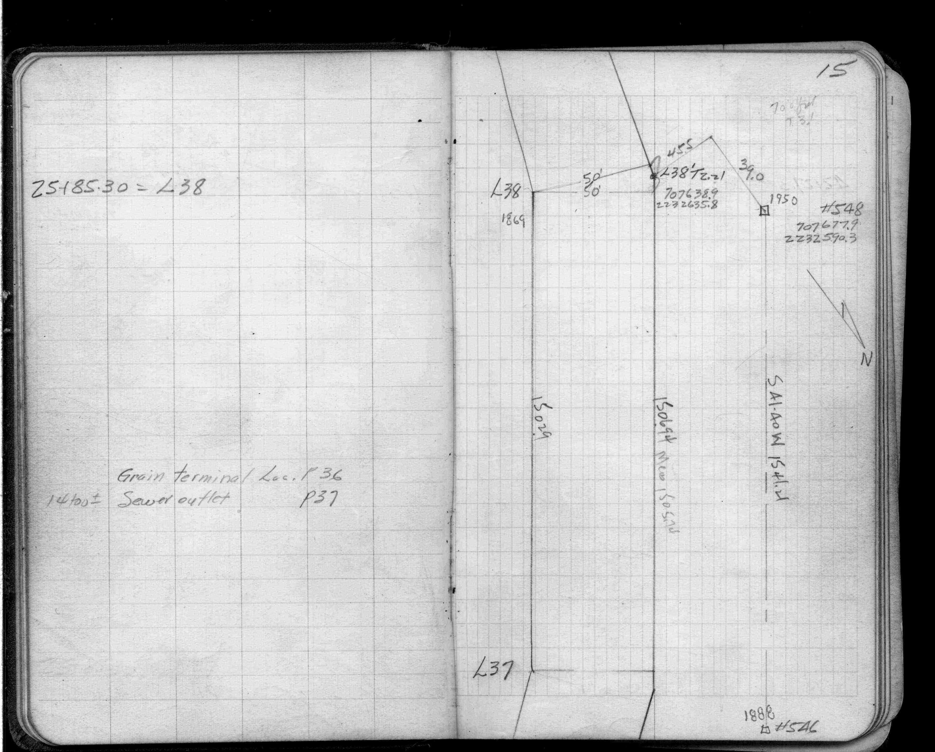
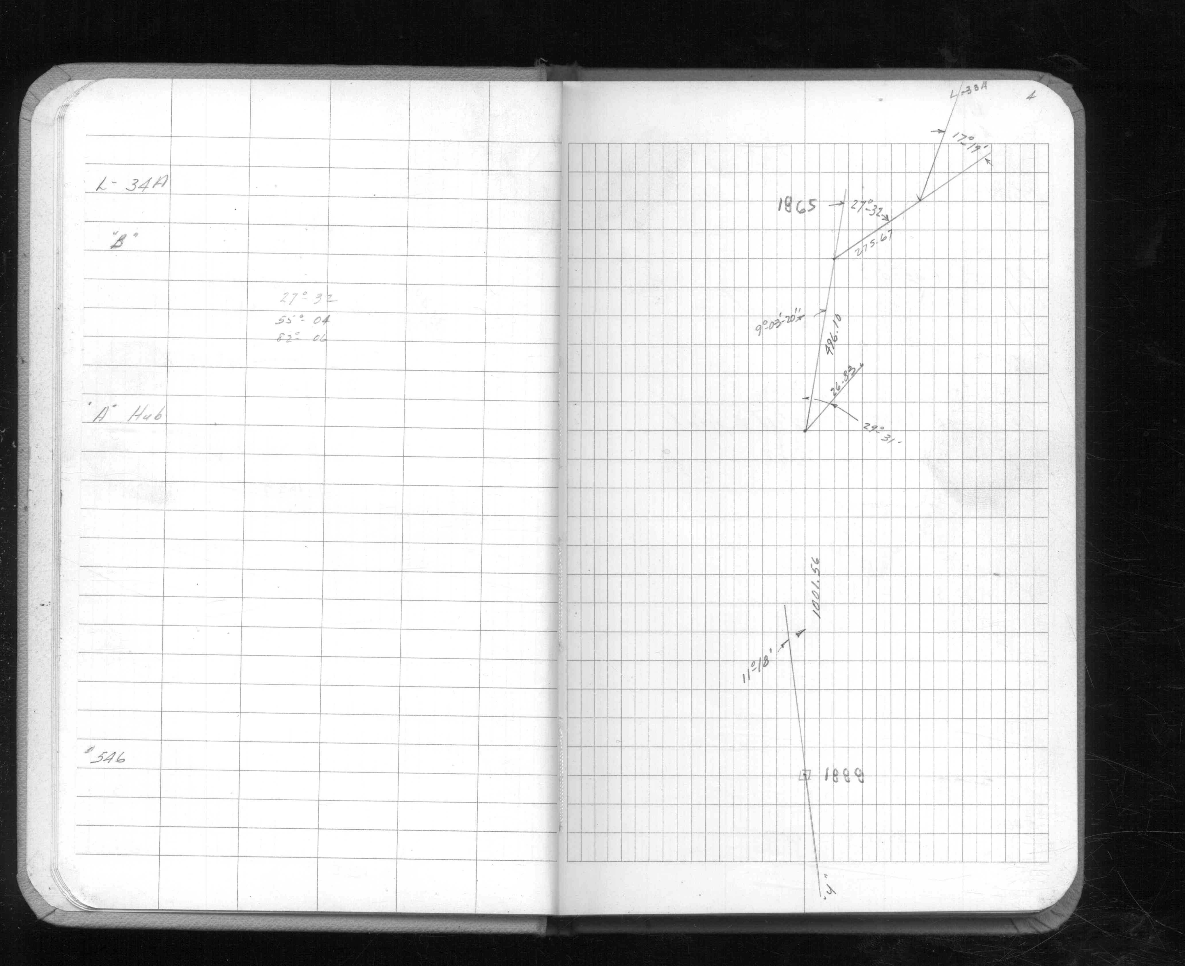
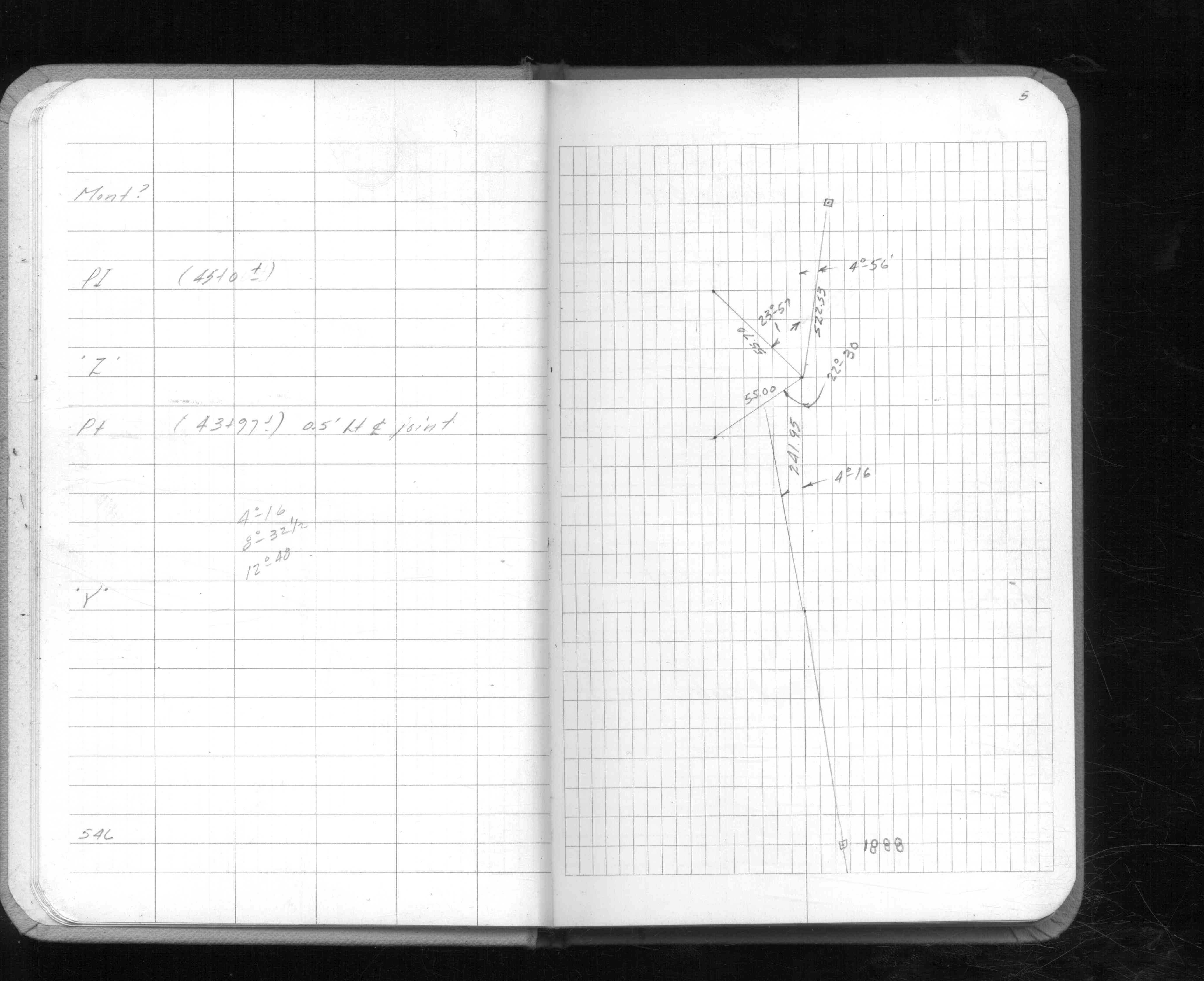
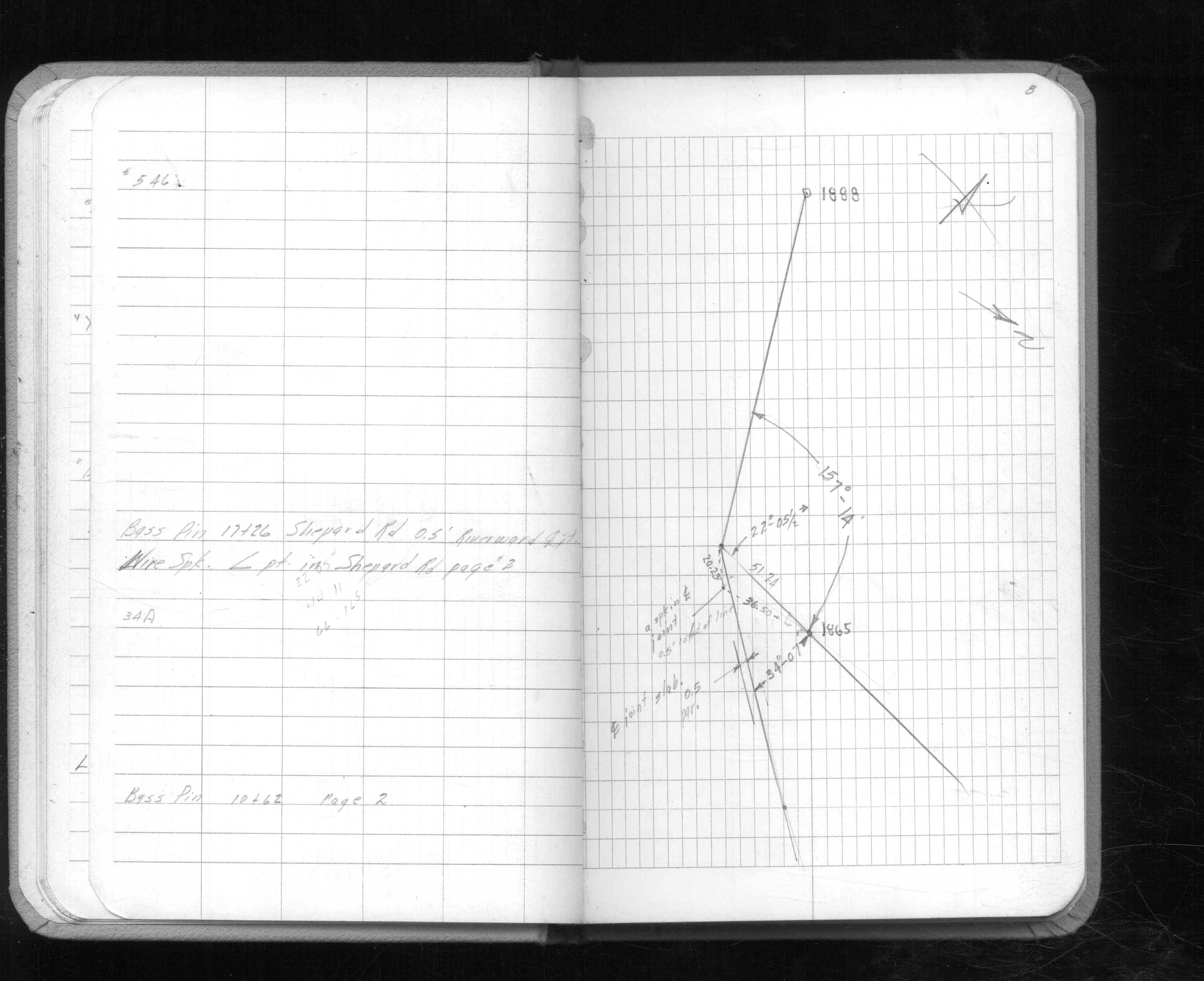
| FB 1401p. 14 ,15 | ||||||
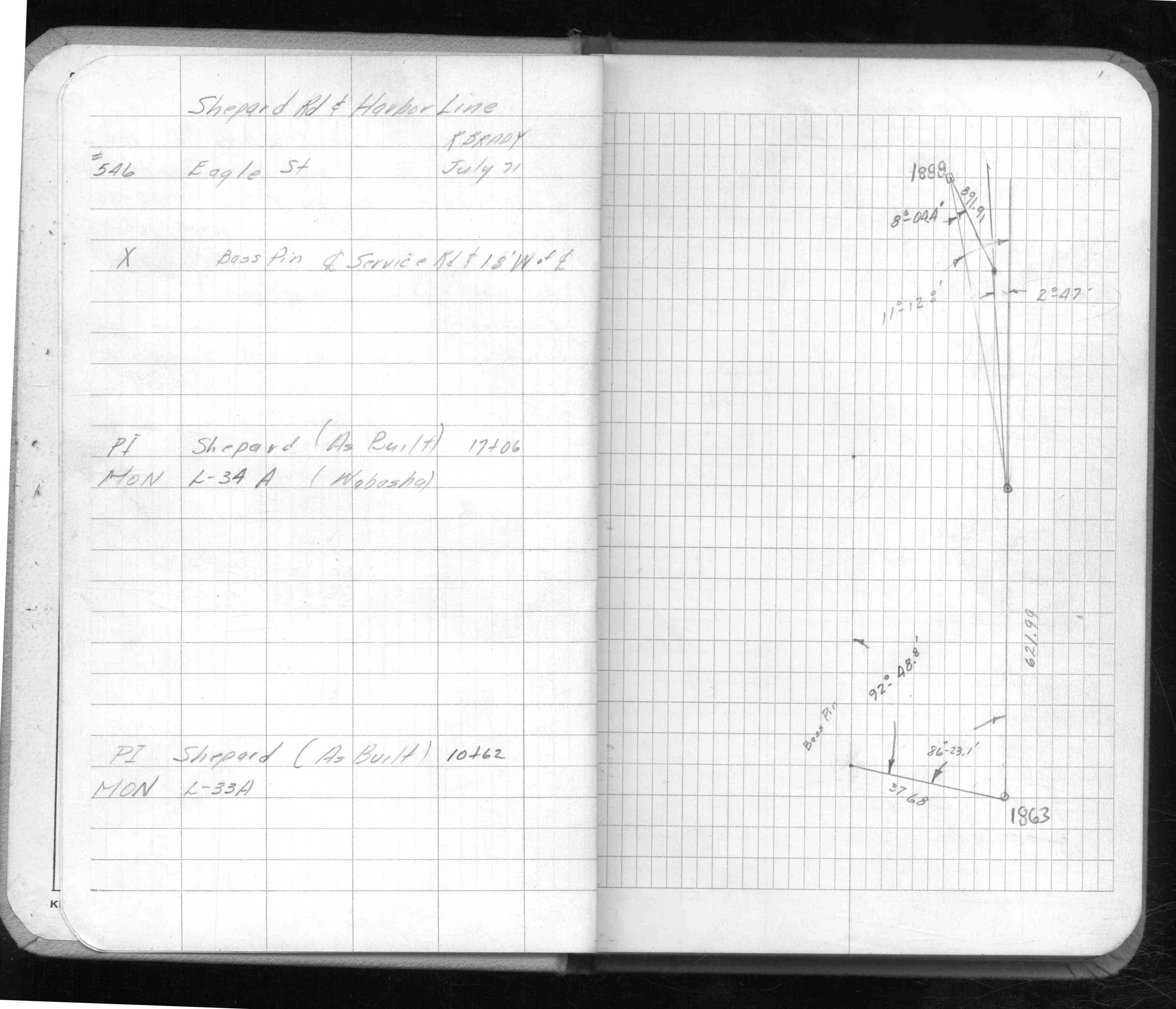
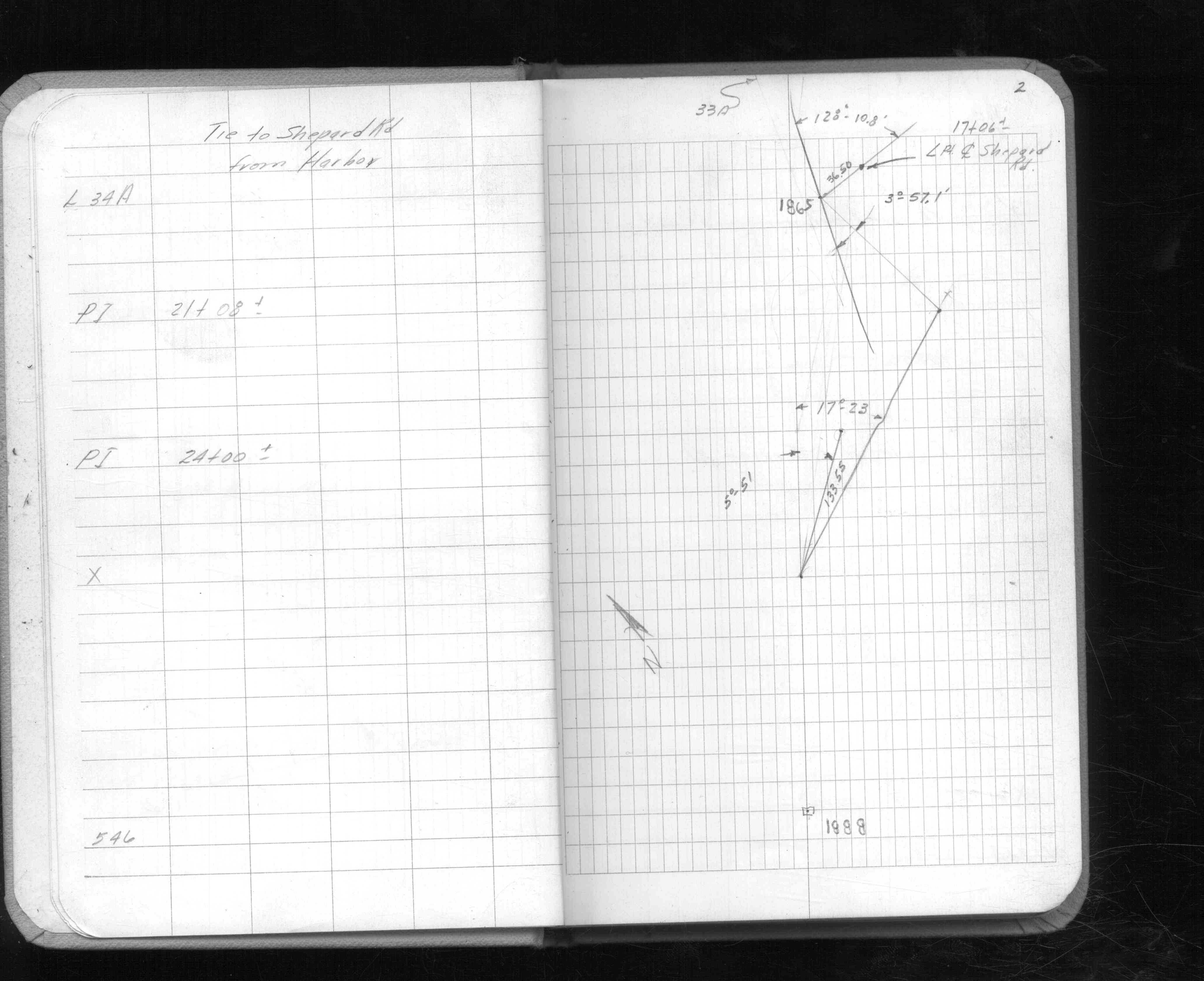
| FB 1615p. 01 ,02 ,03 ,04 ,05 ,07 ,08 ,12 |