| NAD83 COORDINATES (1986 adj.): |
|---|
| X= 581015.212 Y= 156557.155 Z= 000.00 CMP 12/17/1991 |
| 6/1/1951 | (Unknown date Jun __, 1951 ) Corps of Engs recovered 8"x 8"x 24" GM with 3/4 hole. |
| 7/1/1902 | (Unknown date Jul __, 1902 ) Monument set by J H Armstrong |
Above is NOT an all inclusive history of this point. Please review all the links below.
| PLS NOTES | Field | Cross Section | Sewer | J.B. Irvine | Monument | River Survey |
|---|---|---|---|---|---|---|
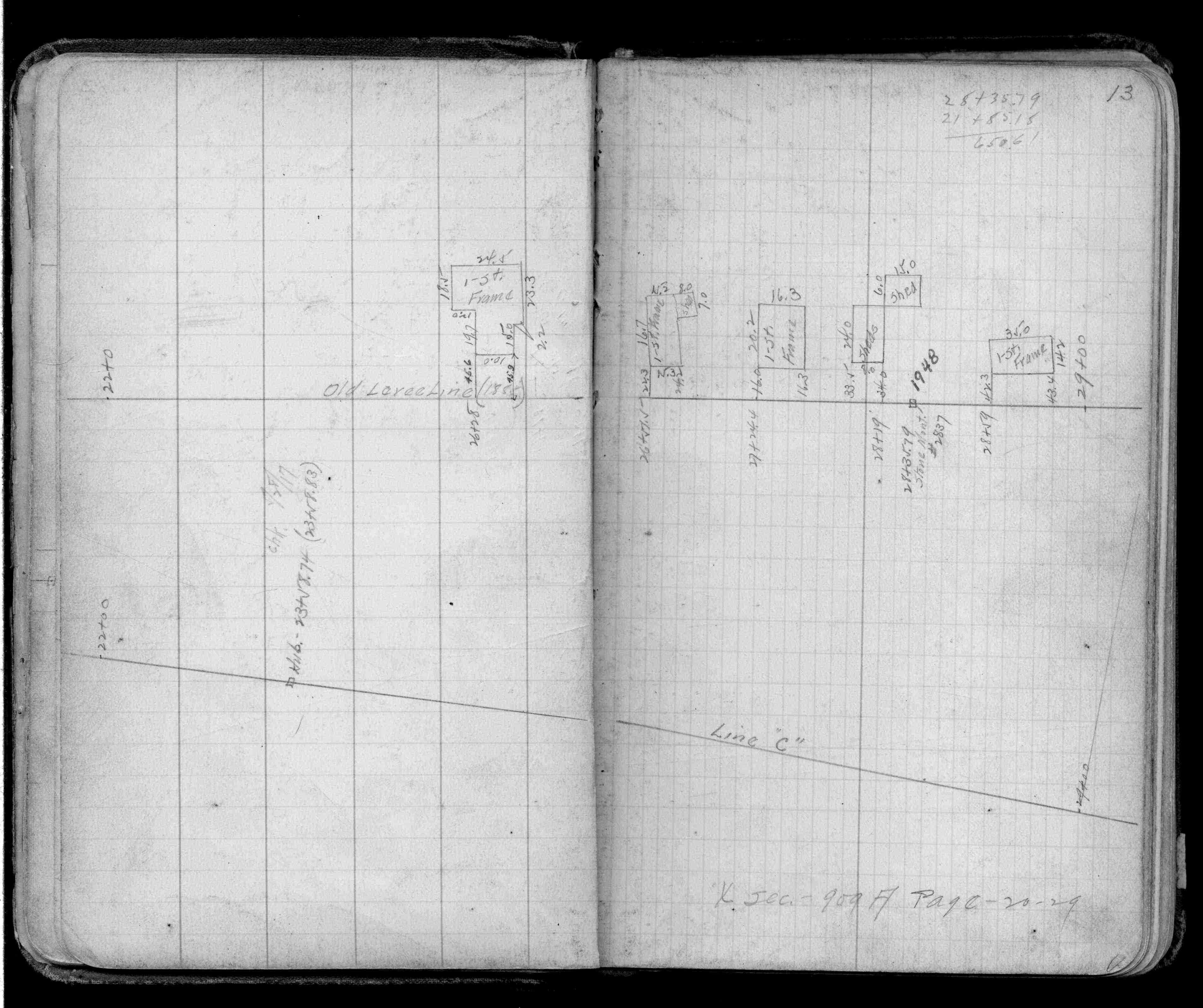
| FB 0909p.13 | ||||||
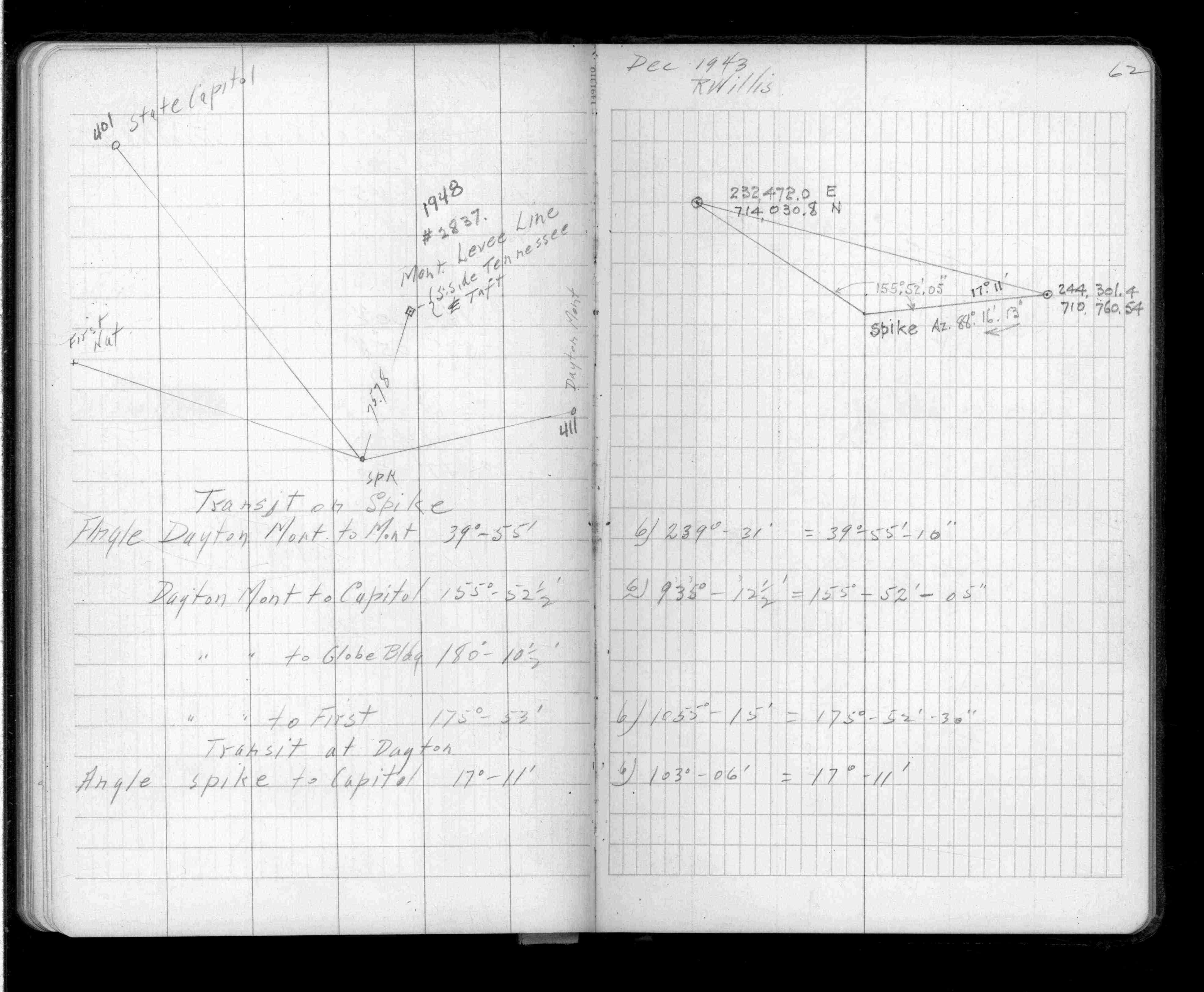
| FB 1340p.62 |