| NAD83 COORDINATES (1986 adj.): |
|---|
| X= 573381.844 Y= 152605.985 Z= 000.00 CMP 12/17/1991 |
| 6/7/1999 | Recovered CIM at base of large cotton wood 0.5 feet below grade |
| 2/1/1989 | (Unknown date Feb __, 1989 ) Located CIM by traverse (single stub). See FB 1713 p.1 |
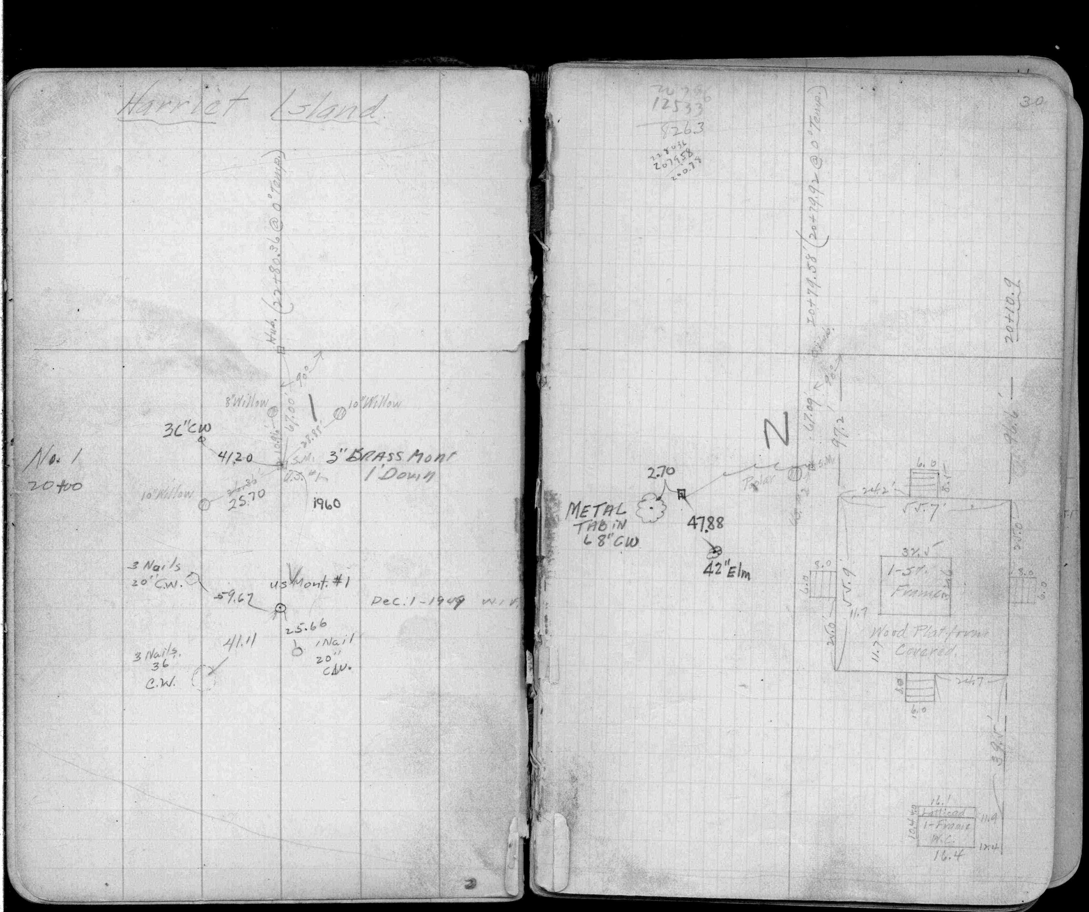
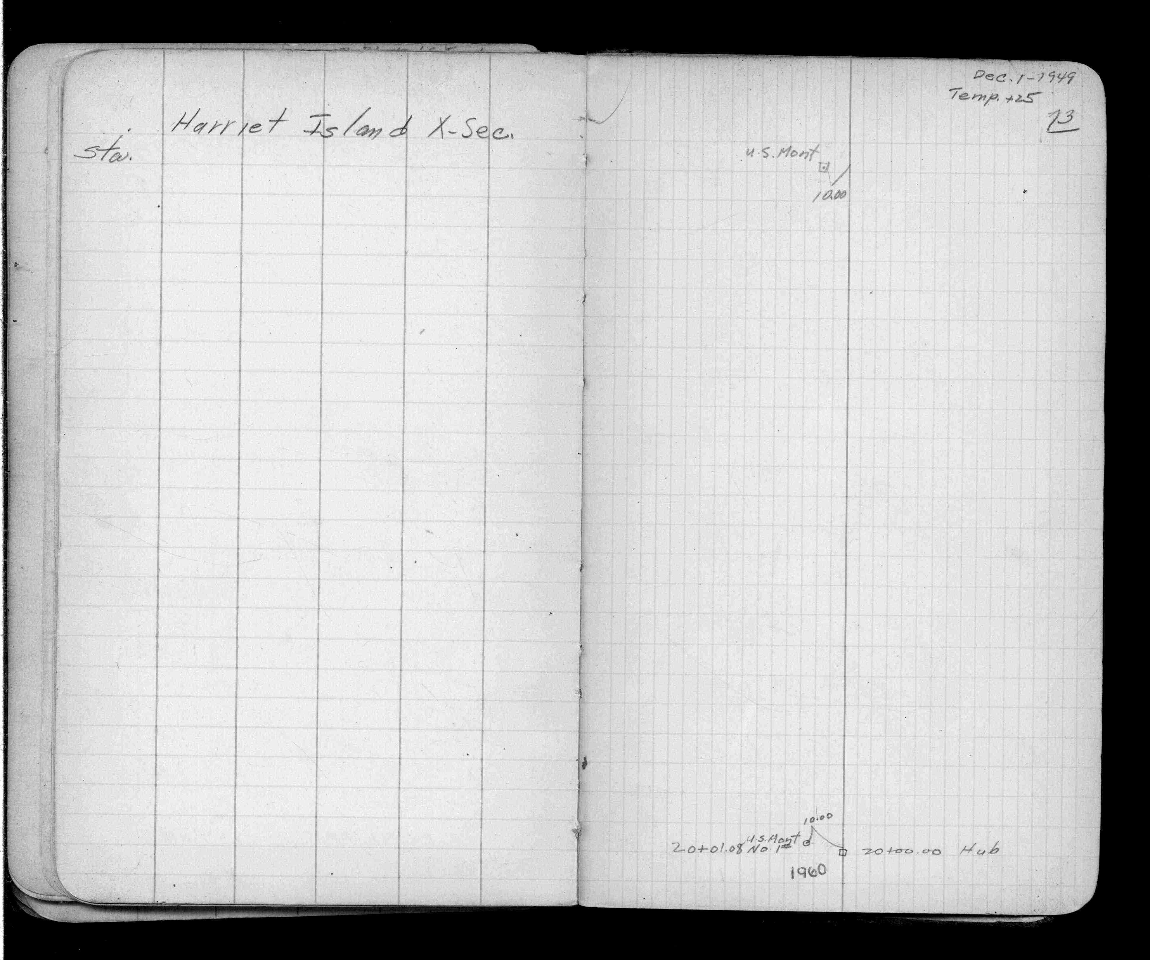
| 12/1/1949 | Placed ties on Brass Plug. See FB 909A p.30 |
Above is NOT an all inclusive history of this point. Please review all the links below.
| PLS NOTES | Field | Cross Section | Sewer | J.B. Irvine | Monument | River Survey |
|---|---|---|---|---|---|---|
| FB 0909Ap.30 | ||||||
| FB 0909Ap. 30 ,73 | ||||||
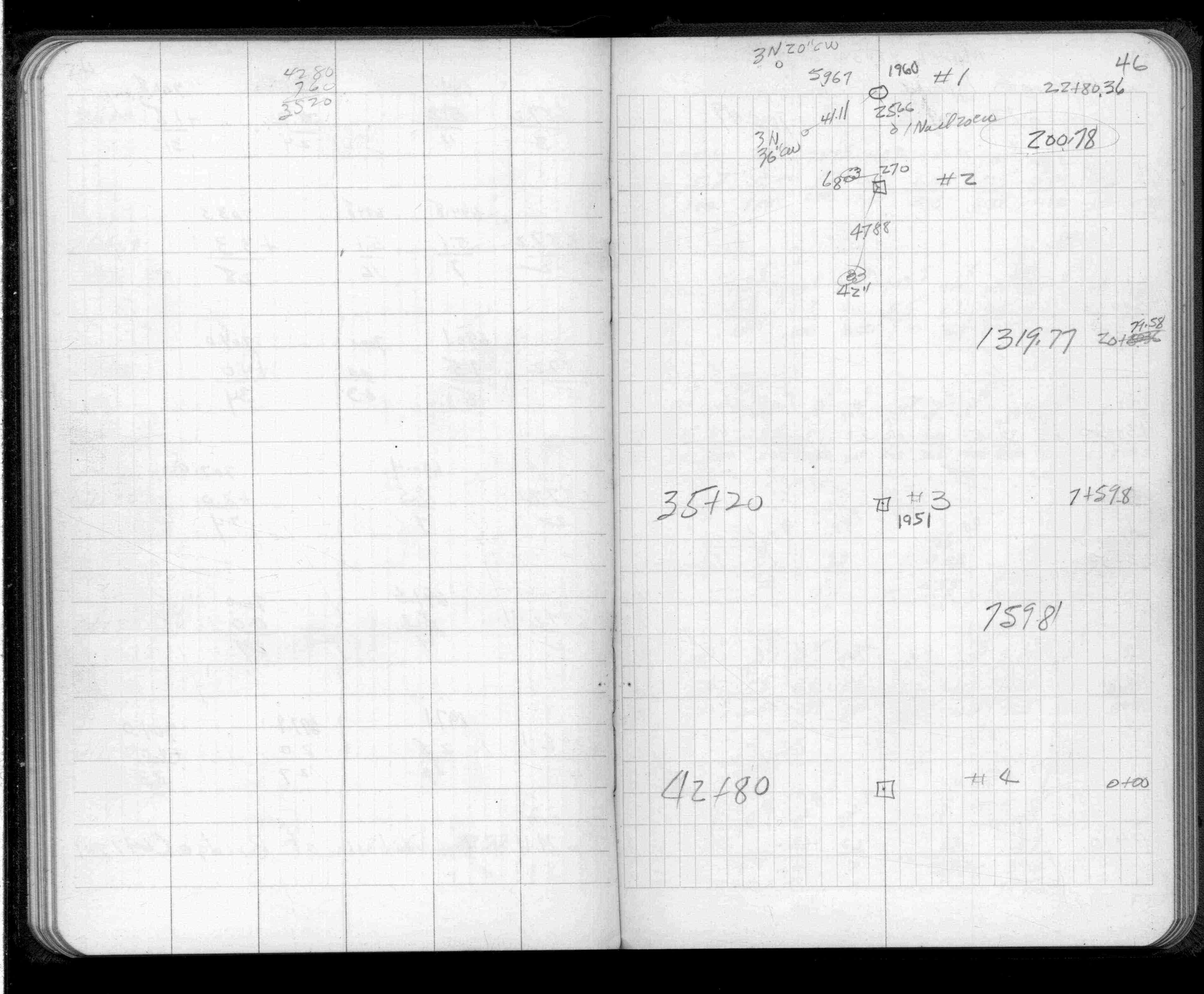
| FB 1403p.46 | ||||||
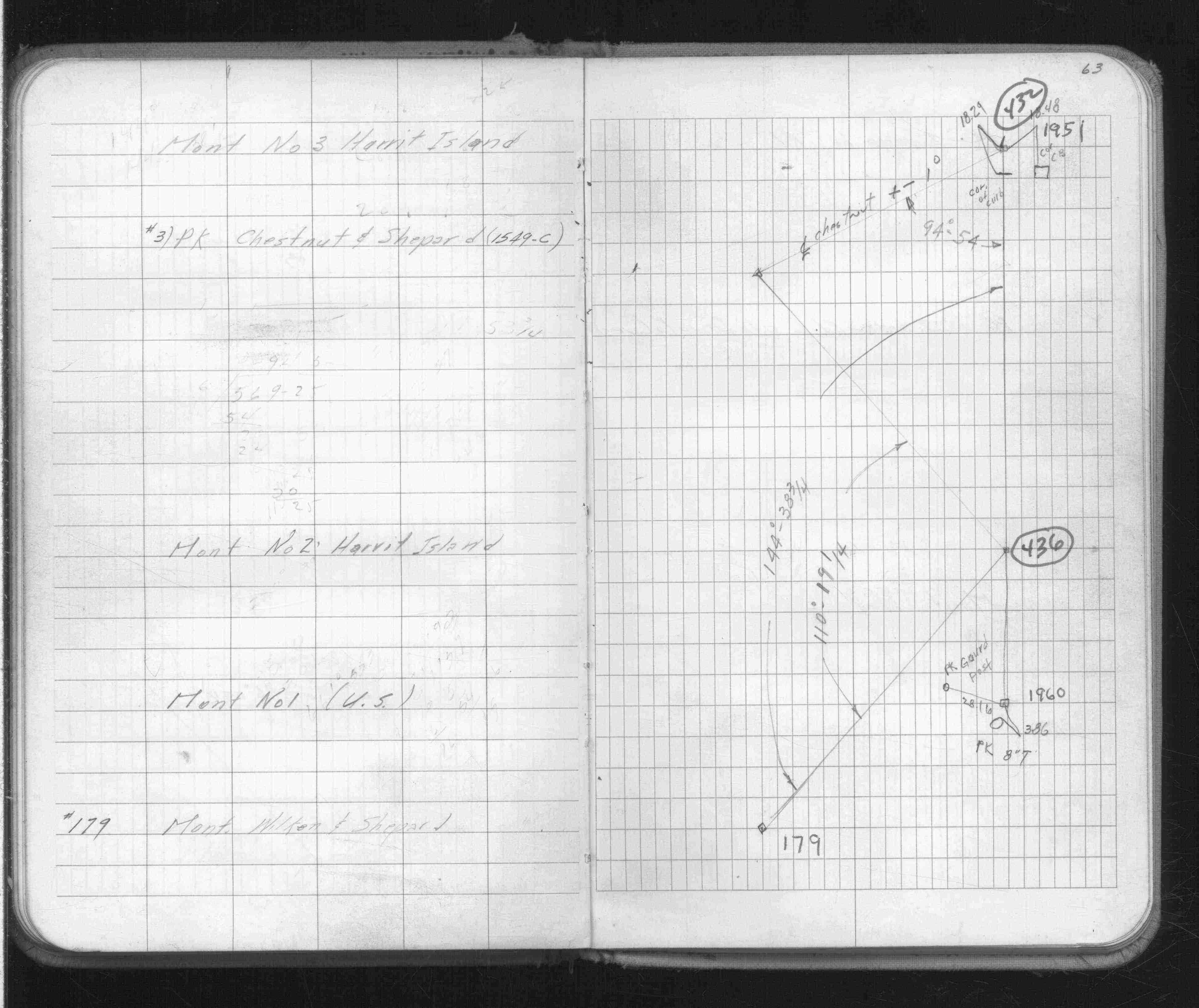
| FB 1514Gp.63 | ||||||
| FB 1686p.53 | ||||||
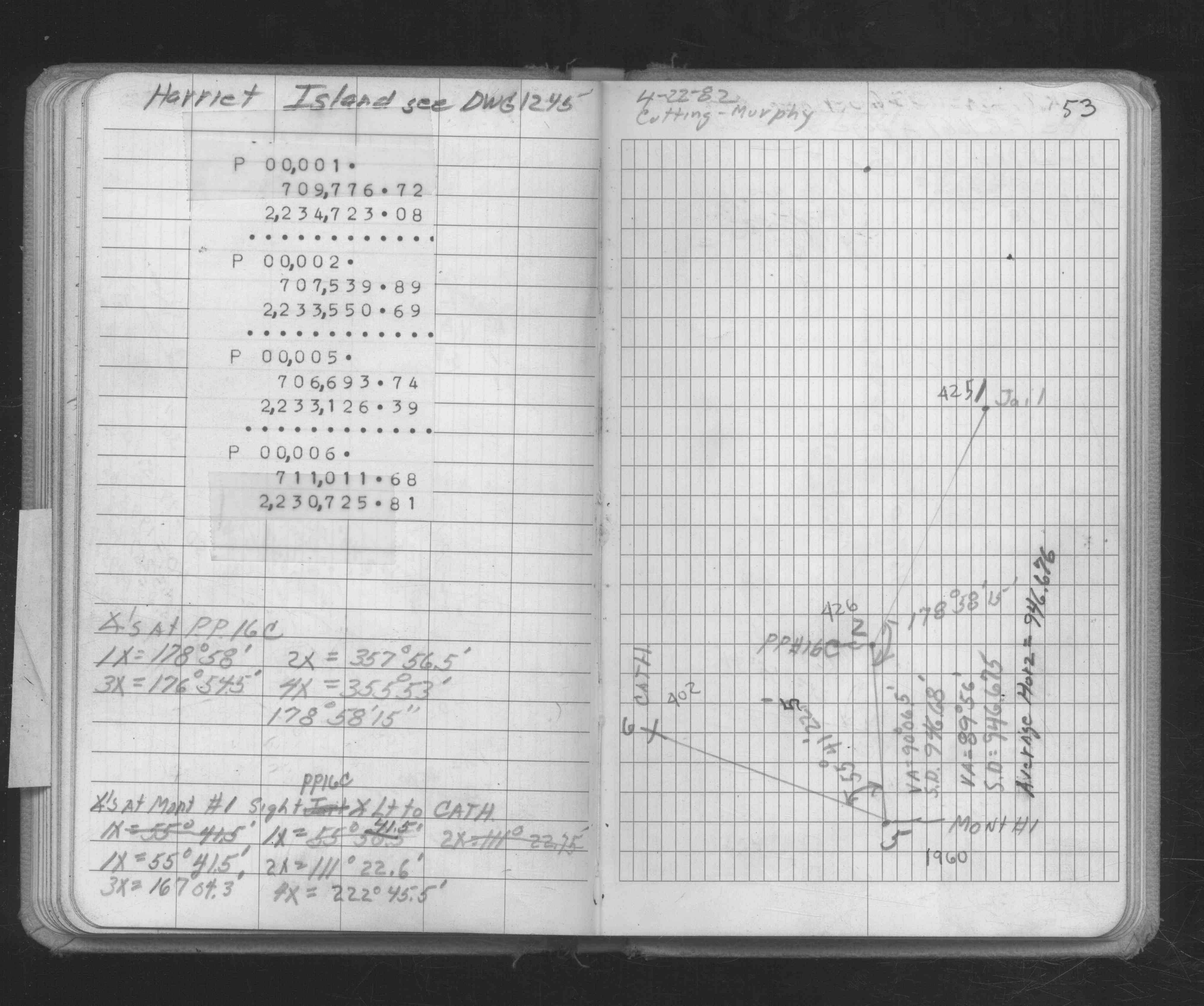
| FB 1713p.01 | ||||||
| FB 1713p.01 |