| NAD83 COORDINATES (1986 adj.): |
|---|
| X= 577879.07 Y= 153843.48 Z= 705.55 04/14/2009 S RTK-VRS |
| X= 577879.107 Y= 153843.358 Z= 000.00 LSQ 12/06/1991 S FLT |
| 4/14/2009 | Position on CIM established by RTK-VRS GPS. Elev 705.5 ft |
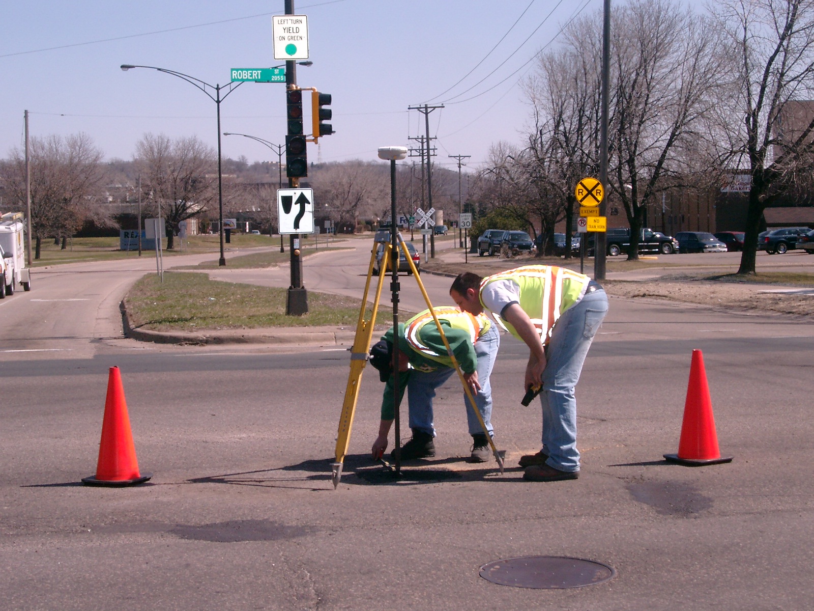
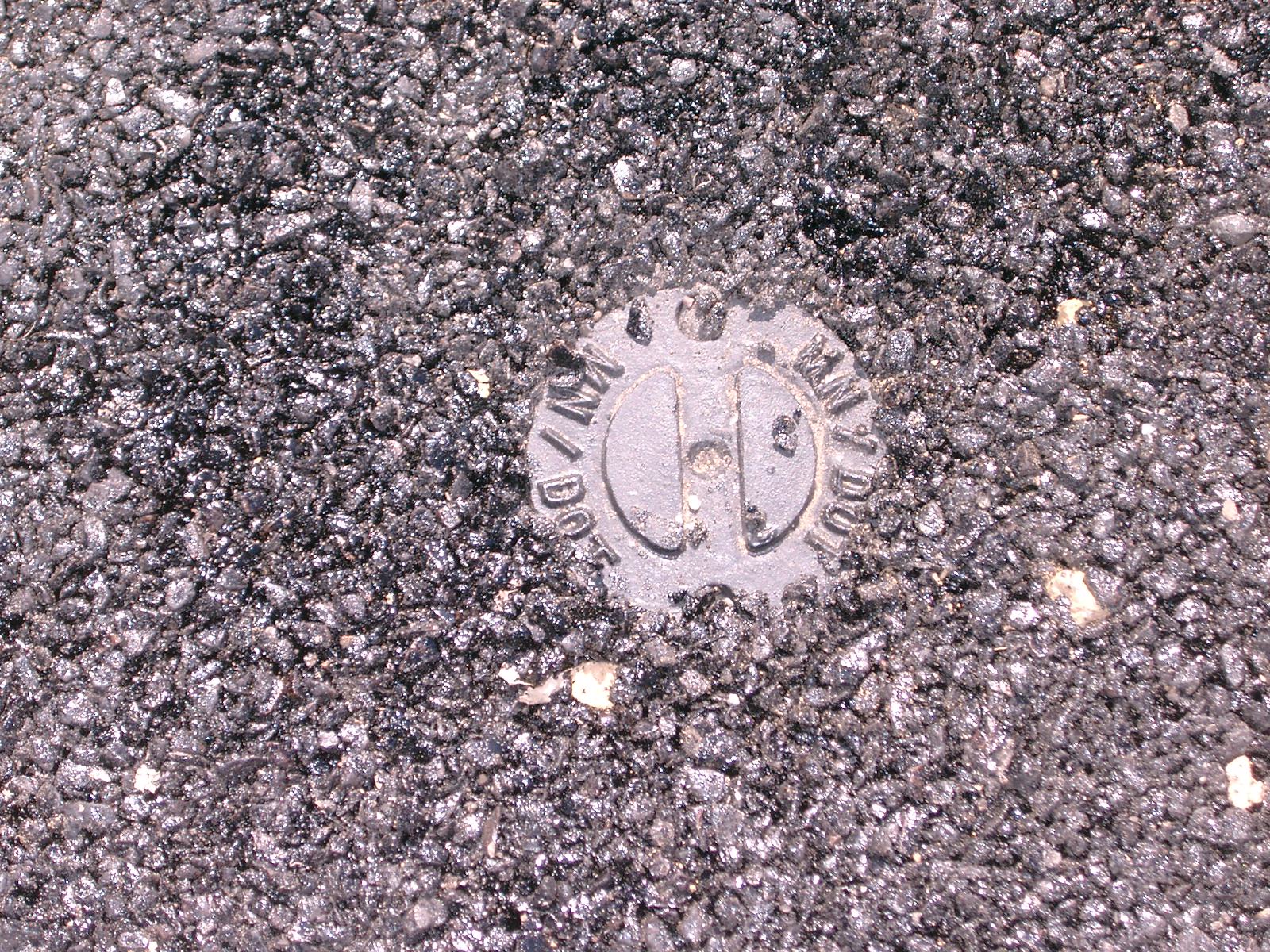
| 4/13/2009 | Fd 'MN DOT' CIM at grade in asphalt. Photos taken. |
| 10/1/1980 | (Unknown date Oct __, 1980 ) The plat of RIVERVIEW INDUSTRIAL PARK NO. 7 shows a GM inplace. |
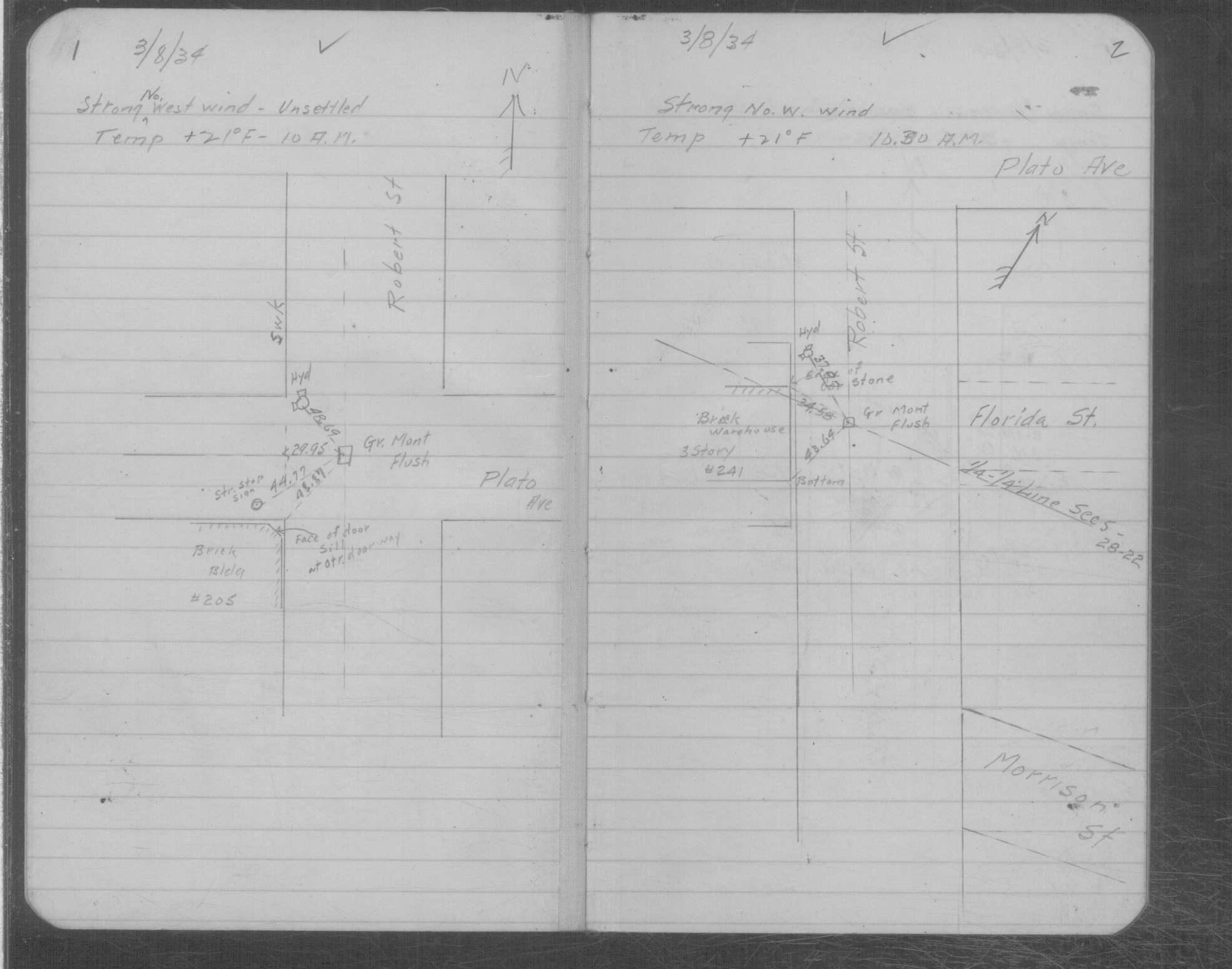
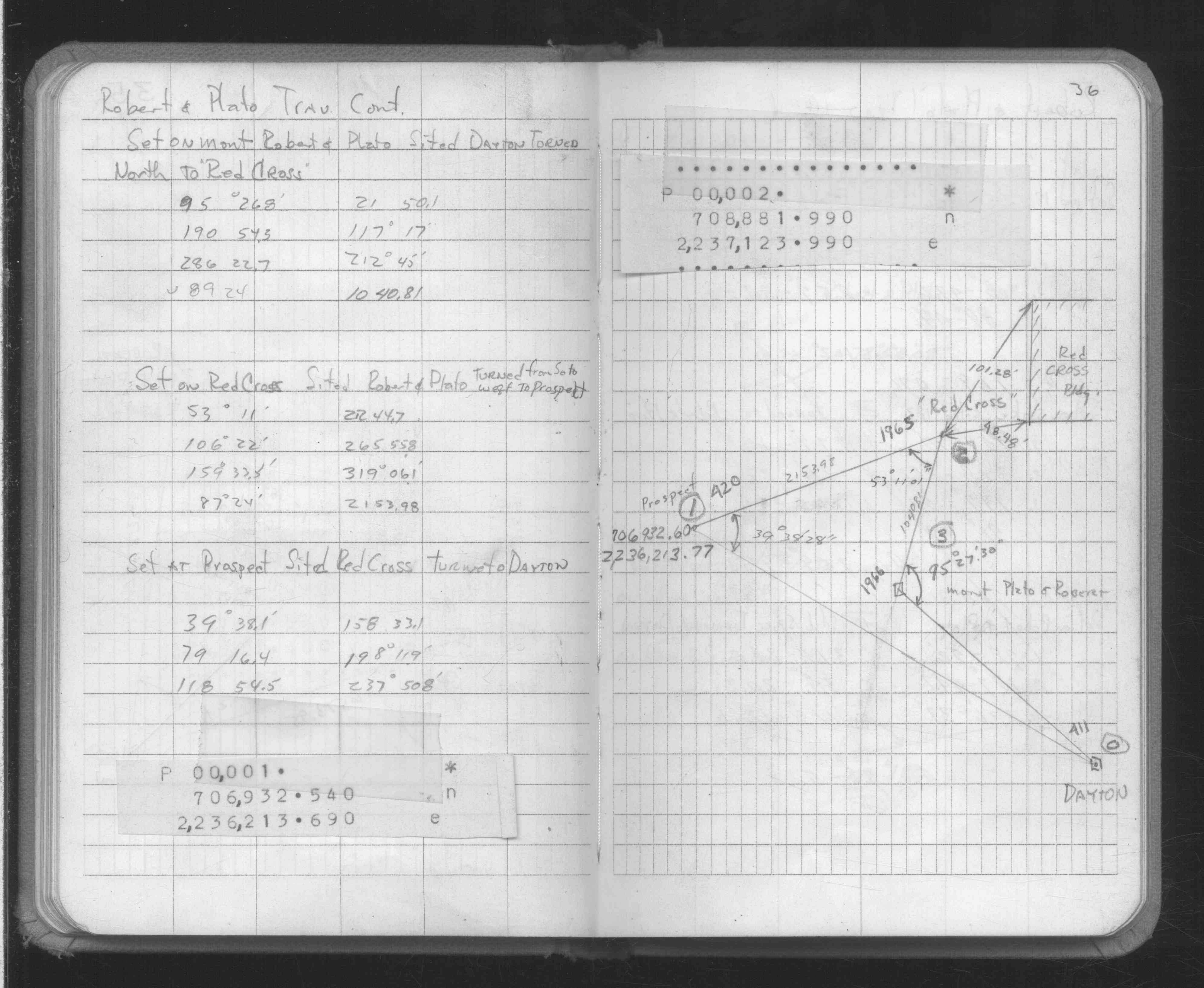
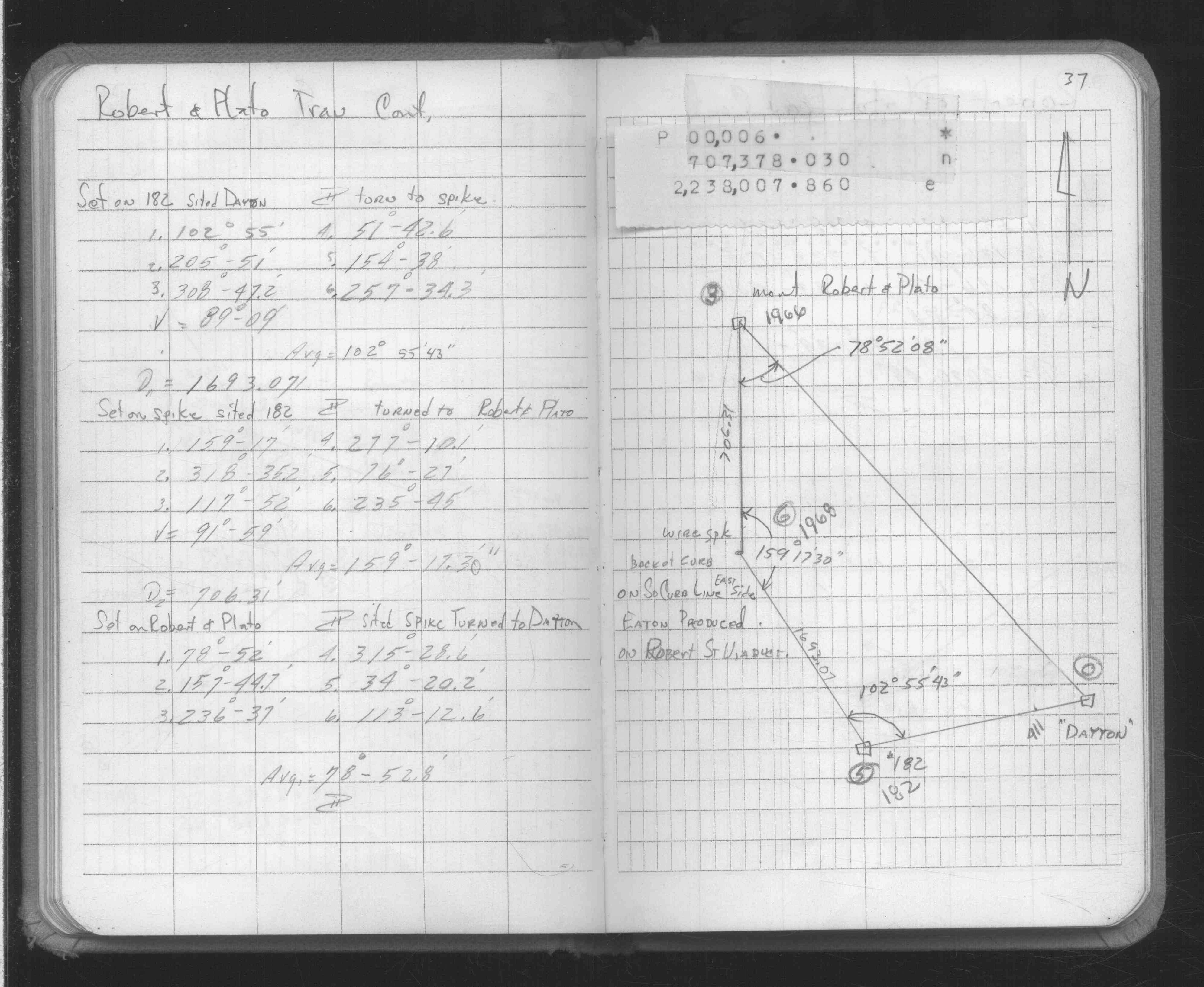
| 3/8/1934 | Placed ties on GM at grade. See MSX 2 p.1-2 |
| 8/1/1895 | (Unknown date Aug __, 1895 ) Monument set by J B Irvine after paving. See paving notes FB 384 |
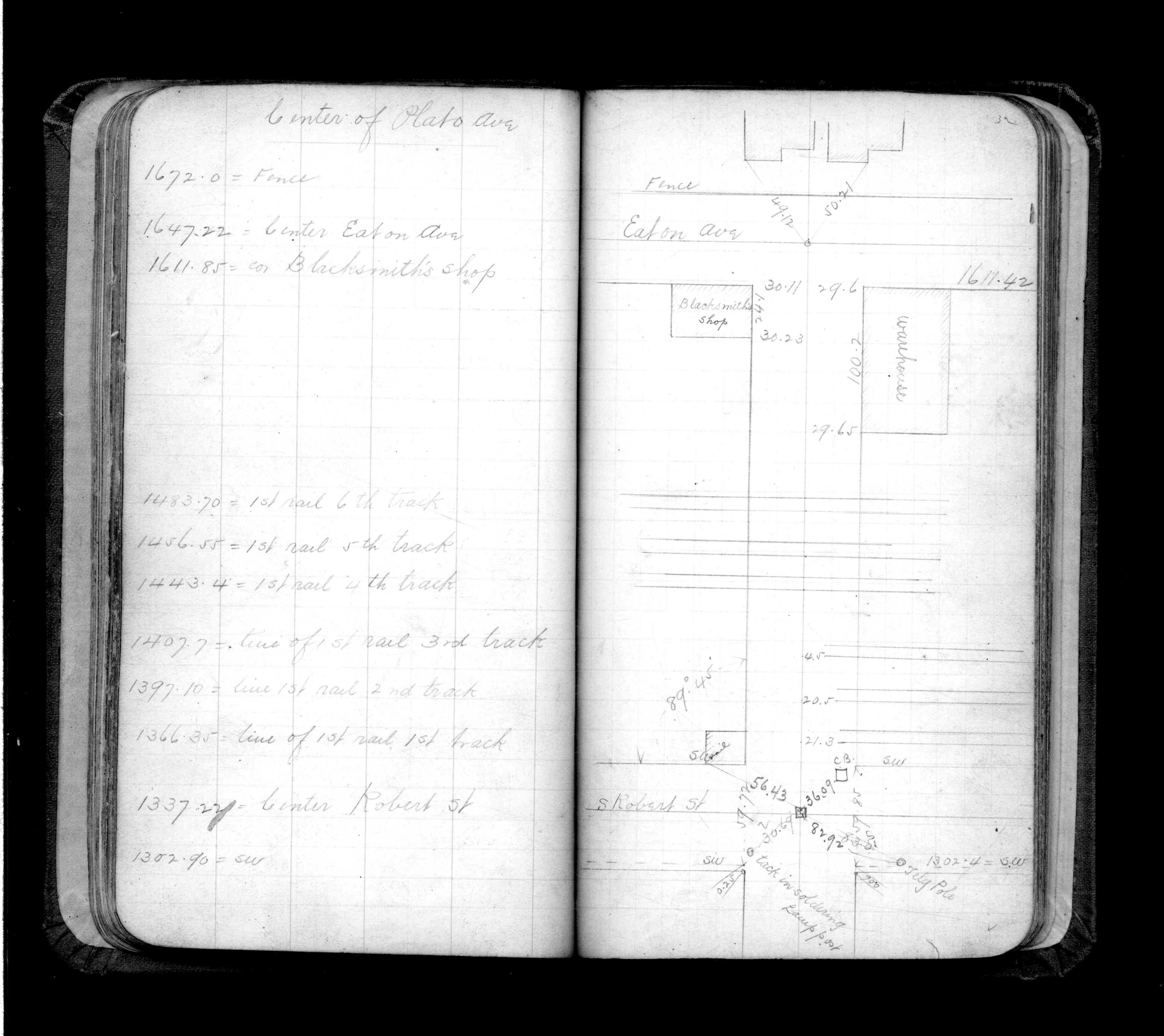
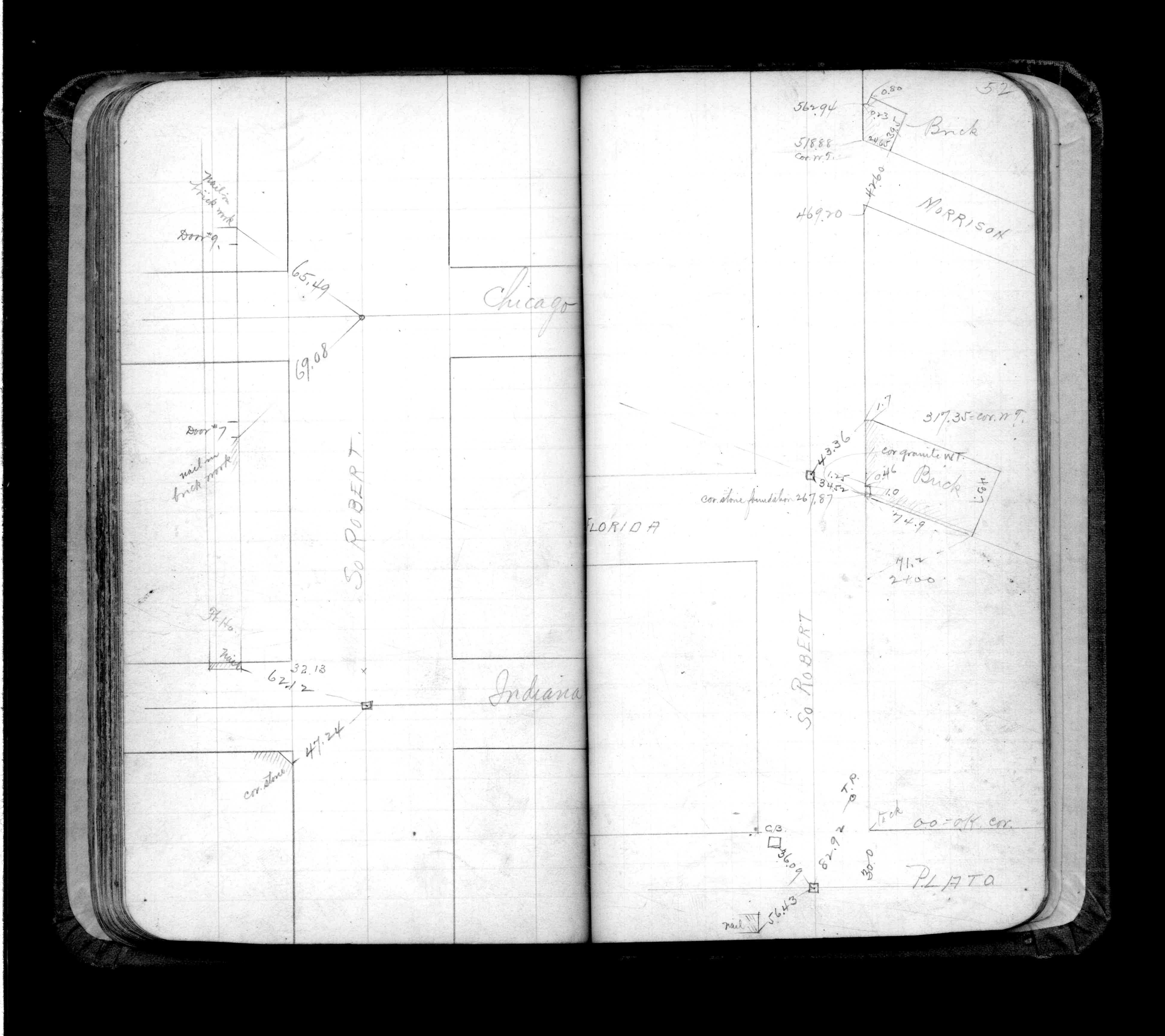
| 9/1/1892 | (Unknown date Sep __, 1892 ) Placed ties. See FB 325 p.52 |
| 1/1/1890 | (Unknown date ___ __, 1890 ) Placed ties. See FB 325 p.32 |
Above is NOT an all inclusive history of this point. Please review all the links below.
| PLS NOTES | Field | Cross Section | Sewer | J.B. Irvine | Monument | River Survey |
|---|---|---|---|---|---|---|
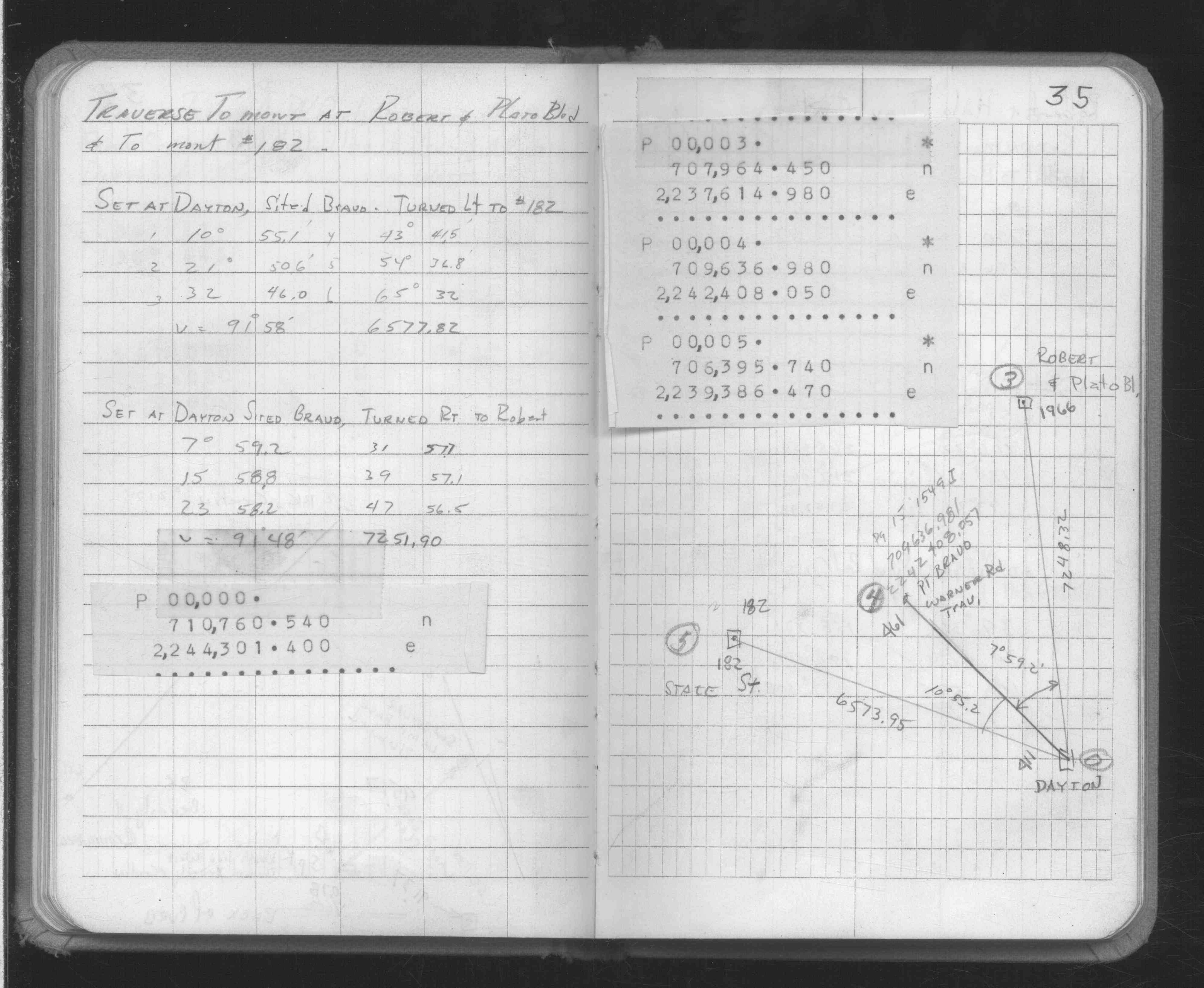
| FB 0325p.32 | MSX 0002 p.001-002 | |||||
| FB 0325p.52 | ||||||
| FB 1634Bp. 35 ,36 ,37 |
| FILE | PHOTO DATE | COMMENTS |
|---|---|---|
| 1966-2719-4.jpg | April 13, 2009 | Looking south toward monument. |
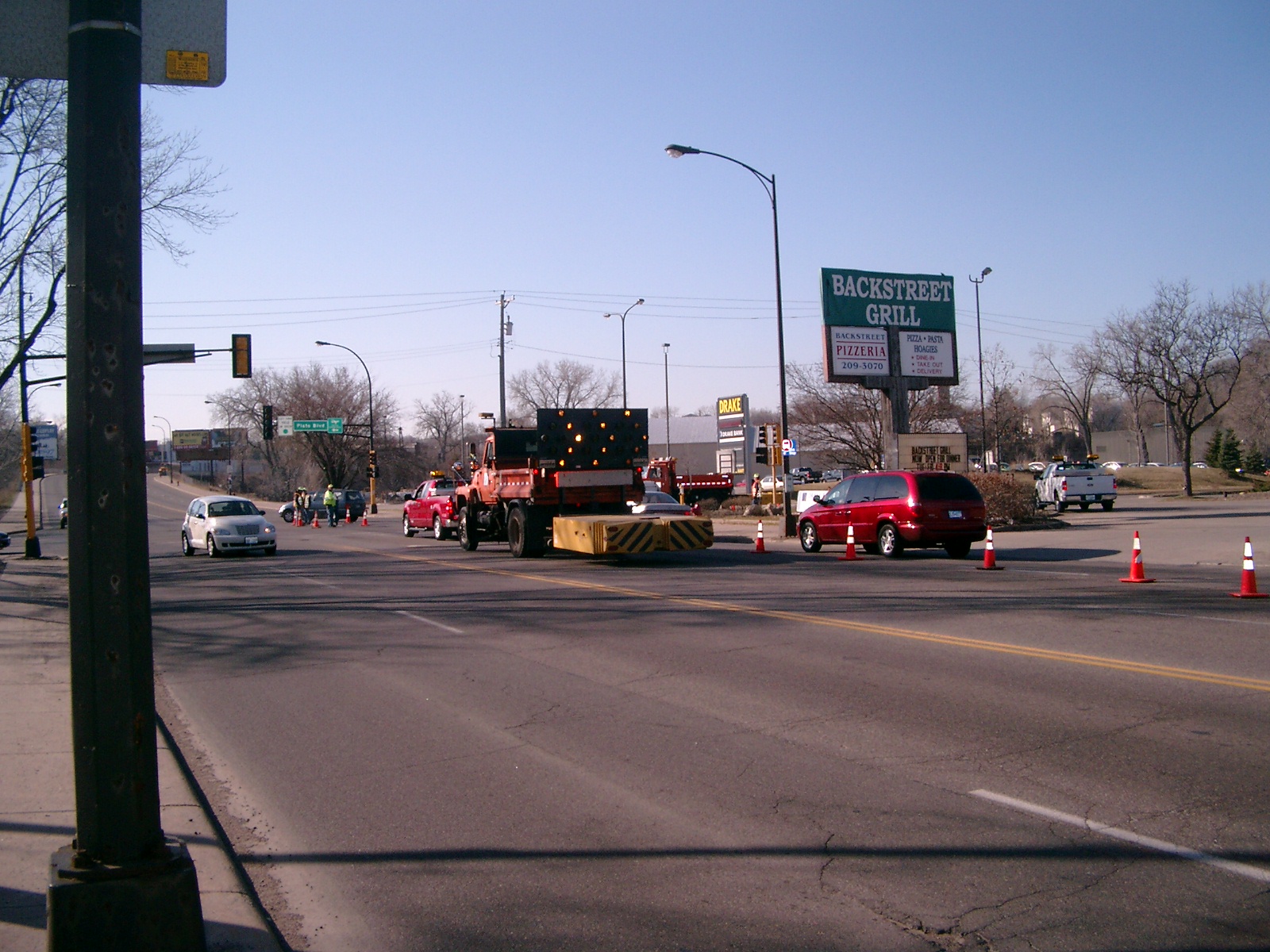
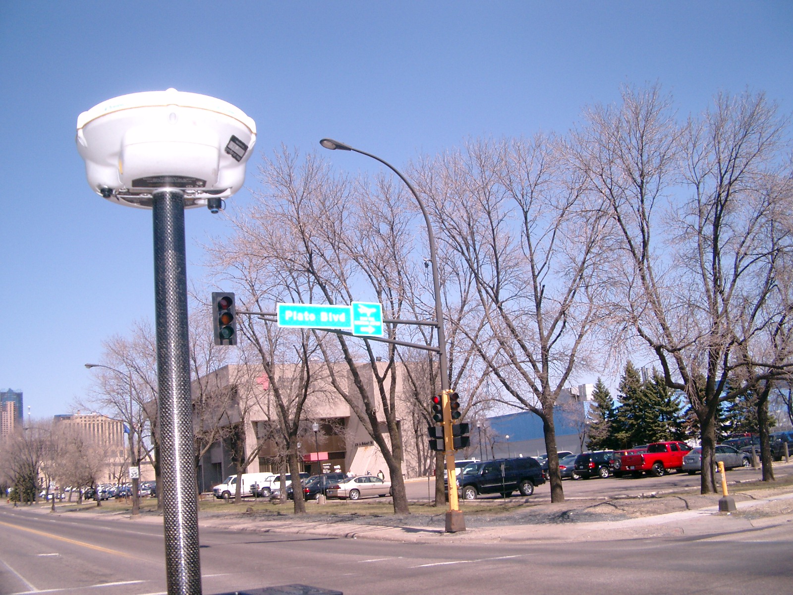
| 1966-2719-3.jpg | April 13, 2009 | Looking east along Plato Blvd. |
| 1966-2719-2.jpg | April 13, 2009 | Looking north along Robert St. |
| 1966-2719-1.jpg | April 13, 2009 | Close up of monument. |