| NAD83 COORDINATES (1986 adj.): |
|---|
| X= 574779.193 Y= 154407.375 Z= 000.00 CMP 05/03/1995 |
| 11/1/1952 | (Unknown date Nov __, 1952 ) Corps of Engs recovered mon't in good condition. |
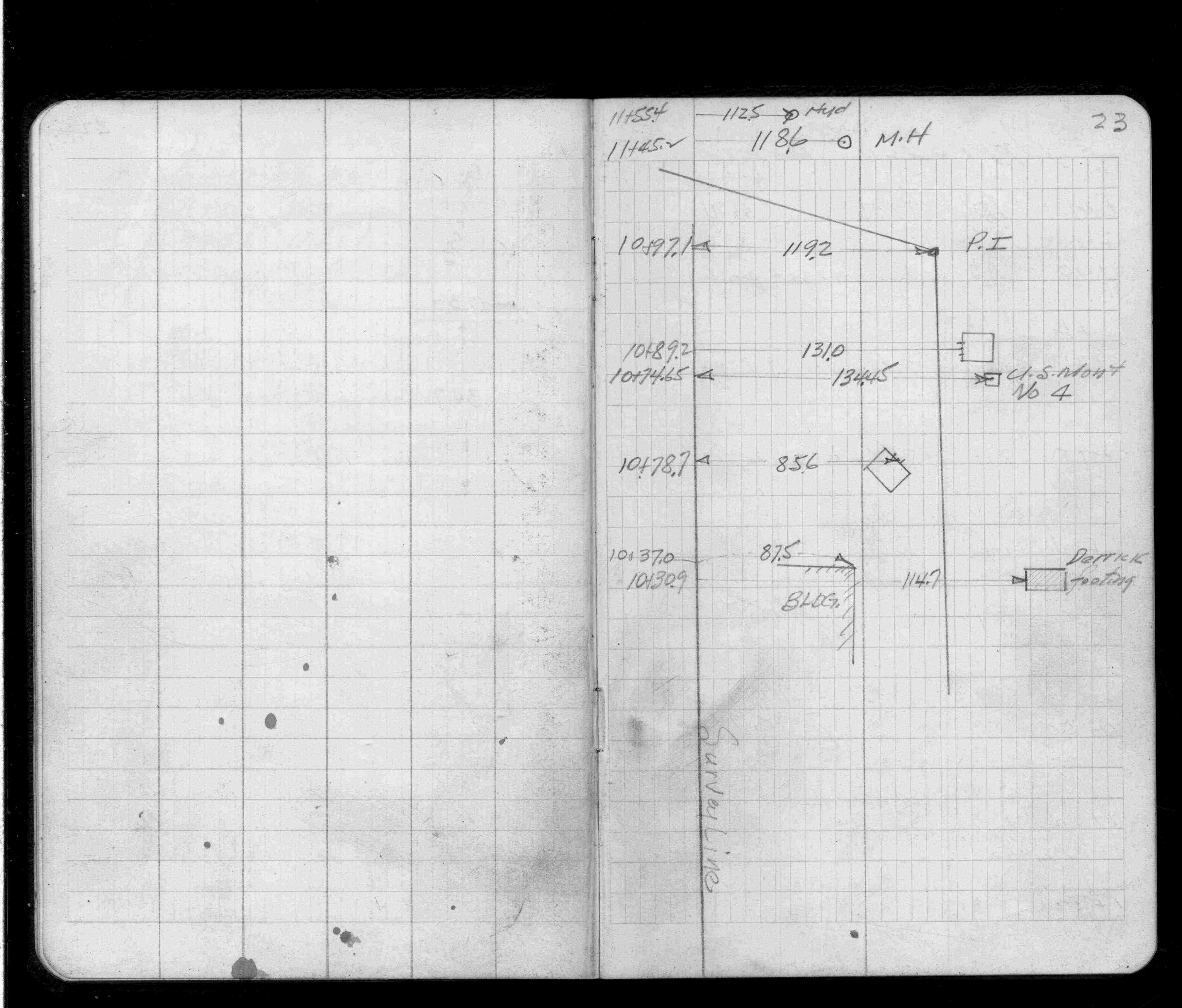
| 1/1/1951 | (Unknown date ___ __, 1951 ) Located during bridge survey. See FB 1419 p.23 |
| 11/1/1948 | (Unknown date Nov __, 1948 ) Corps of Engs recovered mon't in good condition. |
| 1/1/1800 | (Unknown date ___ __, ____ ) Corps of Engs recovered 8"x 8"x 30" GM with 3/4" hole, 1.5 ft below grade. |
Above is NOT an all inclusive history of this point. Please review all the links below.
| PLS NOTES | Field | Cross Section | Sewer | J.B. Irvine | Monument | River Survey |
|---|---|---|---|---|---|---|
| FB 1419p.23 |