| NAD83 COORDINATES (1986 adj.): |
|---|
| X= 550773.176 Y= 140357.112 Z= 000.00 LSQ 12/06/1991 S FLT |
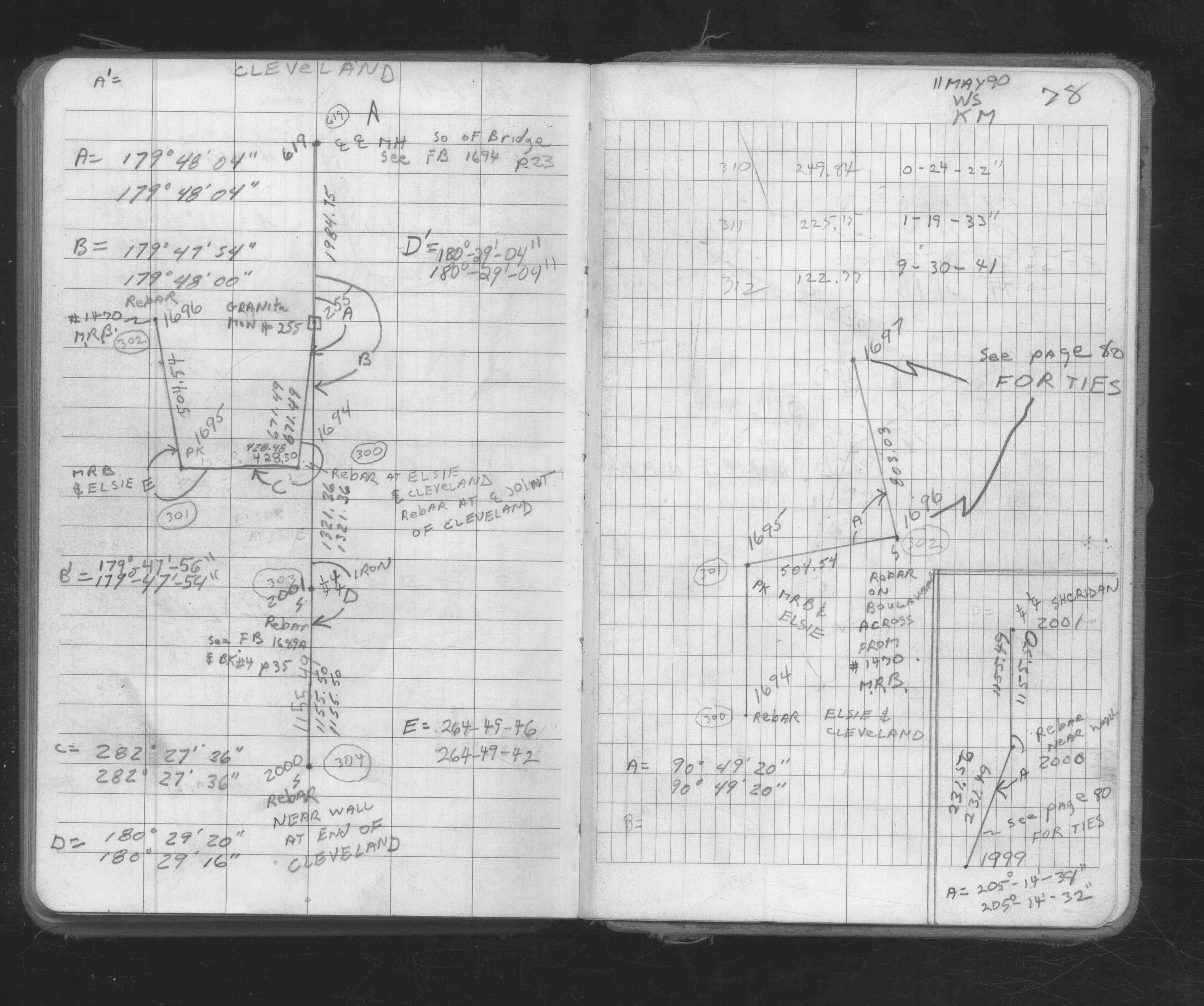
| 5/11/1990 | Traversed through iron. See FB 1673A p.78 |
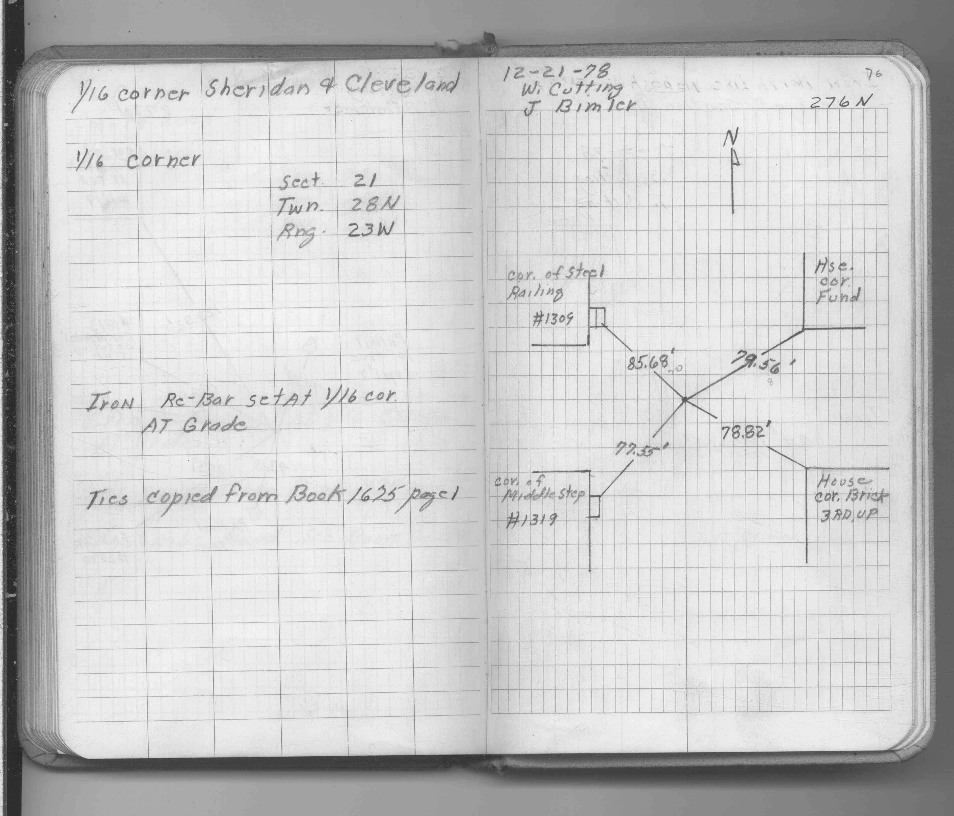
| 12/21/1978 | Set rebar to grade. See FB 1689A p.76 |
| 12/21/1978 | Set rebar to grade. See CofL 2001-1305-A, copied from FB 1689A p.76 |
| 11/1/1978 | (Unknown date Nov __, 1978 ) Set pk nail to grade. See FB 1675 p.1 |
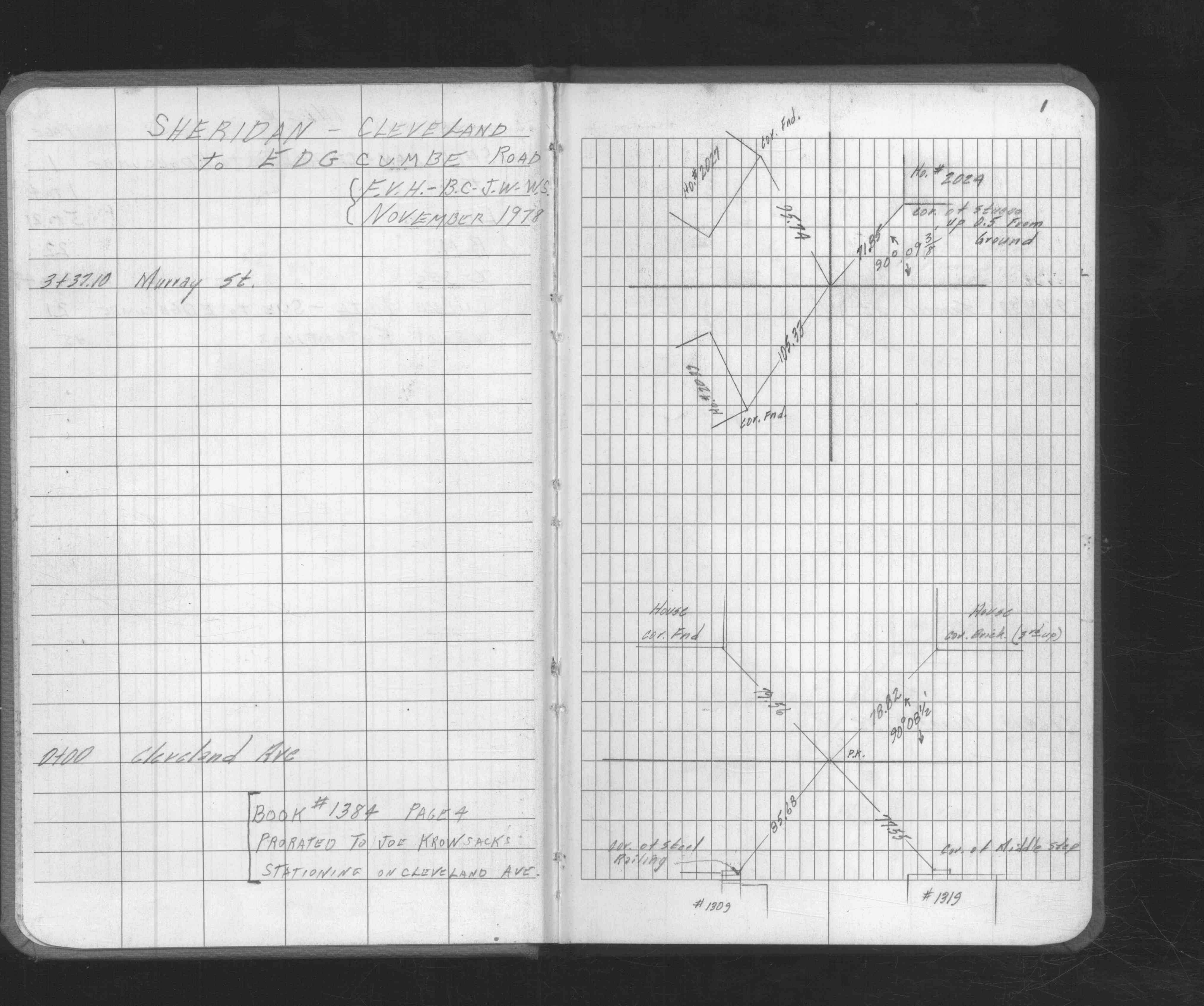
| 6/21/1948 | Stationed through mon't. See FB 1384 p.4 |
| 4/1/1943 | (Unknown date Apr __, 1943 ) Placed ties on mon't. See FB 1059 p.4 |
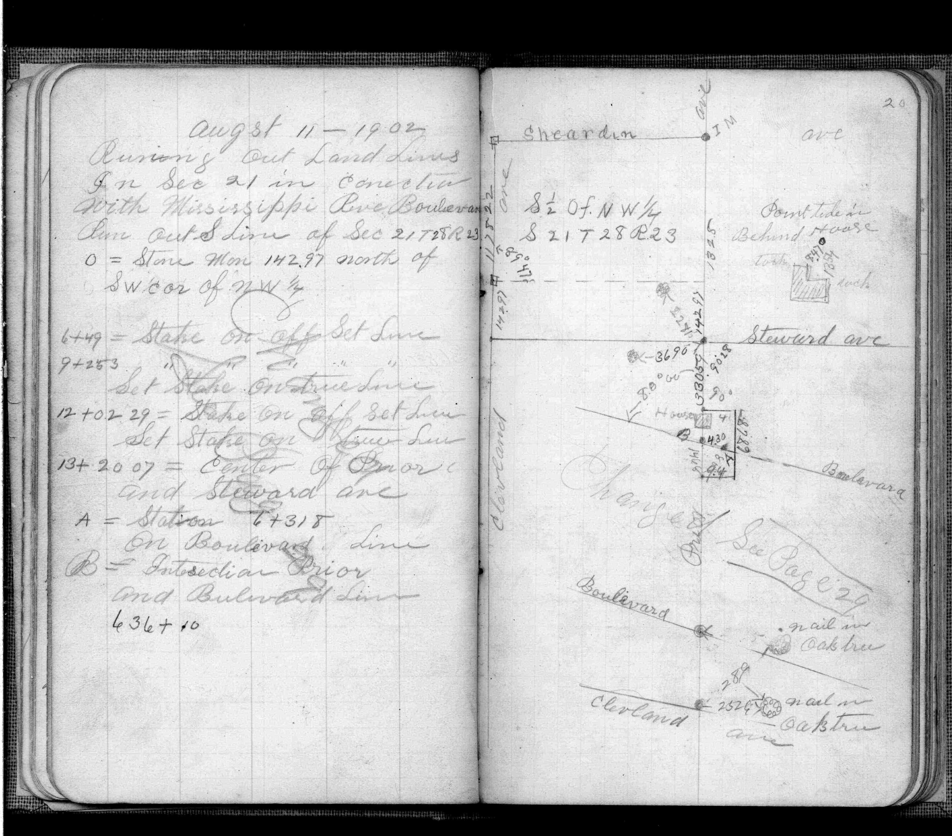
| 8/12/1902 | F OHara running out land lines in connection with Mississippi River Blvd. See FB 474 p.20 |
Above is NOT an all inclusive history of this point. Please review all the links below.
| PLS NOTES | Field | Cross Section | Sewer | J.B. Irvine | Monument | River Survey |
|---|---|---|---|---|---|---|
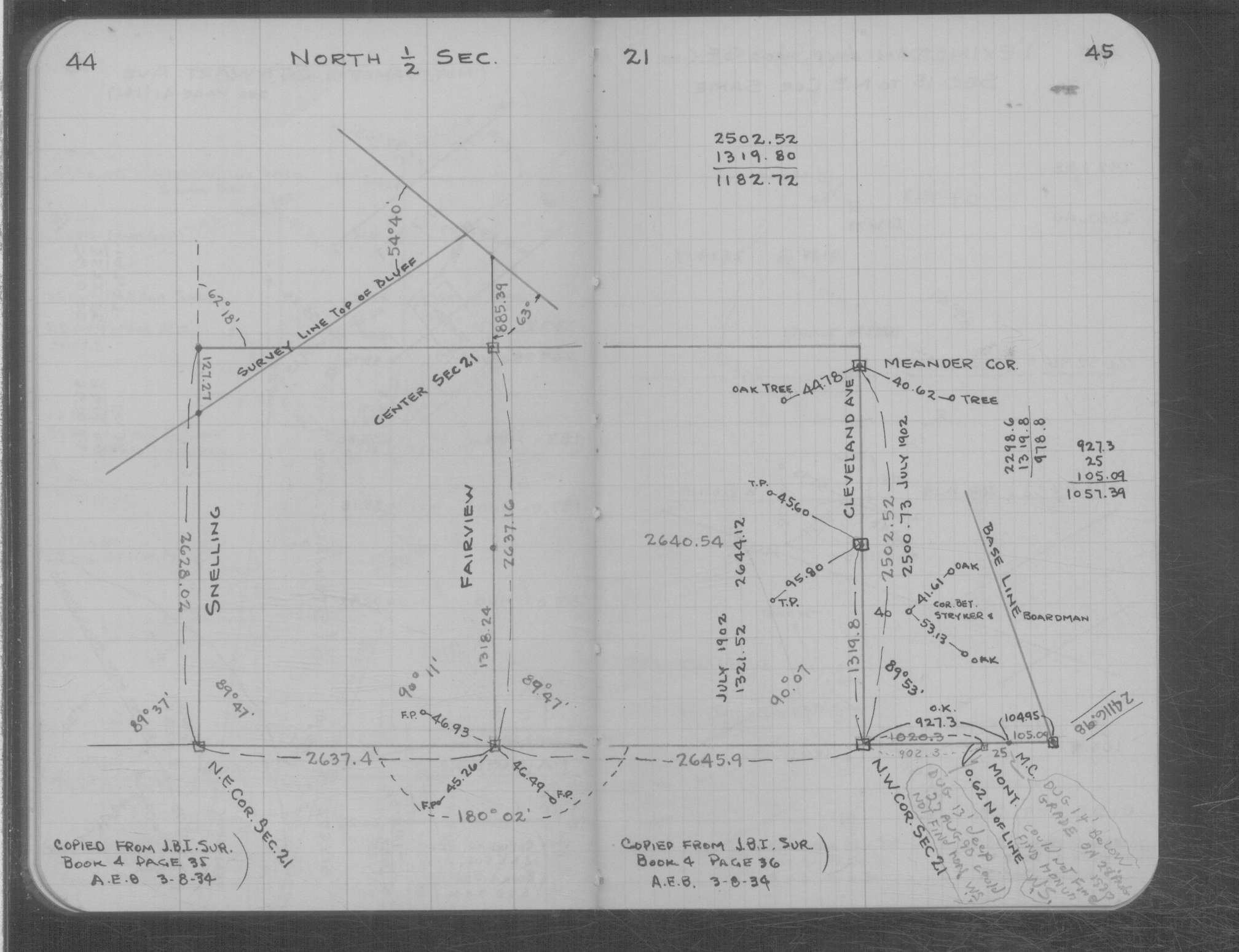
| FB 0474p.20 | MS 0007 p.044-045 | |||||
| FB 1059p.04 | ||||||
| FB 1059p.04 | ||||||
| FB 1384p.04 | ||||||
| FB 1384p.04 | ||||||
| FB 1673Ap.78 | ||||||
| FB 1675p.01 | ||||||
| FB 1675p.01 | ||||||
| FB 1689Ap.76 |
| FILE | SURVEYOR | LIC. NO. | DATE SIGNED | DATE TIED |
|---|---|---|---|---|
| 2001-1305-A.tif | none | none | none | November 1, 1978 |