| NAD83 COORDINATES (1986 adj.): |
|---|
| X= 553415.429 Y= 140375.728 Z= 000.00 LSQ 12/06/1991 S FLT |
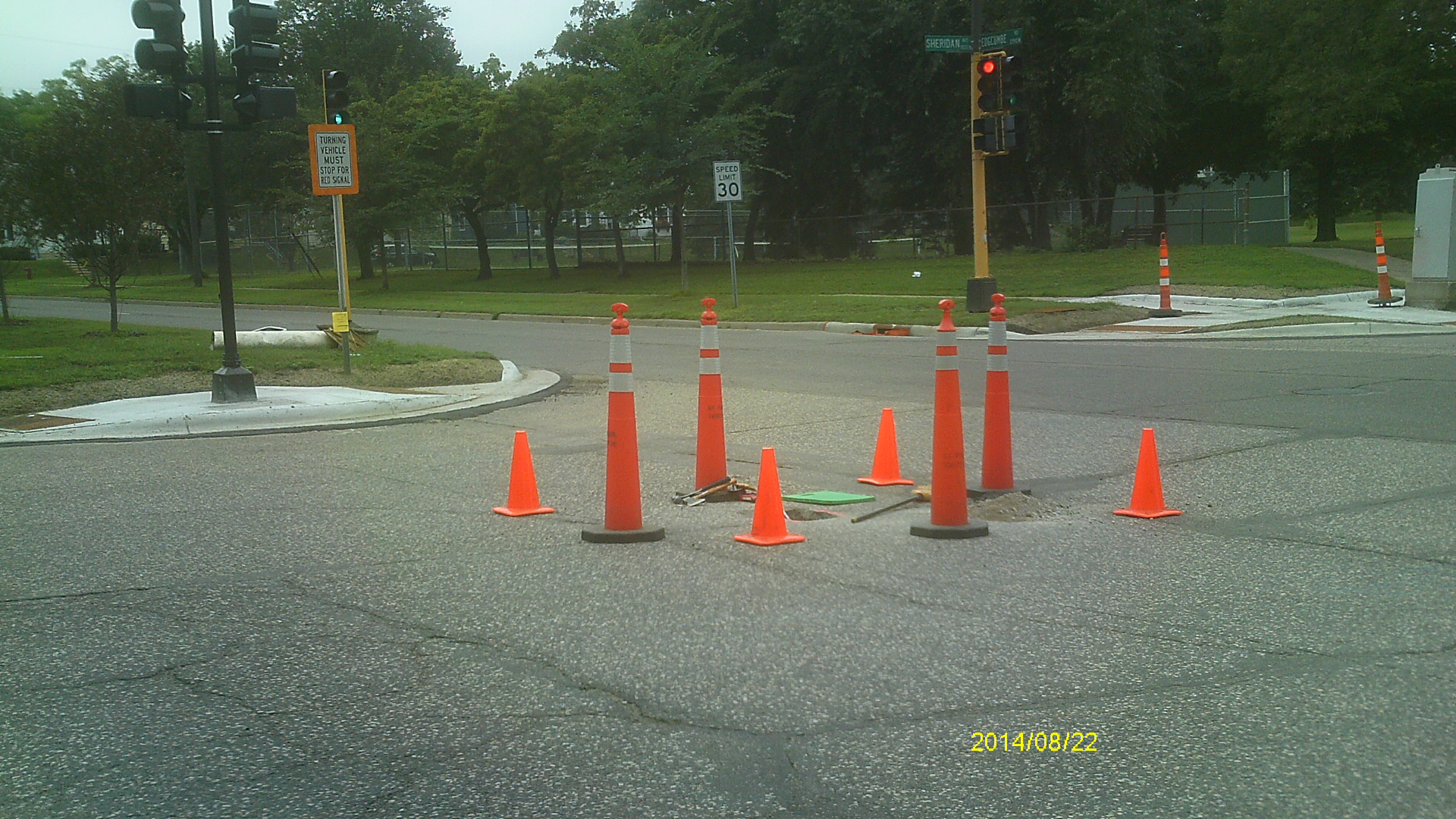
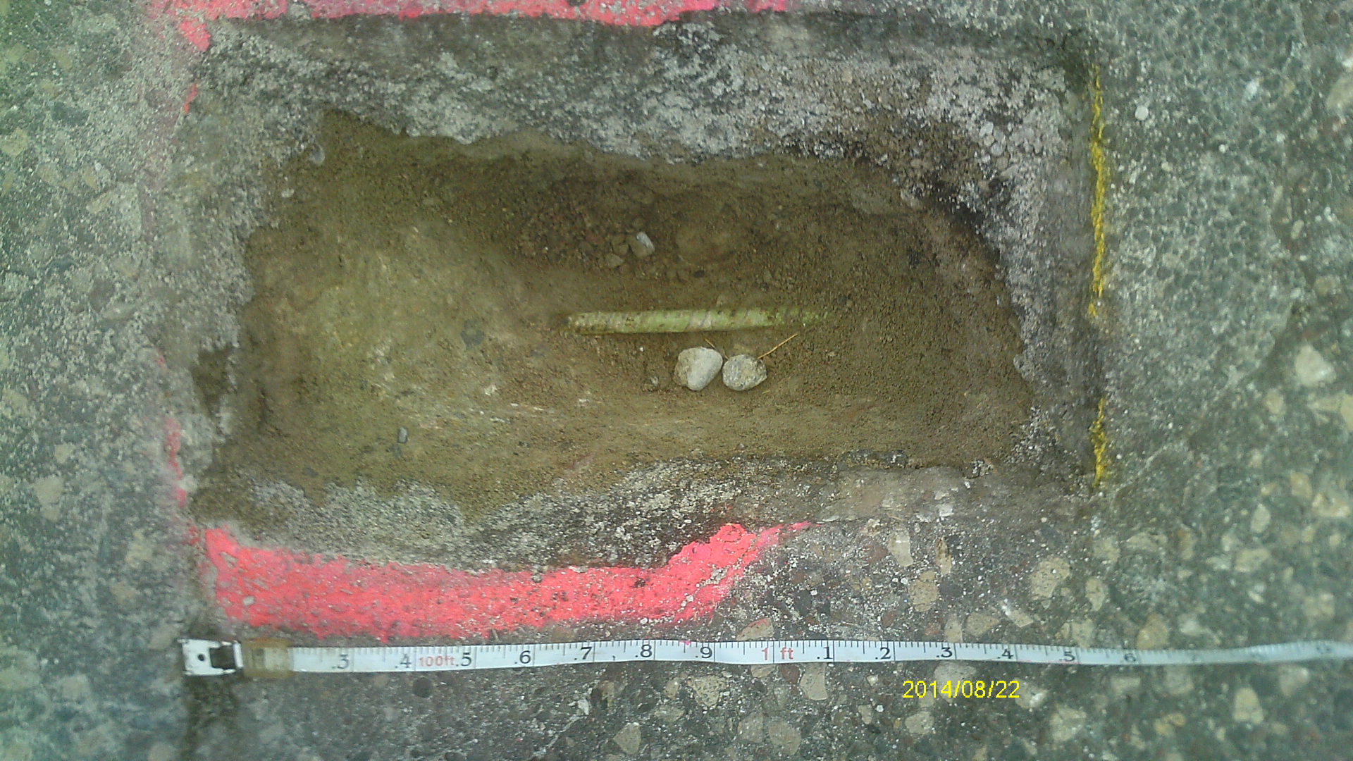
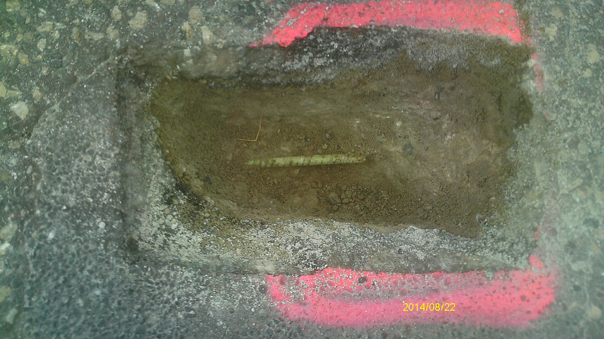
| 8/22/2014 | Found piece of green rebar lying horizontally 0.7 ft below asphalt grade. Photos taken. |
| 2/29/2008 | Monument not found. |
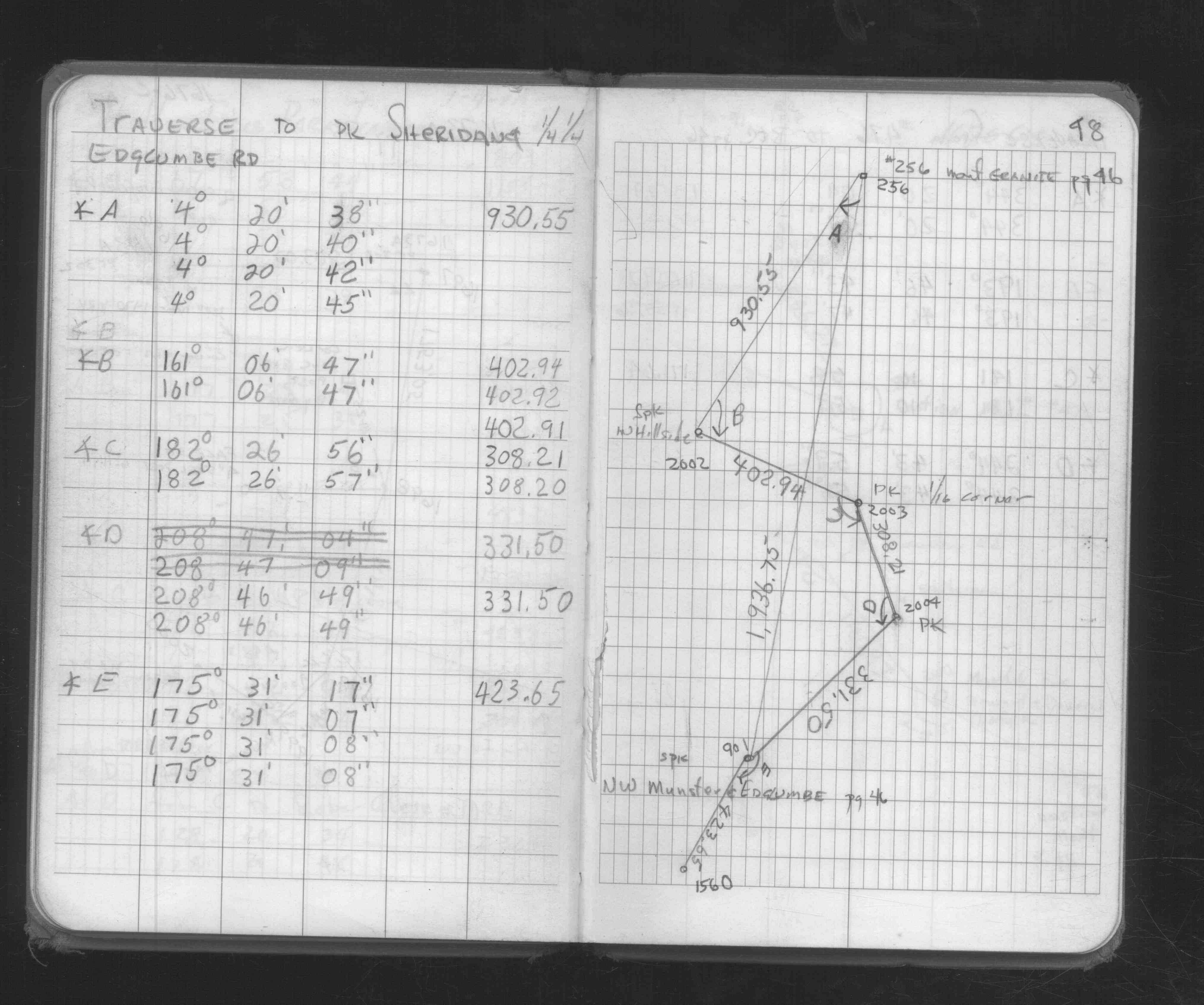
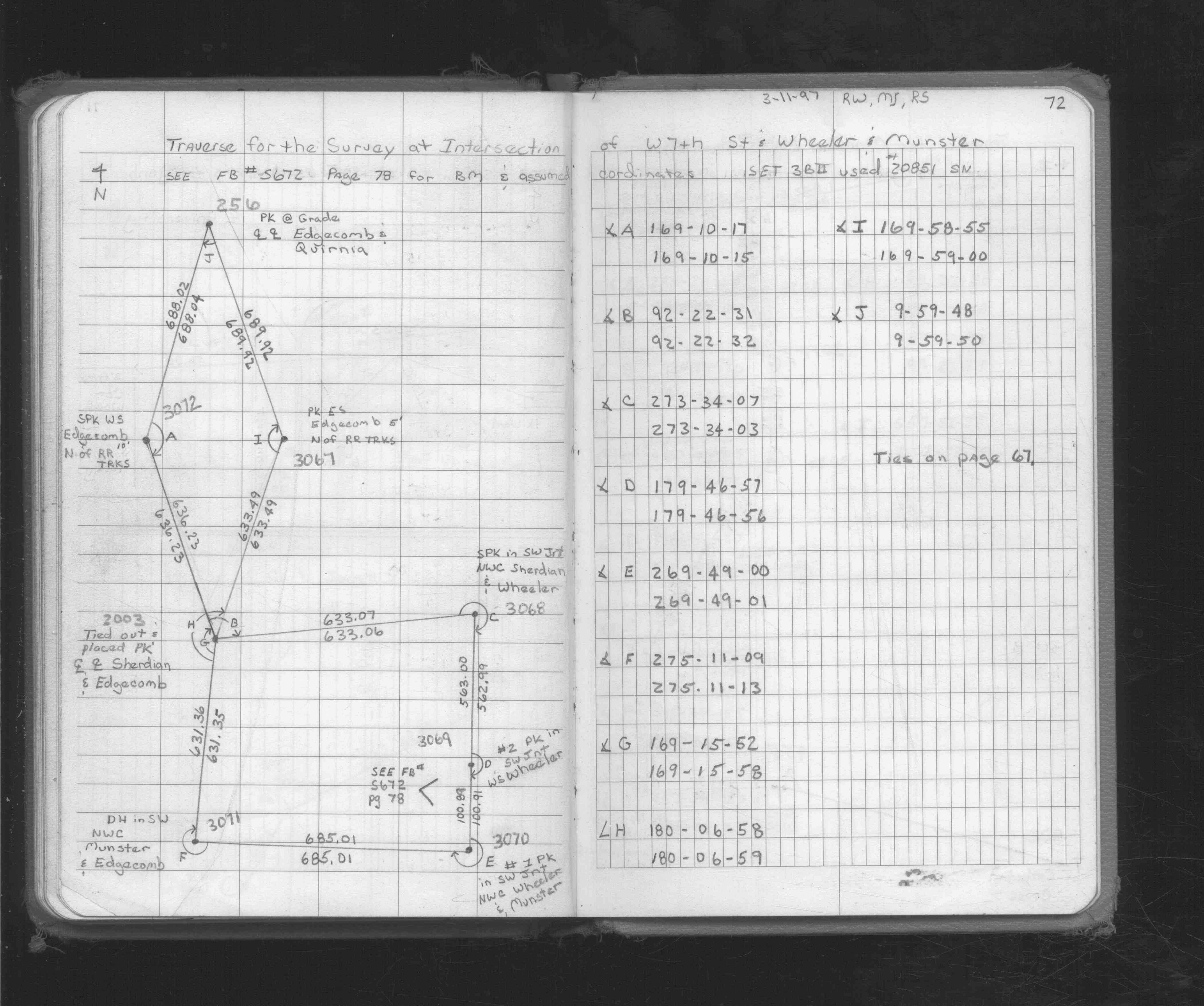
| 3/11/1997 | Traversed through pk nail placed from ties. See FB 1719A p.72 |
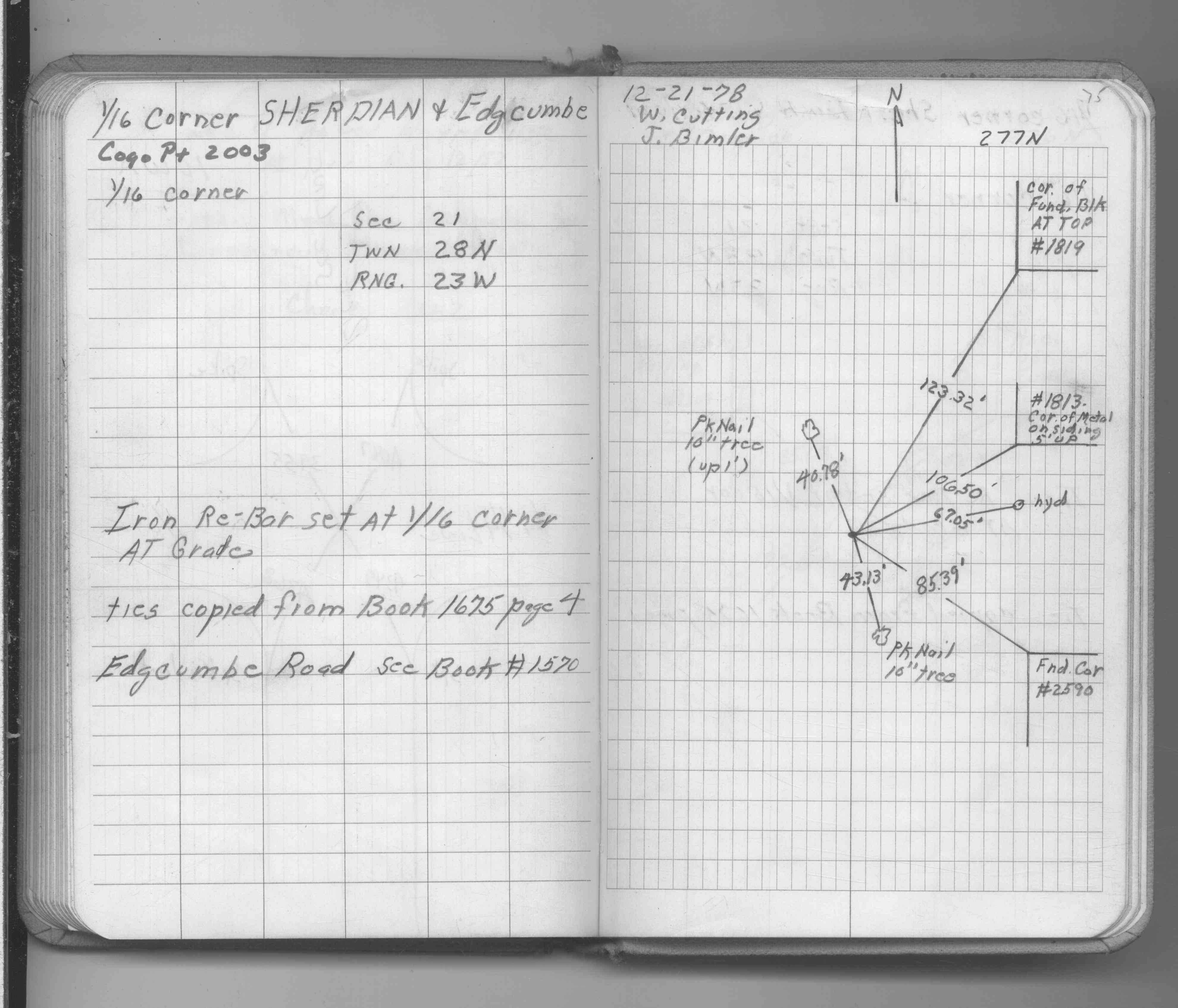
| 12/21/1978 | Set iron rebar. See FB 1689A p.75 |
| 12/21/1978 | See CofL 2003-xxxx-A, copied from FB 1689A p.75 |
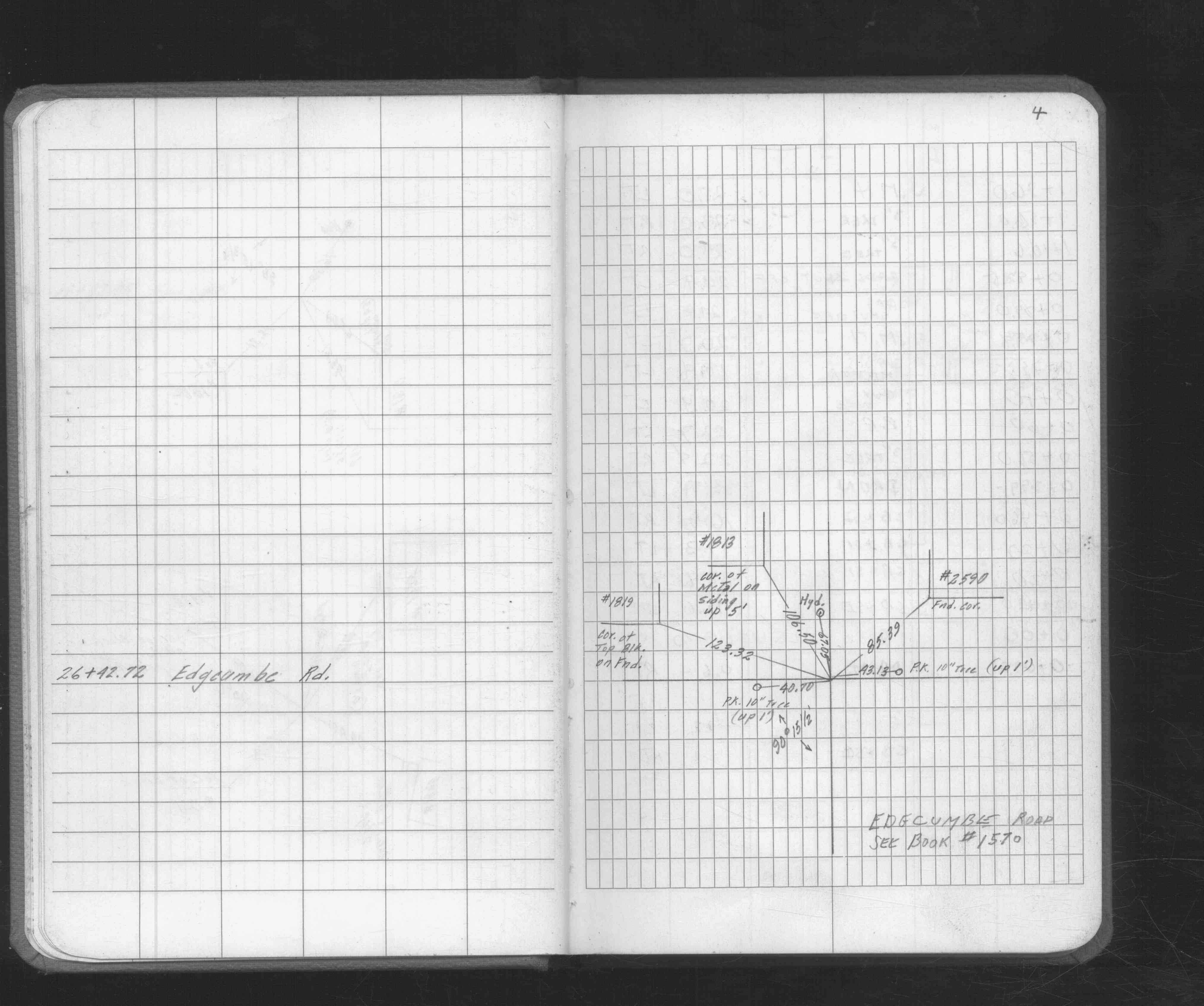
| 11/1/1978 | (Unknown date Nov __, 1978 ) Placed ties. See FB 1675 p.4 |
Above is NOT an all inclusive history of this point. Please review all the links below.
| PLS NOTES | Field | Cross Section | Sewer | J.B. Irvine | Monument | River Survey |
|---|---|---|---|---|---|---|
| FB 1675p.04 | ||||||
| FB 1676Cp.48 | ||||||
| FB 1689Ap.75 | ||||||
| FB 1719Ap.72 |
| FILE | SURVEYOR | LIC. NO. | DATE SIGNED | DATE TIED |
|---|---|---|---|---|
| 2003-xxxx-A.tif | none | none | none | none |
| FILE | PHOTO DATE | COMMENTS |
|---|---|---|
| 2003-__gk-3.jpg | August 22, 2014 | Looking northeast toward monument location. |
| 2003-__gk-2.jpg | August 22, 2014 | Close up of iron found at location. |
| 2003-__gk-1.jpg | August 22, 2014 | Close up of iron found at location. |