| NAD83 COORDINATES (1986 adj.): |
|---|
| X= 548363.937 Y= 149654.620 Z= 000.00 CMP 12/17/1991 |
| X= 548363.792 Y= 149654.503 Z= 823.8 01/14/2005 RTK-VRS |
| 1/14/2005 | Position on GM established by RTK-VRS GPS Elev 823.8 ft. Photos taken. |
| 3/3/1997 | Elev 129.73 ft on GM. See 97adj.pts, 1997/miss-riv-blvd.org/bmmrb.sdr (loop 153) Digital-Adj |
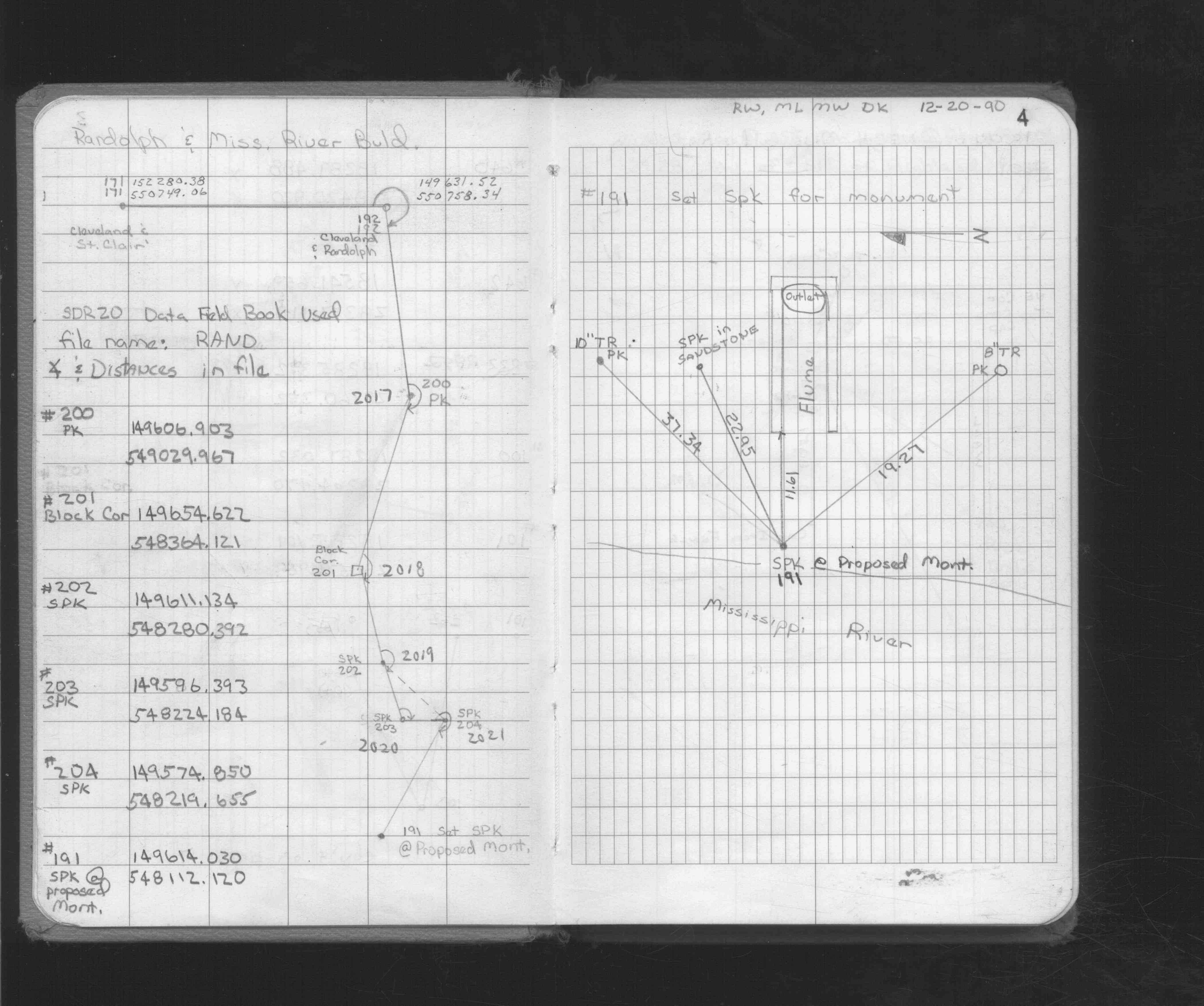
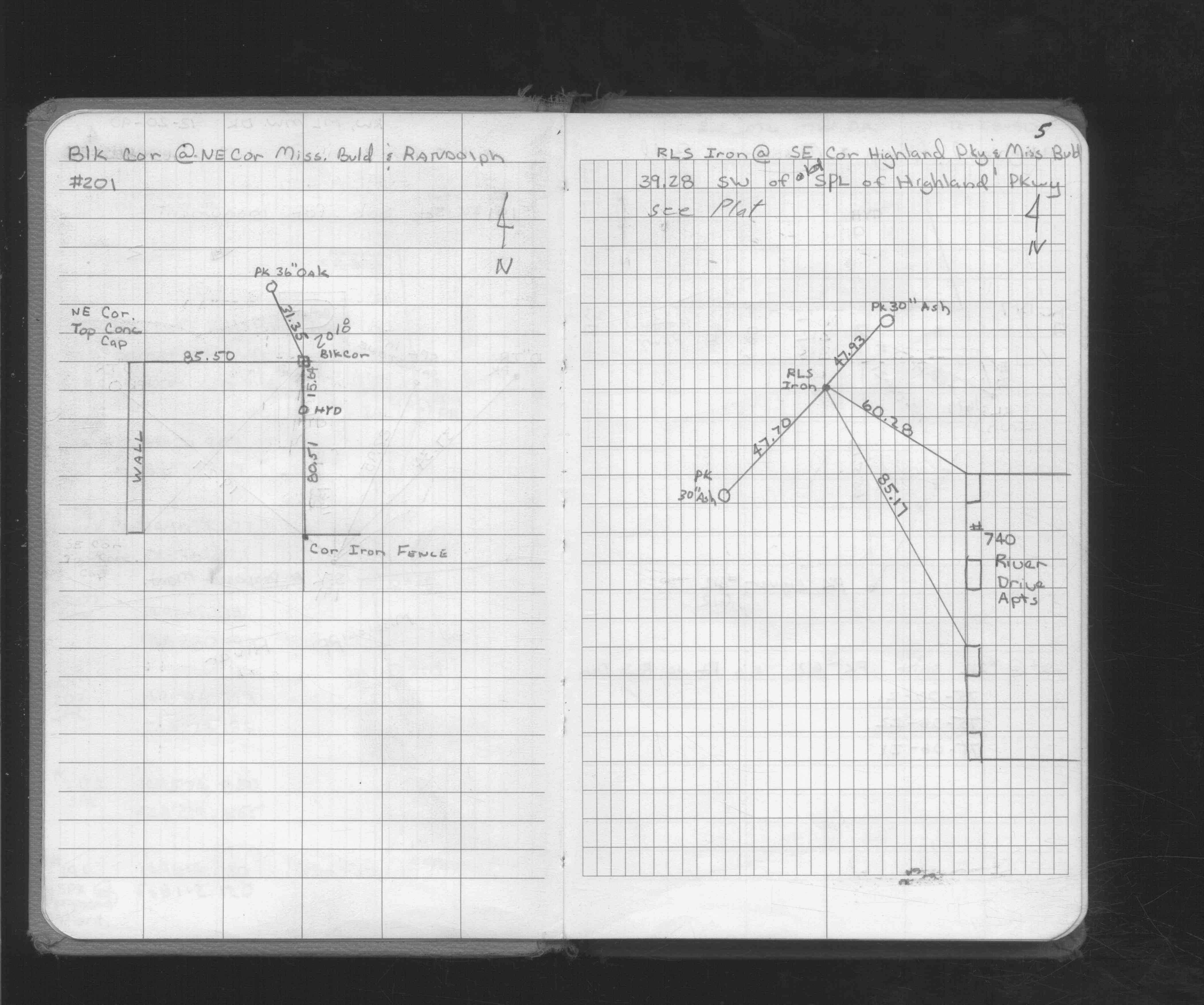
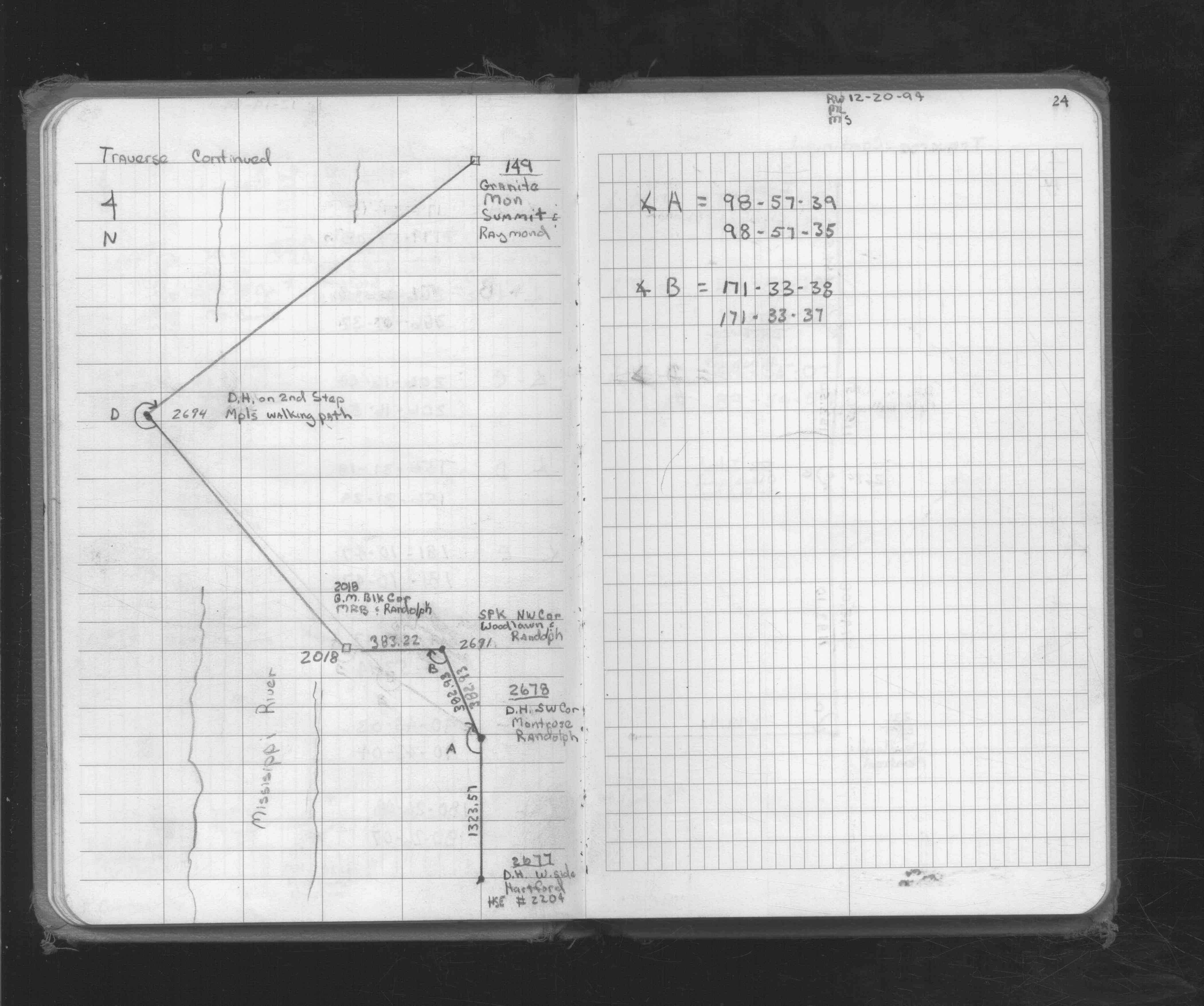
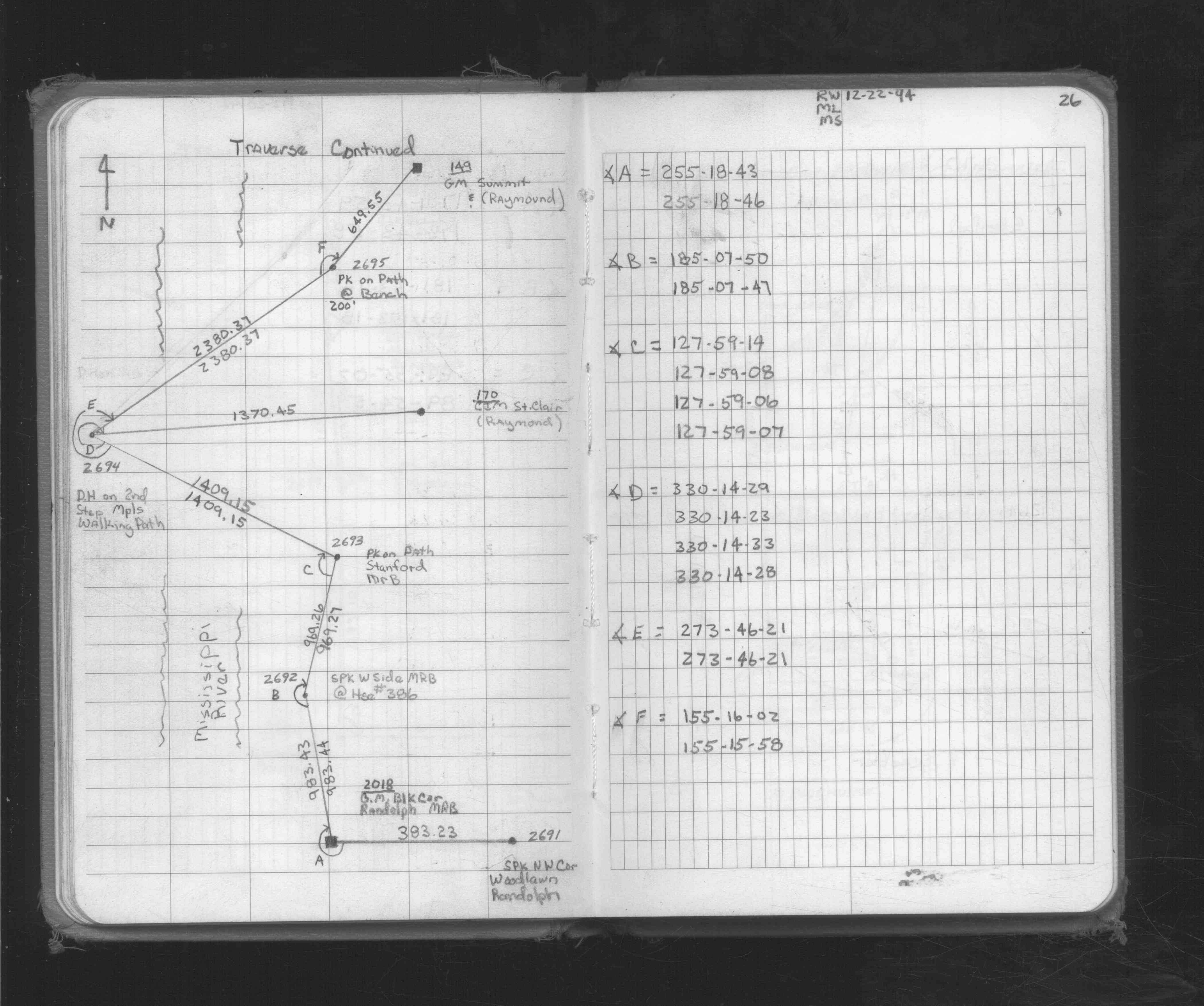
| 12/20/1990 | Traversed through and Placed ties on GM. See FB 1716 p.4,5 |
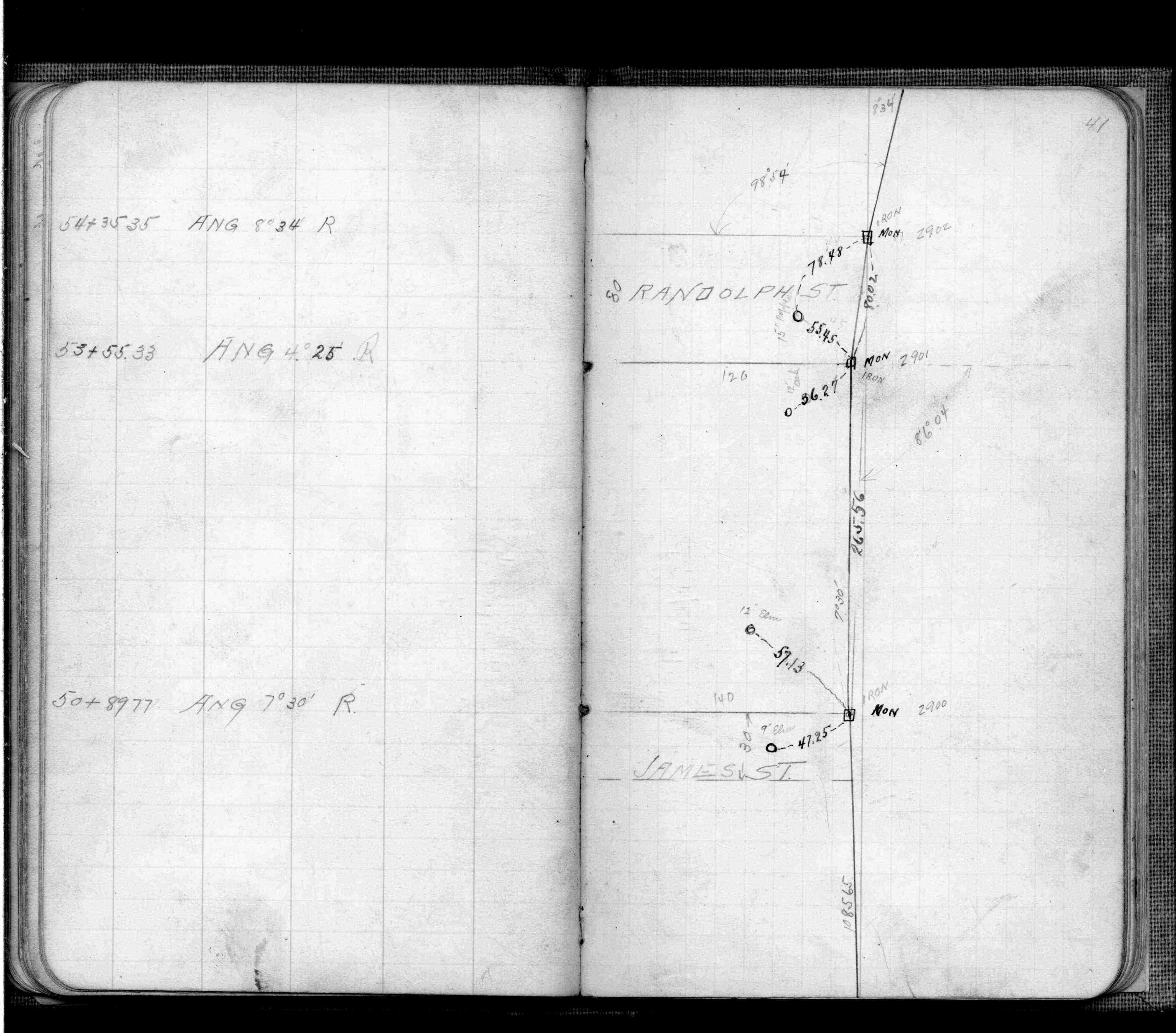
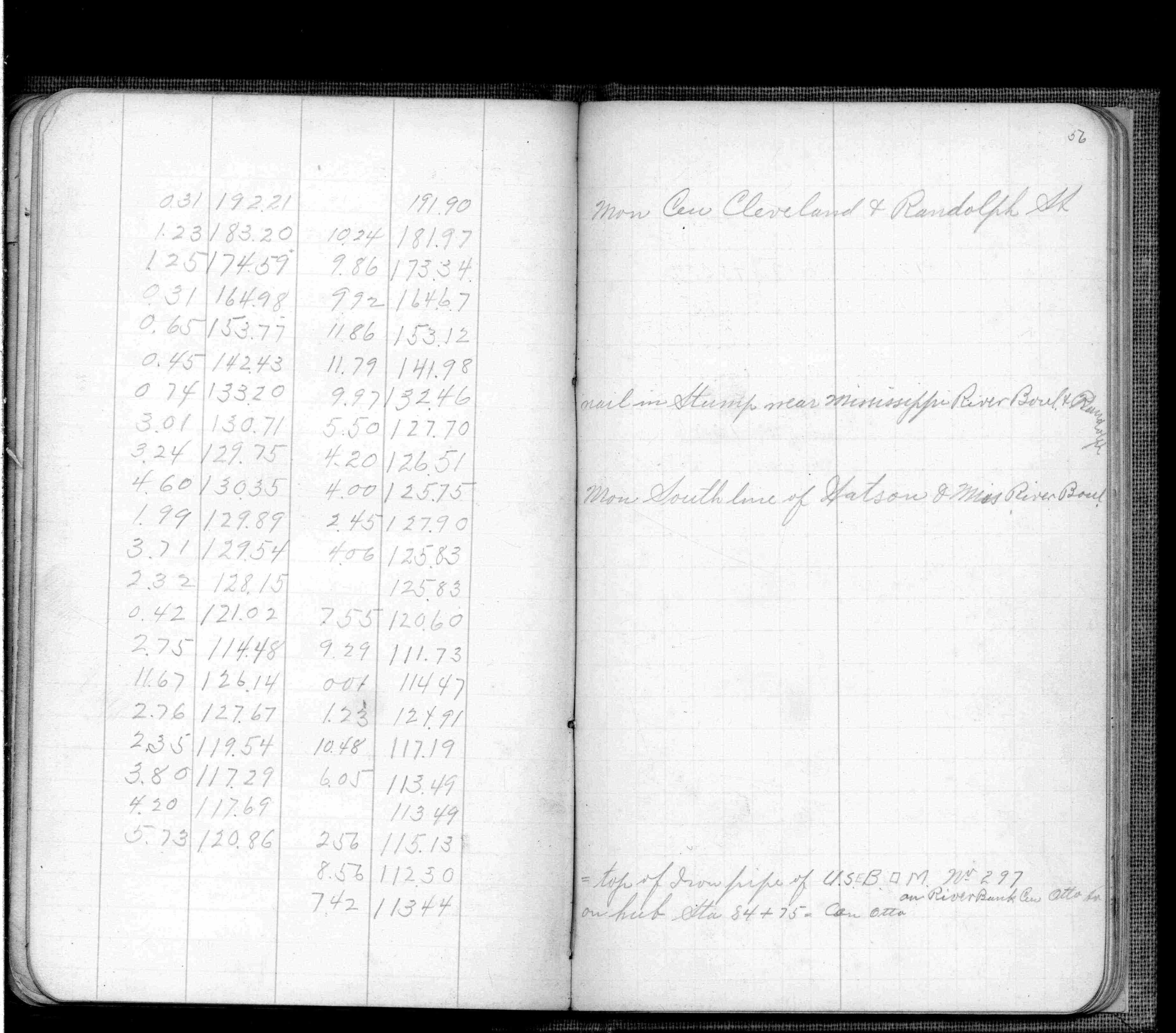
| 2/1/1904 | (Unknown date Feb __, 1904 ) Monument set for Park Board by C F Scheunemann. See FB 474 p.41,56 |
Above is NOT an all inclusive history of this point. Please review all the links below.
| PLS NOTES | Field | Cross Section | Sewer | J.B. Irvine | Monument | River Survey |
|---|---|---|---|---|---|---|
| FB 0474p. 41 ,56 | ||||||
| FB 1716p. 04 ,05 | ||||||
| FB 1719Ap. 24 ,26 |
| FILE | PHOTO DATE | COMMENTS |
|---|---|---|
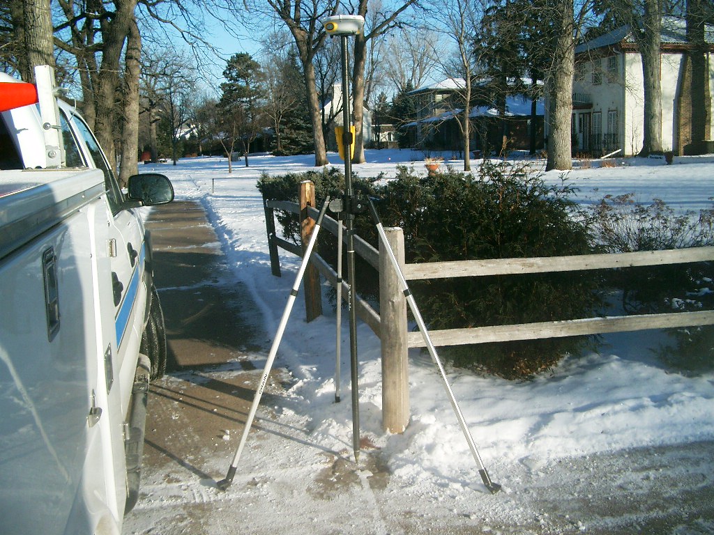
| 2018-2901-4.jpg | January 14, 2005 | Looking South along the East side of Mississippi River Blvd. and North of Randolph Ave. |
| 2018-2901-3.jpg | January 14, 2005 | Looking Southwesterly from the Northeast corner of Mississippi River Blvd. and Randolph Ave. |
| 2018-2901-2.jpg | January 14, 2005 | Looking North along the East side of Mississippi River Blvd. at the North side of Randolph Ave. |
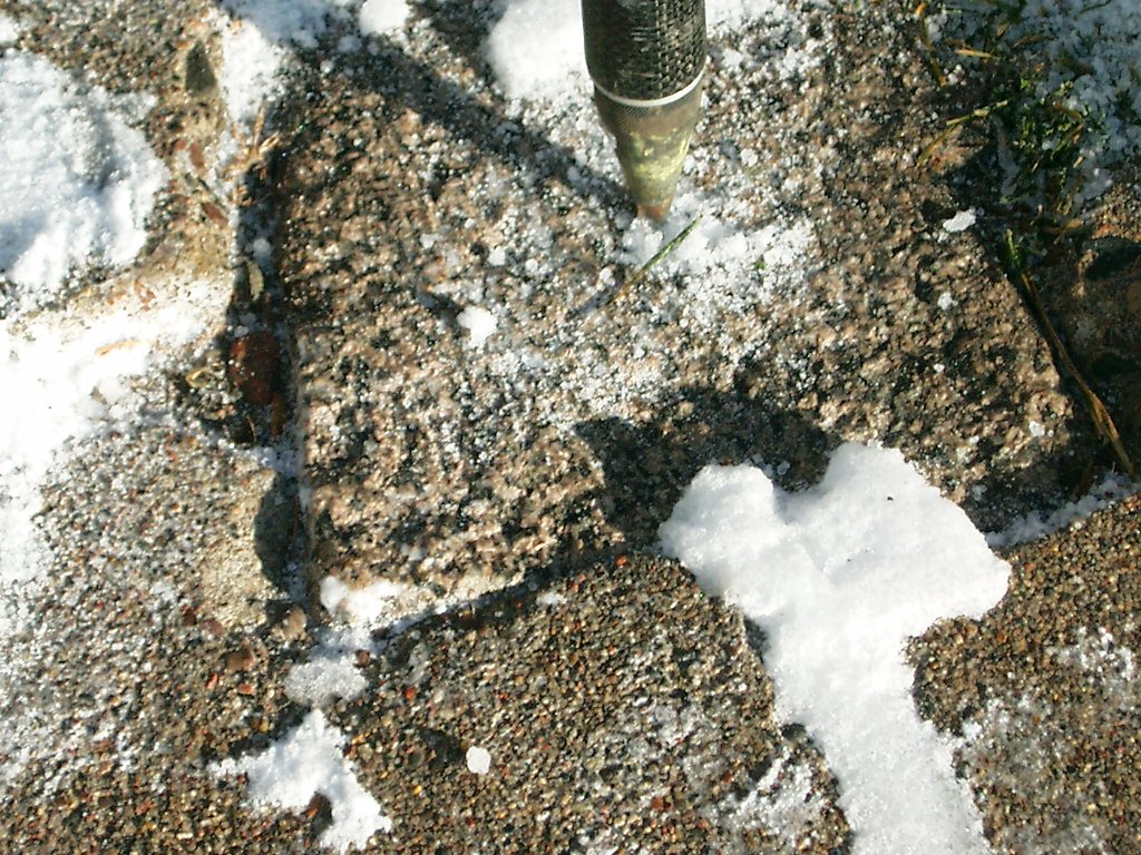
| 2018-2901-1.jpg | January 14, 2005 | Close-up of the granite monument. |