| NAD83 COORDINATES (1986 adj.): |
|---|
| X= 594480.884 Y= 137467.067 Z= 000.00 LSQ 12/06/1991 S FLT |
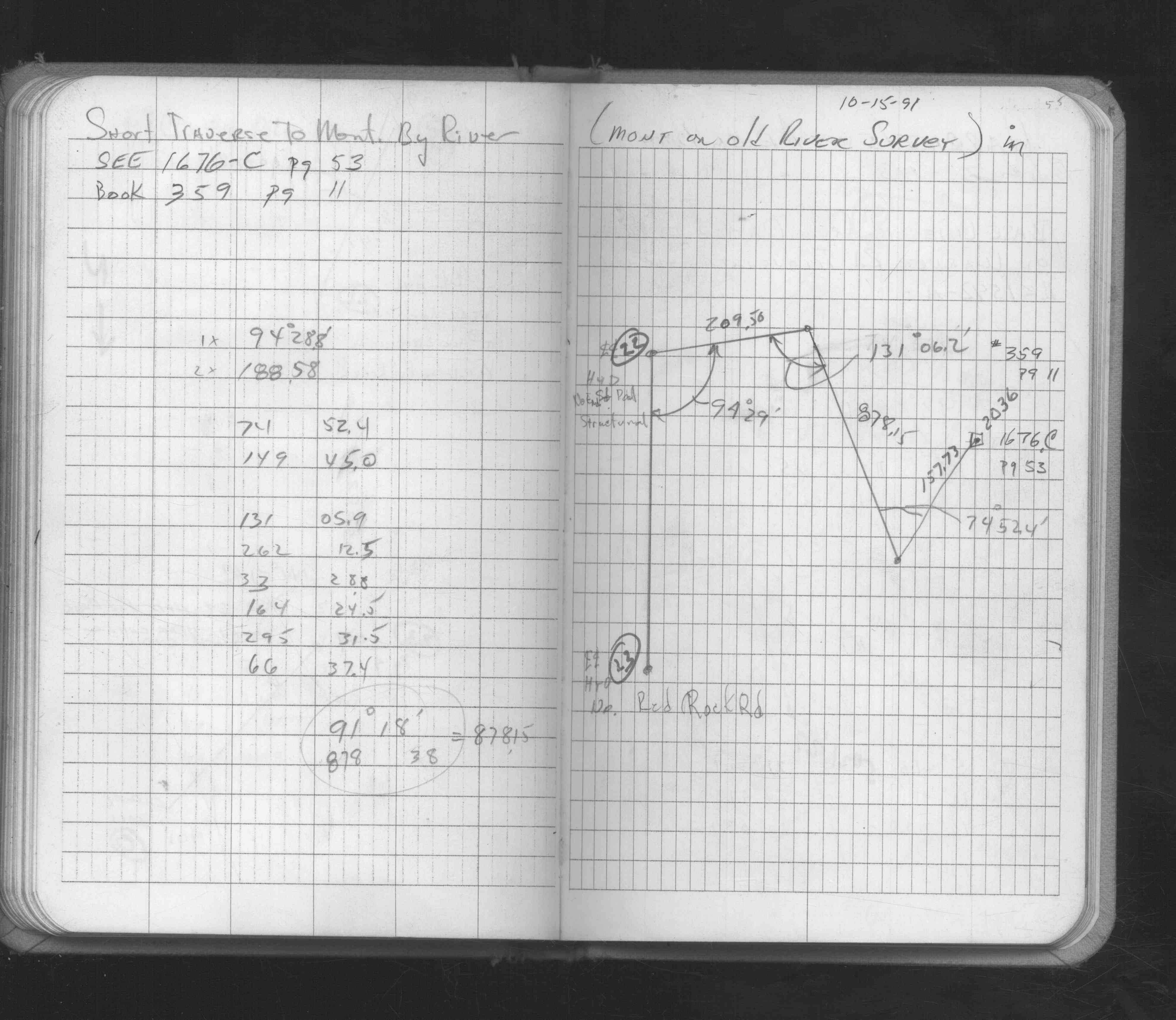
| 12/15/1991 | Traversed into monument. See FB 1549H p.55 |
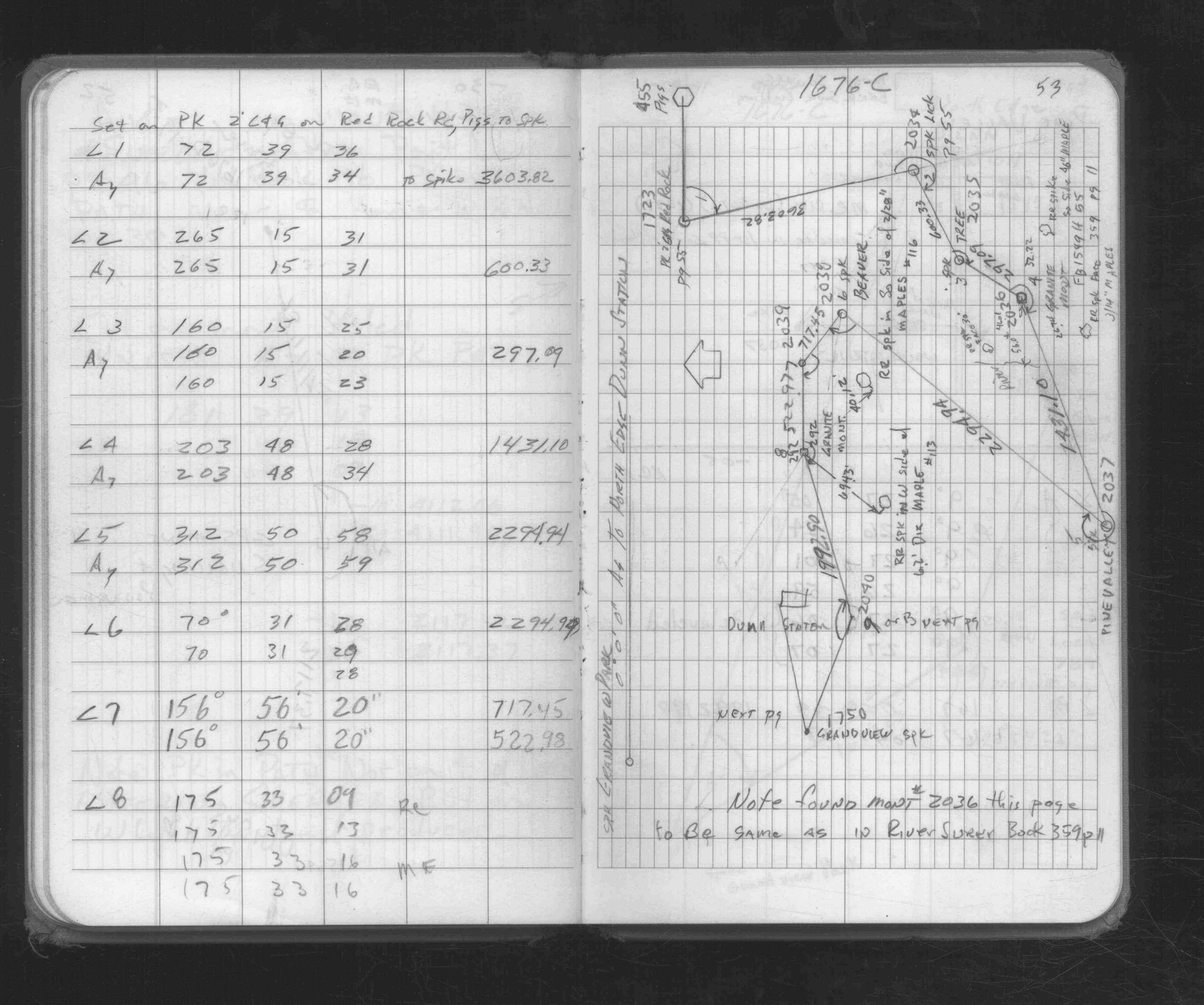
| 1/18/1991 | Traversed through GM. See FB 1676C p.53 |
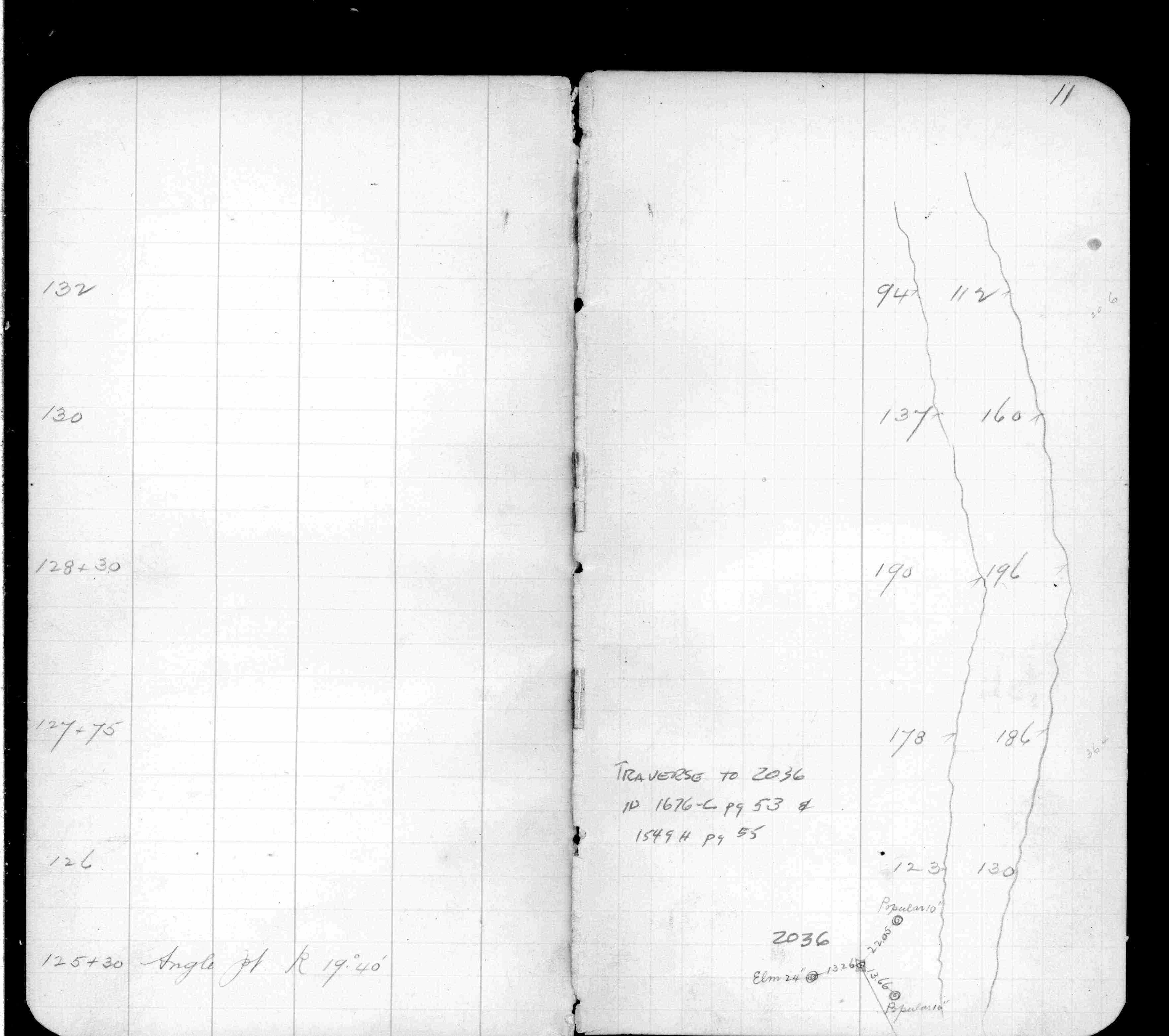
| 1/1/1800 | (Unknown date ___ __, ____ ) Placed ties. See FB 359 p.11 |
Above is NOT an all inclusive history of this point. Please review all the links below.
| PLS NOTES | Field | Cross Section | Sewer | J.B. Irvine | Monument | River Survey |
|---|---|---|---|---|---|---|
| FB 0359p.11 | ||||||
| FB 0359p.11 | ||||||
| FB 1549Hp.55 | ||||||
| FB 1676Cp.53 |