| NAD83 COORDINATES (1986 adj.): |
|---|
| X= 579355.926 Y= 149866.595 Z= 000.00 LSQ 12/06/1991 S FLT |
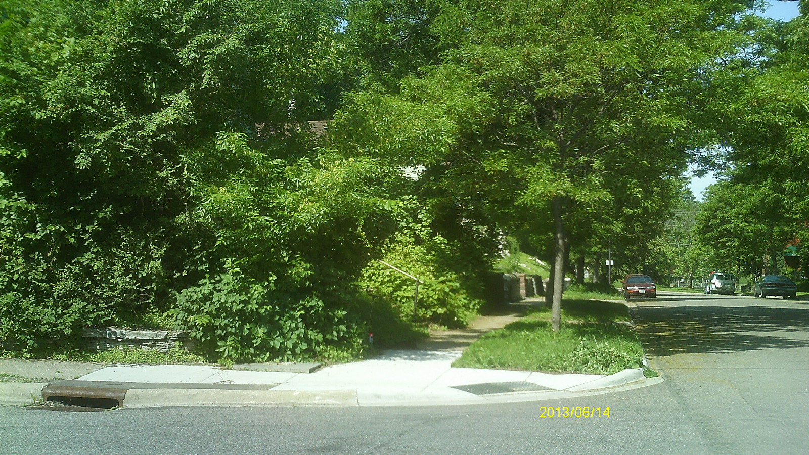
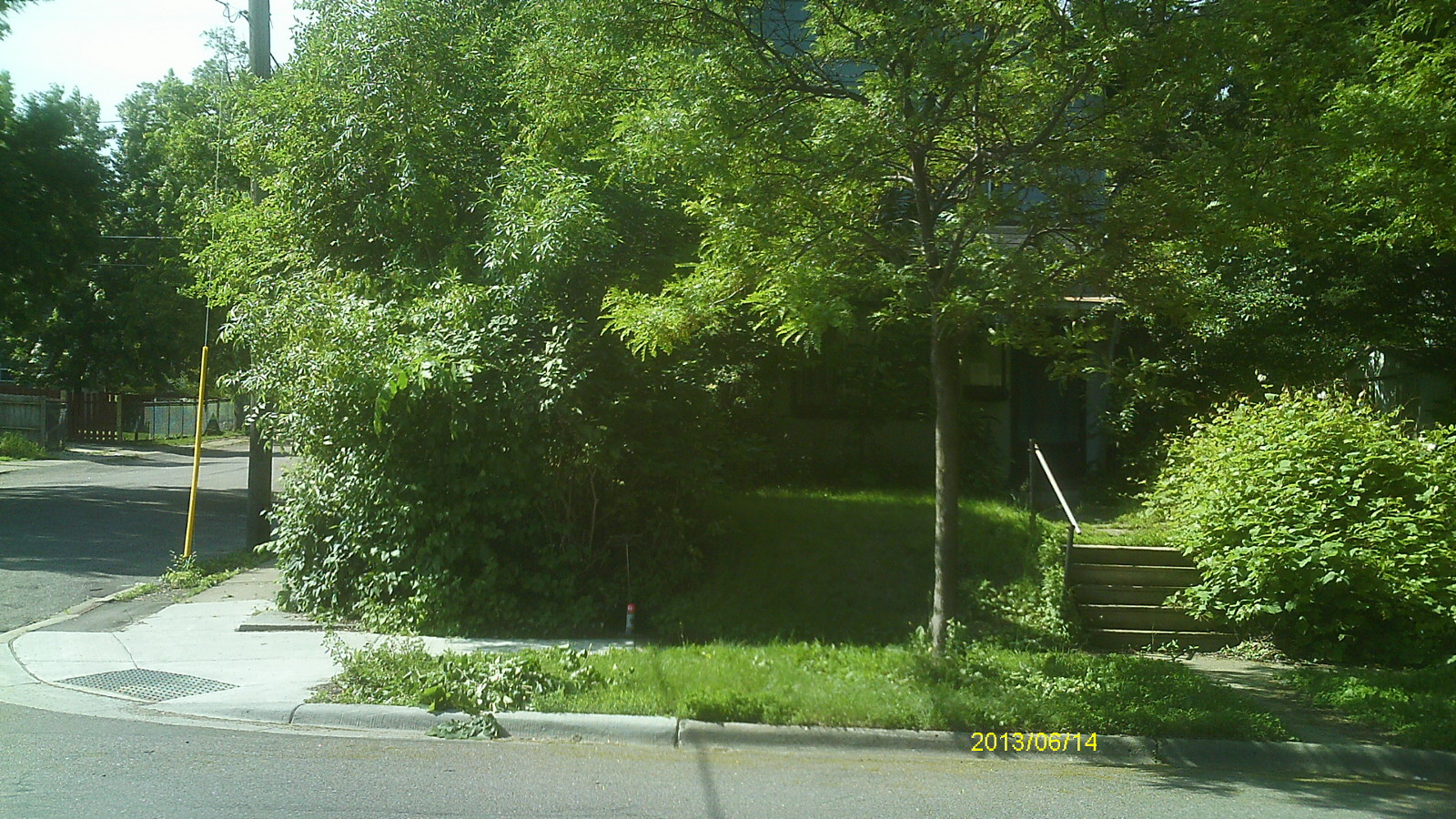
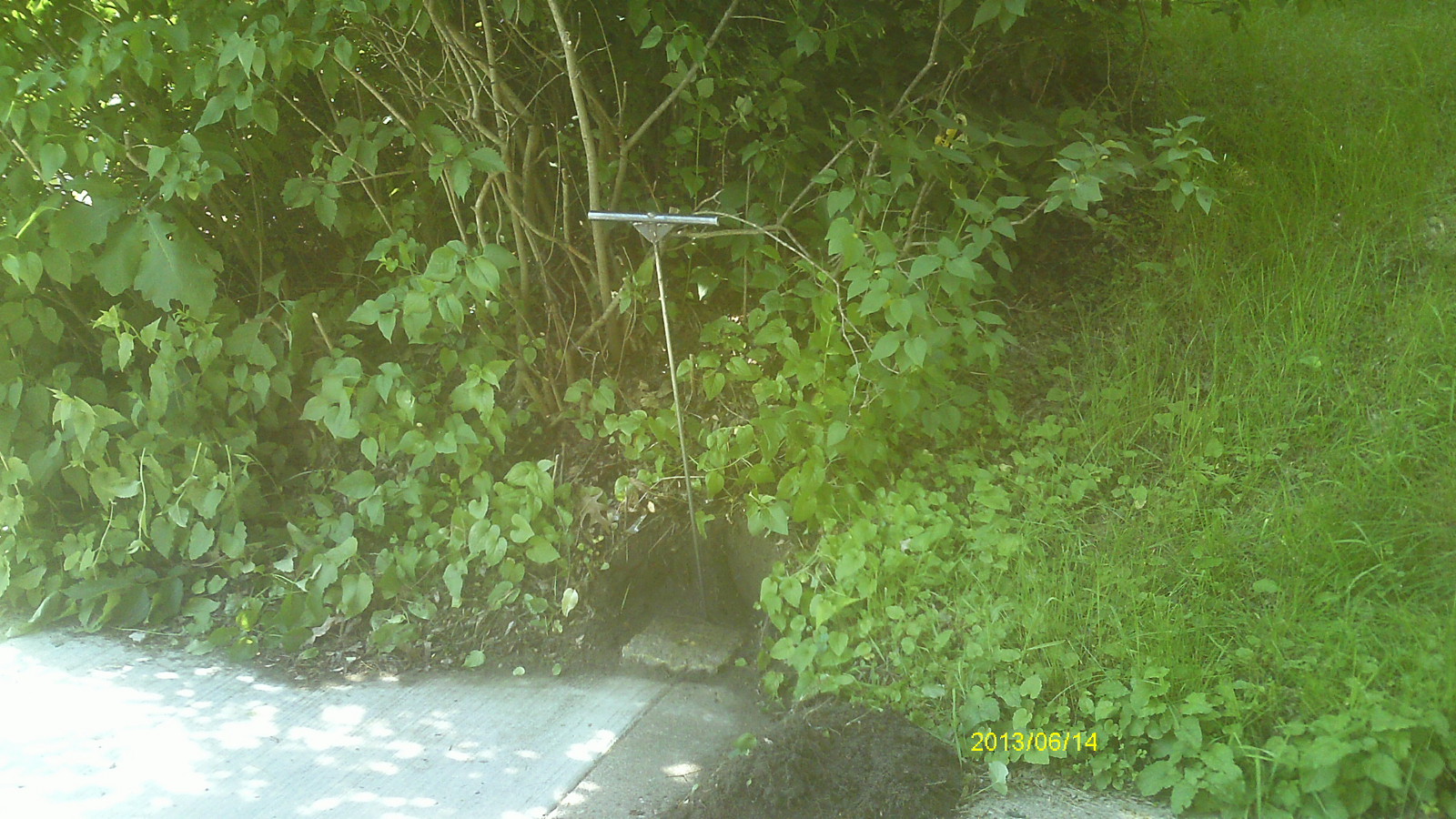
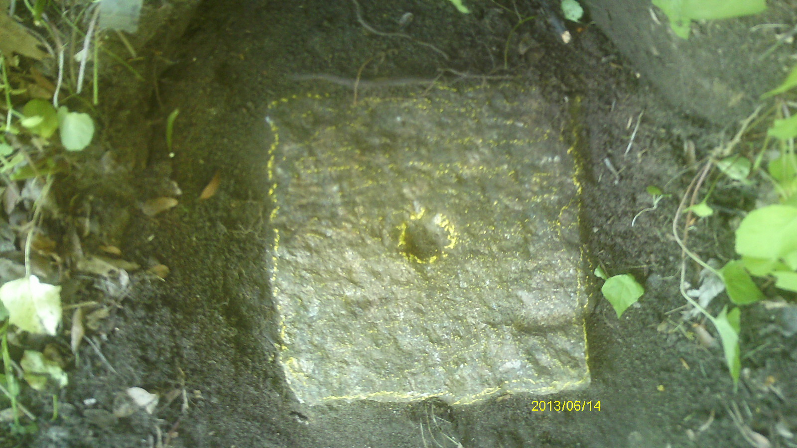
| 6/14/2013 | Found GM 0.1 ft above sidewalk grade and 10 ft east of inside corner of intersection of walk. Photos taken. |
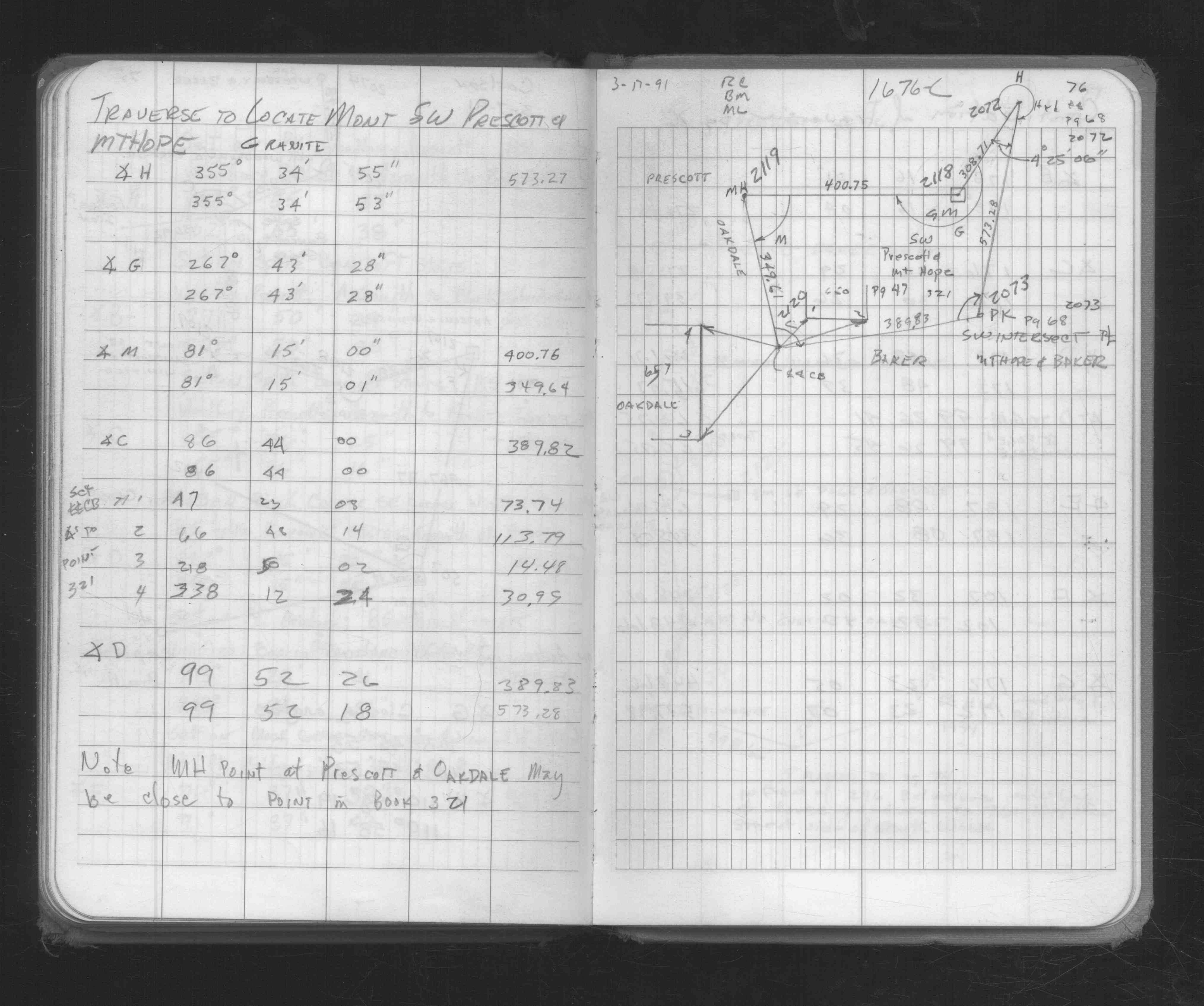
| 3/17/1991 | Traversed through GM. See FB 1676C p.76 |
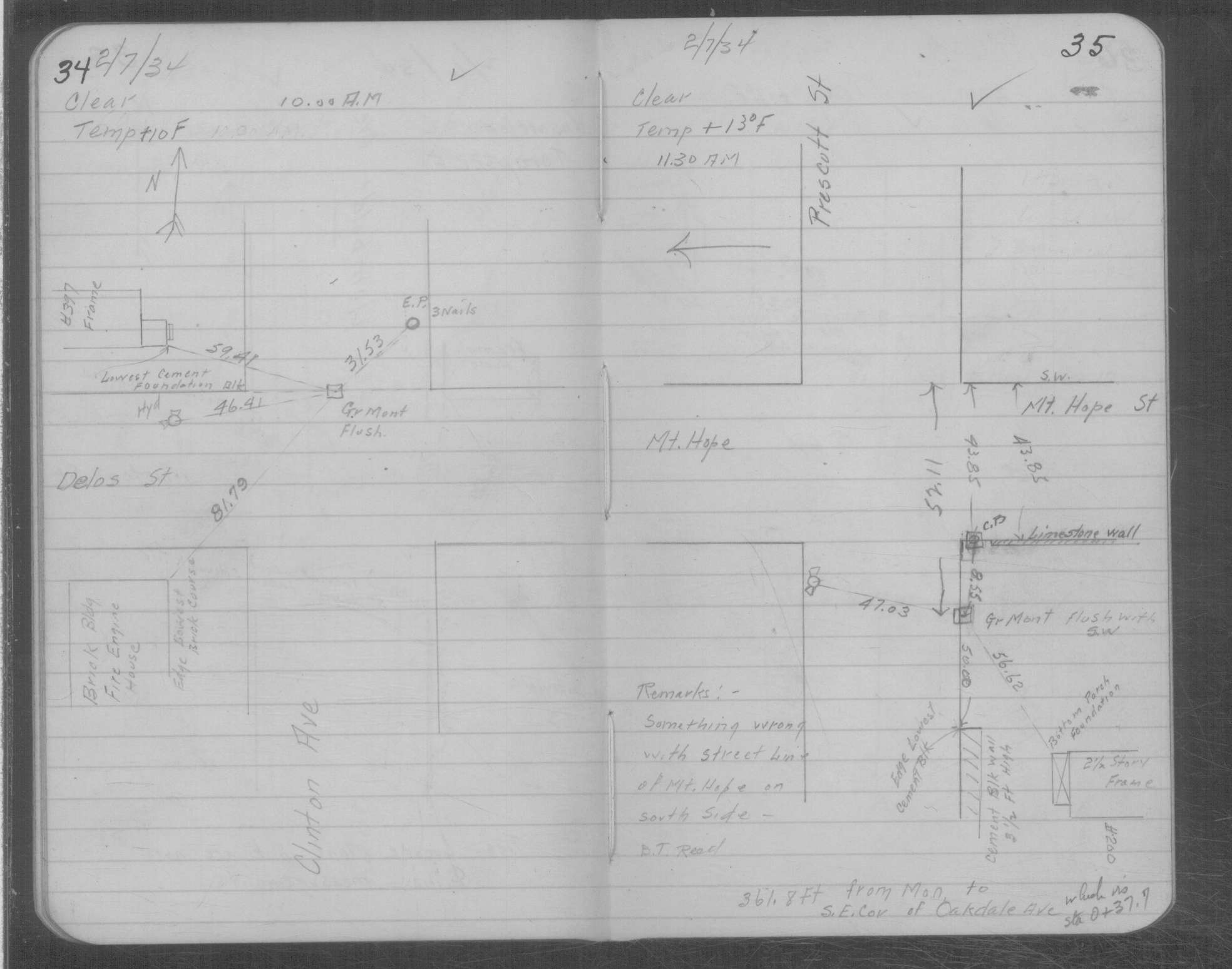
| 2/7/1934 | Placed ties on GM at grade of sidewalk. See MSX 1 p.34-35 |
Above is NOT an all inclusive history of this point. Please review all the links below.
| PLS NOTES | Field | Cross Section | Sewer | J.B. Irvine | Monument | River Survey |
|---|---|---|---|---|---|---|
| FB 1676Cp.76 | MSX 0001 p.034-035 |
| FILE | PHOTO DATE | COMMENTS |
|---|---|---|
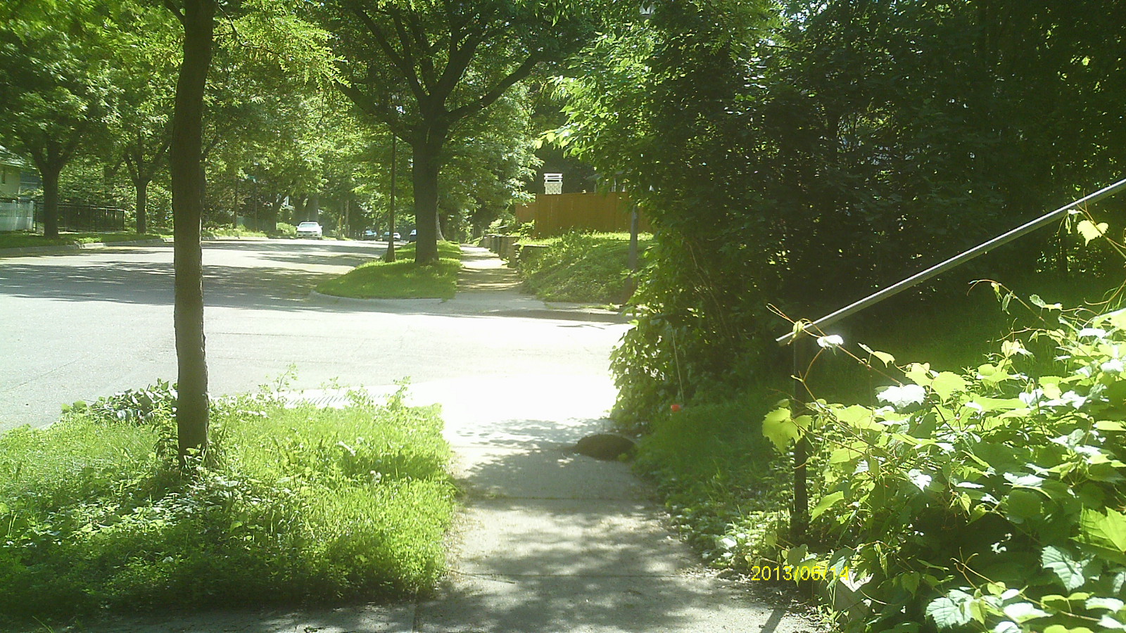
| 2118-__es-6.jpg | June 14, 2013 | Looking west along Prescott St. |
| 2118-__es-5.jpg | June 14, 2013 | Looking south along Mt Hope Ave |
| 2118-__es-4.jpg | June 14, 2013 | Looking east along Prescott St. |
| 2118-__es-3.jpg | June 14, 2013 | Close up of monument location. |
| 2118-__es-2.jpg | June 14, 2013 | Close up of monument location. |
| 2118-__es-1.jpg | June 14, 2013 | Close up of monument. |