| NAD83 COORDINATES (1986 adj.): |
|---|
| X= 581926.910 Y= 149846.570 Z= 000.00 LSQ 12/06/1991 S FLT |
| 10/26/2004 | Fd GM 2.0 ft below grade and placed magnet in the hole. Elev 16.96 ft on monument. |
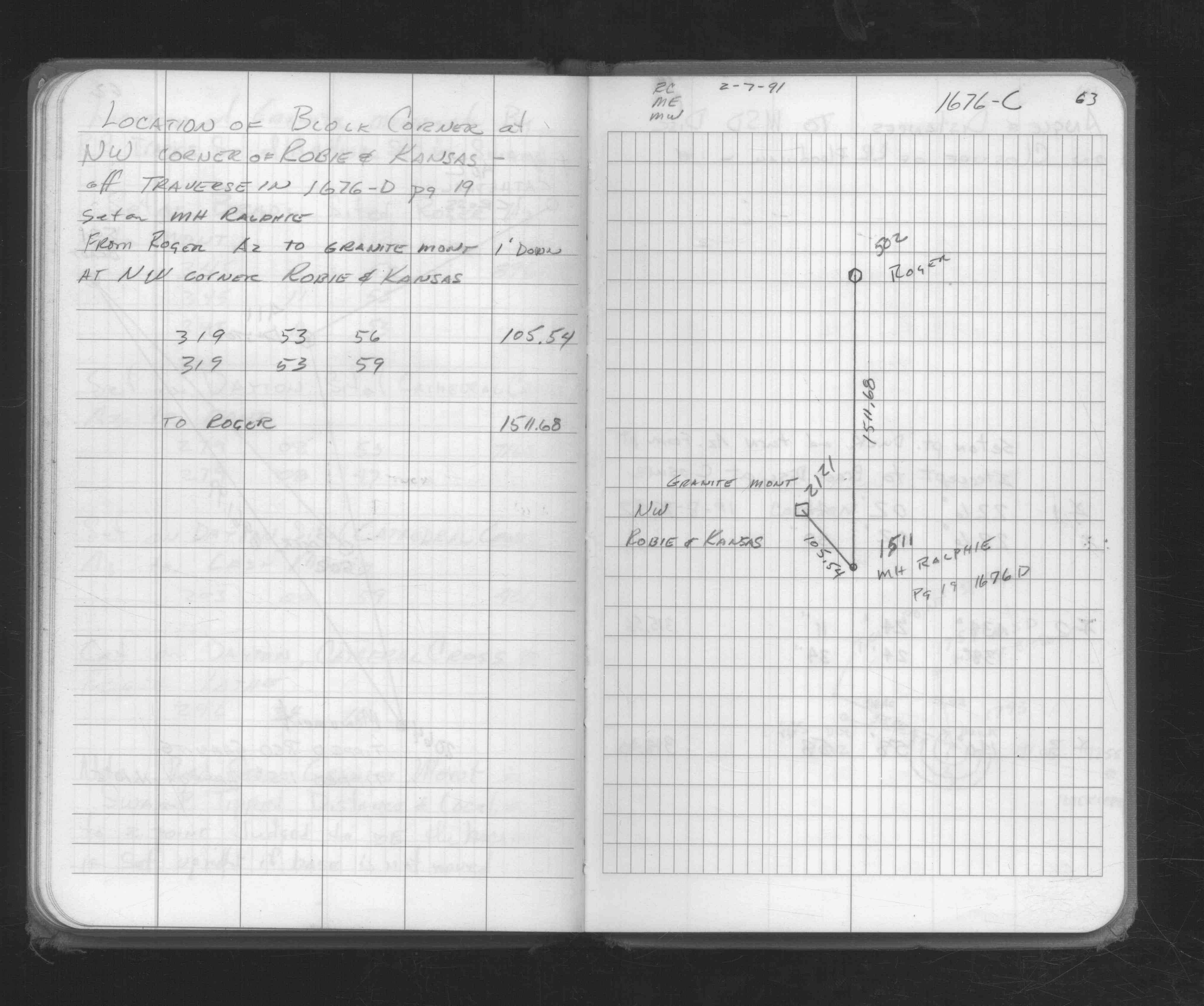
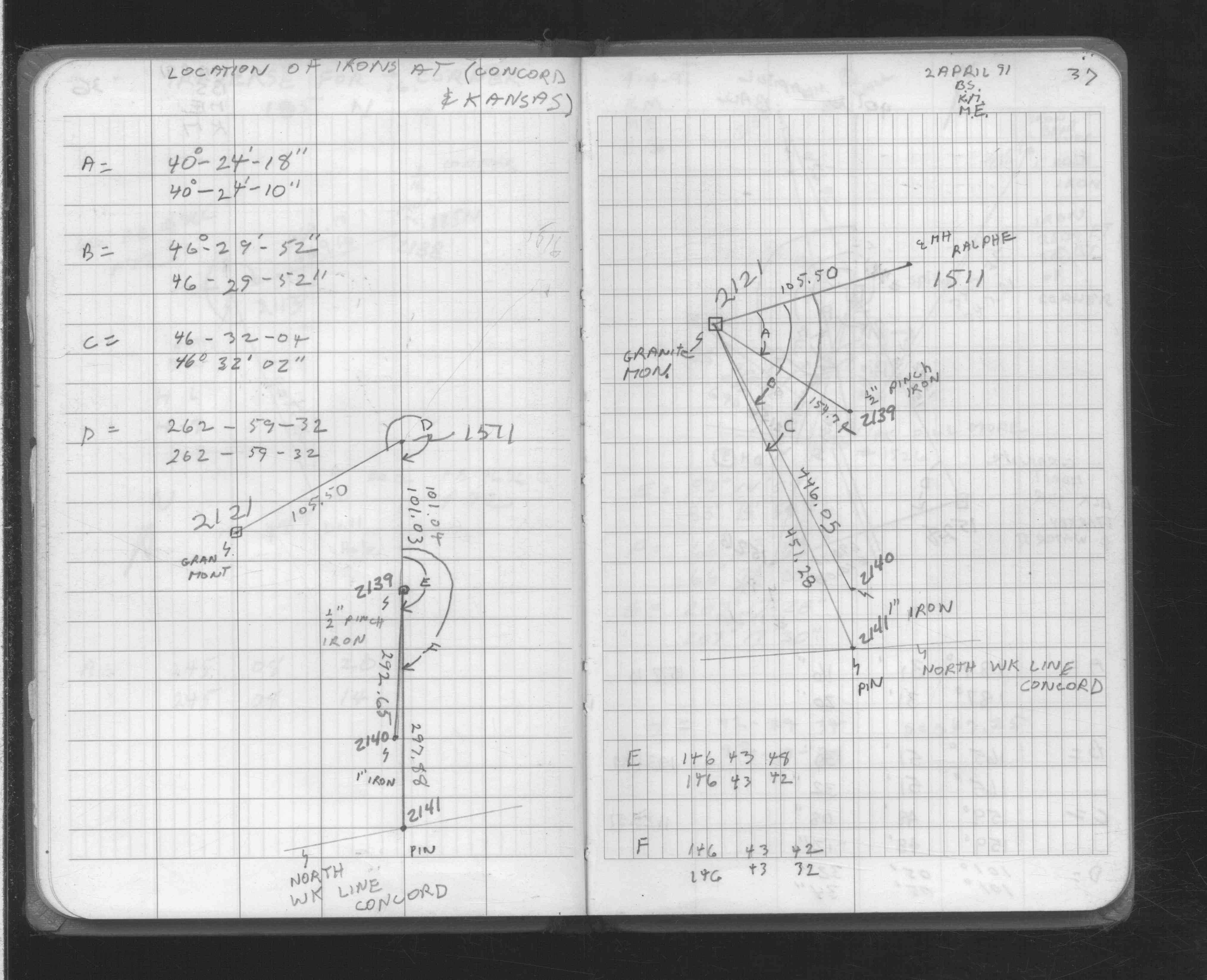
| 4/2/1991 | Fd GM. Located by traverse. See FB 1708A p.37 |
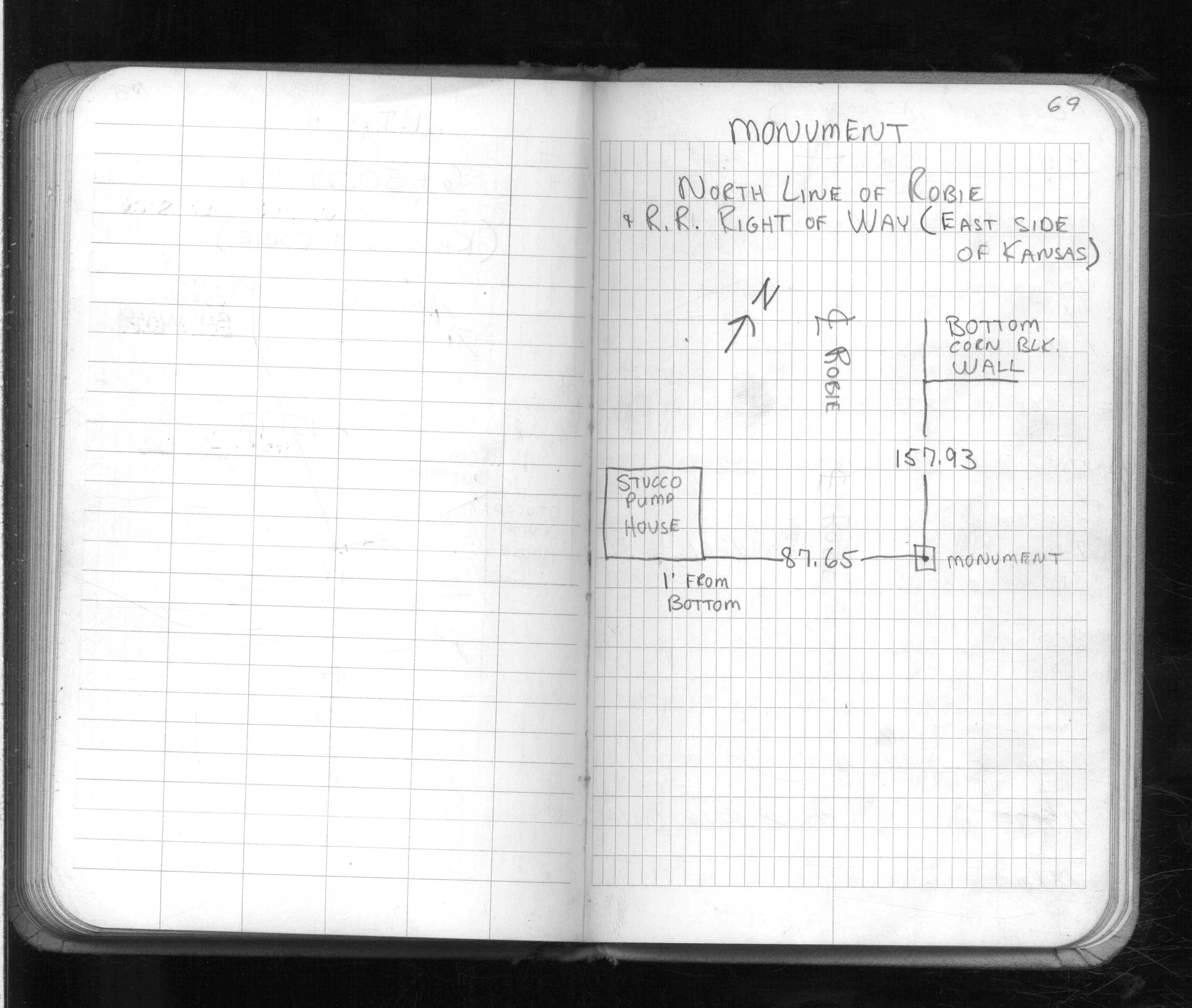
| 7/1/1977 | (Unknown date Jul __, 1977 ) Placed ties on monument. See FB 1581E p.69 |
| 3/4/1965 | Used monument to tie CL Robie & CL Kansas. See CS 3589 p.4 |
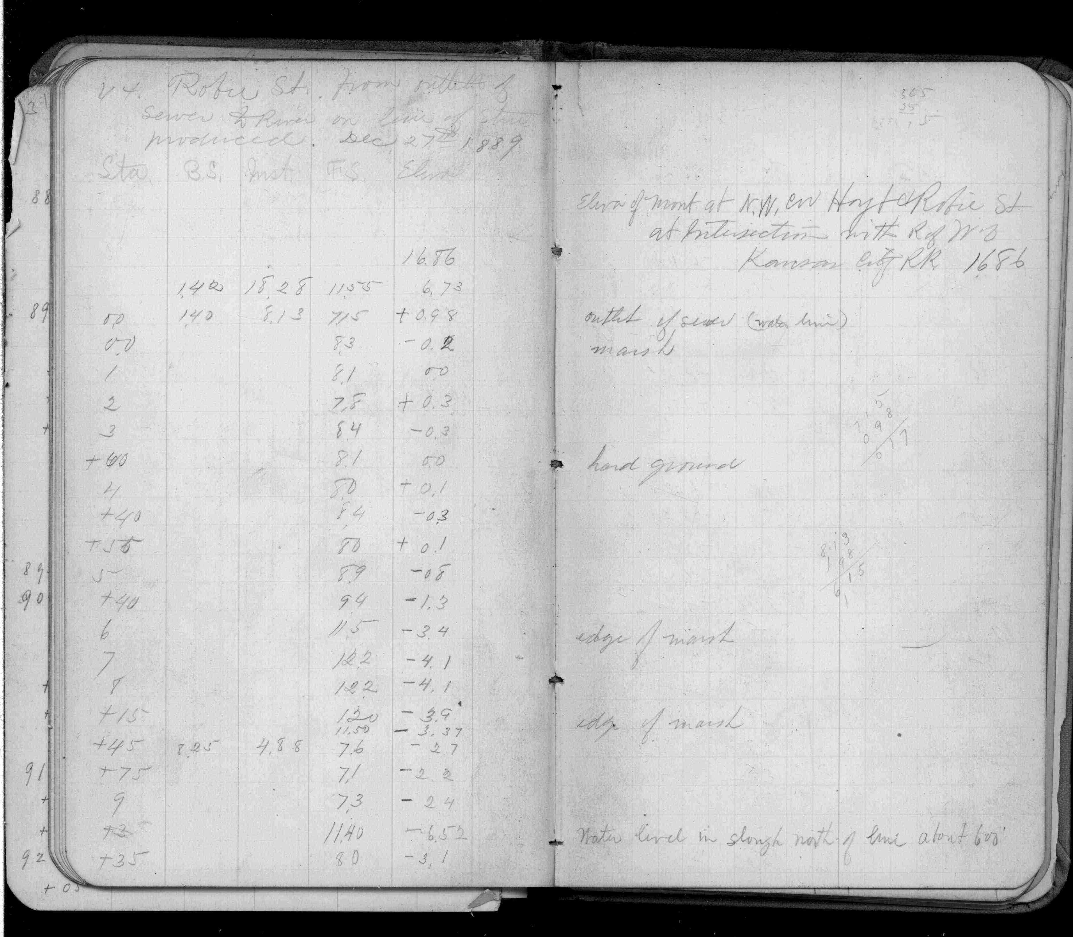
| 12/27/1889 | Elev 16.86 ft on monument. See FB 266 p.44 |
Above is NOT an all inclusive history of this point. Please review all the links below.
| PLS NOTES | Field | Cross Section | Sewer | J.B. Irvine | Monument | River Survey |
|---|---|---|---|---|---|---|
| FB 0266p.44 | CS 0692p.04 | |||||
| FB 1581Ep.69 | CS 3589p.04 | |||||
| FB 1676Cp.63 | ||||||
| FB 1708Ap.37 |