| NAD83 COORDINATES (1986 adj.): |
|---|
| X= 576967.780 Y= 154741.543 Z= 000.00 CMP 12/17/1991 |
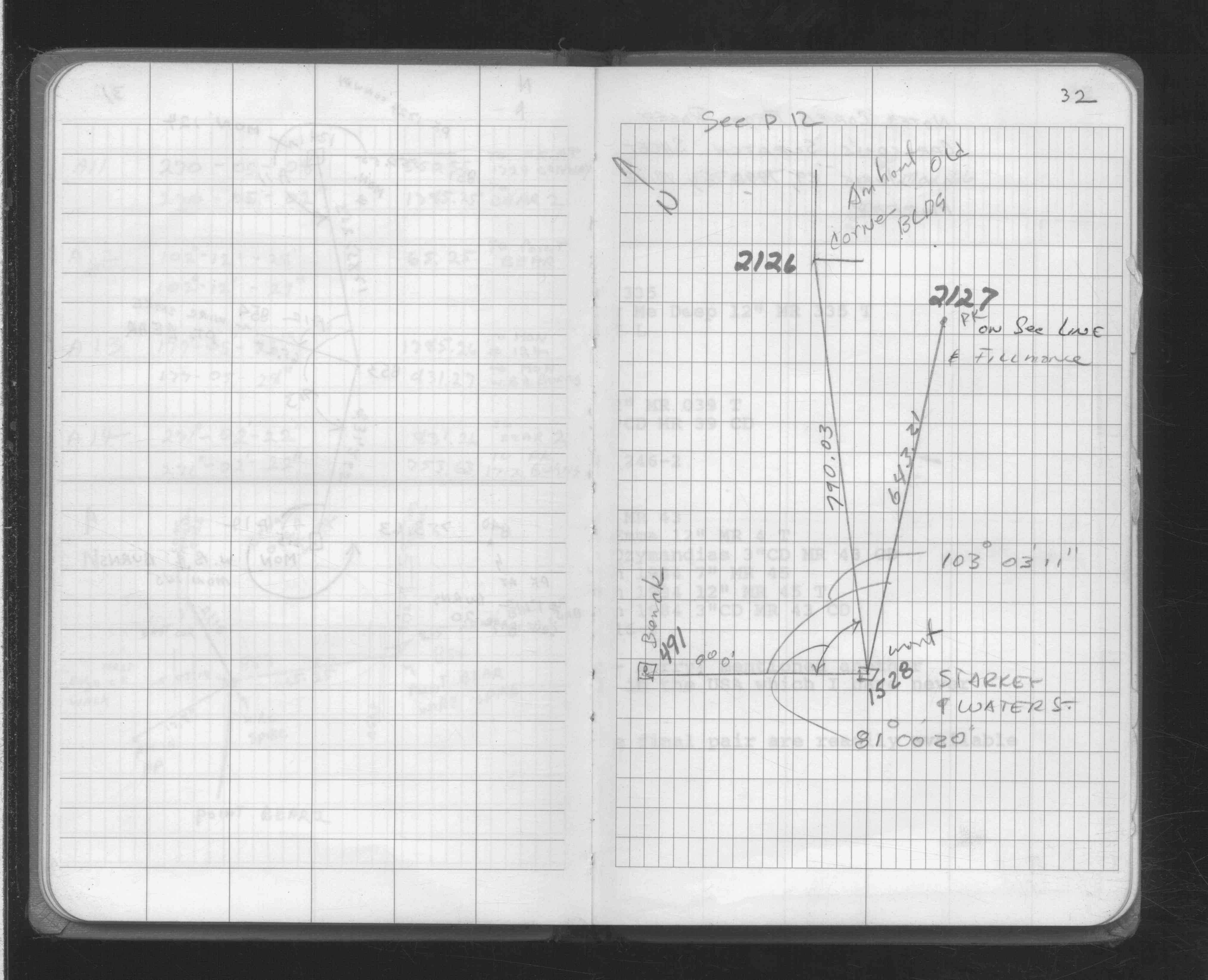
| 1/1/1980 | (Unknown date ___ __, ____ ) Located pk nail. See FB 1708A p.32 |
| 12/18/1899 | Monument set by F J McCarron |
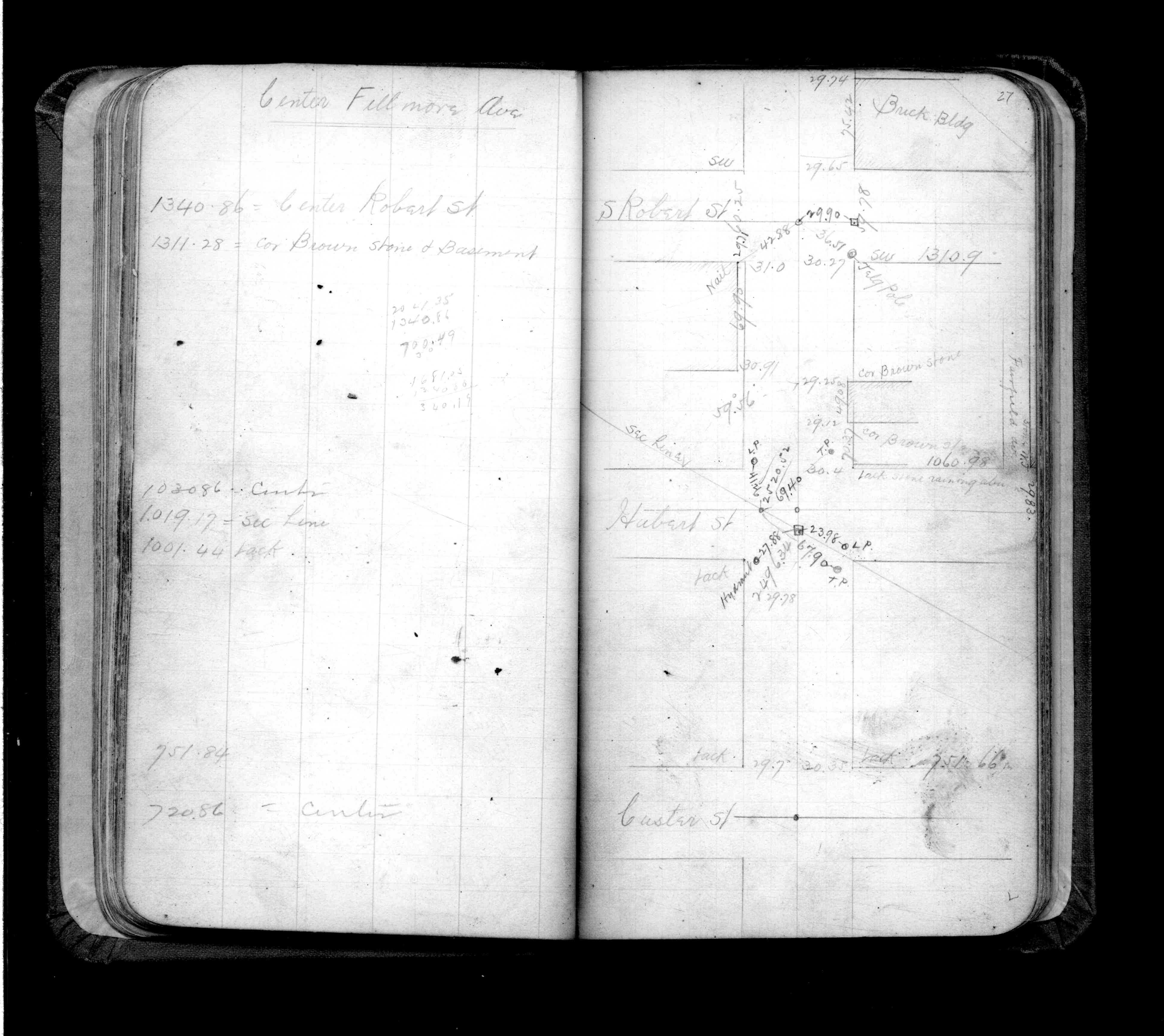
| 1/1/1890 | (Unknown date ___ __, 1890 ) Placed ties. See FB 325 p.27 |
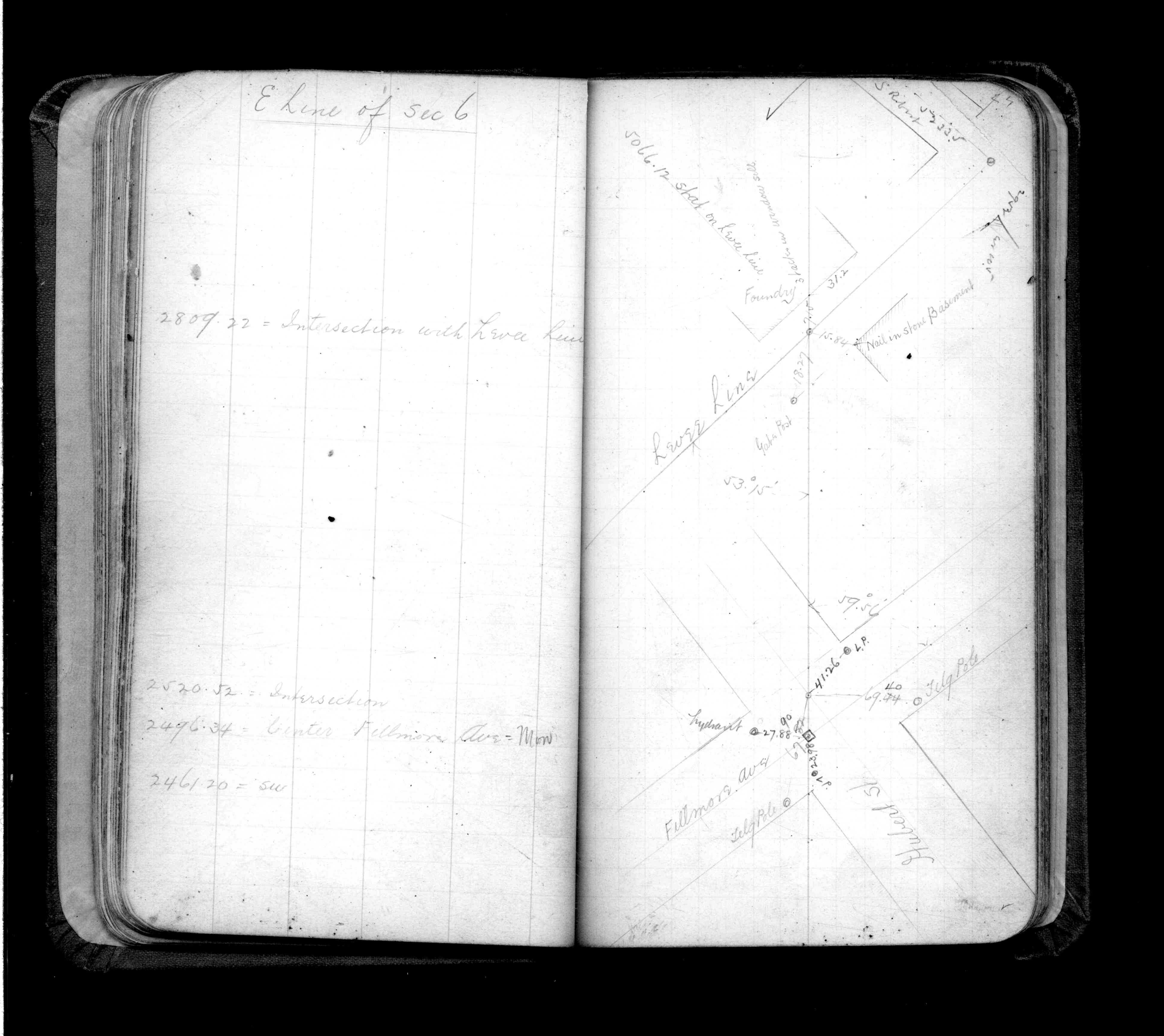
| 1/1/1890 | (Unknown date ___ __, 1890 ) Placed ties. See FB 325 p.24 |
Above is NOT an all inclusive history of this point. Please review all the links below.
| PLS NOTES | Field | Cross Section | Sewer | J.B. Irvine | Monument | River Survey |
|---|---|---|---|---|---|---|
| FB 0325p.24 | ||||||
| FB 0325p.24 | ||||||
| FB 0325p.27 | ||||||
| FB 1708Ap.32 |