| NAD83 COORDINATES (1986 adj.): |
|---|
| X= 582365.096 Y= 151332.403 Z= 000.00 CMP 12/17/1991 |
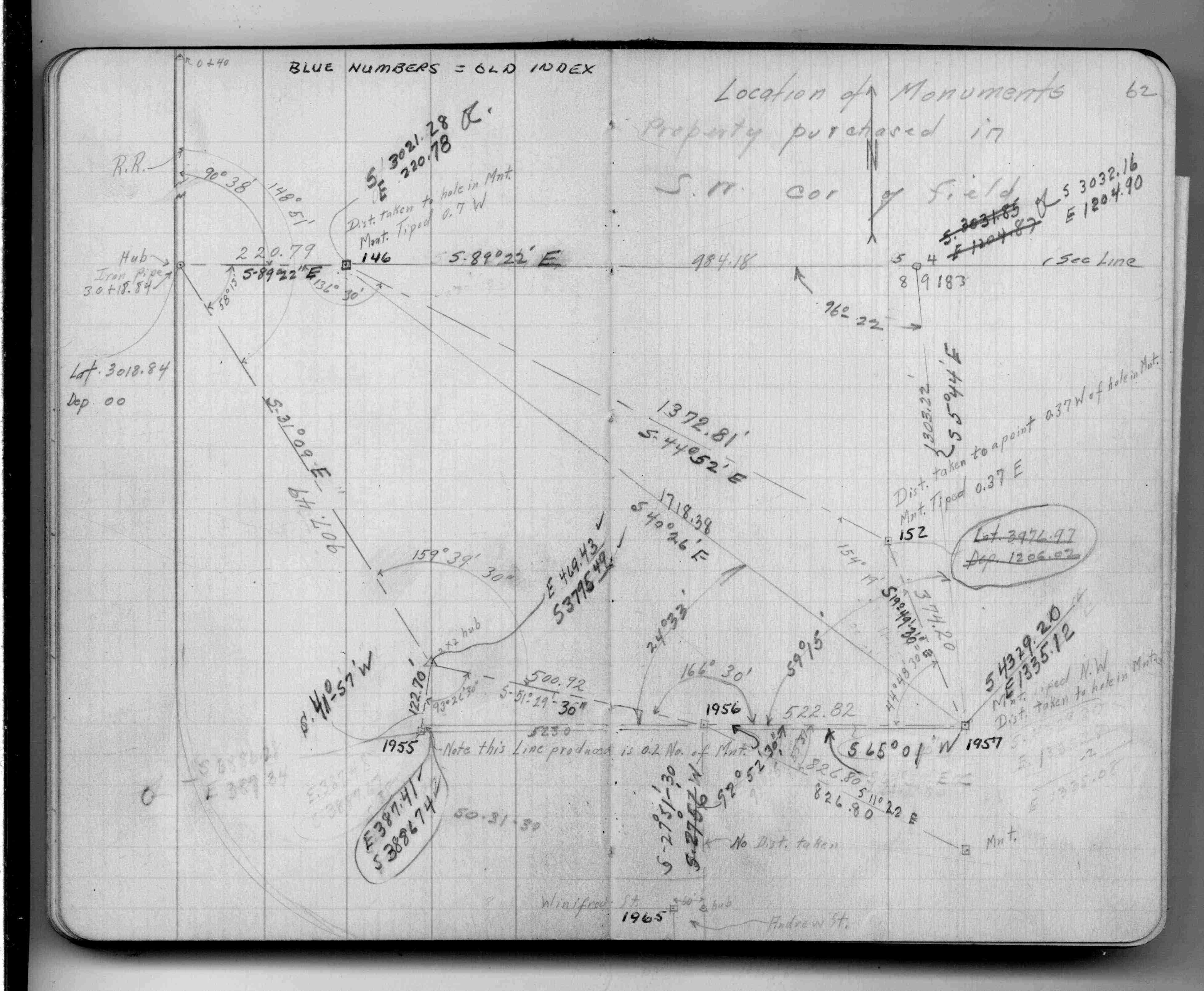
| 1/1/1938 | (Unknown date ___ __, 1938 ) Survey locating GM, GM tipped 0.37 ft east. See FB 1347 p.62 |
| 3/1/1877 | (Unknown date Mar __, 1877 ) Stake put in from bearing stump |
| 1/1/1800 | (Unknown date ___ __, 18?? ) Monument put in 250.0 ft south of MC or 1724.0 ft north of old index #167 (See 824) |
Above is NOT an all inclusive history of this point. Please review all the links below.
| PLS NOTES | Field | Cross Section | Sewer | J.B. Irvine | Monument | River Survey |
|---|---|---|---|---|---|---|
| FB 1347p.62 |