| NAD83 COORDINATES (1986 adj.): |
|---|
| X= 569230.613 Y= 149970.682 Z= 000.00 CMP 12/17/1991 |
| X= 569234.724 Y= 149970.658 Z= 000.00 CMP 06/12/1997 |
| 4/5/2012 | Location obstructed by asphalt. One tie remains from 1972. Area has been extensively reconstructed. |
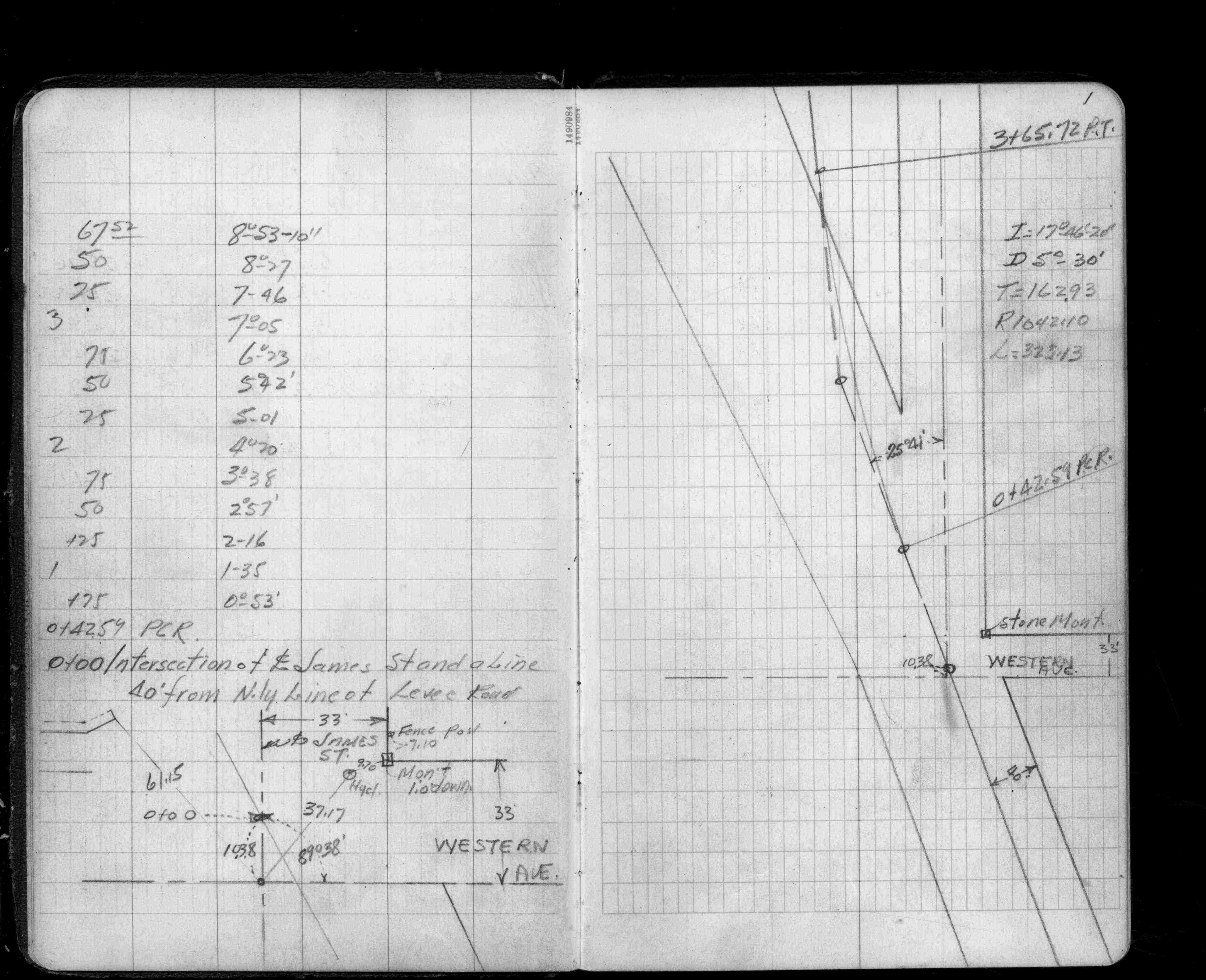
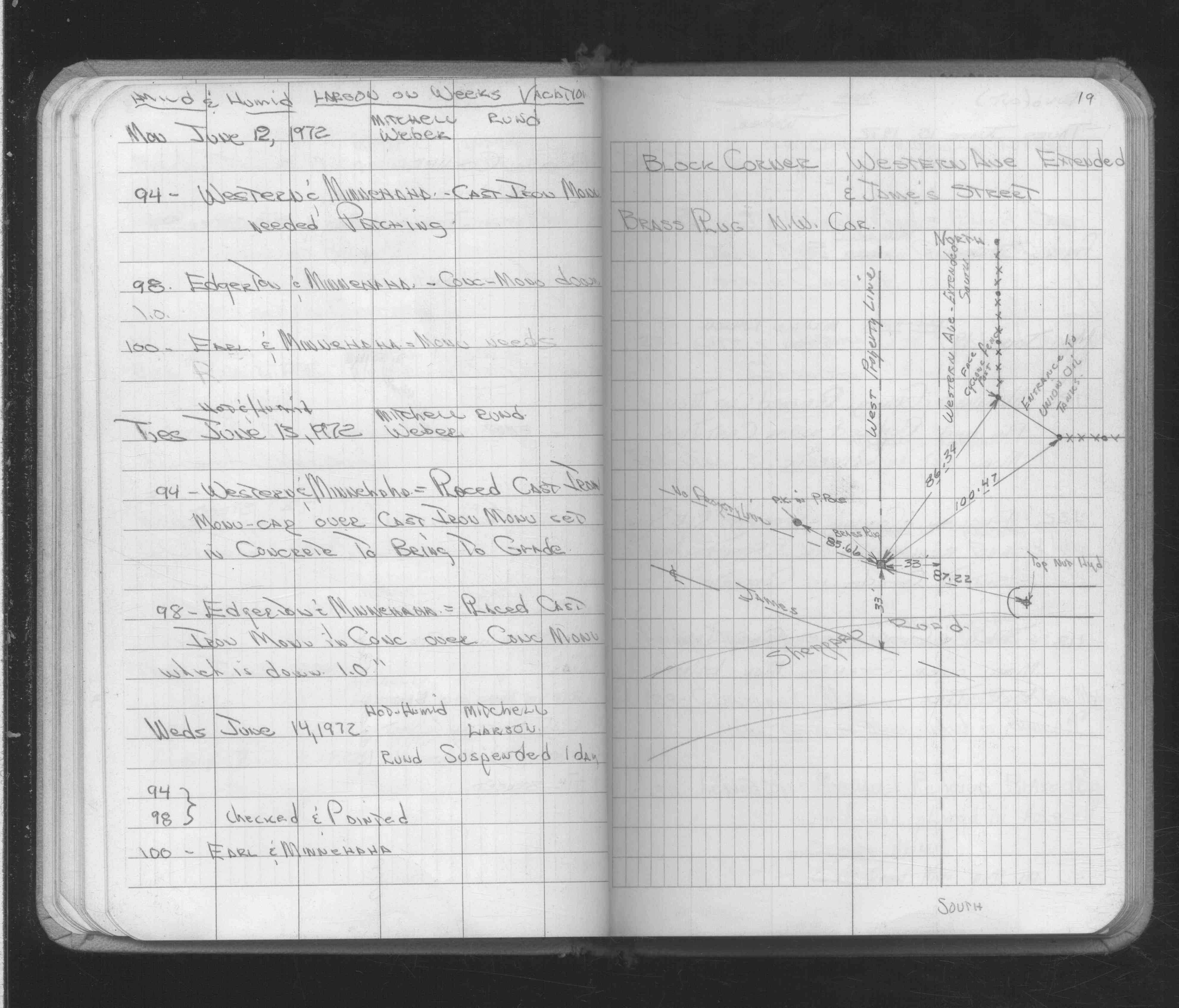
| 1/1/1972 | (Unknown date ___ __, 1972 ) Placed ties on brass plug. See FB 1689A p.19 |
| 12/1/1951 | (Unknown date Dec __, 1951 ) Fd stone monument 1.0 ft below grade. See FB 1408 p.1 |
| 1/1/1951 | (Unknown date ___ __, 1951 ) Corps of Engs recovered 3" standard mon't 4" below grade. |
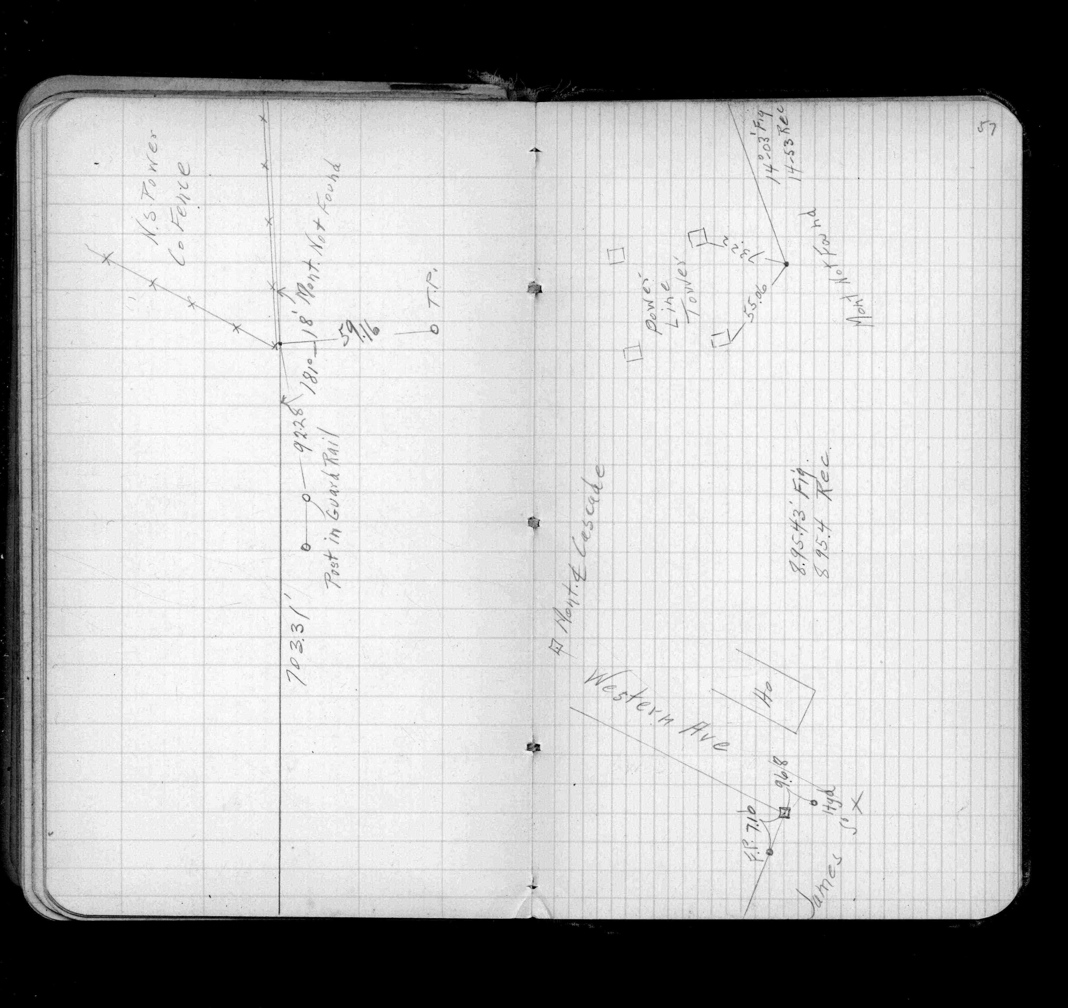
| 1/1/1940 | (Unknown date ___ __, 1940 ) Placed ties. See FB 956 p.57 |
| 8/17/1888 | New Monument set by J H Armstrong as W line of Western Ave & Center of James St |
| 1/1/1885 | (Unknown date ___ __, 1885 ) Armstrong survey 1885 |
| 1/1/1800 | (Unknown date ___ __, ____ ) The old mont covered up by grading of levee |
Above is NOT an all inclusive history of this point. Please review all the links below.
| PLS NOTES | Field | Cross Section | Sewer | J.B. Irvine | Monument | River Survey |
|---|---|---|---|---|---|---|
| FB 0956p.57 | ||||||
| FB 1408p.01 | ||||||
| FB 1689Ap.19 | ||||||
| FB 1733p.09 |