| NAD83 COORDINATES (1986 adj.): |
|---|
| * X= 550758.188 Y= 149631.429 Z= 000.00 LSQ 12/06/1991 S FIX |
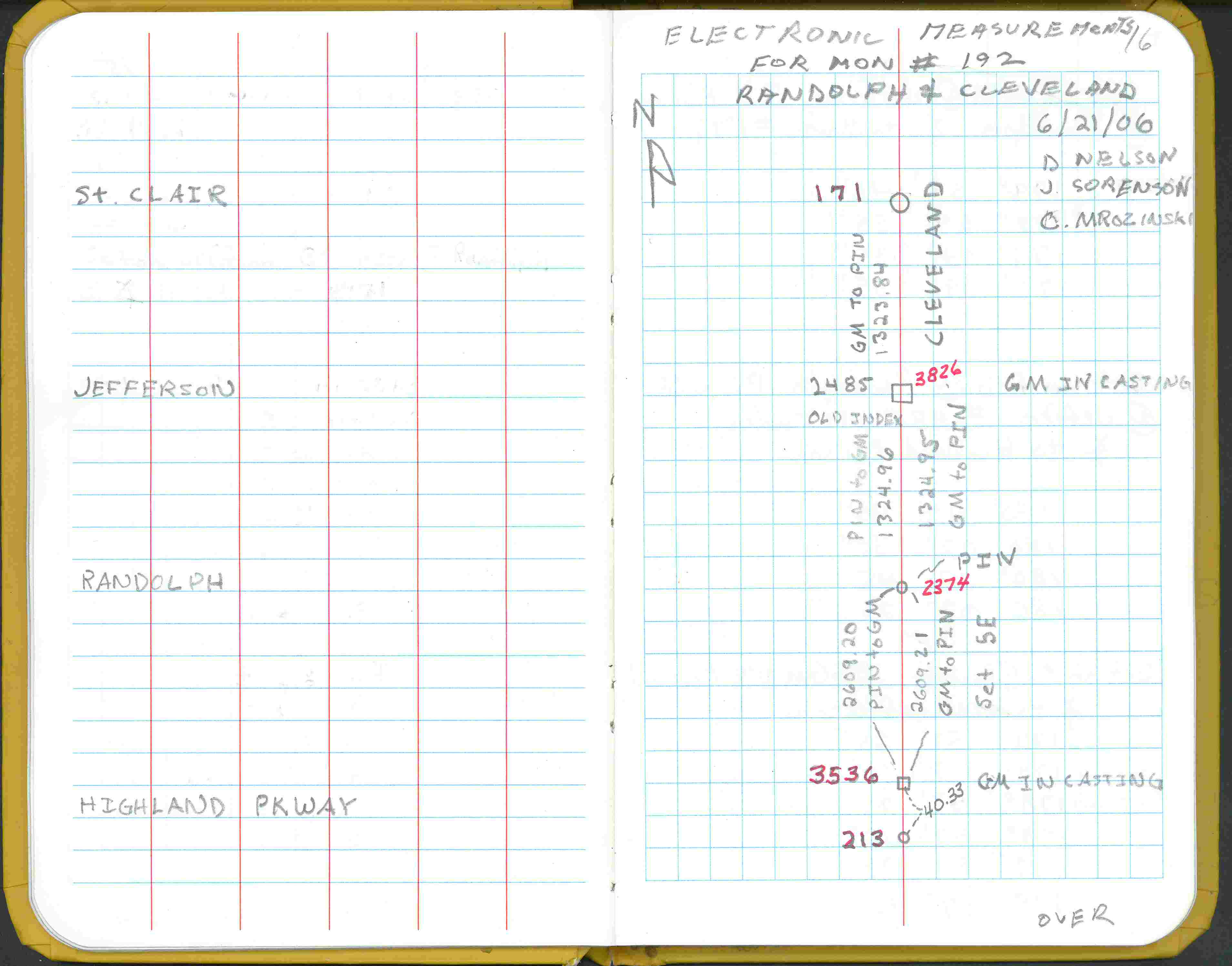
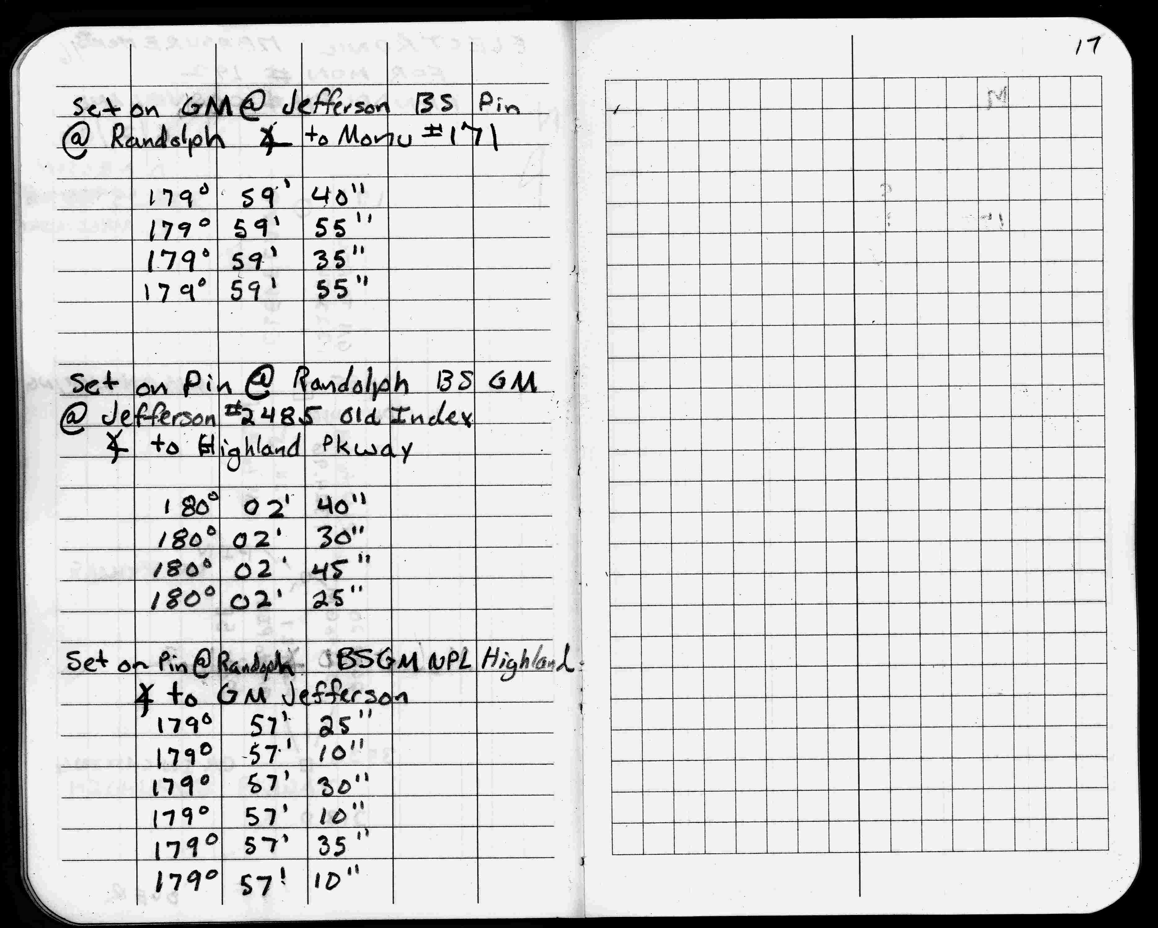
| 6/21/2006 | Electronic meas.on Cleveland btwn Randolph & Jefferson. See FB 1738 p.16,17 |
| 6/21/2006 | Electronic meas.on Cleveland btwn Randolph & Highland Pkwy. See FB 1738 p.16,17 |
| 2/20/2002 | Elev 190.26 ft on CIM at asphalt surface. See FB 1736 p.22 |
| 3/22/1996 | Painted CIM. |
| 2/22/1996 | Elev 190.31 ft on CIM. See 97adj.pts, 1996/ran-snel-clev.org/bmrand2.sdr (loop 055) Digital-Adj |
| 9/27/1995 | Painted CIM. |
| 12/19/1994 | Elev 190.31 ft on CIM. See 97adj.pts, 1994/clev-cretin.org/clevcret.sdr (loop 031) Digital-Adj |
| 7/29/1994 | Placed ties on a CIM. See CofL 2374-xxxx-A |
| 7/1/1994 | (Unknown date Jul __, 1994 ) See folder labeled MONUMENT 192. See CofL 2374-xxxx-A |
| 1/7/1992 | Electronic measurement 2649.69 ft from the mon't at Highland & Cleveland. See monument folder. |
| 4/1/1991 | (Unknown date Apr __, 1991 ) Fd CIM to grade. |
| 10/12/1985 | Position on CIM established GPS (Ramsey County Project). Photos taken. |
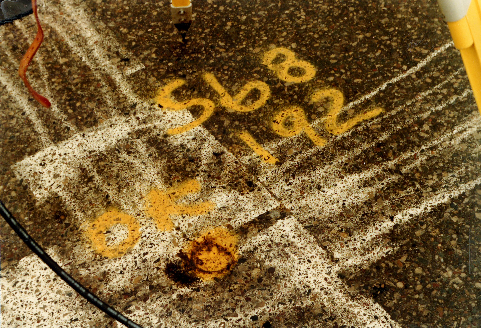
| 1/1/1985 | (Unknown date ___ __,1985 ) Historic, one time only GPS survey = S068 |
| 1/1/1973 | (Unknown date Jan __, 1973 ) Set CIM to grade. See tie book. (Most likely replacing pk nail set Dec 1972) |
| 12/1/1972 | Placed pk nail by chaining 2650.55 ft from the mon't at Highland & Cleveland. See tie book. |
| 1/1/1800 | (Unknown date ___ __, ____ ) Measured 2650.55 ft on Cleveland from Highland & Cleveland (mon't 213) |
Above is NOT an all inclusive history of this point. Please review all the links below.
| PLS NOTES | Field | Cross Section | Sewer | J.B. Irvine | Monument | River Survey |
|---|---|---|---|---|---|---|
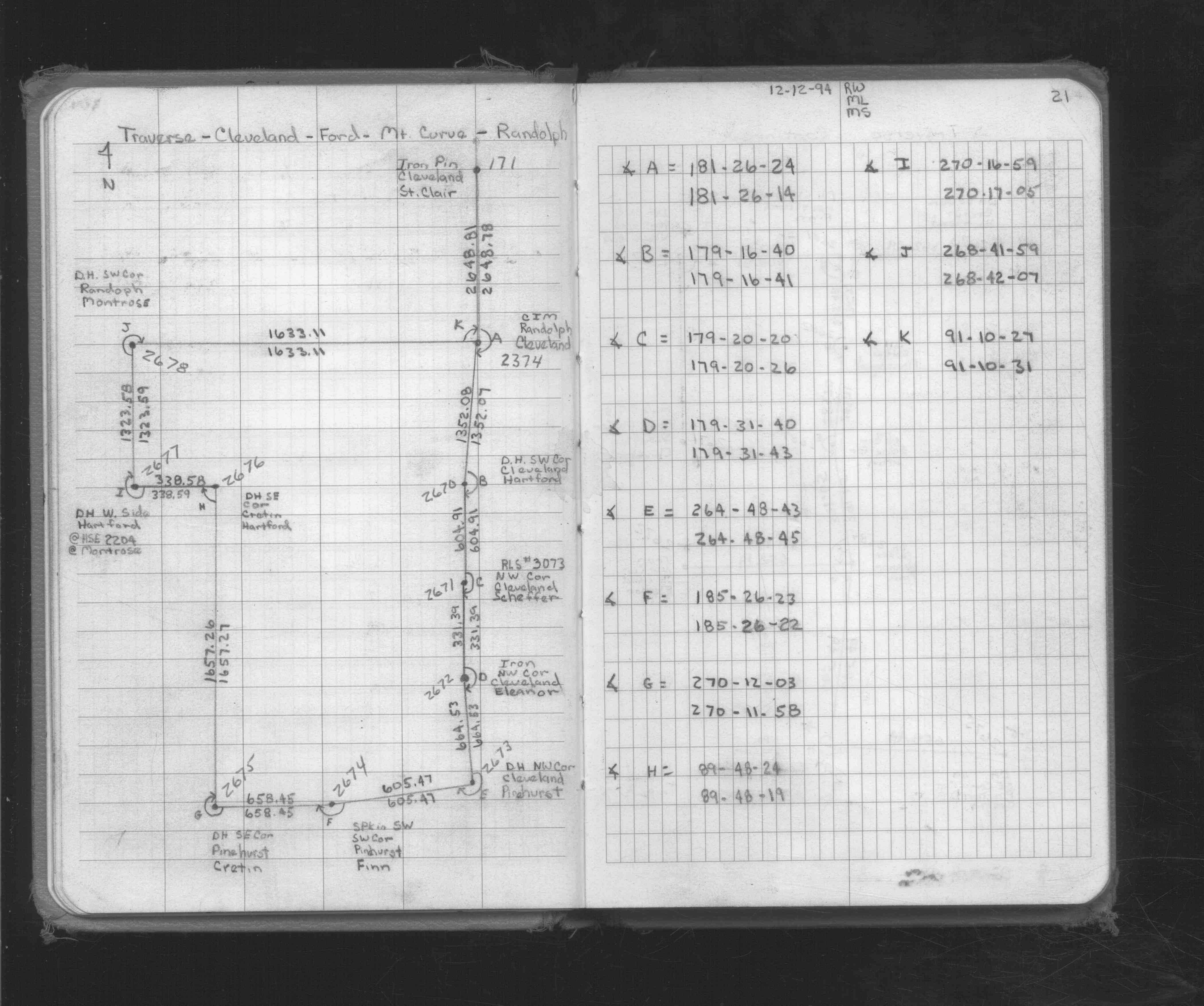
| FB 1719Ap.21 | ||||||
| FB 1738p. 16 ,17 |
| FILE | SURVEYOR | LIC. NO. | DATE SIGNED | DATE TIED |
|---|---|---|---|---|
| 2374-xxxx-A.tif | none | none | none | none |
| FILE | PHOTO DATE | COMMENTS |
|---|---|---|
| 2374-__kb-7.jpg | May 16, 2006 | Looking Southwest from the pin at Randolph Ave. and Cleveland Ave. |
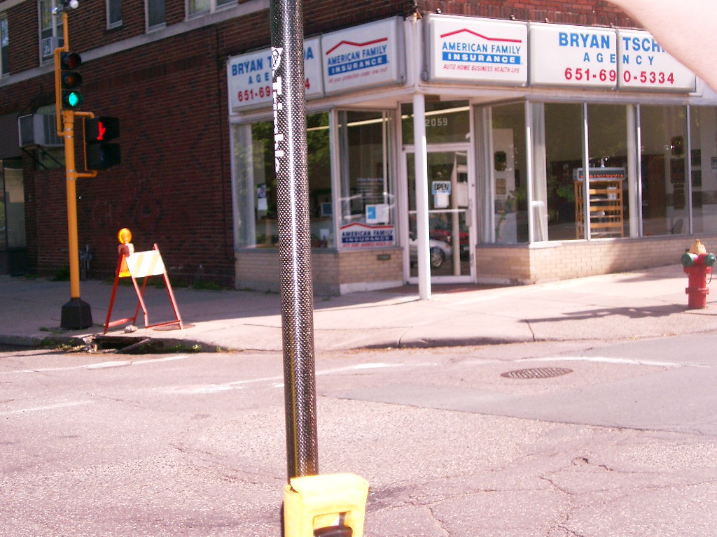
| 2374-__kb-6.jpg | May 16, 2006 | Looking Southeast from the pin at Randolph Ave. and Cleveland Ave. |
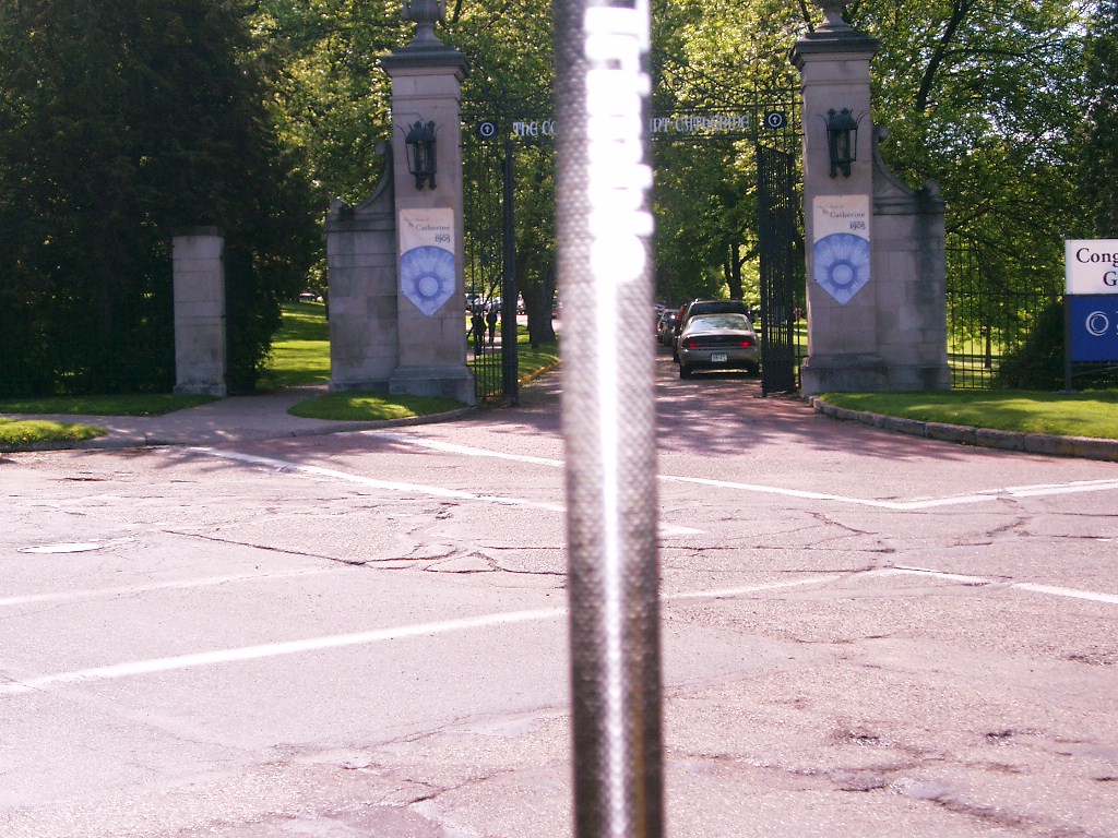
| 2374-__kb-5.jpg | May 16, 2006 | Looking Northeast from the pin at Randolph Ave. and Cleveland Ave. |
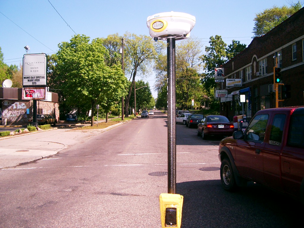
| 2374-__kb-4.jpg | May 16, 2006 | Looking North along Cleveland Ave. |
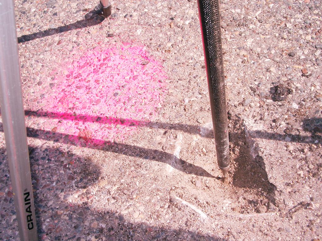
| 2374-__kb-3.jpg | May 16, 2006 | Close-up of the pin that was under the CIM. |
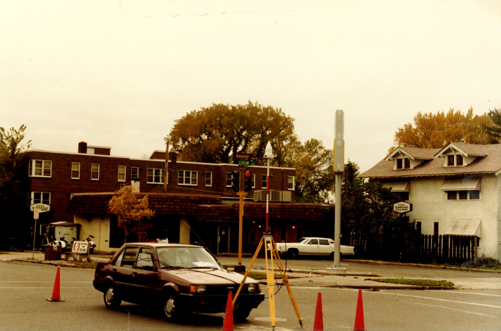
| 2374-__kb-2.jpg | October 12, 1985 | Looking Southwesterly from the Northeast corner of Randolph Ave. and Cleveland Ave. |
| 2374-__kb-1.jpg | October 12, 1985 | Close-up of the CIM (NOT Monument 0192 as marked). |