| NAD83 COORDINATES (1986 adj.): |
|---|
| * X= 562202.162 Y= 168022.922 Z= 196.10 CPS 10/01/1992 FLT |
| * X= 562202.162 Y= 168022.922 Z= 198.11 CPS 10/01/1992 FLT |
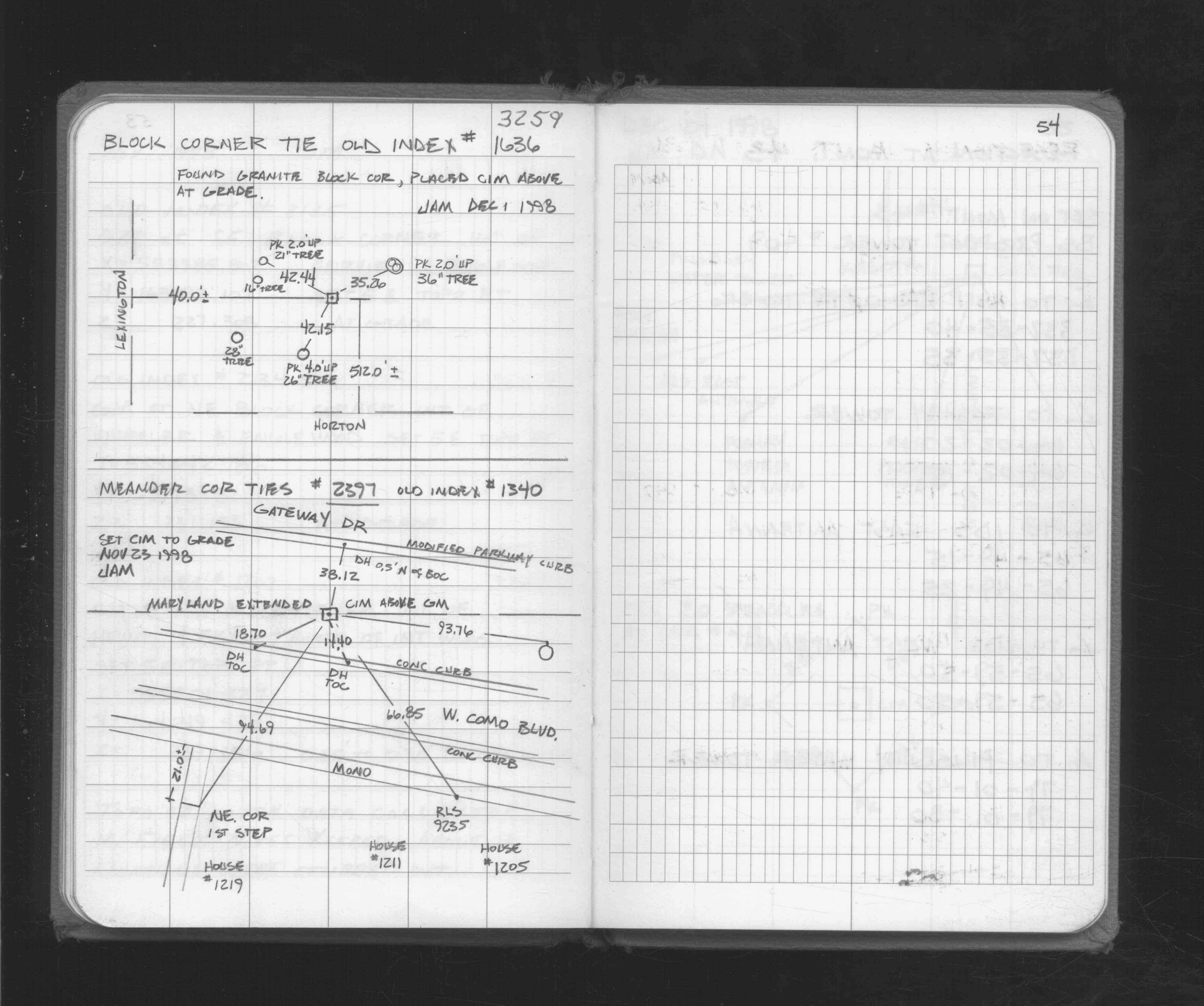
| 12/1/1998 | Fd GM 2 ft below grade, set CIM over GM to grade (GM Elev 196.10 ft, CIM Elev 198.11 ft) See FB 1716 p.54 |
| 11/1/1998 | (Unknown date Nov __, 1998 ) See CofL 2397-1340-B |
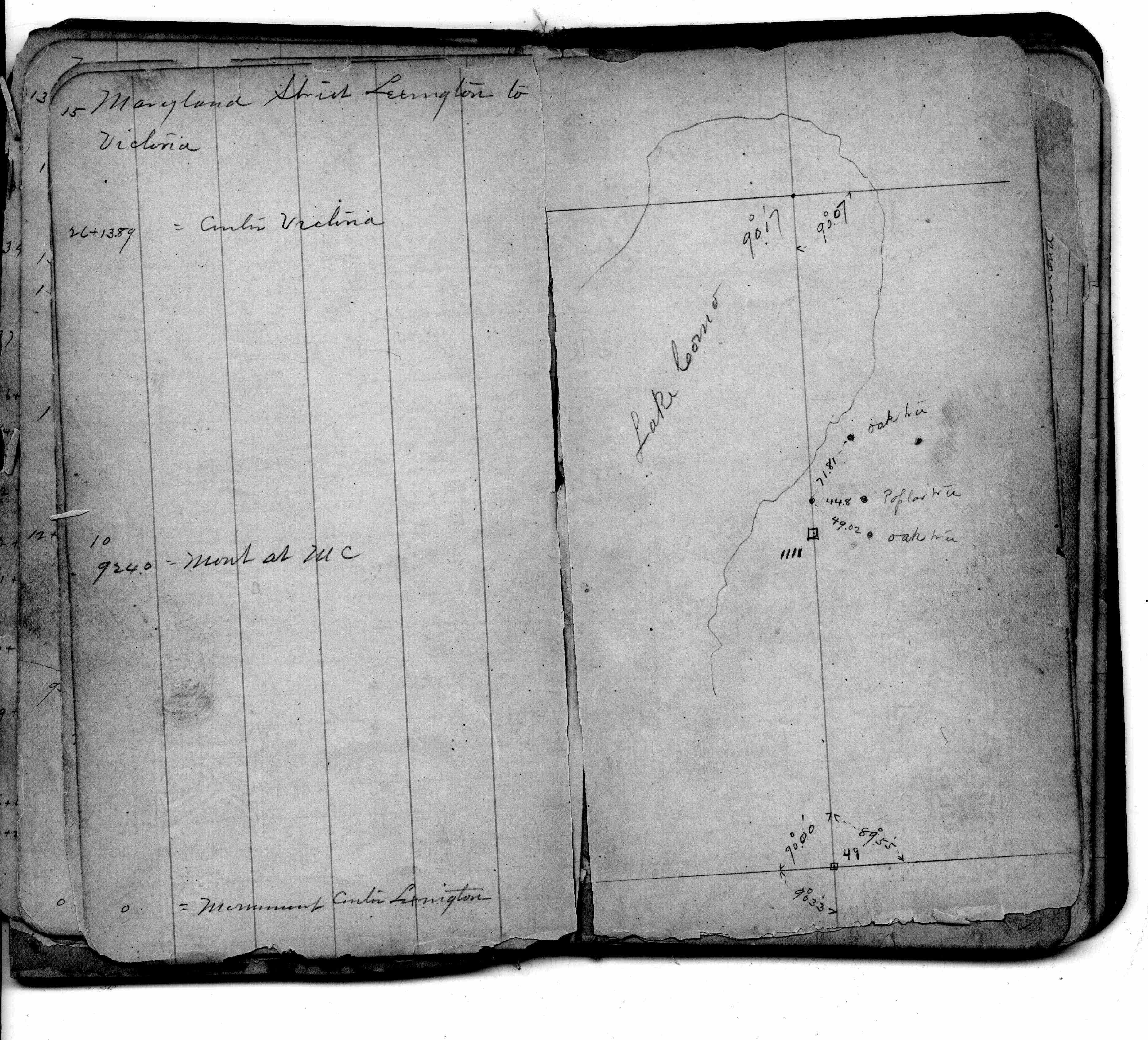
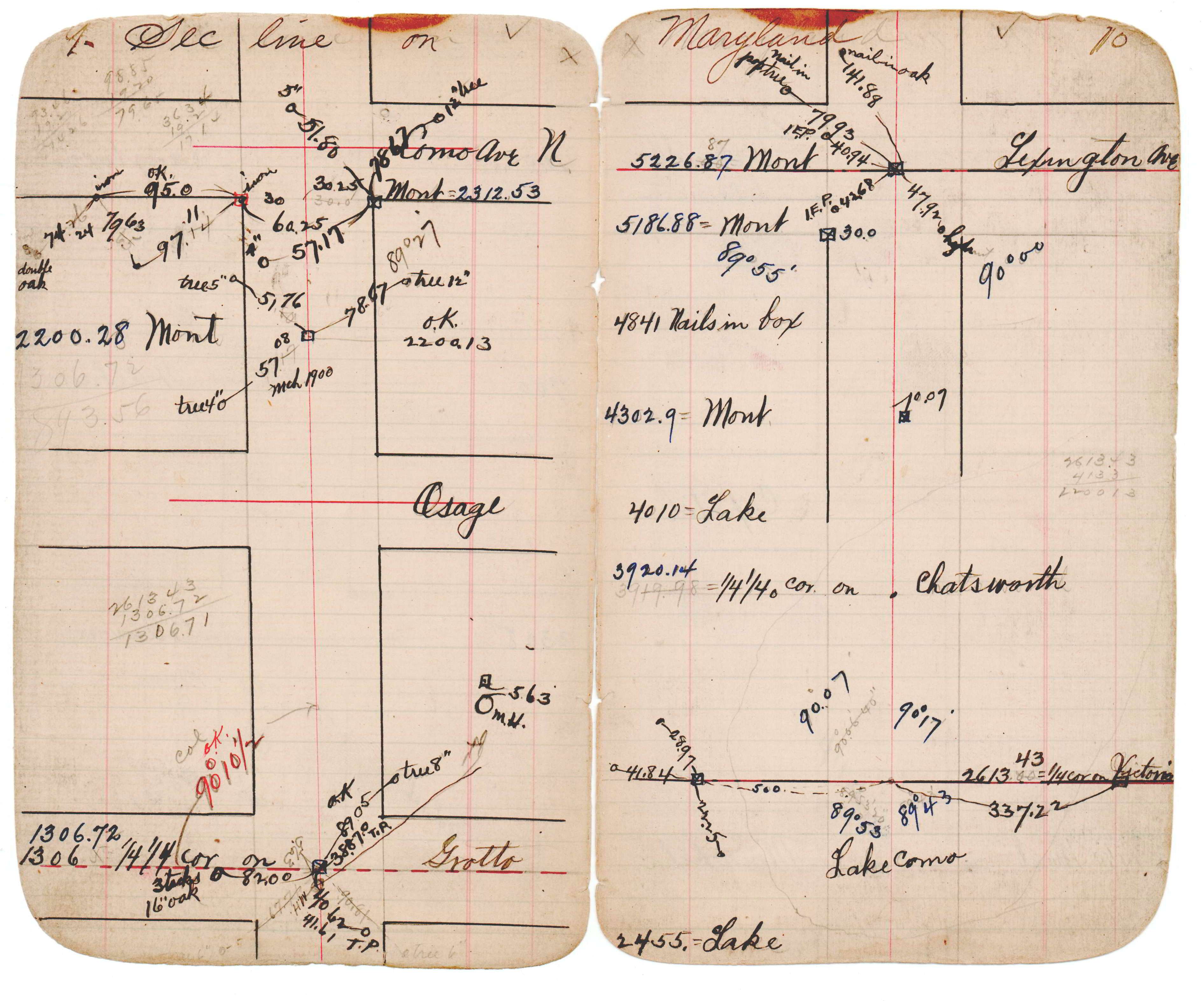
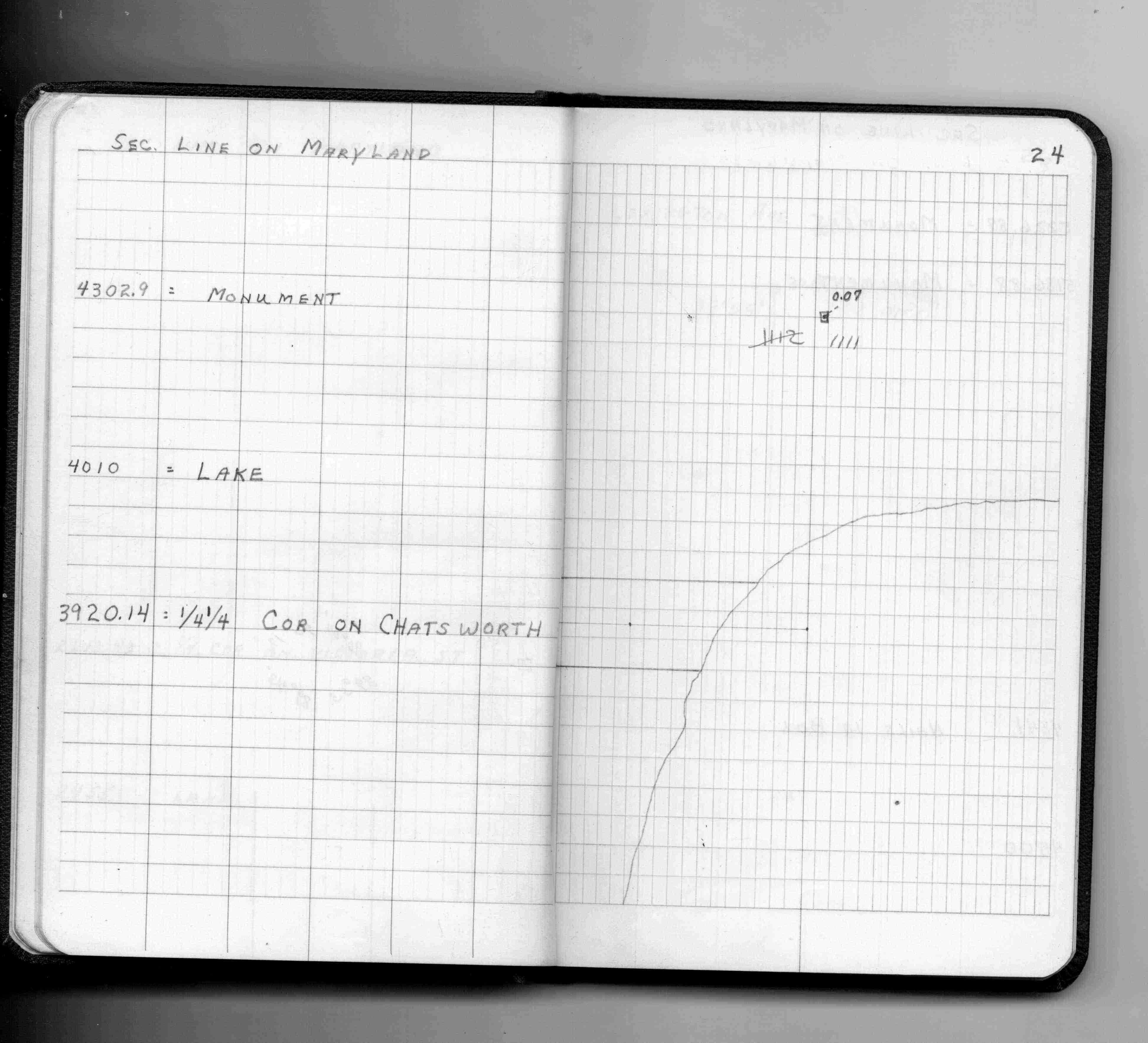
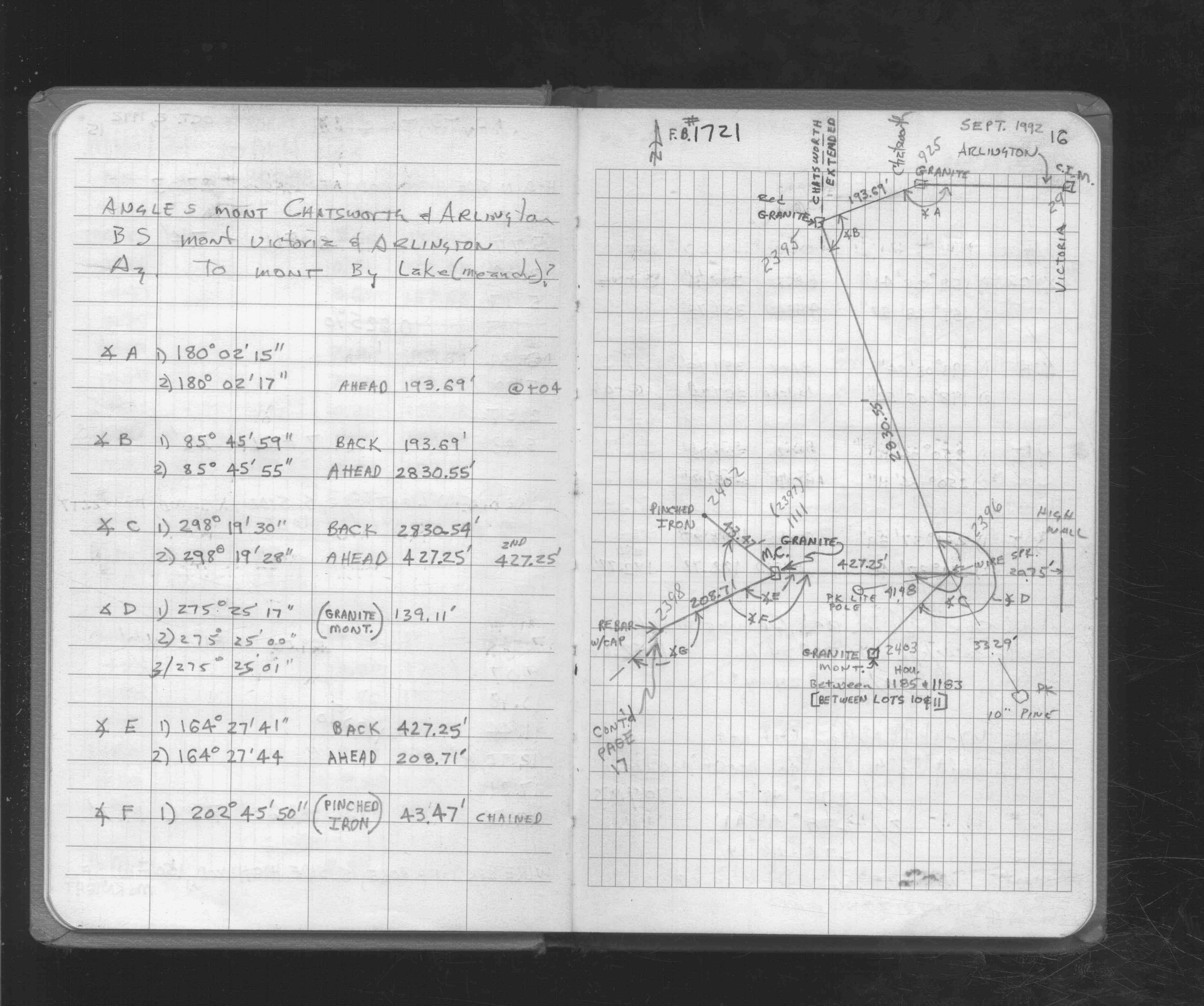
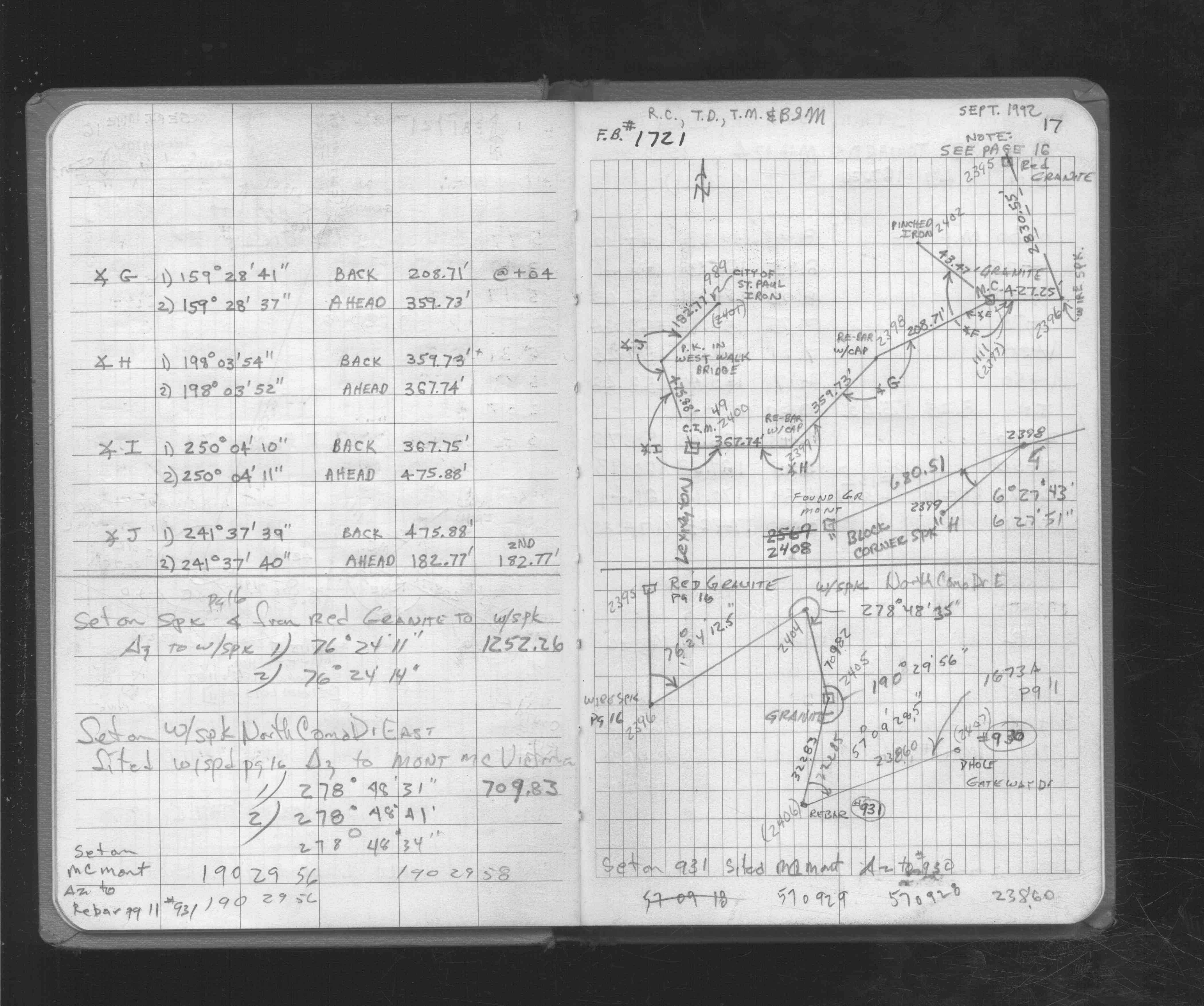
| 9/1/1992 | (Unknown date Sep __, 1992 ) Located GM by traverse. See FB 1721 p.16 |
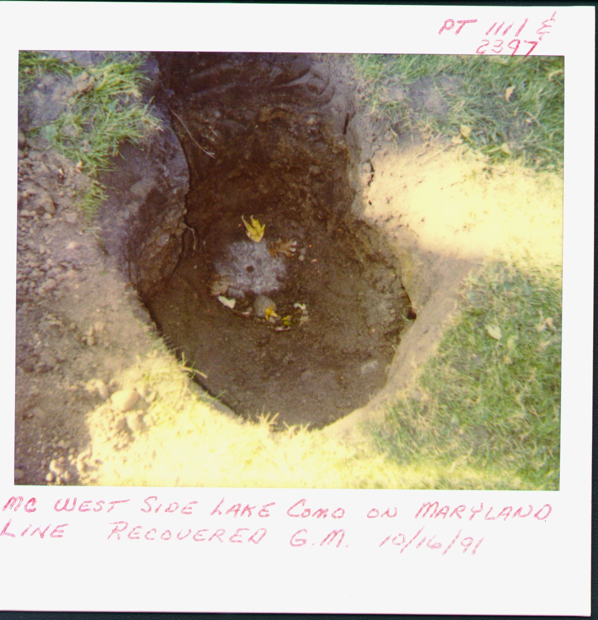
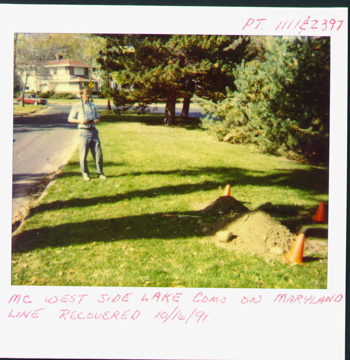
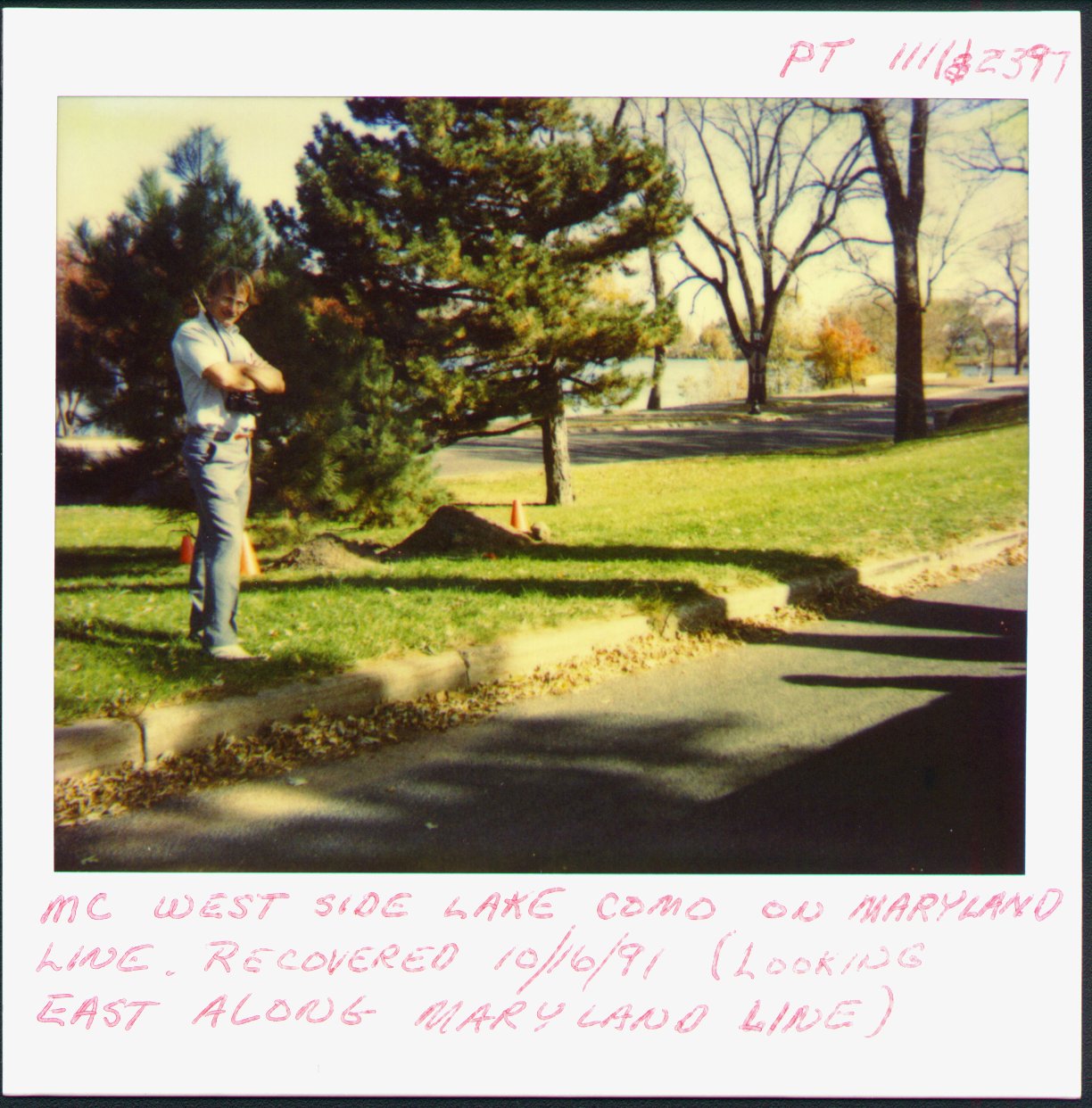
| 10/16/1991 | Fd GM 2 ft below grade. |
| 10/1/1991 | (Unknown date Oct __, 1991 ) See MCs 1111/2397 & 1112 folder CofL 2397-1340-A |
| 1/1/1887 | (Unknown date ___ __, 1887 ) Monument set by J H Armstrong on Maryland St line 924 ft east of Lexington at MC |
| 11/1/1847 | (Unknown date Nov __, 1847 ) Isaac N Higbee deputy surveyor set post. Tied to 2 BTs. See IH p.082-083 2923 |
Above is NOT an all inclusive history of this point. Please review all the links below.
| PLS NOTES | Field | Cross Section | Sewer | J.B. Irvine | Monument | River Survey |
|---|---|---|---|---|---|---|
| IH p.082-083 | FB 0169p.15 | JBI 16 p.09-10 | ||||
| FB 0311CPYp.24 | ||||||
| FB 1716p.54 | ||||||
| FB 1721p.16 | ||||||
| FB 1721p. 16 ,17 |
| FILE | SURVEYOR | LIC. NO. | DATE SIGNED | DATE TIED |
|---|---|---|---|---|
| 2397-1340-B.tif | Jeffery L. Grosso | 13144 | December 8, 1998 | November 23, 1998 |
| 2397-1340-A.tif | none | none | none | October 16, 1991 |
| FILE | PHOTO DATE | COMMENTS |
|---|---|---|
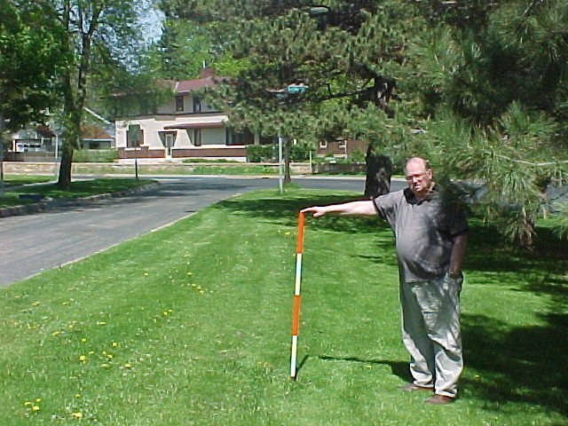
| 2397-1340-6.jpg | May 23, 2002 | Looking north. |
| 2397-1340-5.jpg | May 23, 2002 | Looking west. |
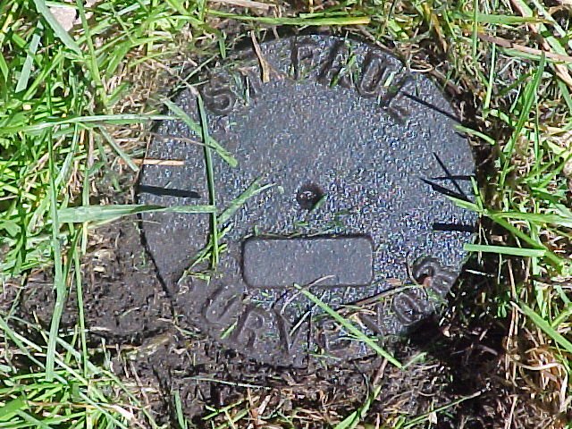
| 2397-1340-4.jpg | May 23, 2002 | Close up of CIM. |
| 2397-1340-1.jpg | October 16, 1991 | Close up of GM |
| 2397-1340-3.jpg | August 27, 1991 | Looking north |
| 2397-1340-2.jpg | August 27, 1991 | Looking east across Lake Como along Maryland Ave line |