| NAD83 COORDINATES (1986 adj.): |
|---|
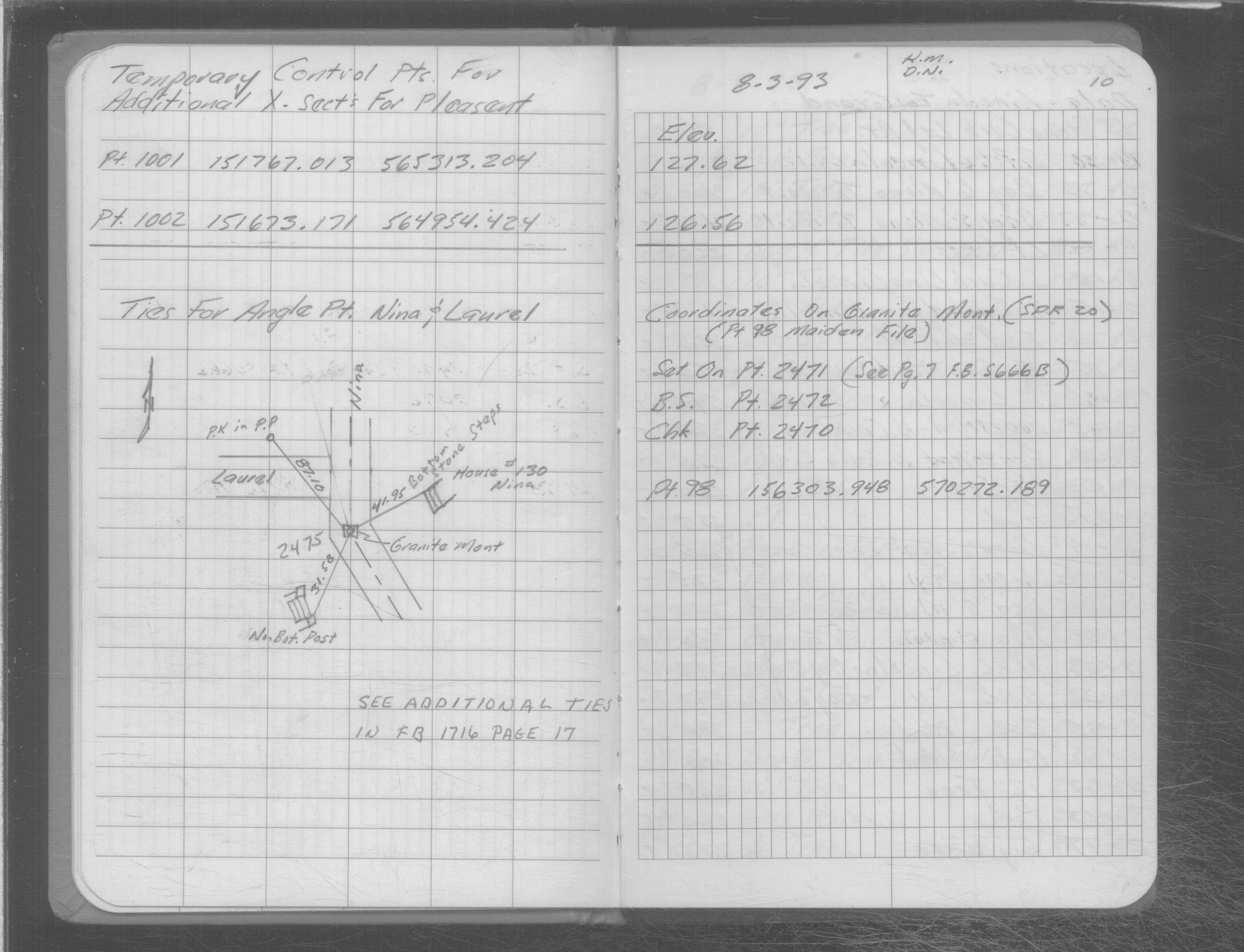
| X= 570272.189 Y= 156303.948 Z= 000.00 TOT 08/03/1993 |
| 1/1/1995 | (Unknown date ___ __, 1995 ) GM removed during sewer construction. Position now falls on sewer MH. |
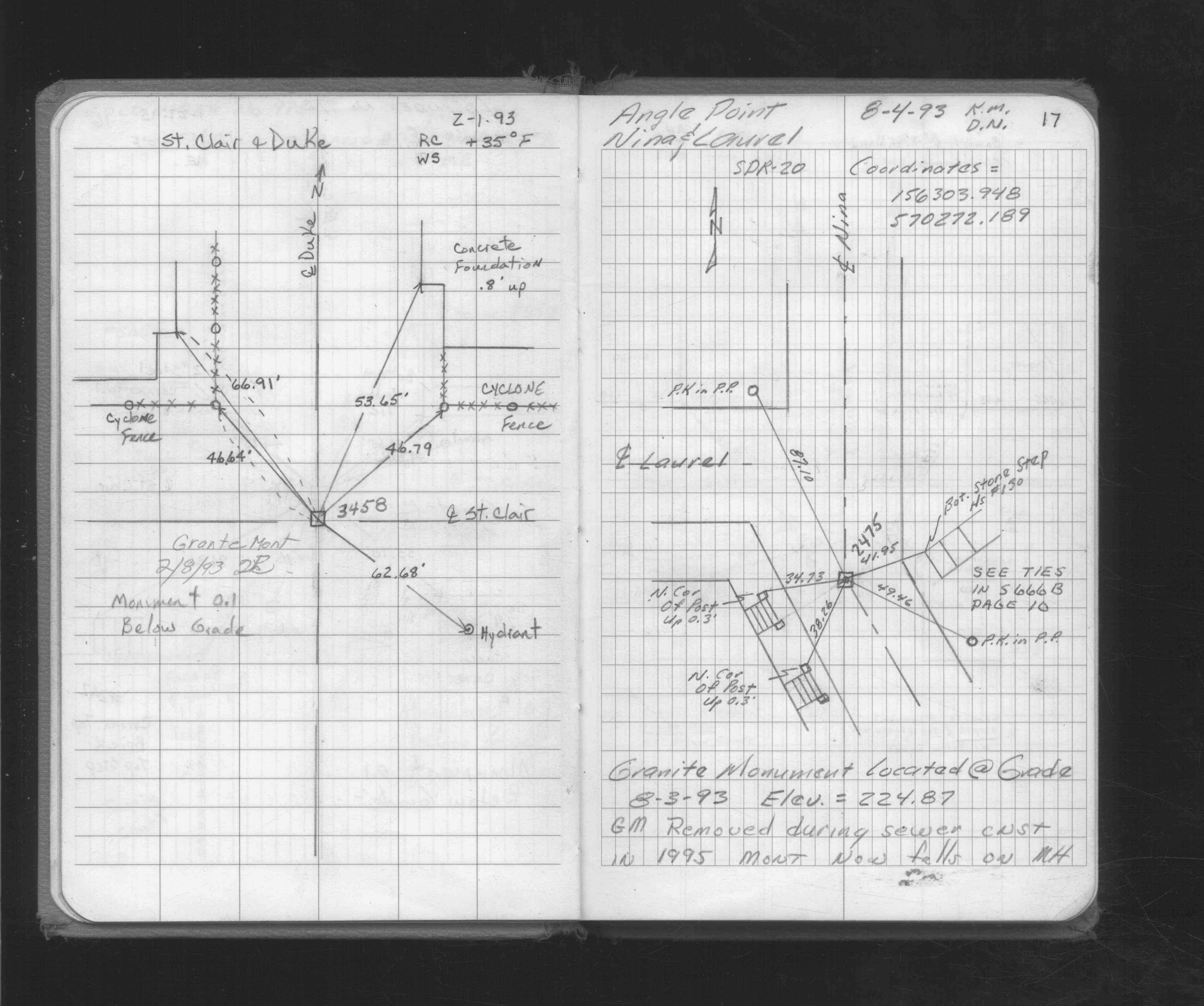
| 8/4/1993 | Placed ties on GM. See FB 1716 p.17 |
| 8/3/1993 | GM at street grade and at Elev 224.87 ft. See FB 1716 p.17 |
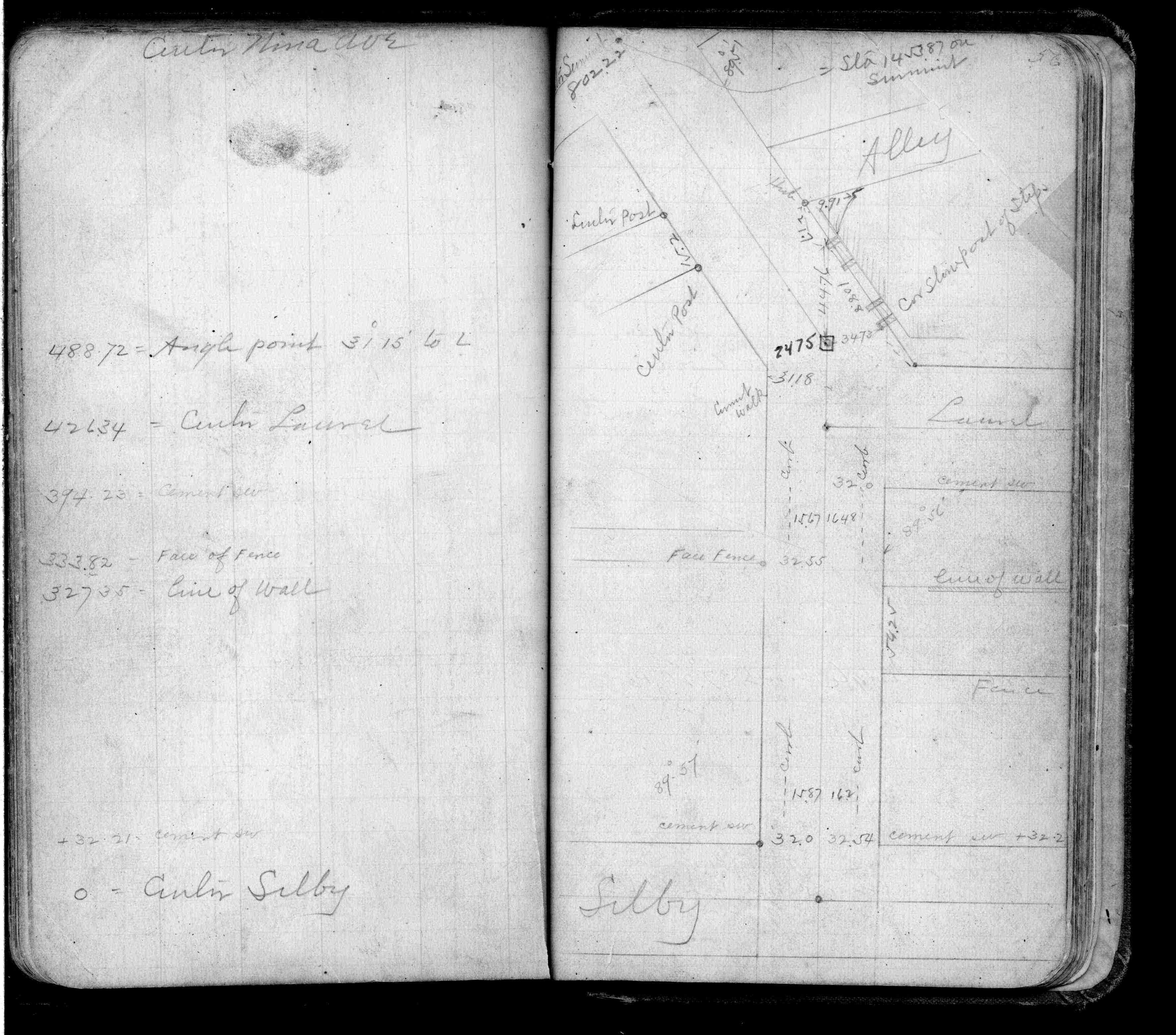
| 8/1/1993 | (Unknown date Aug __, 1993 ) Fd GM 0.1 ft below grade, placed ties. See SB 666B p.10 |
| 8/1/1993 | (Unknown date Aug __, 1993 ) Elev 224.87 ft on GM. From total station. No FB |
Above is NOT an all inclusive history of this point. Please review all the links below.
| PLS NOTES | Field | Cross Section | Sewer | J.B. Irvine | Monument | River Survey |
|---|---|---|---|---|---|---|
| FB 0269p.56 | SB 0666Bp.10 | |||||
| FB 1716p.17 | ||||||
| FB 1716p.17 |