| NAD83 COORDINATES (1986 adj.): |
|---|
| X= 573157.87 Y= 151246.98 Z= 887.8 03/21/2007 RTK-VRS |
| X= 573157.803 Y= 151246.999 Z= 000.00 CPS 06/06/1994 |
| 4/30/2013 | Record correction: Old Index #0475 found to have been mistakenly attributed to Mon't #4236 (See CS120 p.04 for tie to house corner shown in Old Index #0475). |
| 4/17/2012 | Found GM 0.2 ft below sidewalk grade. Photos taken. Ties from 2007 are still in place. |
| 1/12/2007 | Position on GM established by RTK-VRS GPS Elev 887.8 ft |
| 1/4/2007 | Fd GM West of sidewalk intersection. Placed ties. See CofL 2496-__gy-A |
| 9/8/1995 | Elev 193.83 ft on GM. See 97adj.pts, 1995/ohio.org/ohio.sdr (loop 061) Digital-Adj |
| 11/8/1994 | Elev 193.83 ft on GM. See 97adj.pts, 1995/george.org/george.sdr (loop 015) Digital-Adj |
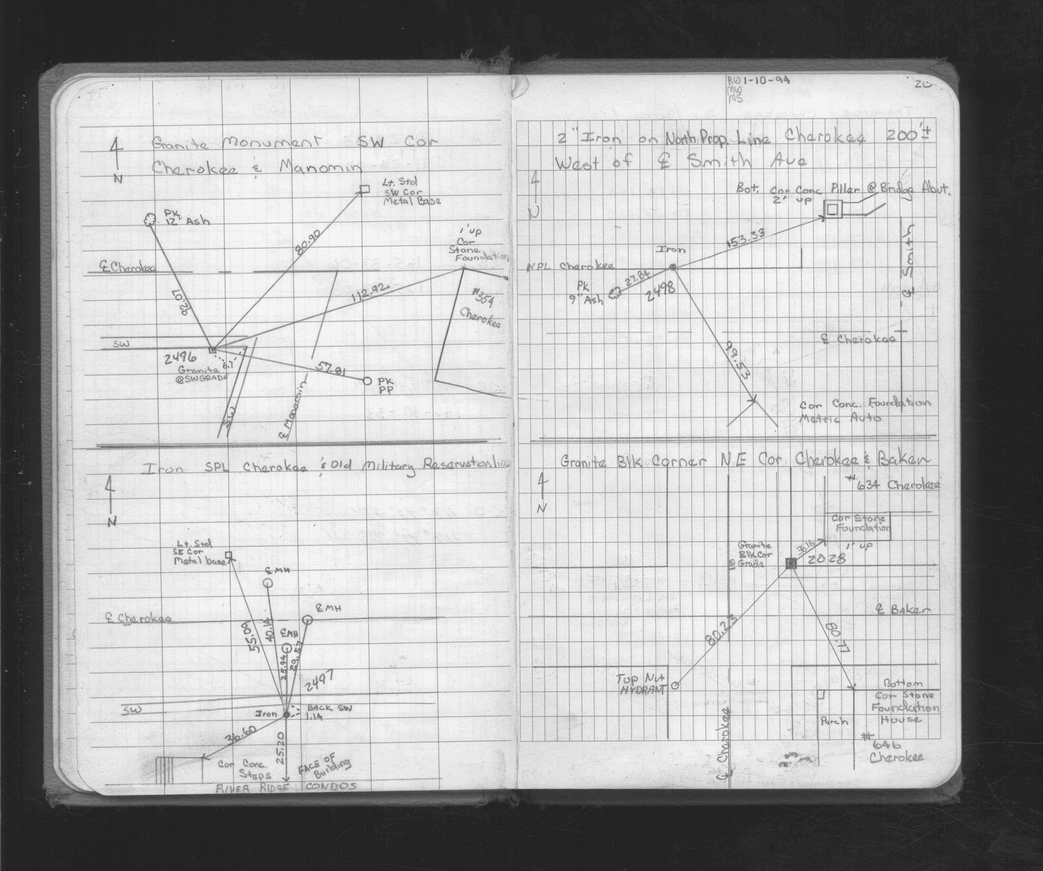
| 1/10/1994 | Placed ties on GM. See FB 1716 p.20 |
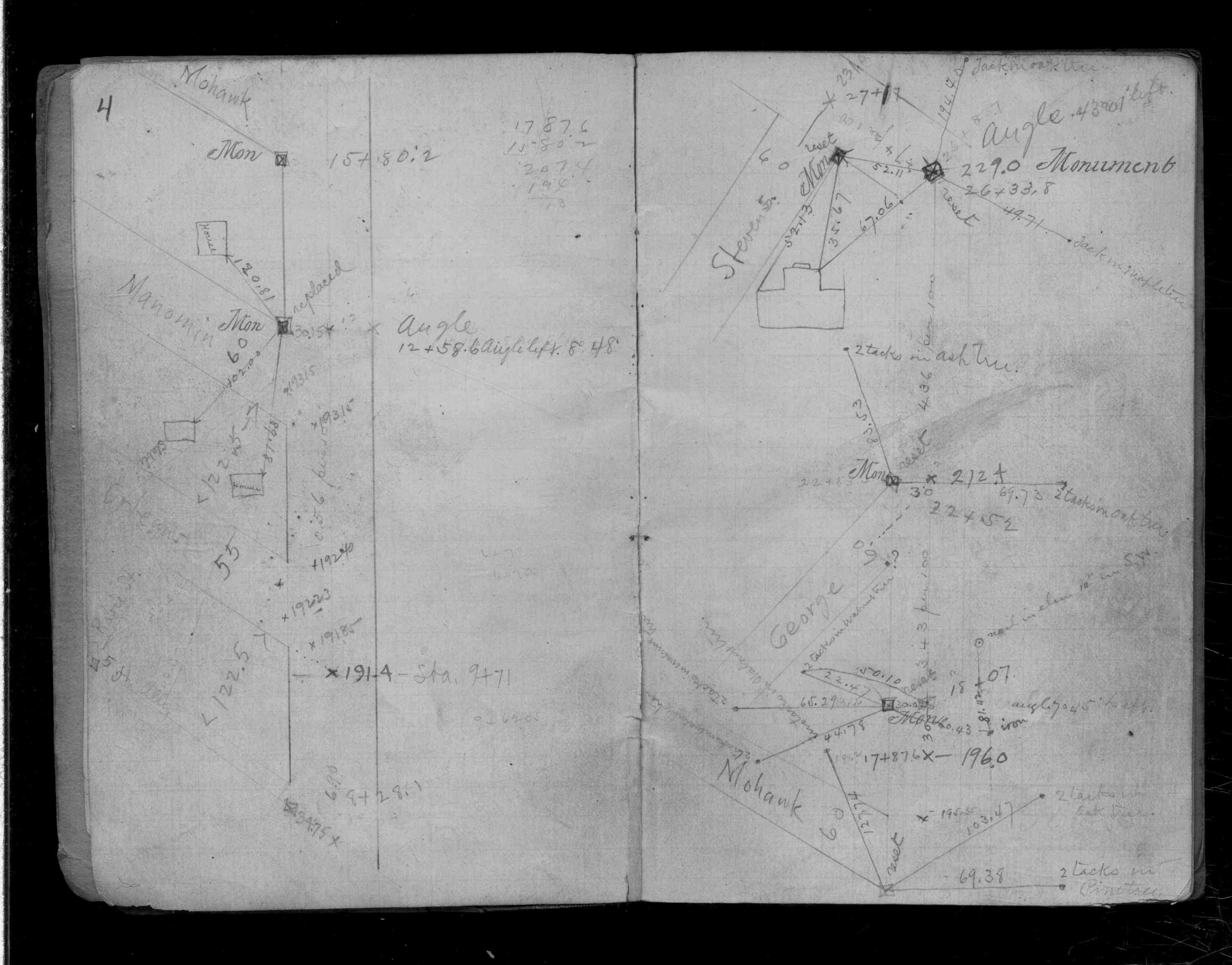
| 1/5/1994 | Fd GM & traversed through. See FB 1716 p.19 |
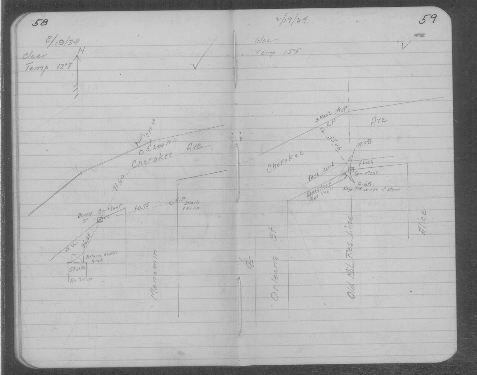
| 2/19/1934 | Placed ties on GM two inches below grade. See MSX 1 p.58-59 |
| 1/1/1800 | (Unknown date ___ __, ____ ) Centre Cherokee come 2.5 ft north of Monument near Cottonwood |
Above is NOT an all inclusive history of this point. Please review all the links below.
| PLS NOTES | Field | Cross Section | Sewer | J.B. Irvine | Monument | River Survey |
|---|---|---|---|---|---|---|
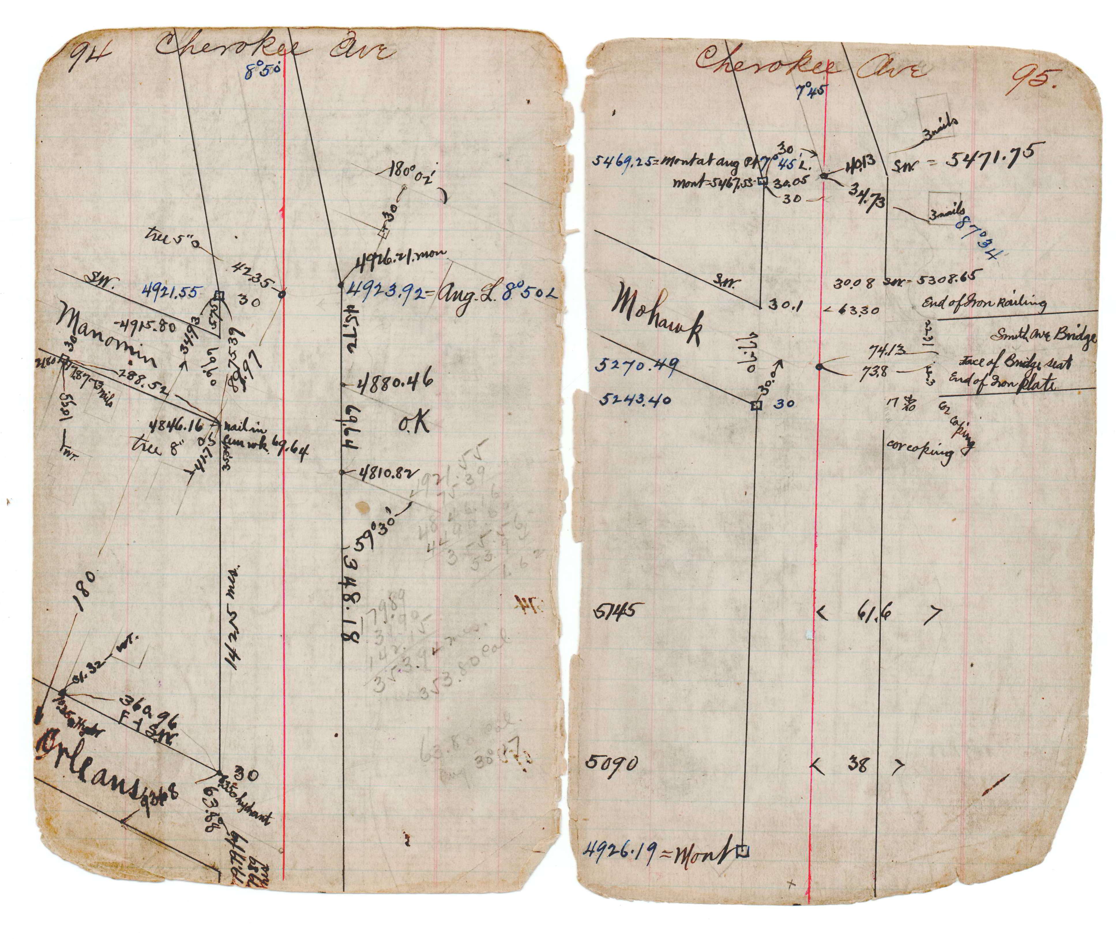
| FB 1716p.19 | CS 0120p.04 | JBI 17 p.94-95 | MSX 0001 p.058-059 | |||
| FB 1716p. 19 ,20 | ||||||
| FB 1716p.20 |
| FILE | SURVEYOR | LIC. NO. | DATE SIGNED | DATE TIED |
|---|---|---|---|---|
| 2496-0475-A.tif | none | none | none | January 4, 2007 |
| FILE | PHOTO DATE | COMMENTS |
|---|---|---|
| 2496-0475-5.jpg | April 17, 2012 | Looking west along Cherokee Ave. |
| 2496-0475-4.jpg | April 17, 2012 | Looking south along Manomin Ave. |
| 2496-0475-3.jpg | April 17, 2012 | Looking east along Cherokee Ave. |
| 2496-0475-2.jpg | April 17, 2012 | Looking north. |
| 2496-0475-1.jpg | April 17, 2012 | Close up of monument. |