| NAD83 COORDINATES (1986 adj.): |
|---|
| X= 573524.815 Y= 151470.048 Z= 000.00 CPS 01/06/1994 |
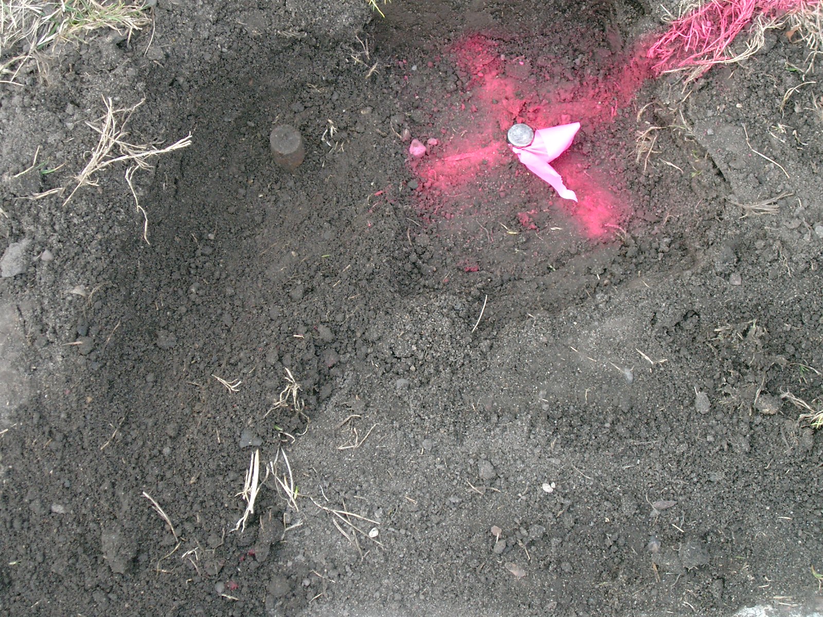
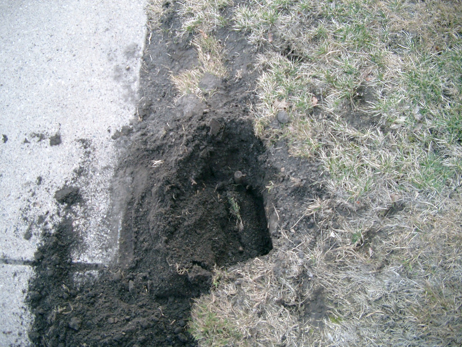
| 4/12/2010 | Excavated location based on ties, no bent iron or GM found. Non-bent iron found nearby, but did not match distance given by either tie. Photos taken of found iron. |
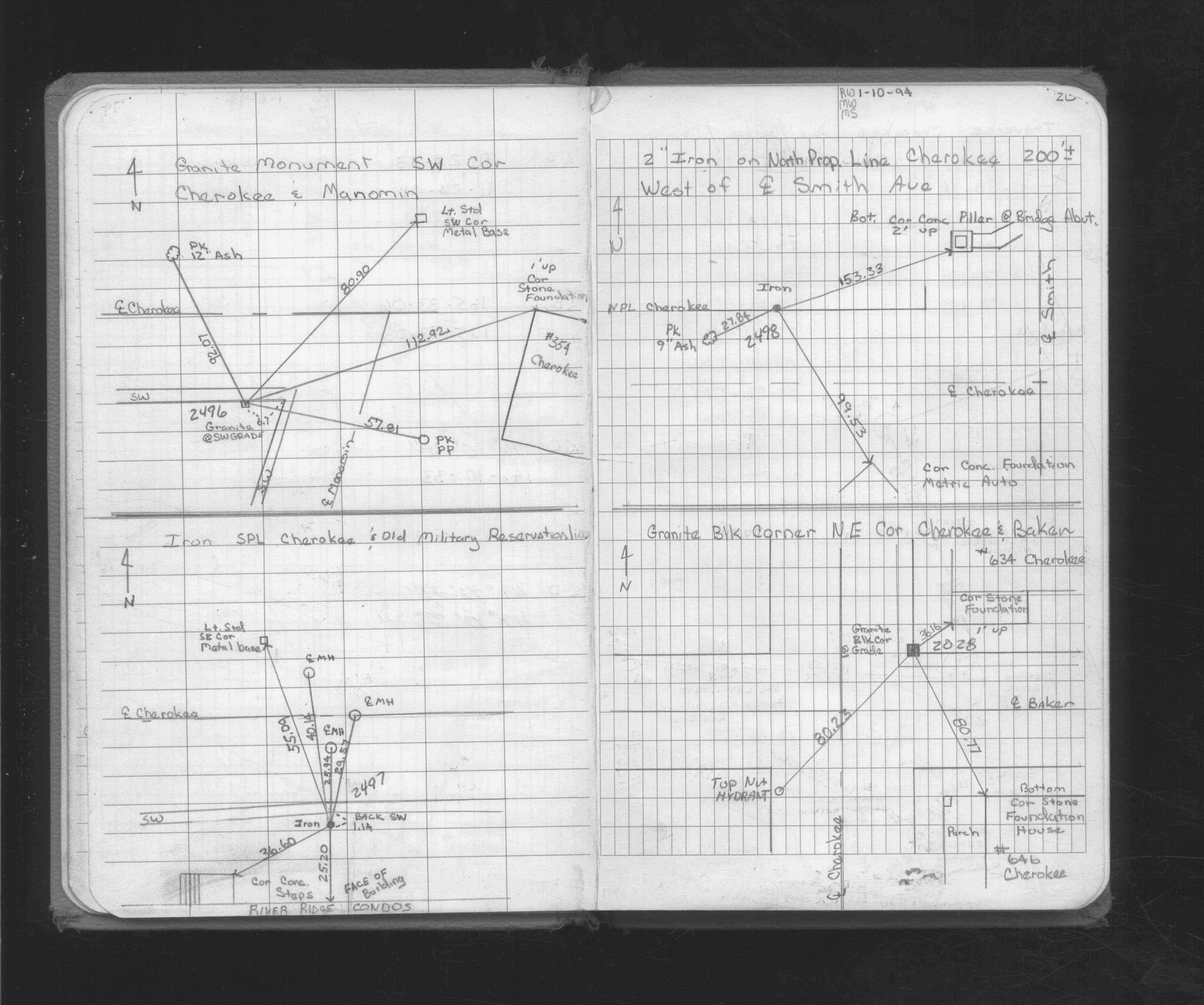
| 1/5/1994 | Recovered Bent Iron. See FB 1716 p.20 |
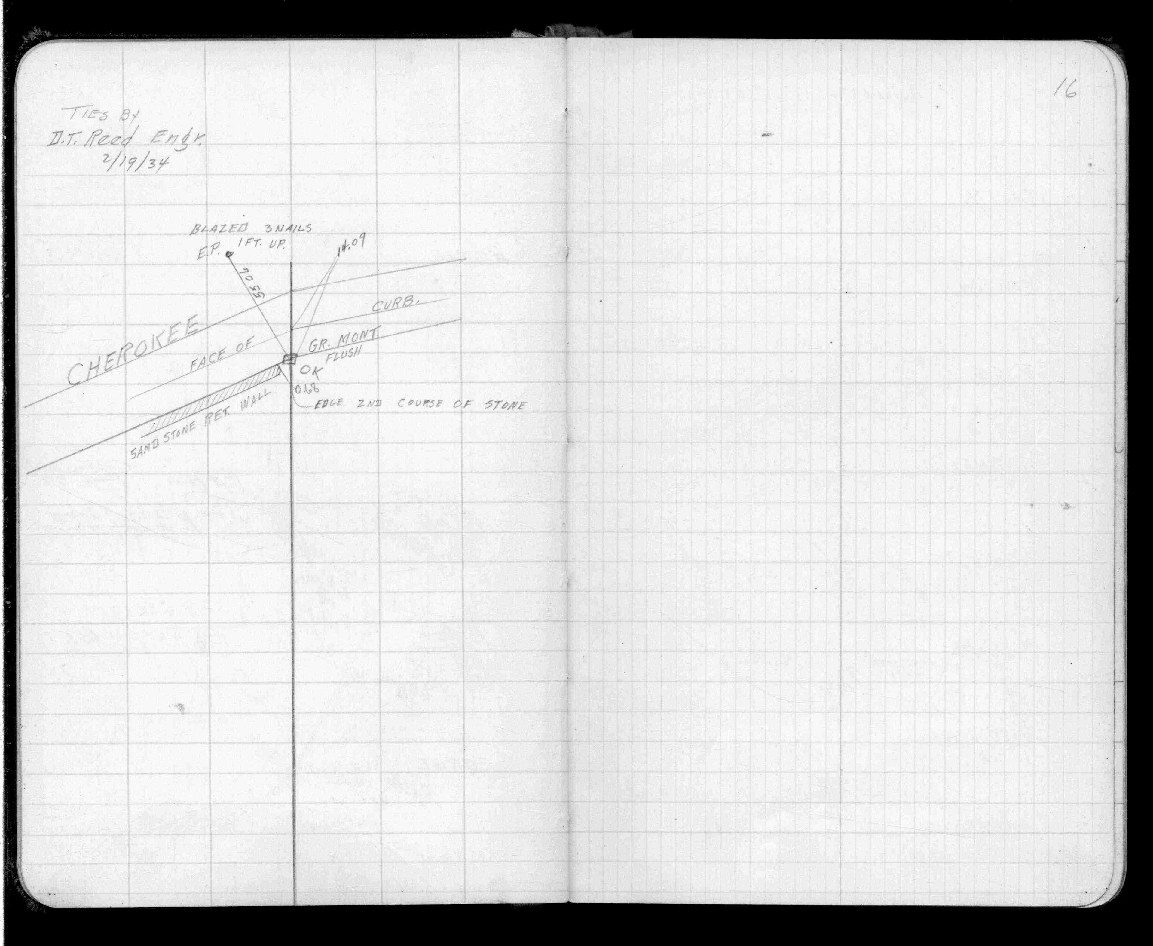
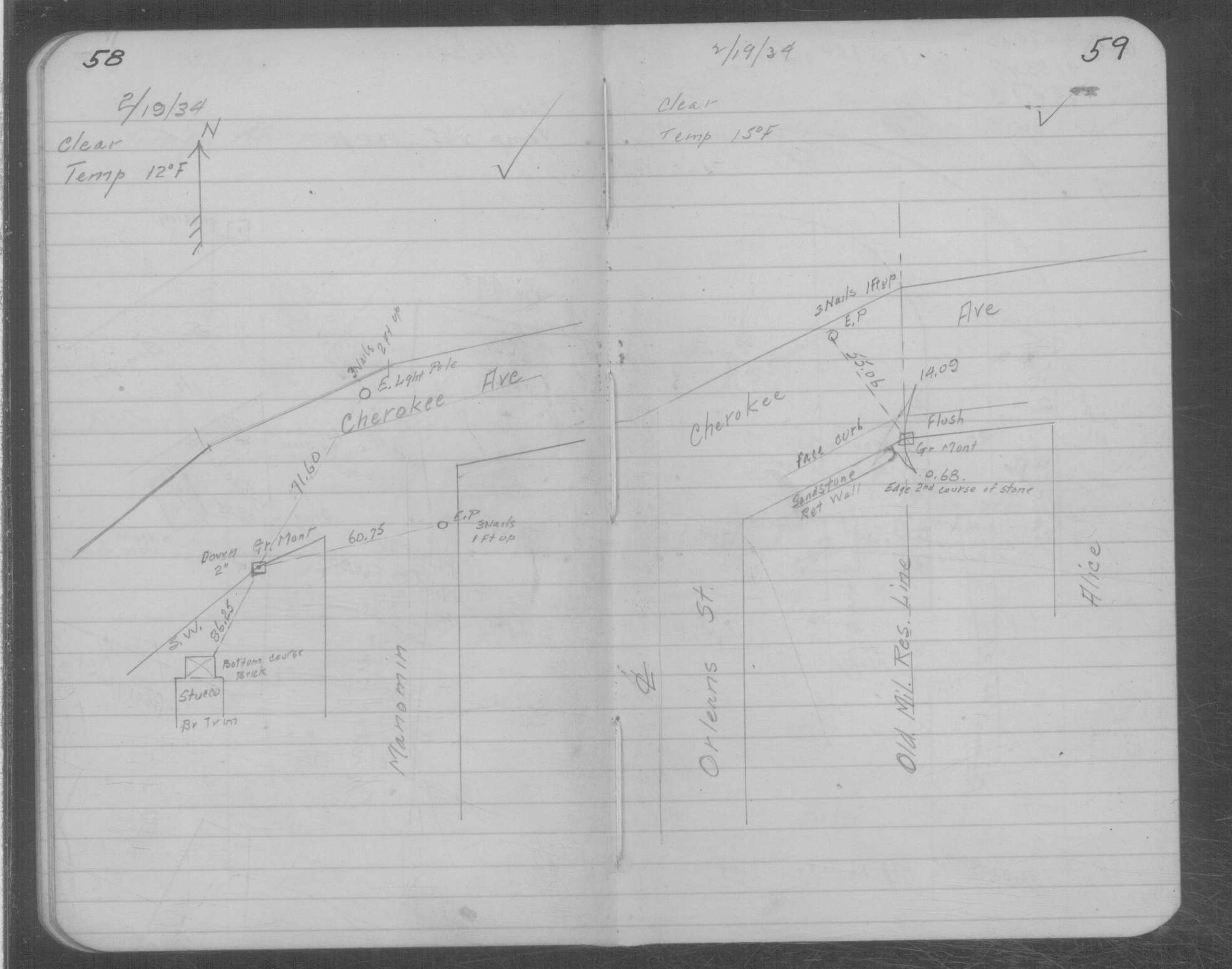
| 2/19/1934 | Ties to GM. See FB 1504 p.16 |
Above is NOT an all inclusive history of this point. Please review all the links below.
| PLS NOTES | Field | Cross Section | Sewer | J.B. Irvine | Monument | River Survey |
|---|---|---|---|---|---|---|
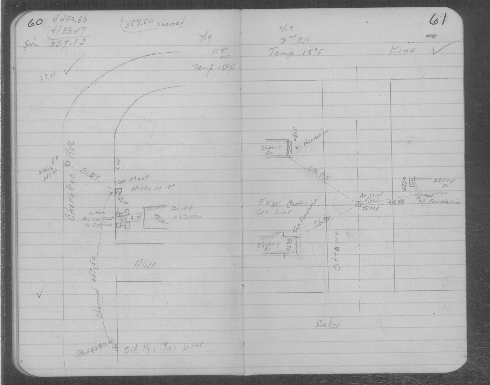
| FB 1504p.16 | MSX 0001 p.058-059 | |||||
| FB 1716p. 19 ,20 | MSX 0001 p.060-061 | |||||
| FB 1716p.20 |
| FILE | PHOTO DATE | COMMENTS |
|---|---|---|
| 2497-__gz-2.jpg | April 12, 2010 | Close up of iron showing relationship to GM tie. |
| 2497-__gz-1.jpg | April 12, 2010 | Close up of location showing iron. |