| NAD83 COORDINATES (1986 adj.): |
|---|
| X= 552089.332 Y= 143011.131 Z= 000.00 LSQ 02/15/1994 FLT |
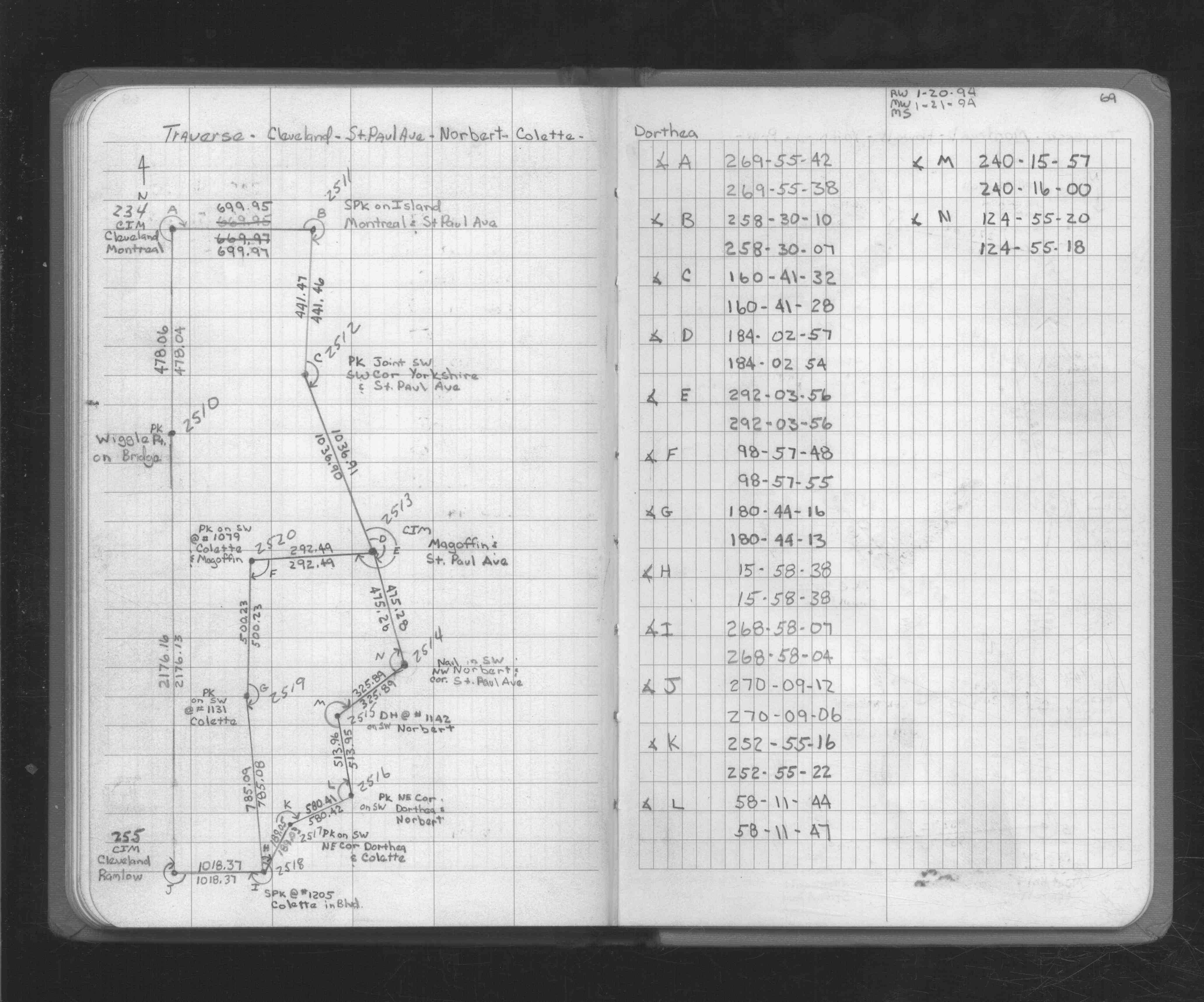
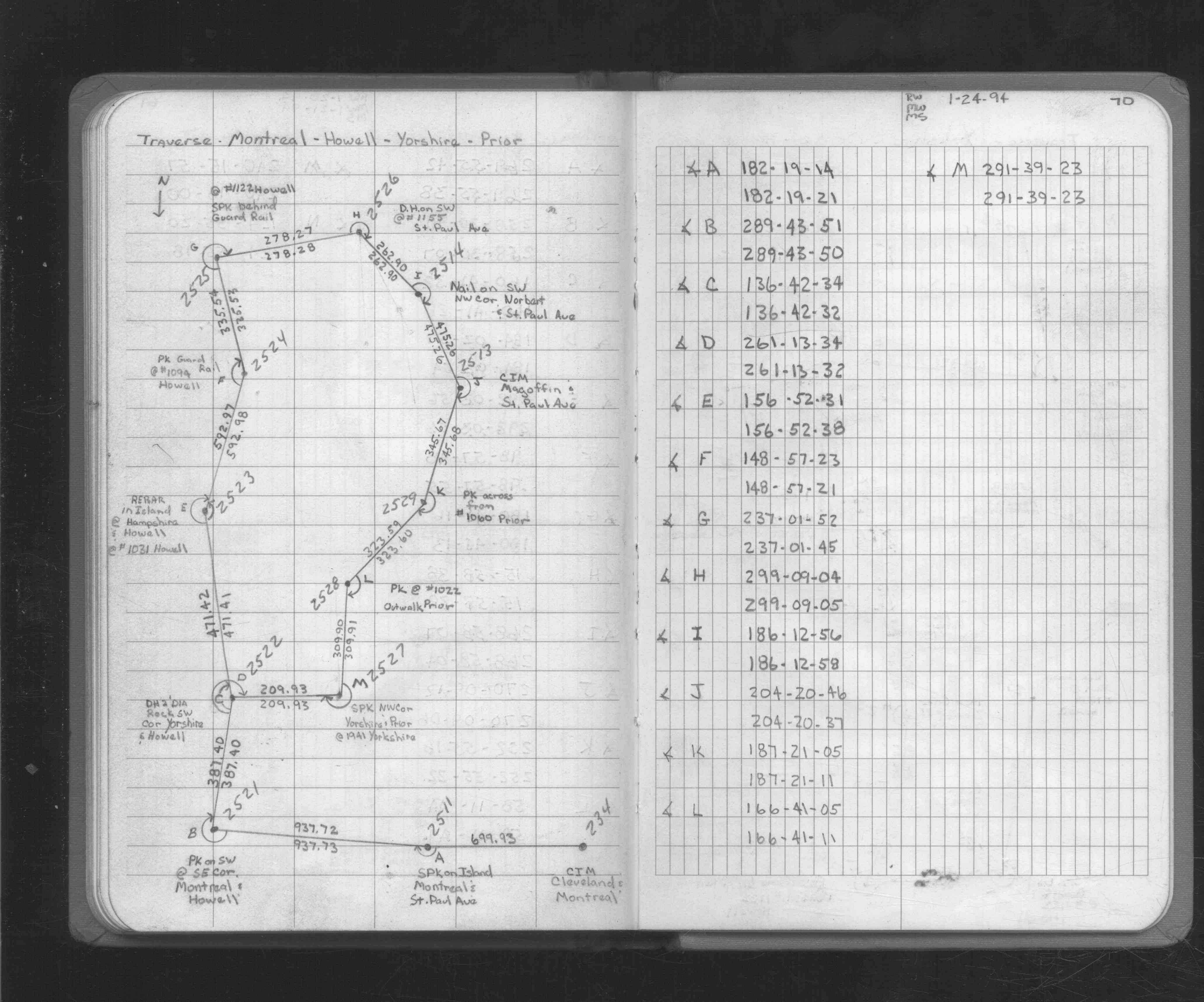
| 1/21/1994 | Traversed through CIM. See FB 1726 p.69,70 |
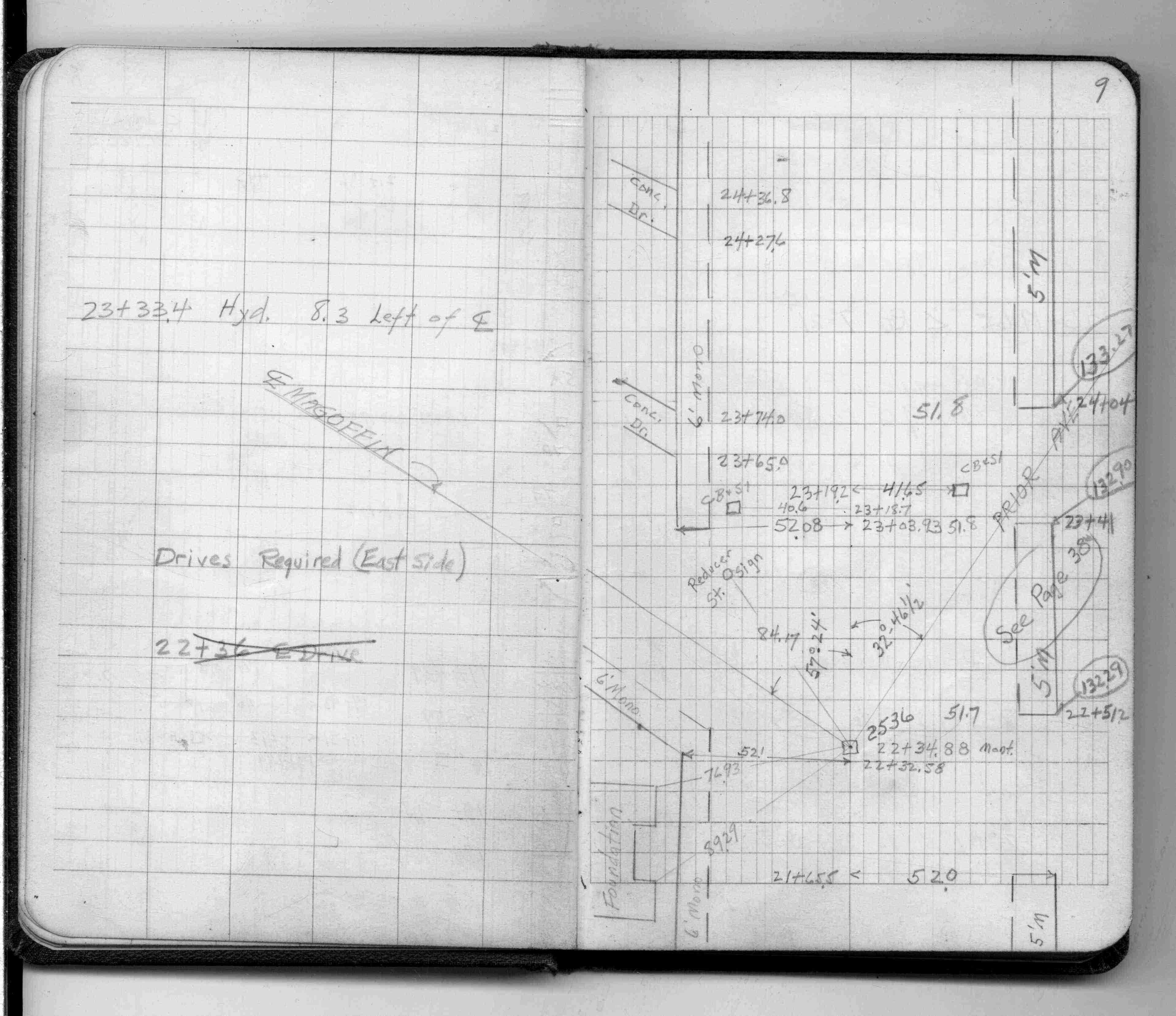
| 2/1/1956 | (Unknown date Feb __, 1956 ) Placed ties. See FB 1484 p.9 |
Above is NOT an all inclusive history of this point. Please review all the links below.
| PLS NOTES | Field | Cross Section | Sewer | J.B. Irvine | Monument | River Survey |
|---|---|---|---|---|---|---|
| FB 1484p.09 | ||||||
| FB 1726p. 69 ,70 |