| NAD83 COORDINATES (1986 adj.): |
|---|
| X= 563529.834 Y= 170663.701 Z= 000.00 PRO 08/22/1994 |
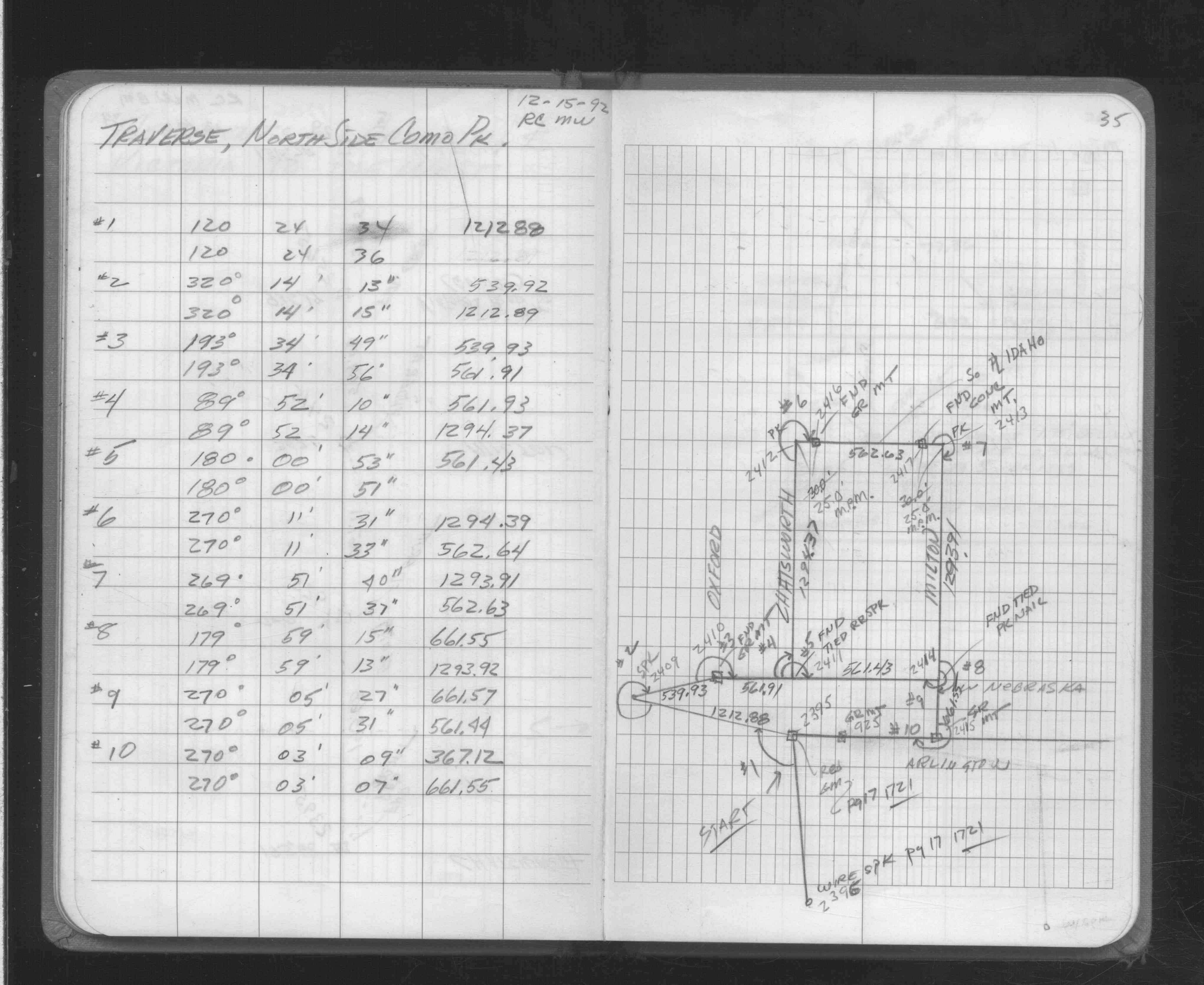
| 12/1/1992 | (Unknown date Dec __, 1992 ) Fd GM, traversed through GM. See FB 1706A p.35 |
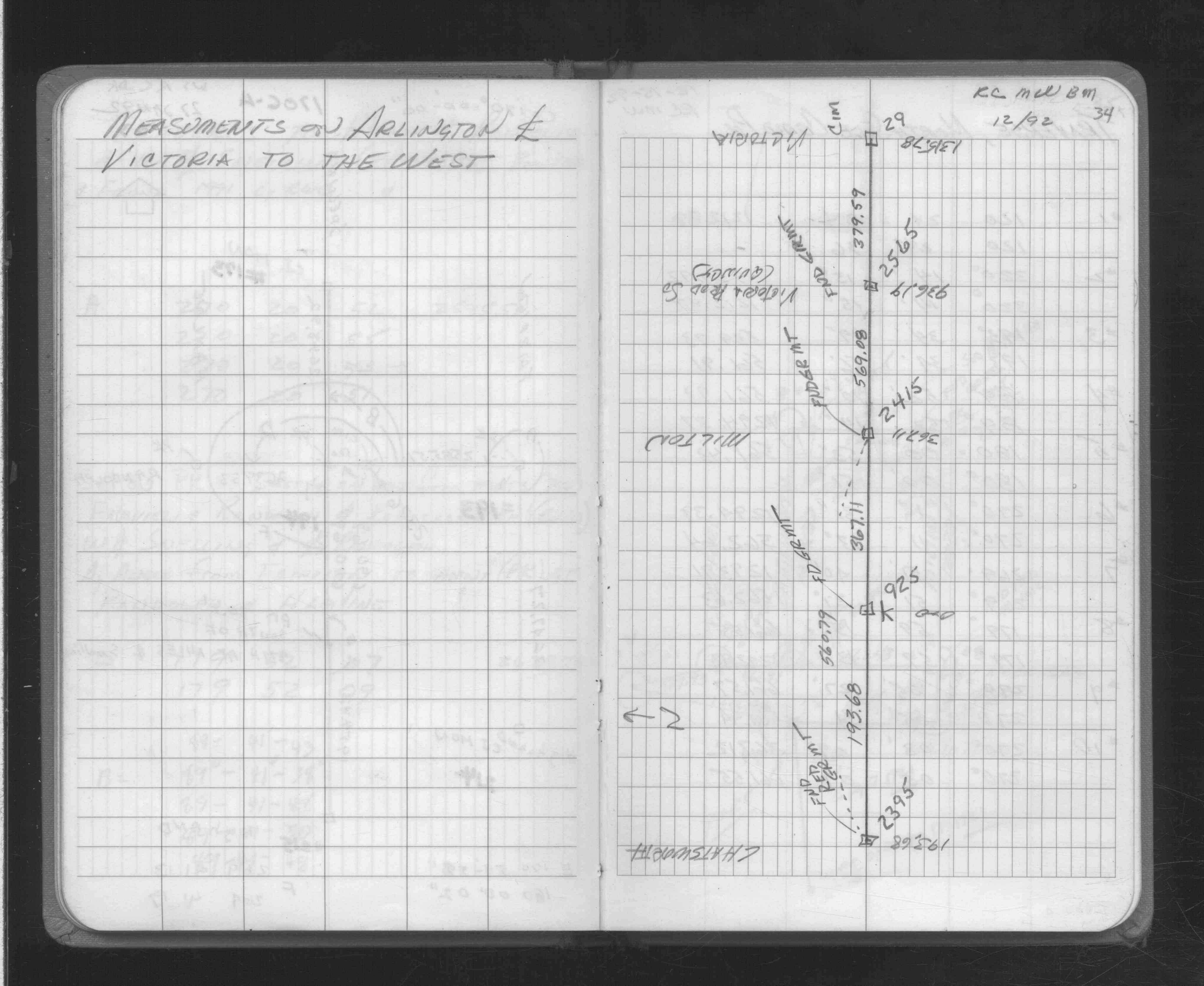
| 12/1/1992 | (Unknown date Dec __, 1992 ) Fd GM, measured distances on Arlington betwn monuments. See FB 1706A p.34 |
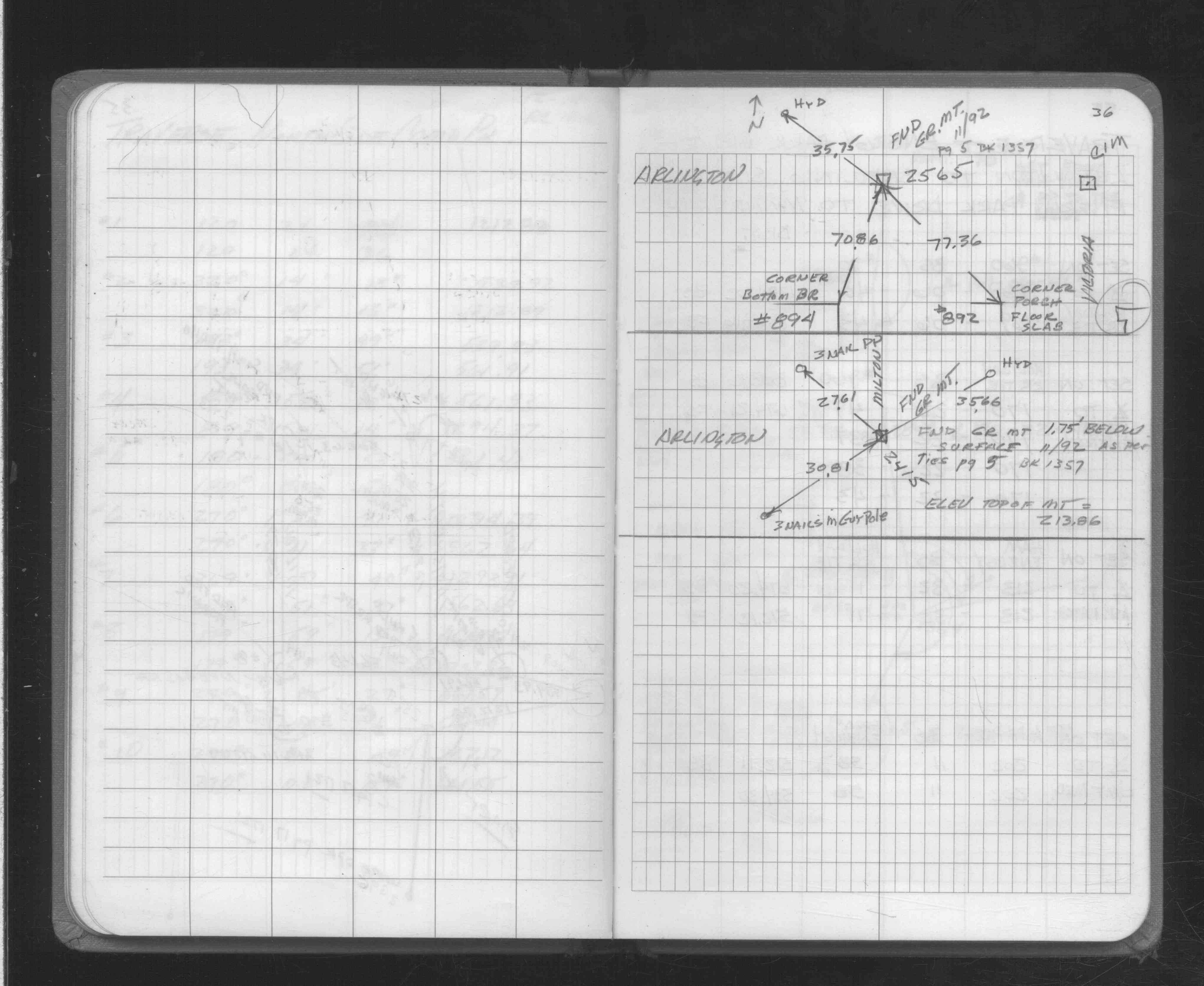
| 11/1/1992 | (Unknown date Nov __, 1992 ) Fd GM, placed ties. See FB 1706A p.36 |
| 6/1/1928 | Monument identified on plat for Stebbing's Como View shown to be on CL Arlington and 6.0 ft W of CL Quincy. |
| 12/28/1891 | Monument found to be 9.47 ft N of CL Arlington Ave. See FB 353 p.039-040 |
Above is NOT an all inclusive history of this point. Please review all the links below.
| PLS NOTES | Field | Cross Section | Sewer | J.B. Irvine | Monument | River Survey |
|---|---|---|---|---|---|---|
| FB 0353p.039-040 | ||||||
| FB 1357p. 02 ,05 | ||||||
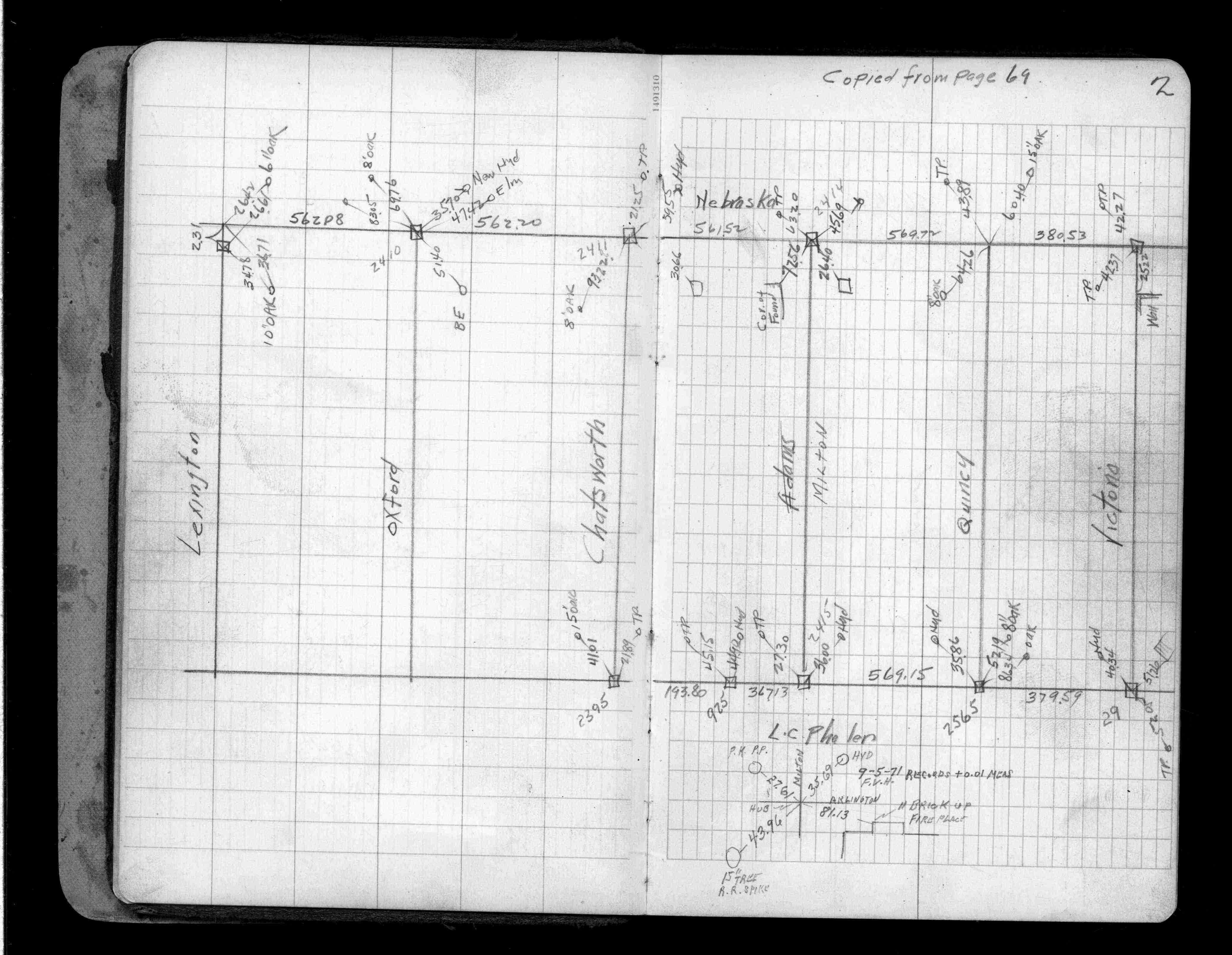
| FB 1706Ap.34 | ||||||
| FB 1706Ap.34 | ||||||
| FB 1706Ap.35 | ||||||
| FB 1706Ap.36 |