| NAD83 COORDINATES (1986 adj.): |
|---|
| X= 573519.825 Y= 155725.571 Z= 000.00 LSQ 09/22/1994 FLT |
| X= 573519.955 Y= 155725.597 Z= 000.00 LSQ 11/06/2001 STB |
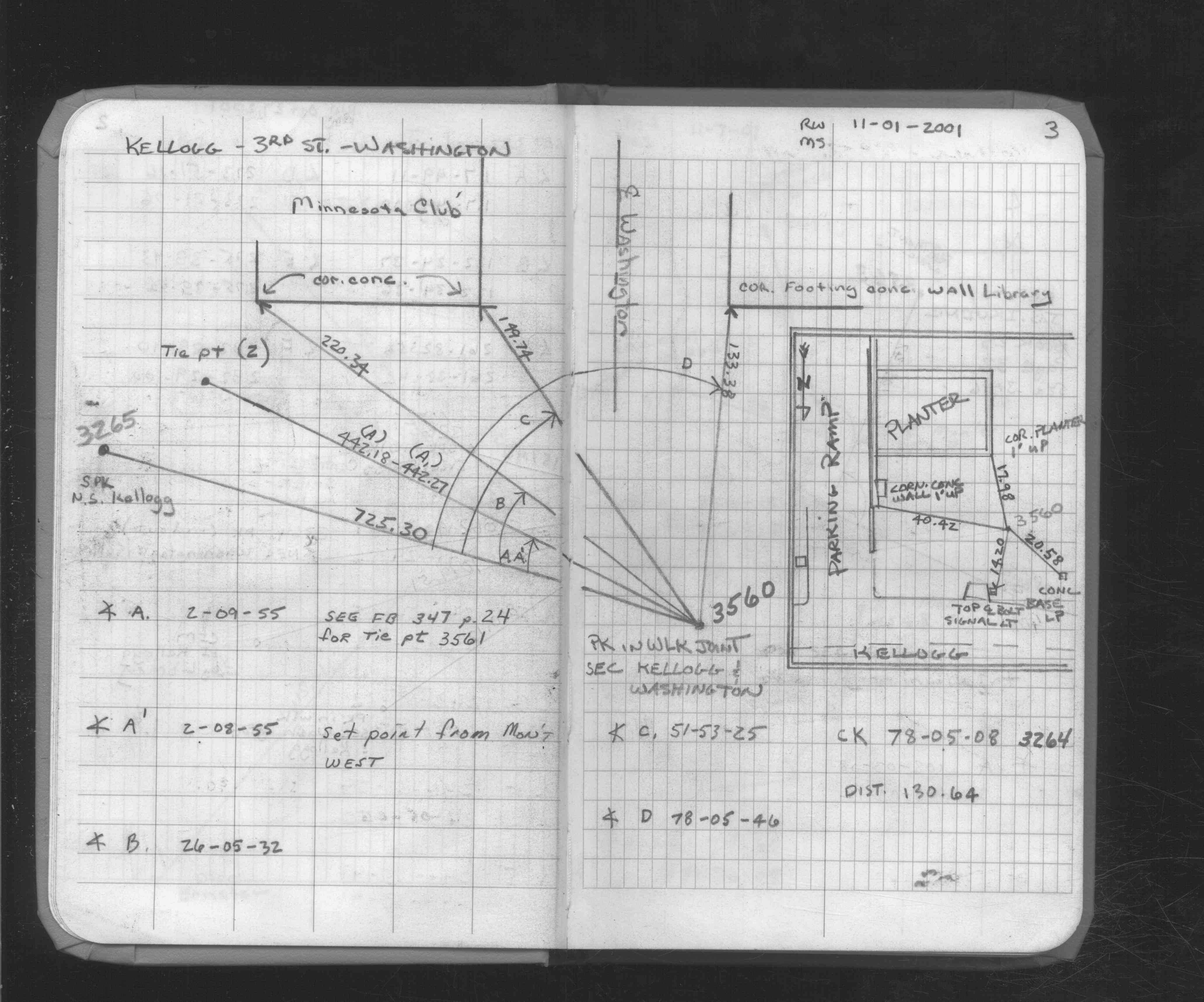
| 11/6/2001 | Set Brass Plug in concrete pavement using ties in FB 347 p.22 |
| 11/1/2001 | Set temporary point using ties in FB 347 p.22 |
| 11/1/2001 | Located tied point. See FB 1735 p.3 |
| 6/23/1995 | Removed asphalt surface down to concrete base. No monument found. |
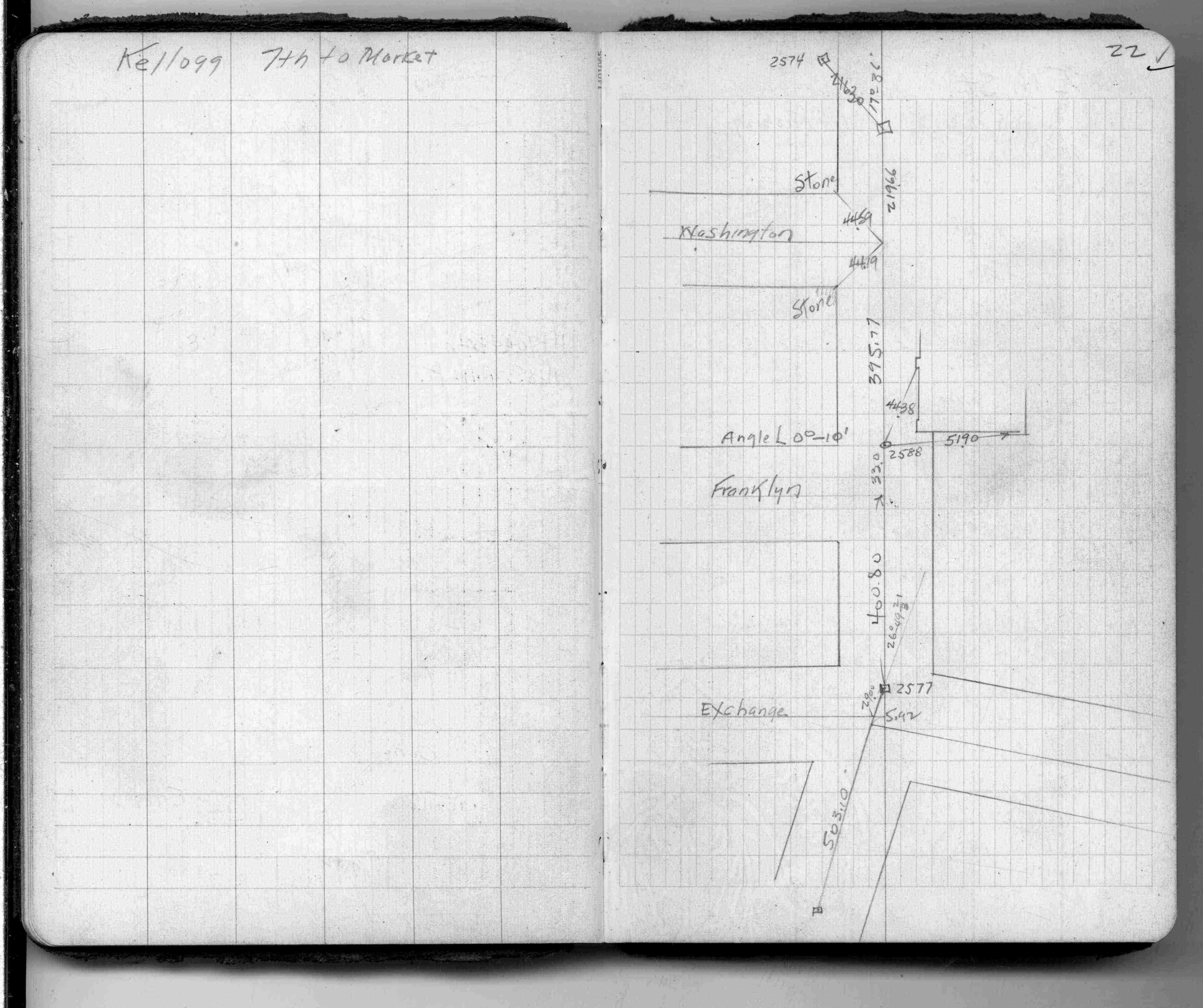
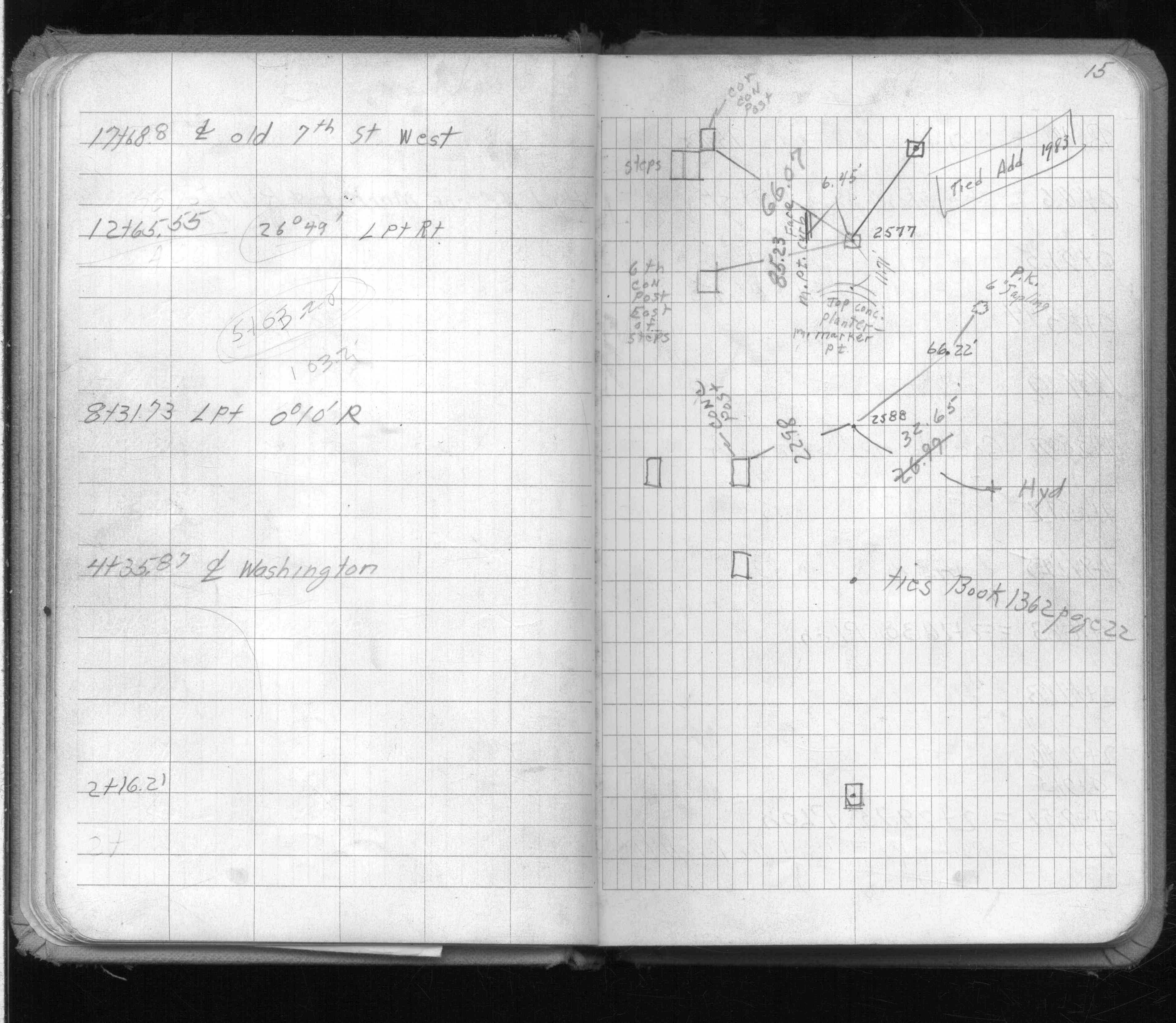
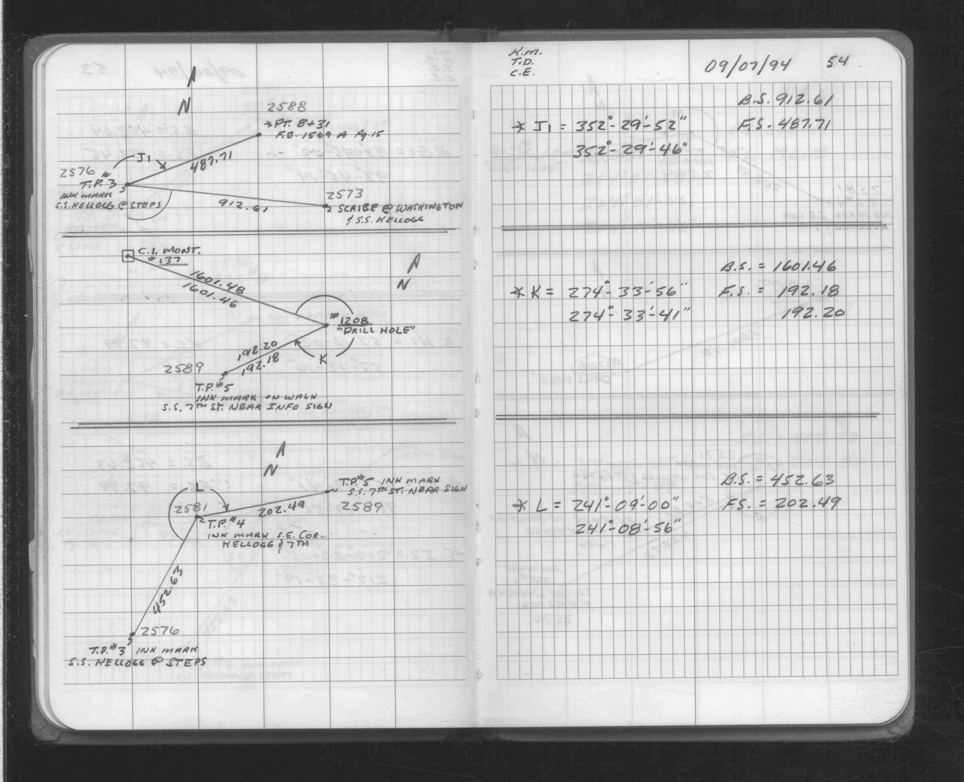
| 8/7/1994 | Coordinate on pk place by ties. See FB 1569A p.15 & FB 1362 p.22 |
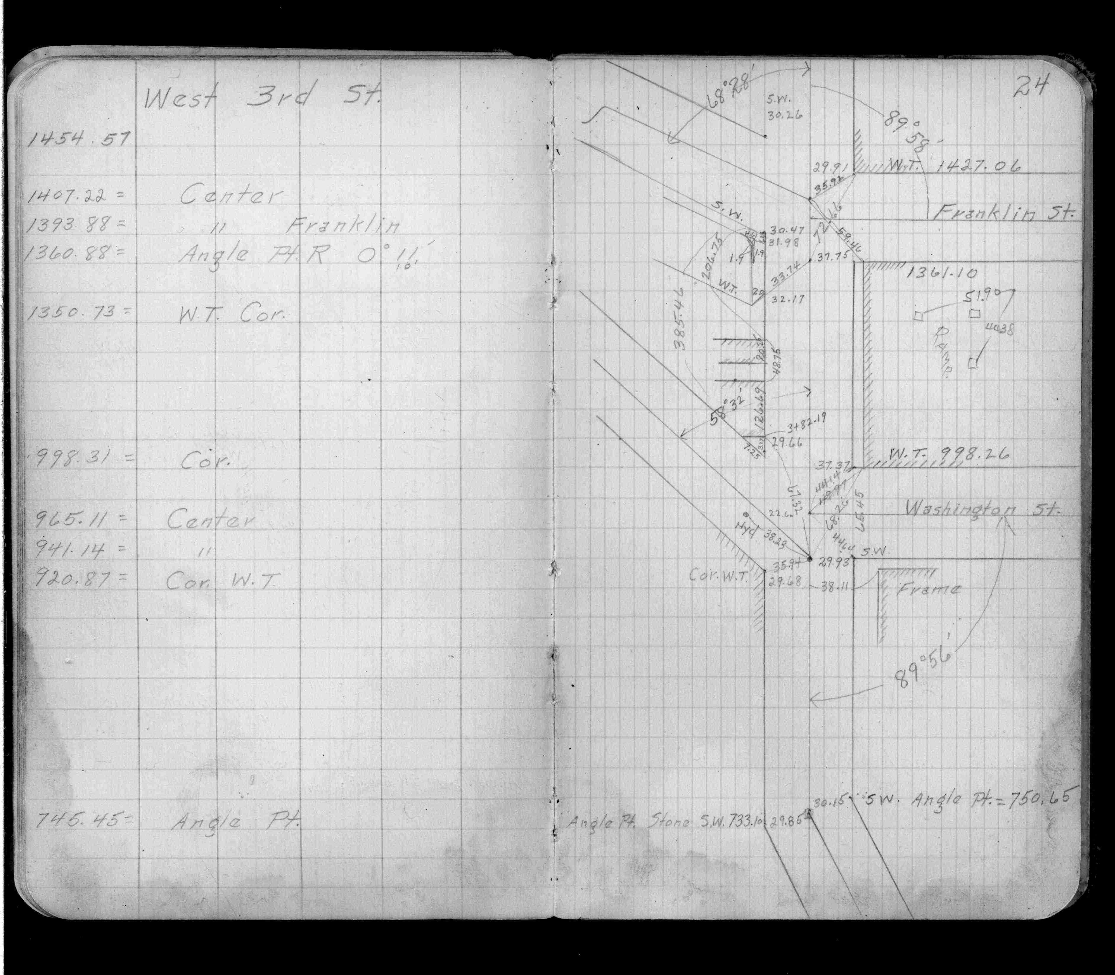
| 1/1/1800 | (Unknown date ___ __, ____ ) Placed ties. See FB 347 p.24 |
Above is NOT an all inclusive history of this point. Please review all the links below.
| PLS NOTES | Field | Cross Section | Sewer | J.B. Irvine | Monument | River Survey |
|---|---|---|---|---|---|---|
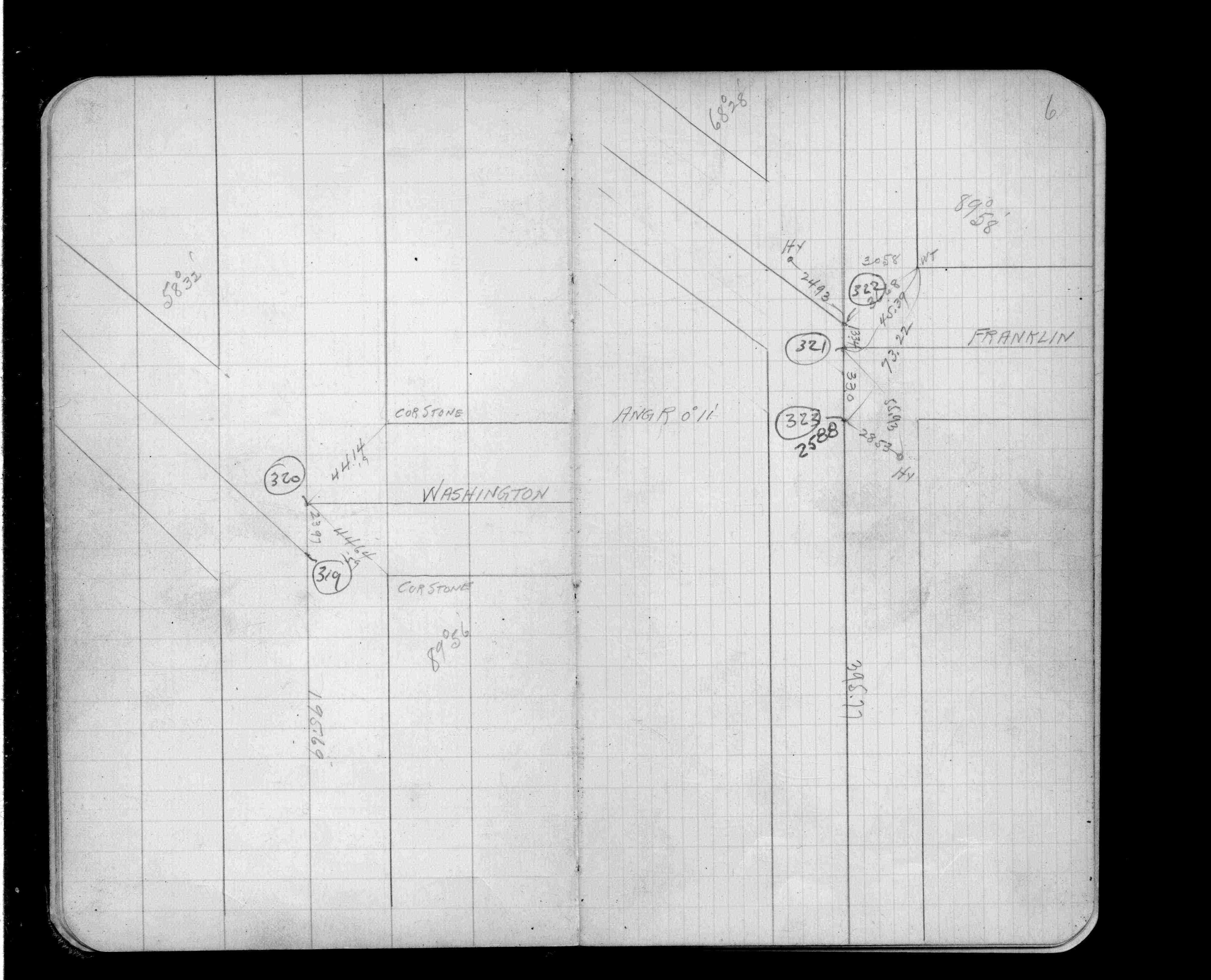
| FB 0347p.24 | ||||||
| FB 0347p.24 | ||||||
| FB 1198Ap.06 | ||||||
| FB 1362p.22 | ||||||
| FB 1569Ap.15 | ||||||
| FB 1708Ap.54 | ||||||
| FB 1735p.03 | ||||||
| FB 1735p.03 |
| FILE | SURVEYOR | LIC. NO. | DATE SIGNED | DATE TIED |
|---|---|---|---|---|
| 2588-xxxx-A.tif | Jeffery L. Grosso | 13144 | November 26, 2001 | November 7, 2001 |