| NAD83 COORDINATES (1986 adj.): |
|---|
| X= 565445.470 Y= 149599.208 Z= 000.00 LSQ 11/04/1994 DBL |
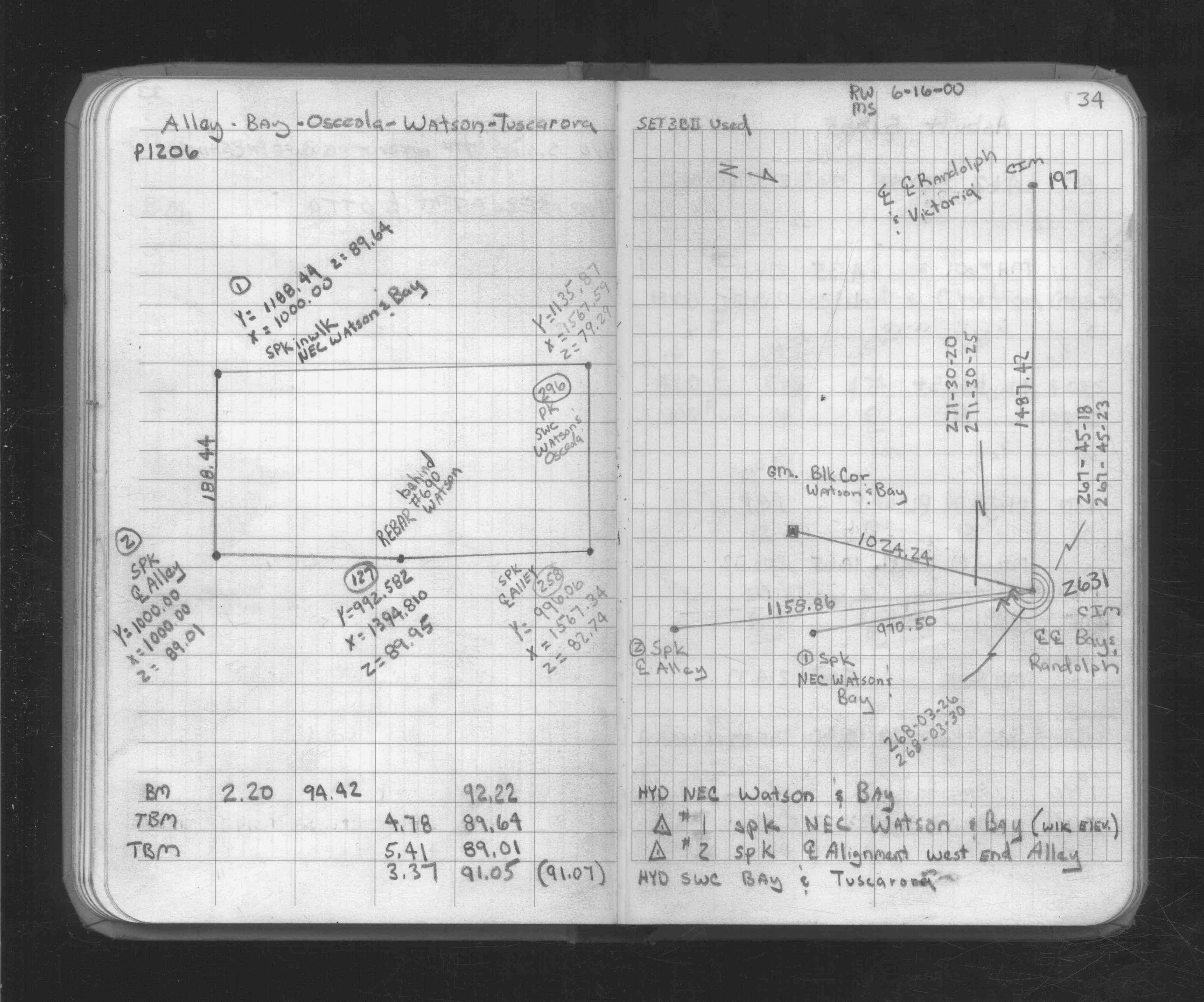
| 6/16/2000 | Fd CIM. See FB 1734A p.34 |
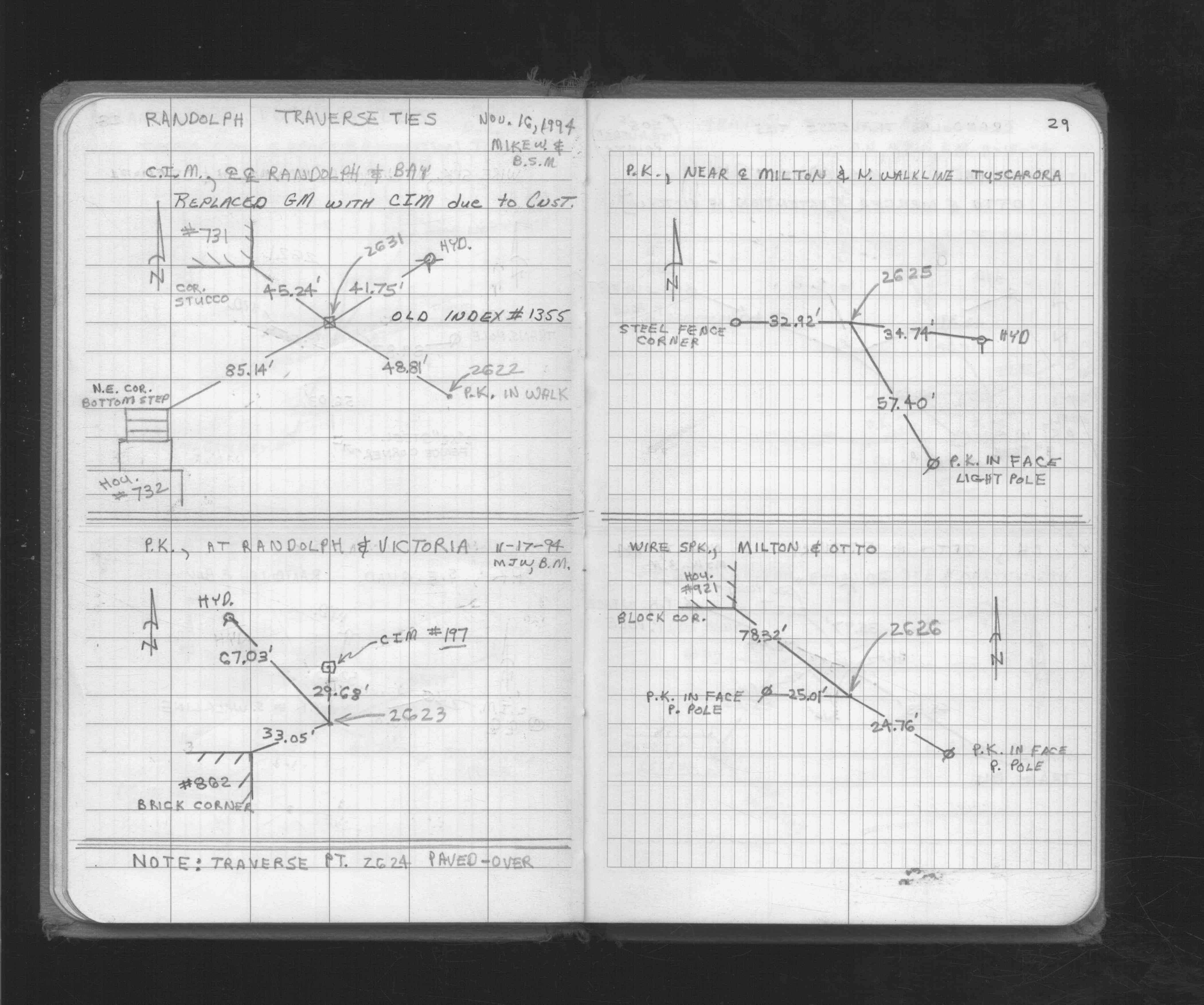
| 11/16/1994 | Set CIM, placed ties on CIM. See FB 1716 p.29 |
| 10/20/1994 | GM removed during construction. |
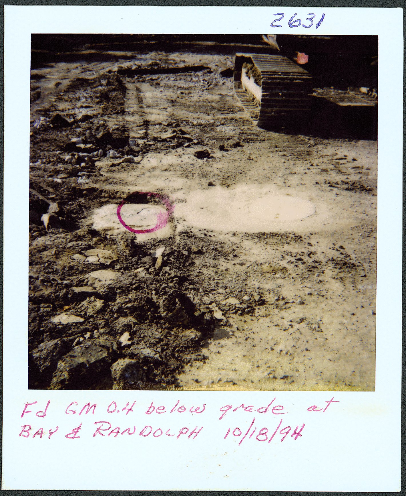
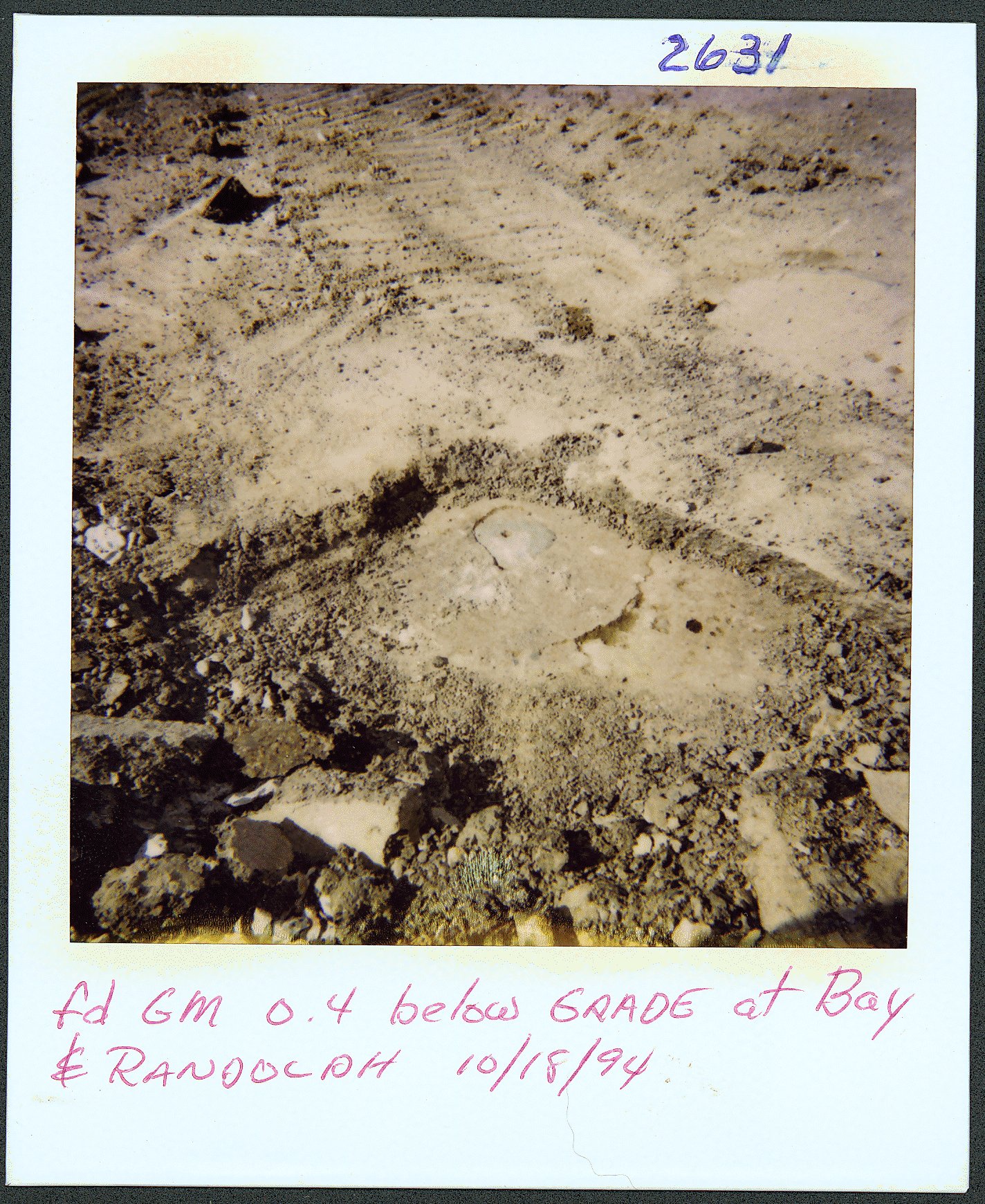
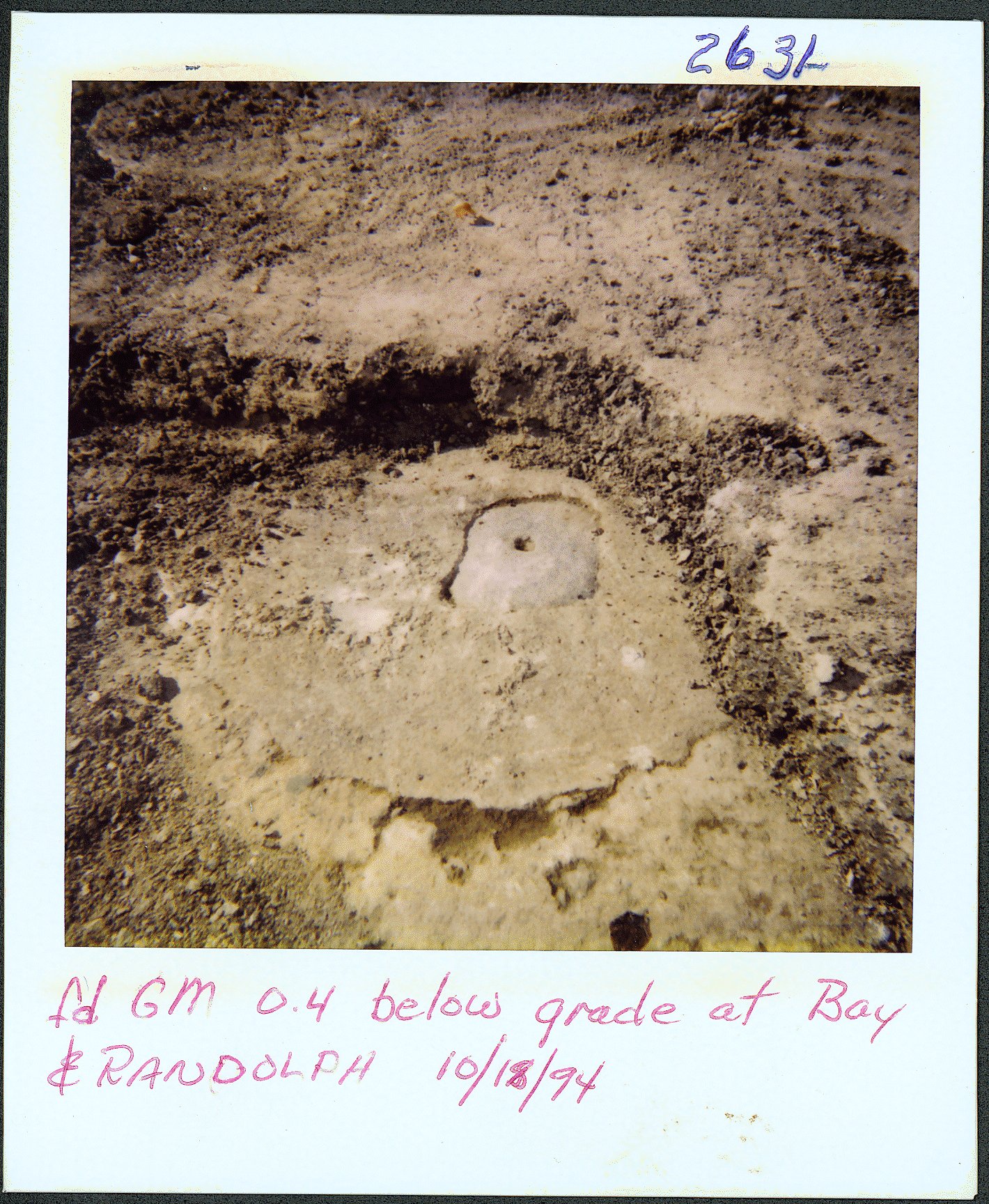
| 10/18/1994 | Photos taken of GM. |
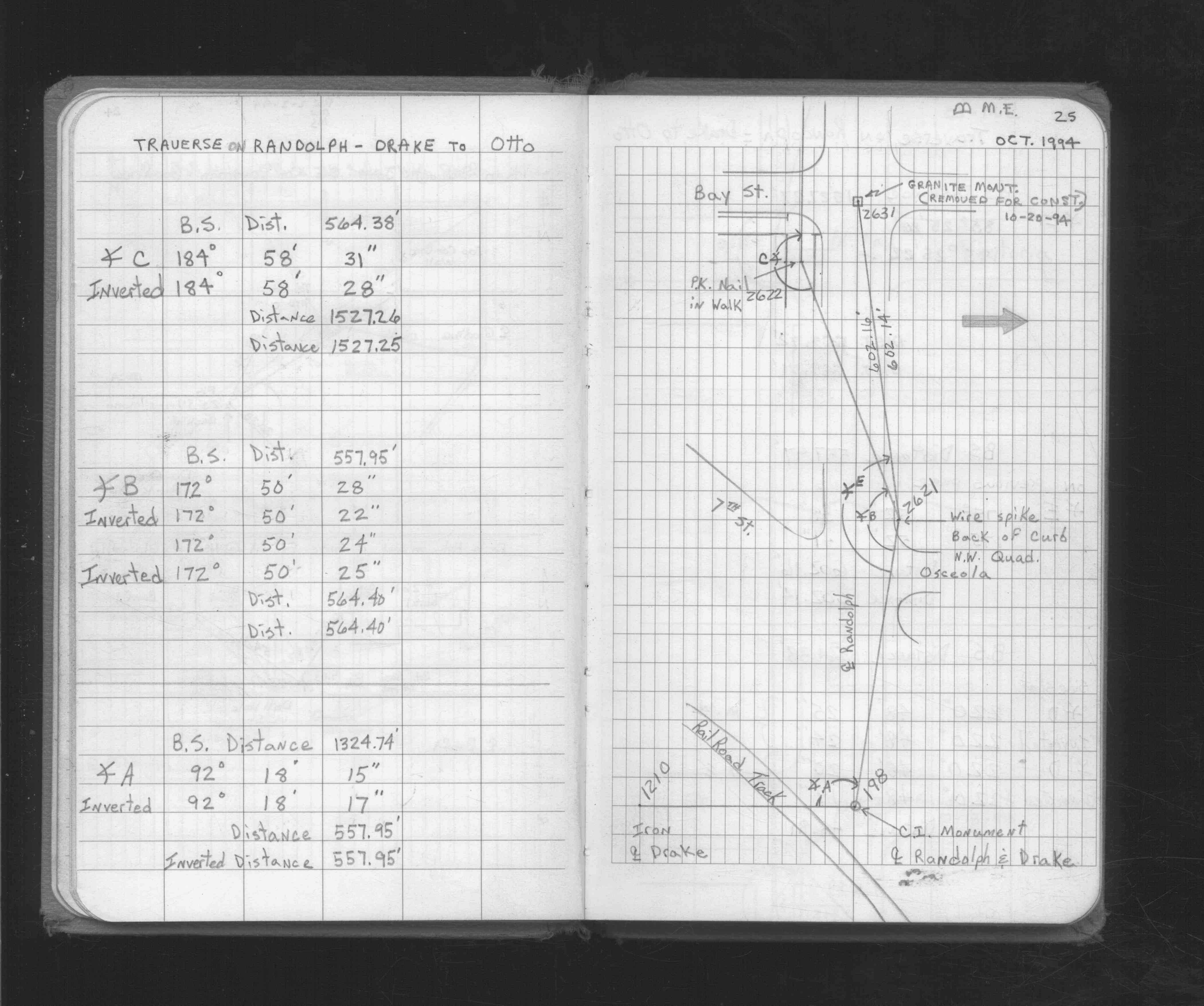
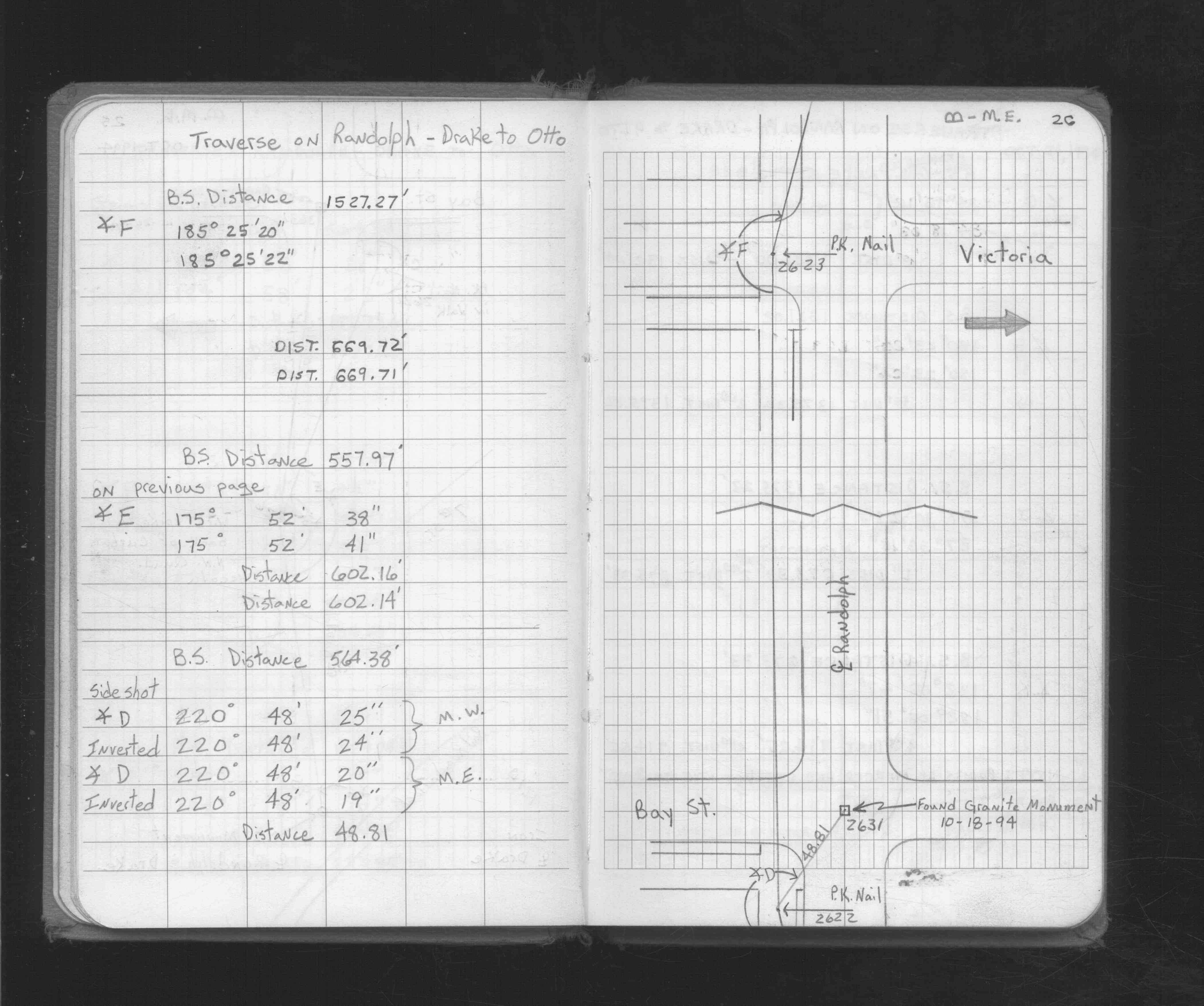
| 10/18/1994 | Located by traverse (double stubbed). See FB 1716 p.25,26 |
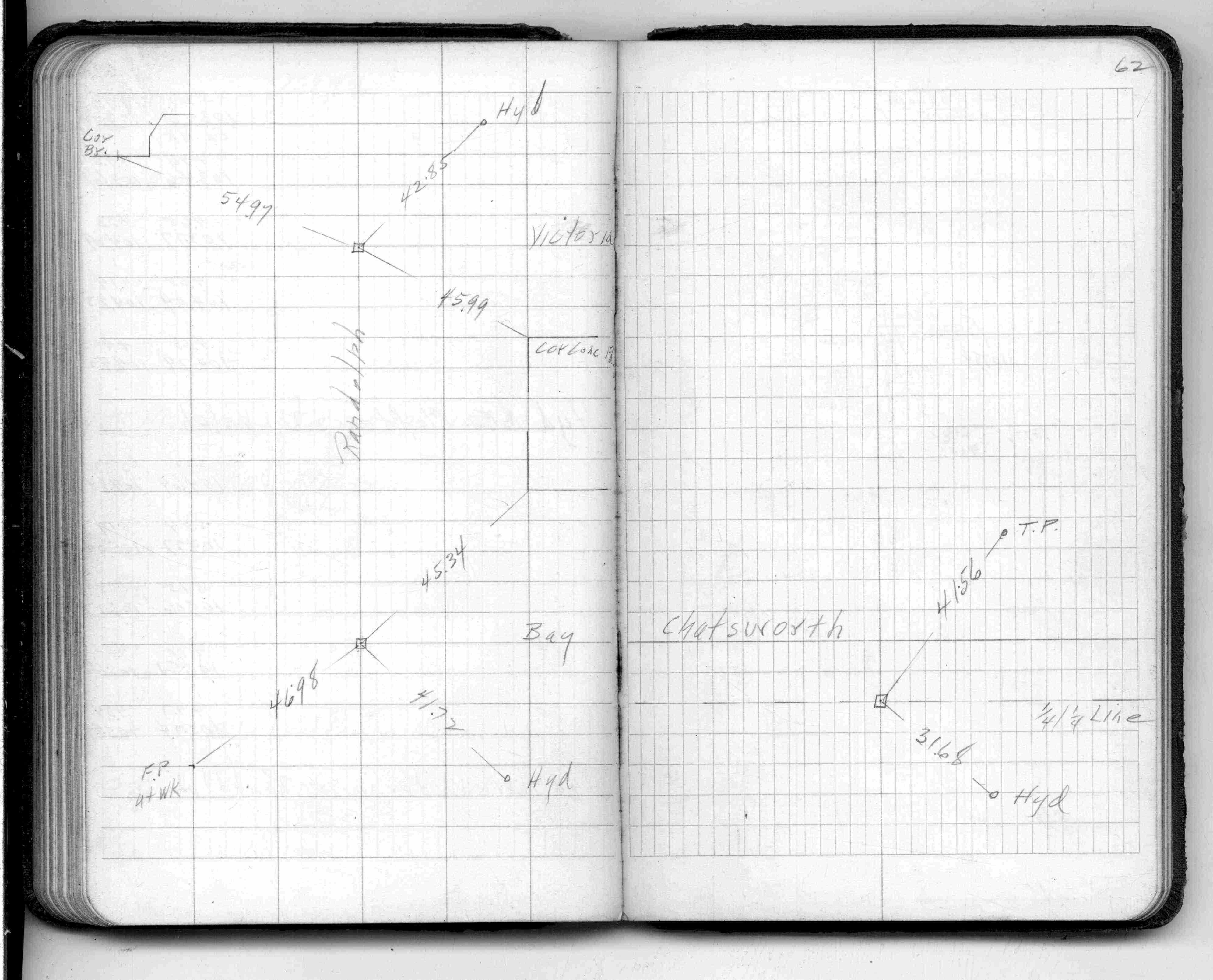
| 5/1/1961 | (Unknown date May __, 1961 ) Placed ties. See FB 1384 p.62 |
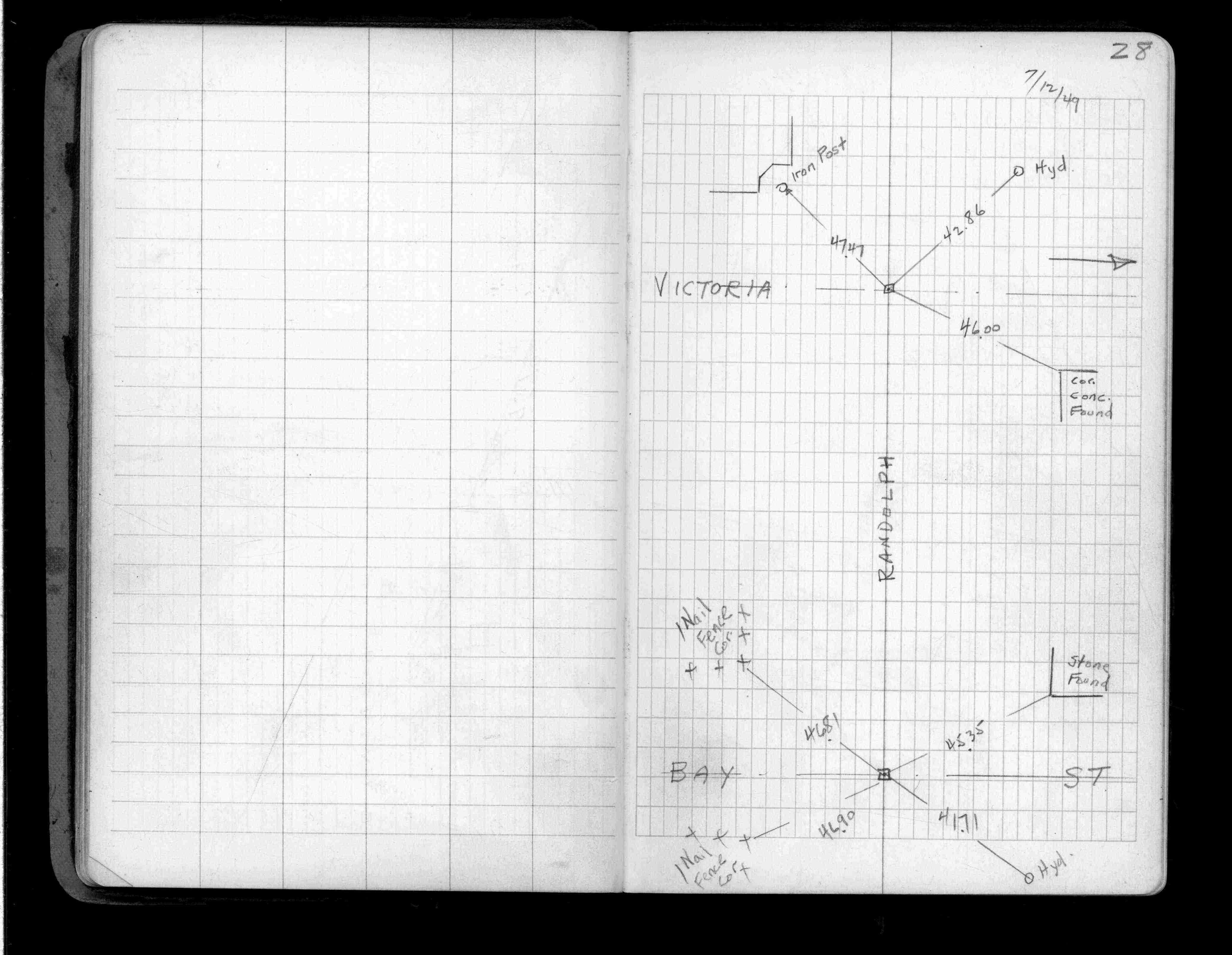
| 7/1/1949 | (Unknown date Jul __, 1949 ) Placed ties. See FB 1357 p.28 |
| 8/31/1889 | Monument reset by Chas Hunt after grading. |
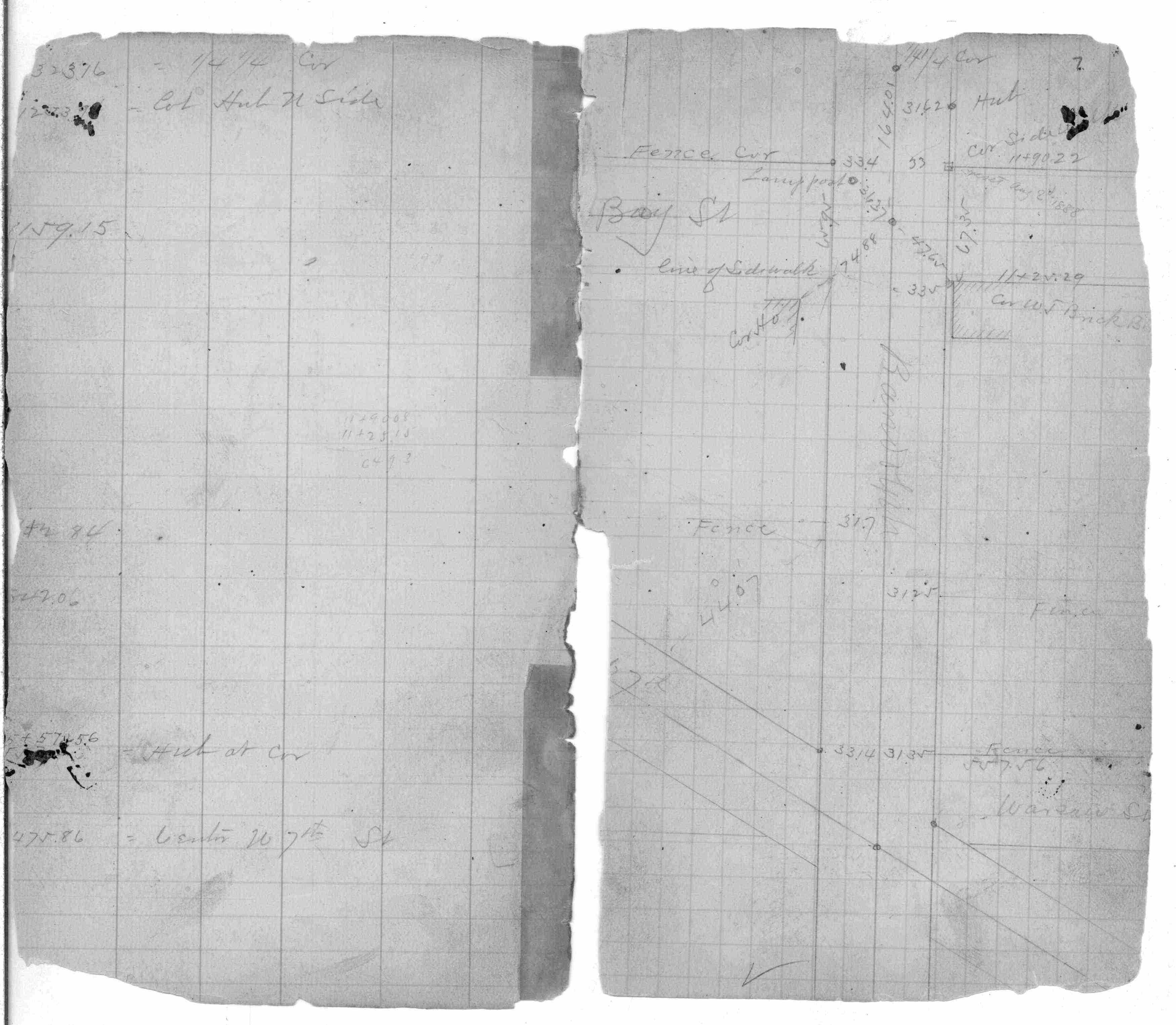
| 7/17/1888 | Monument set by J H Armstrong See FB 258 p.7 |
Above is NOT an all inclusive history of this point. Please review all the links below.
| PLS NOTES | Field | Cross Section | Sewer | J.B. Irvine | Monument | River Survey |
|---|---|---|---|---|---|---|
| FB 0258p.07 | ||||||
| FB 1357p.28 | ||||||
| FB 1384p.62 | ||||||
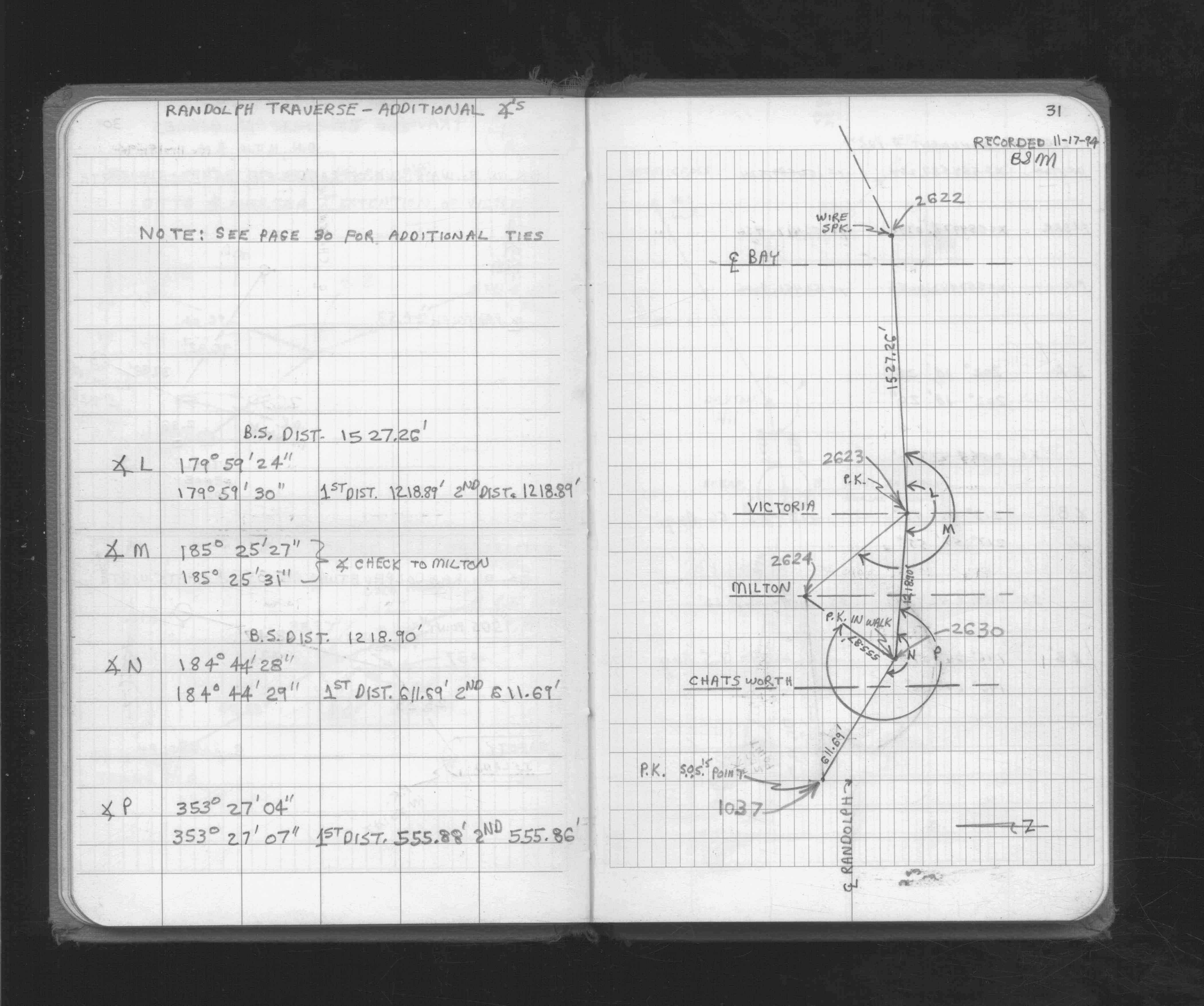
| FB 1716p. 25 ,26 ,29 ,31 | ||||||
| FB 1734Ap.34 |
| FILE | PHOTO DATE | COMMENTS |
|---|---|---|
| 2631-1355A-3.jpg | October 18, 1994 | Found GM 0.4' below grade at Bay & Randolph. |
| 2631-1355A-2.jpg | October 18, 1994 | Found GM 0.4' below grade at Bay & Randolph. |
| 2631-1355A-1.jpg | October 18, 1994 | Close up of GM |