| NAD83 COORDINATES (1986 adj.): |
|---|
| X= 569247.553 Y= 154916.018 Z= 000.00 LSQ 02/08/1995 STB |
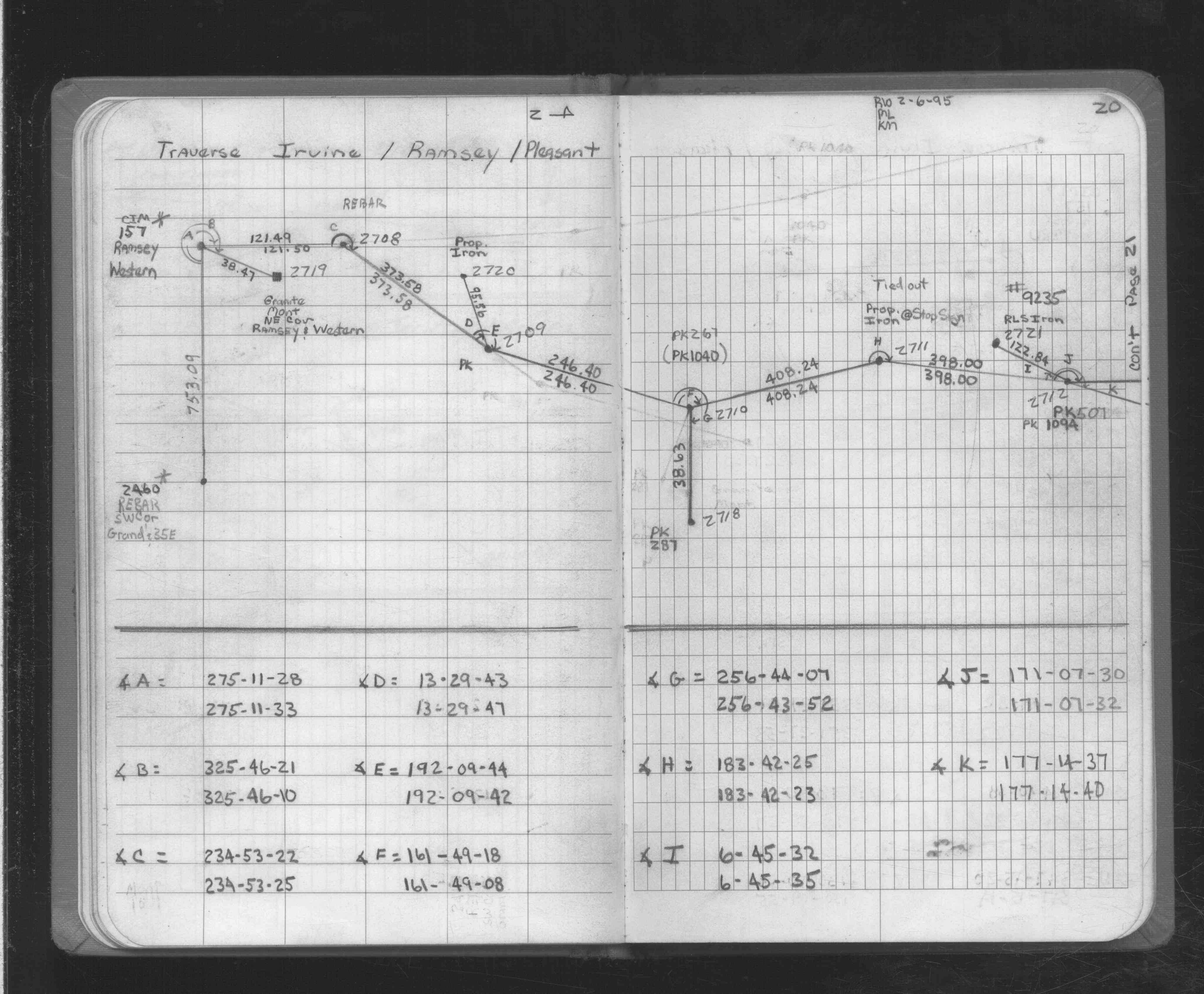
| 2/6/1995 | Located GM by traverse (single stub). See FB 1725 p.20 |
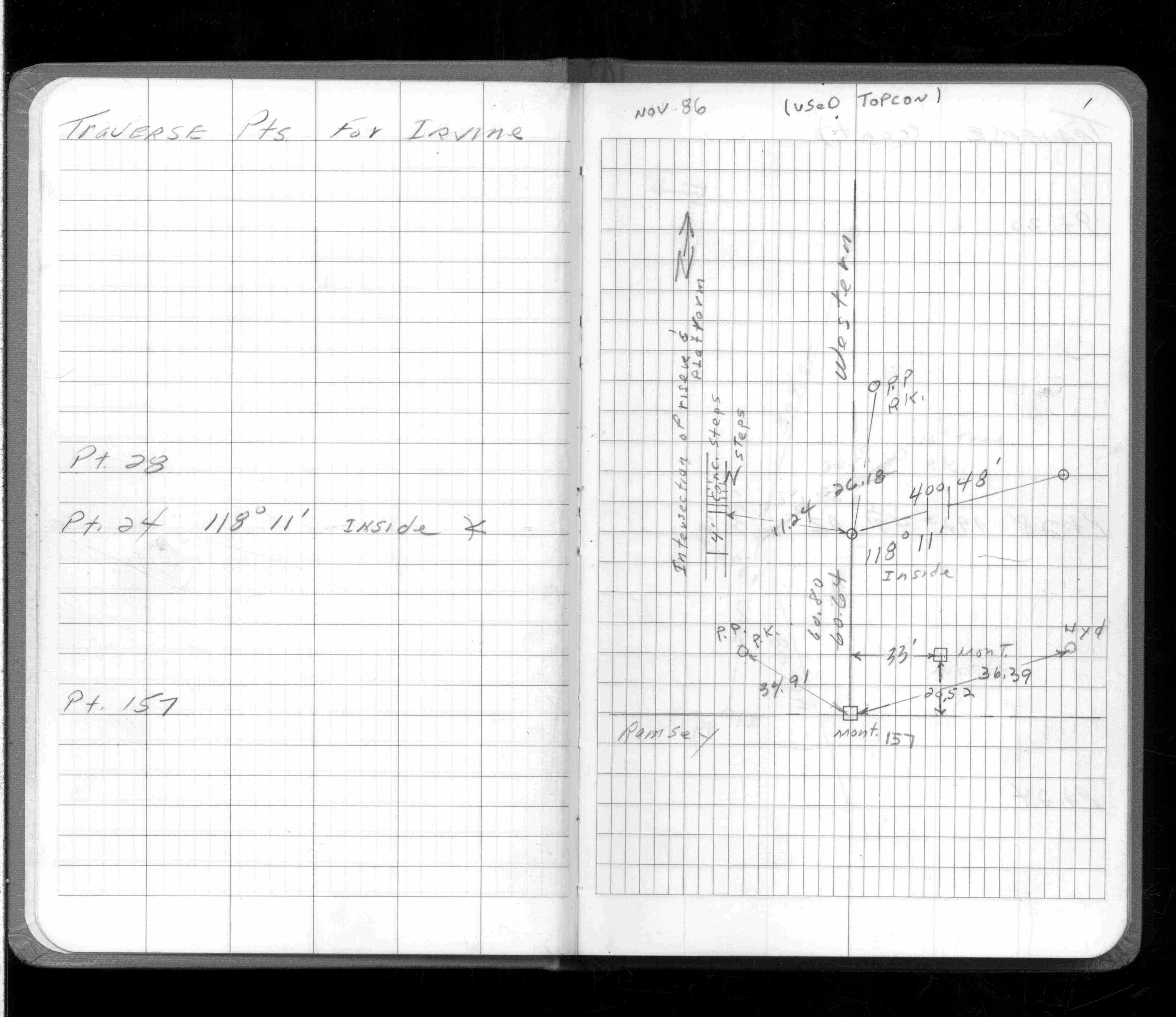
| 11/1/1986 | (Unknown date Nov __, 1986 ) Fd monument. See FB 1234B p.1 |
Above is NOT an all inclusive history of this point. Please review all the links below.
| PLS NOTES | Field | Cross Section | Sewer | J.B. Irvine | Monument | River Survey |
|---|---|---|---|---|---|---|
| FB 1234Bp.01 | ||||||
| FB 1725p.20 | ||||||
| FB 1725p.20 |