| NAD83 COORDINATES (1986 adj.): |
|---|
| X= 569819.000 Y= 155198.150 Z= 000.00 LSQ 02/08/1995 STB |
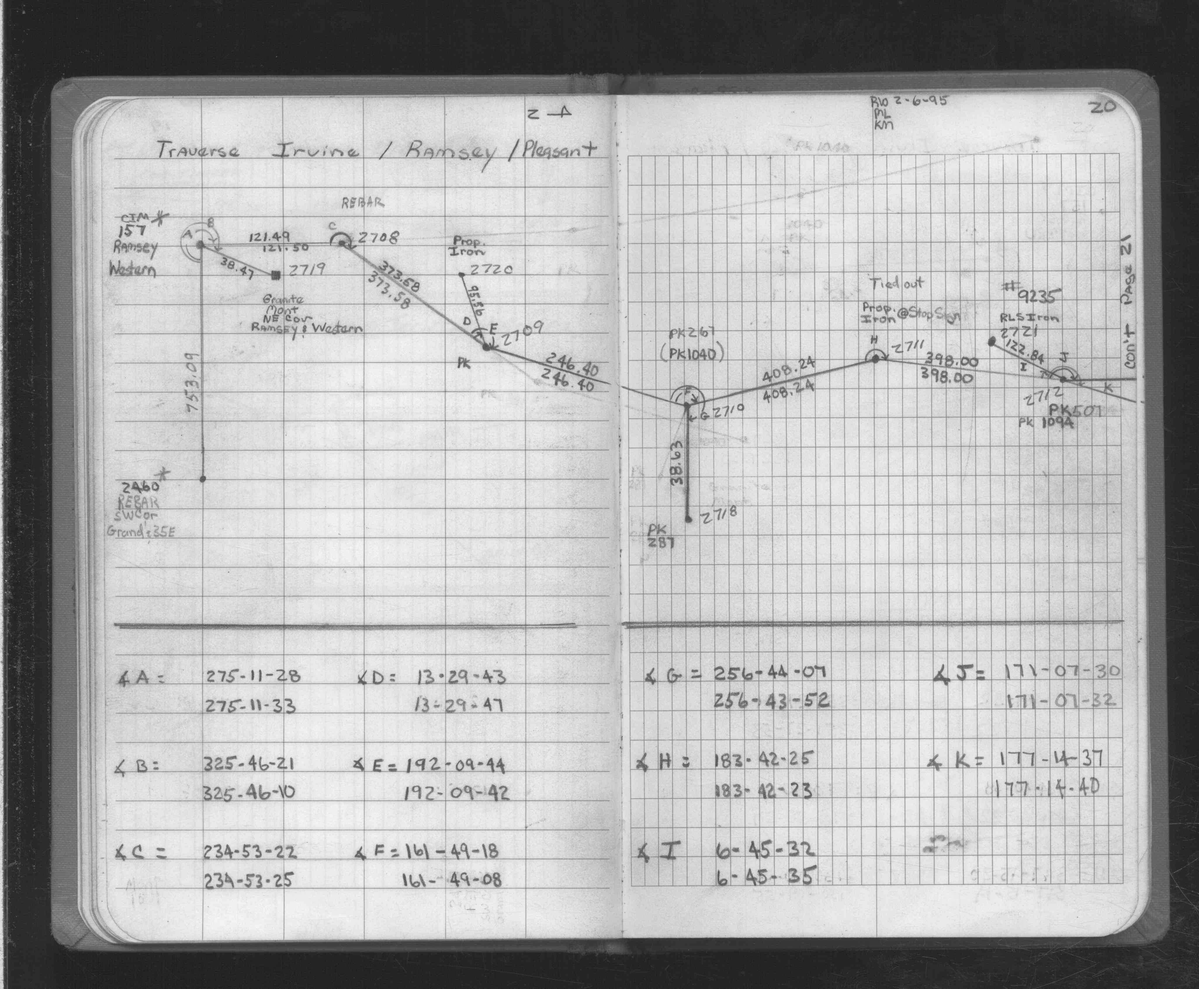
| 2/7/1995 | Located GM by traverse (single stub). See FB 1725 p.20 |
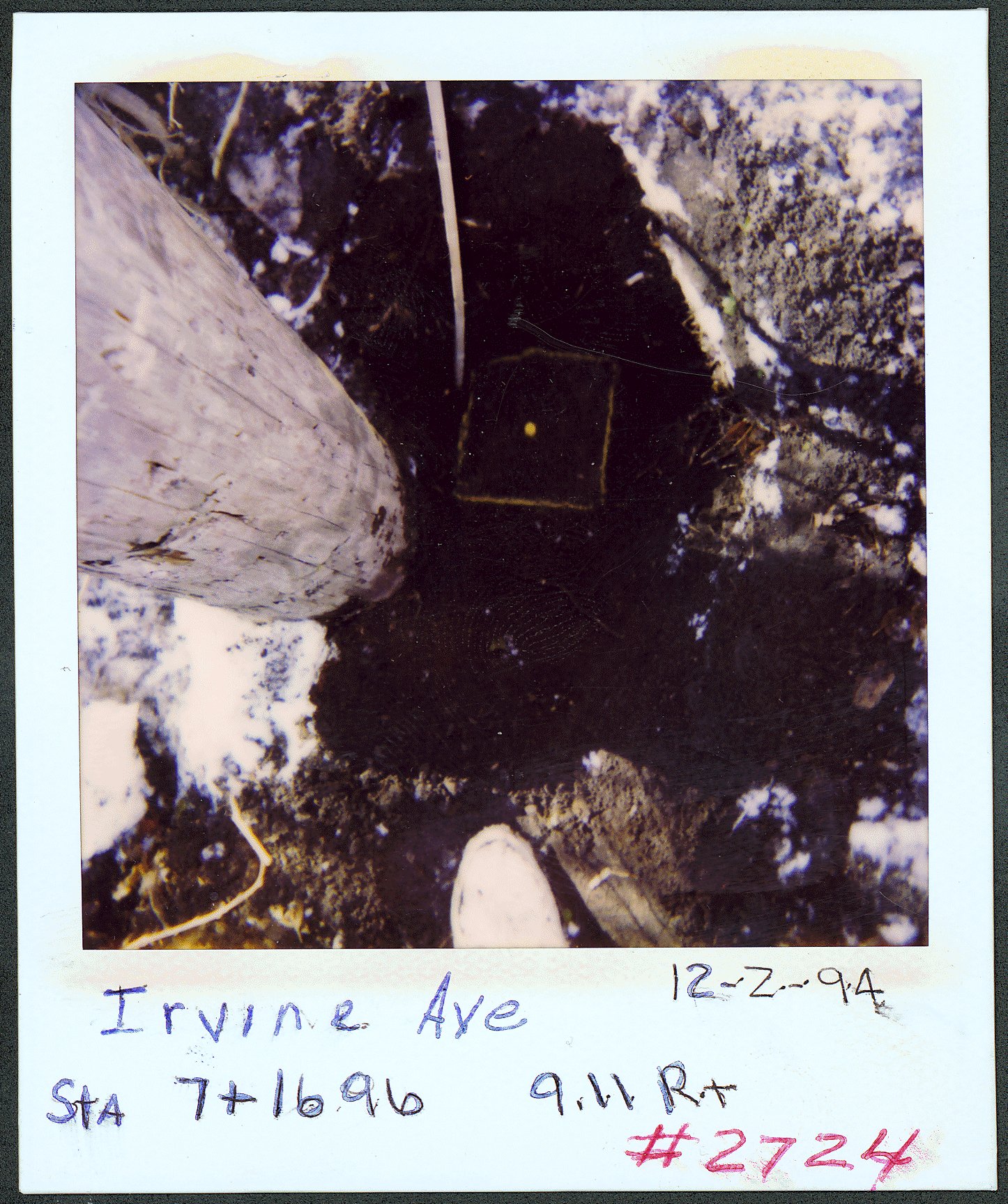
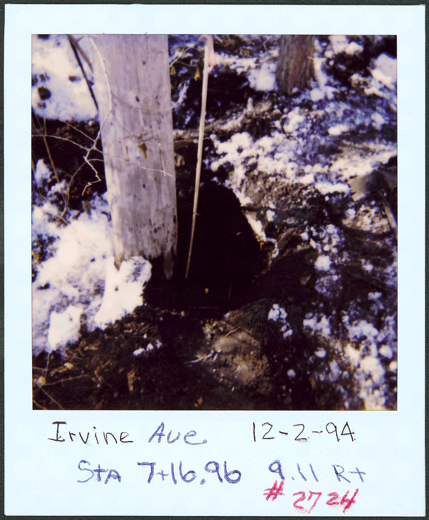
| 12/2/1994 | Placed ties on GM 1.0 ft below grade. See CofL 2724-__hi-A |
Above is NOT an all inclusive history of this point. Please review all the links below.
| PLS NOTES | Field | Cross Section | Sewer | J.B. Irvine | Monument | River Survey |
|---|---|---|---|---|---|---|
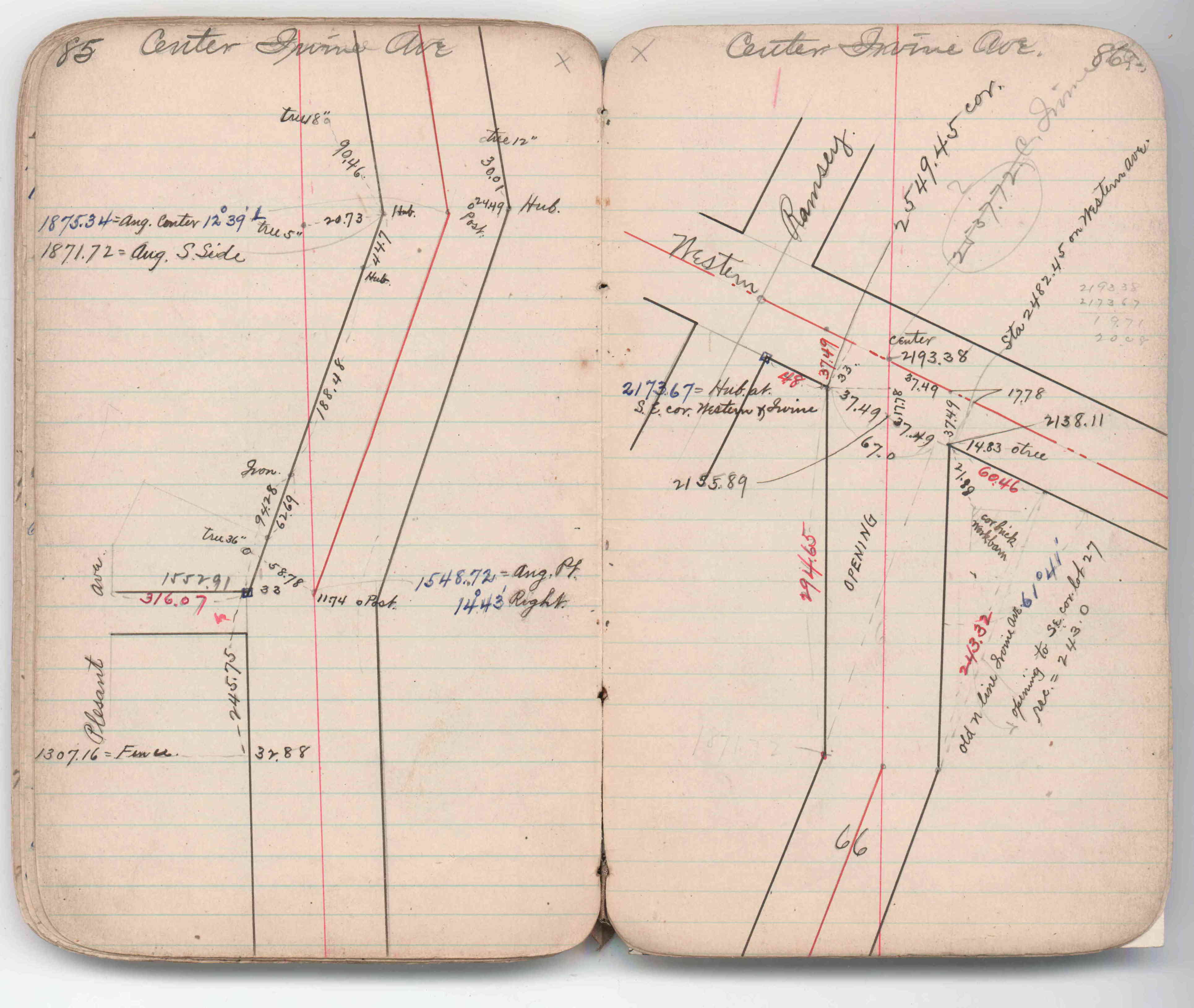
| FB 1725p.20 | JBI 07 p.85-86 | |||||
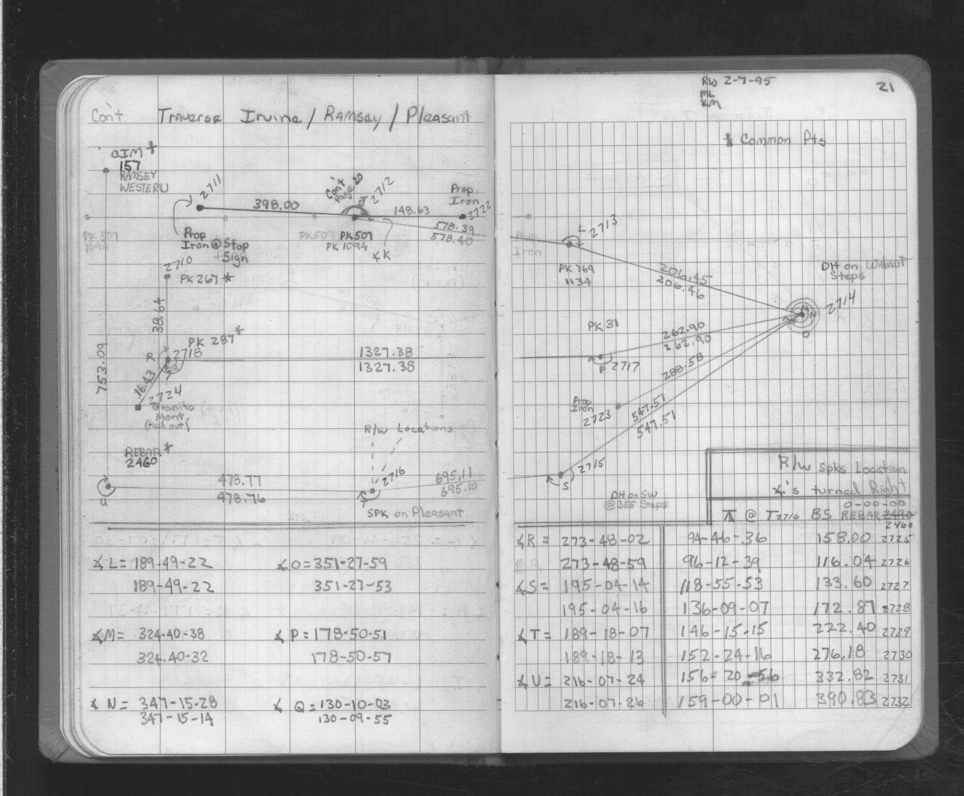
| FB 1725p.21 |
| FILE | SURVEYOR | LIC. NO. | DATE SIGNED | DATE TIED |
|---|---|---|---|---|
| 2724-__hi-A.tif | William J. Cutting | 20576 | December 2, 1994 | December 2, 1994 |
| FILE | PHOTO DATE | COMMENTS |
|---|---|---|
| 2724-__hi-2.jpg | December 2, 1994 | Close up of GM at base of power pole. |
| 2724-__hi-1.jpg | December 2, 1994 | Close up of GM at base of power pole. |