| NAD83 COORDINATES (1986 adj.): |
|---|
| X= 595361.039 Y= 156205.646 Z= 000.00 UAJ 05/10/1995 |
| 9/3/2012 | GM removed during street reconstruction project. |
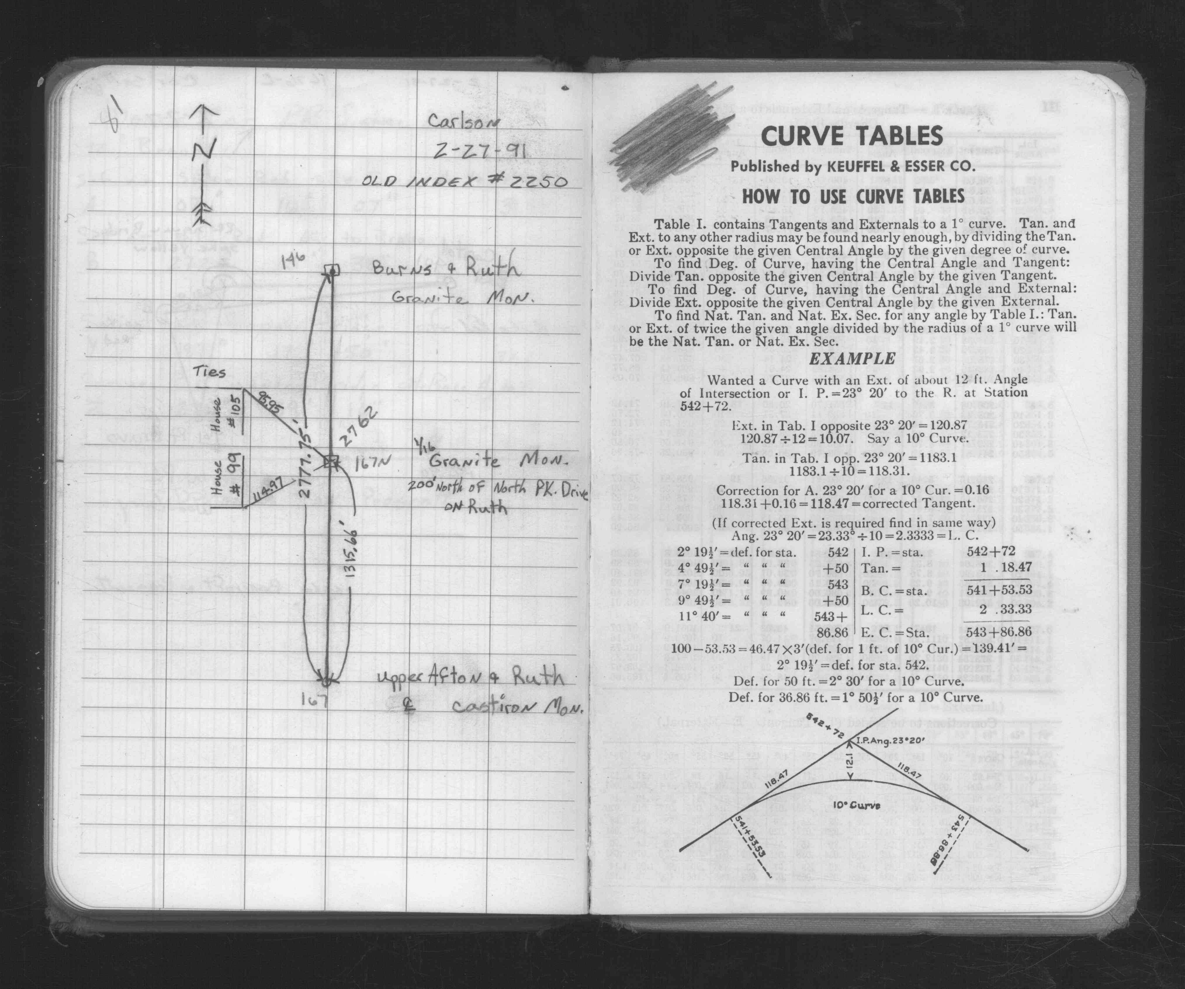
| 2/27/1991 | Located GM by measurements & placed ties. See FB 1676C p.81 |
| 3/1/1891 | (Unknown date Mar __, 1891 ) Monument set by J H Armstrong. See Std Map Sec 2-28-22 |
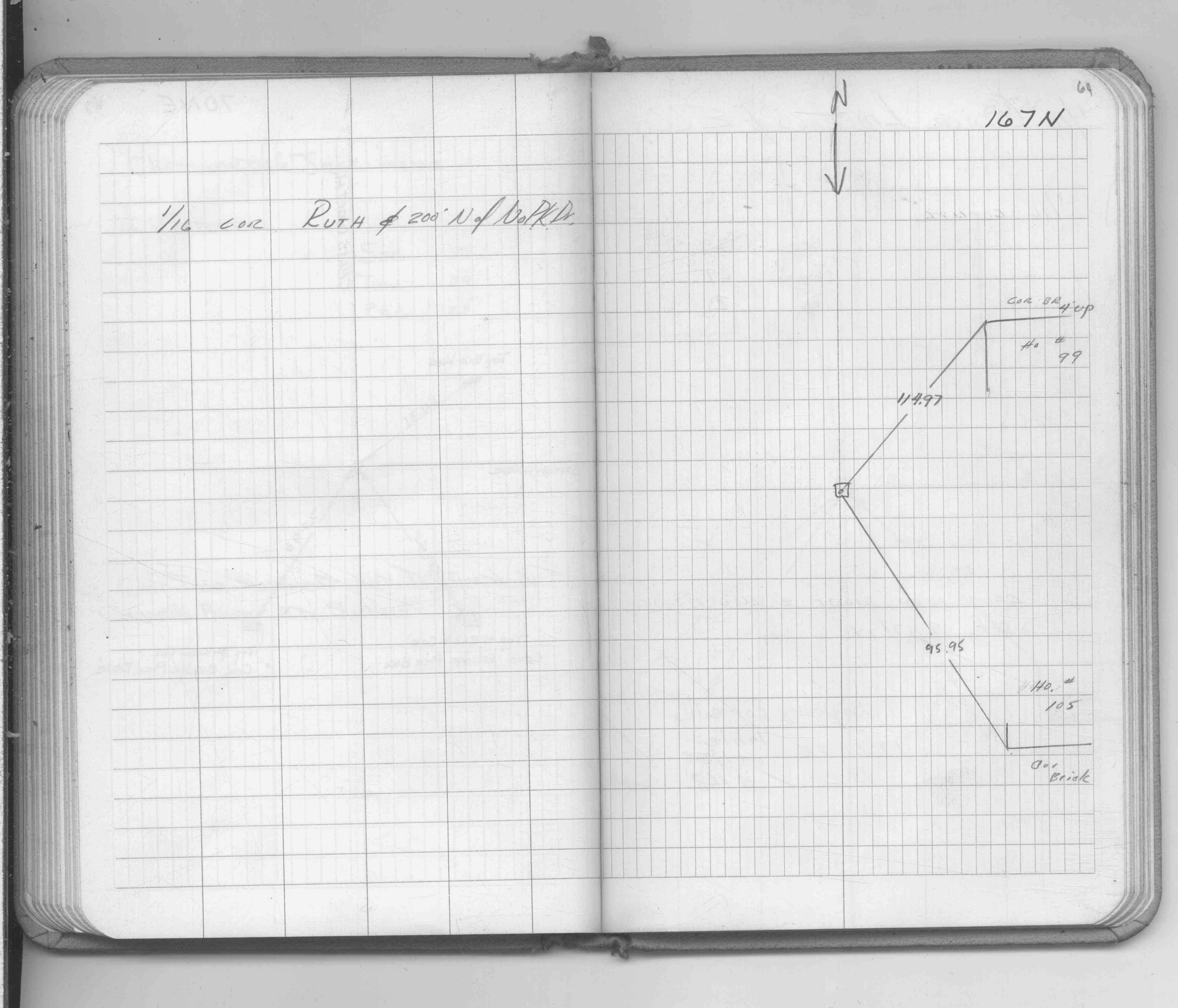
| 1/1/1800 | (Unknown date ___ __, ____ ) Placed ties. See FB 1689A p.64 |
Above is NOT an all inclusive history of this point. Please review all the links below.
| PLS NOTES | Field | Cross Section | Sewer | J.B. Irvine | Monument | River Survey |
|---|---|---|---|---|---|---|
| FB 1676Cp.81 | ||||||
| FB 1689Ap.64 |