| NAD83 COORDINATES (1986 adj.): |
|---|
| X= 592746.015 Y= 156201.651 Z= 882.10 10/24/2006 RTK-VRS |
| X= 592745.993 Y= 156201.603 Z= 000.00 UAJ 05/11/1995 |
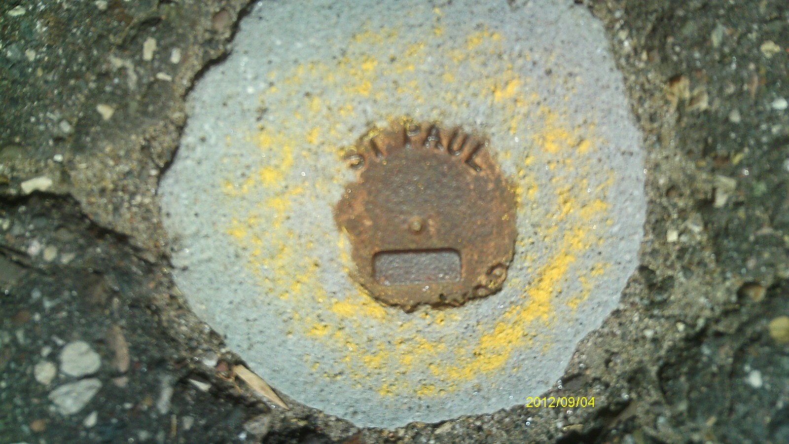
| 9/4/2012 | Found CIM at street grade. Photos taken. |
| 10/24/2006 | Position on CIM established by RTK-VRS GPS Elev 882.1 ft. |
| 5/20/1995 | Set CIM in concrete. See CofL 2763-2234-A |
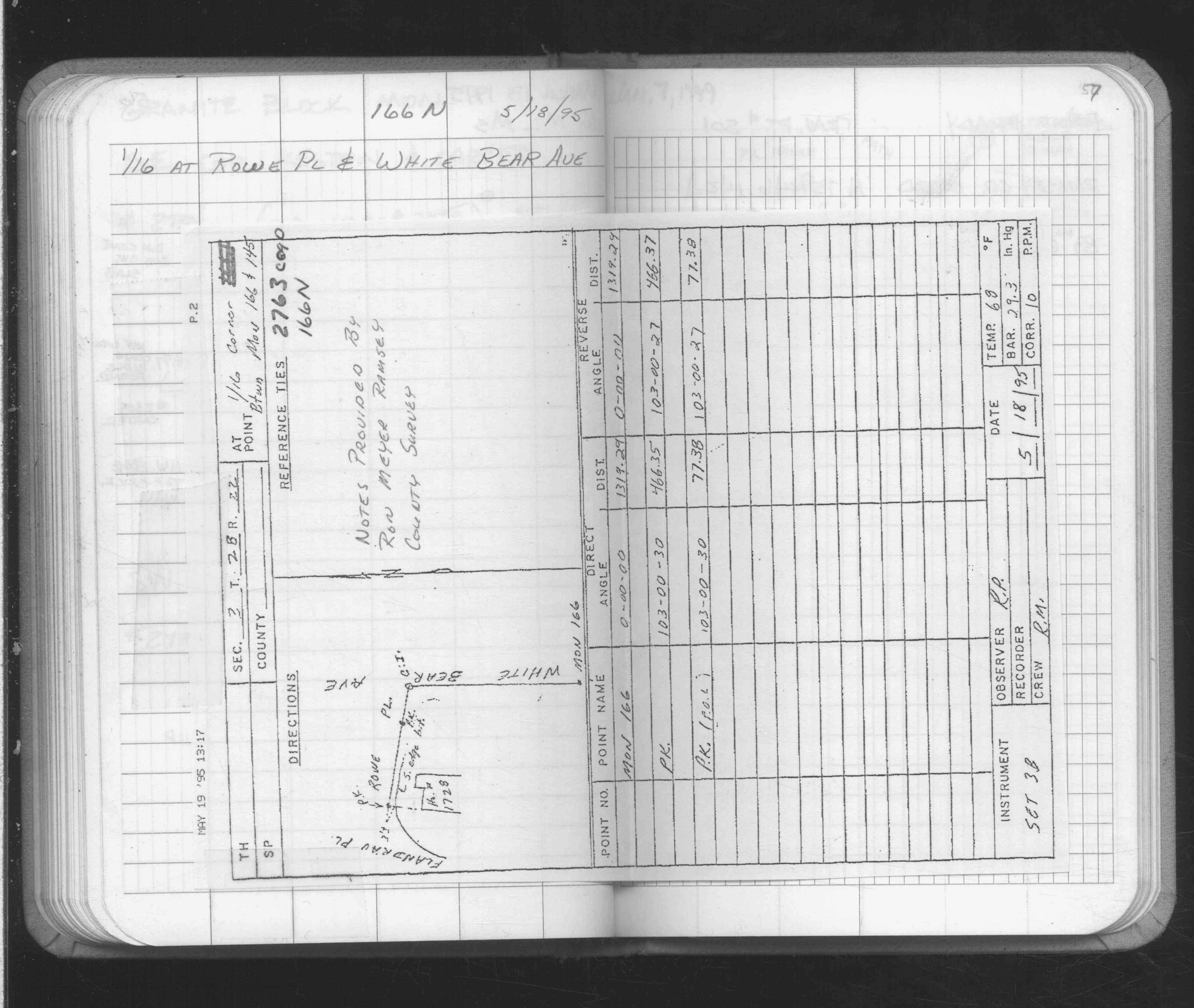
| 5/18/1995 | Fd CIM, placed ties, removed CIM for milling. See CofL 2763-2234-A |
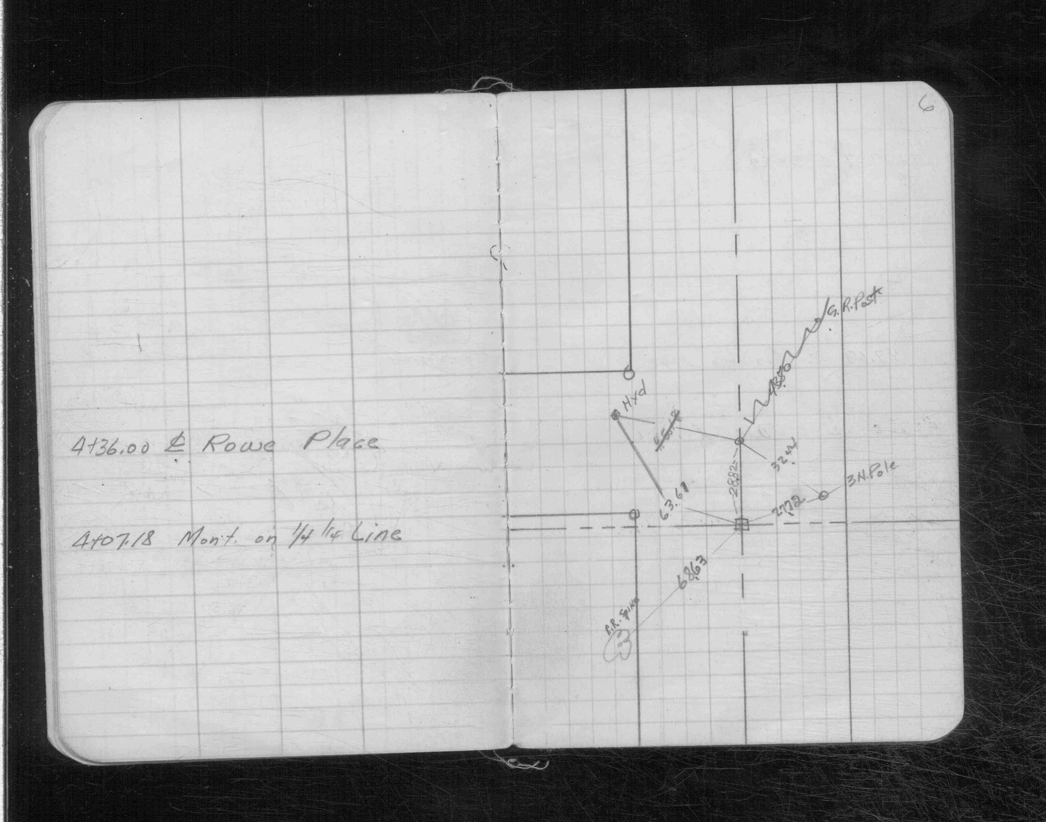
| 5/1/1995 | (Unknown date May __, 1995 ) Placed ties. See FB 1689 p.57 |
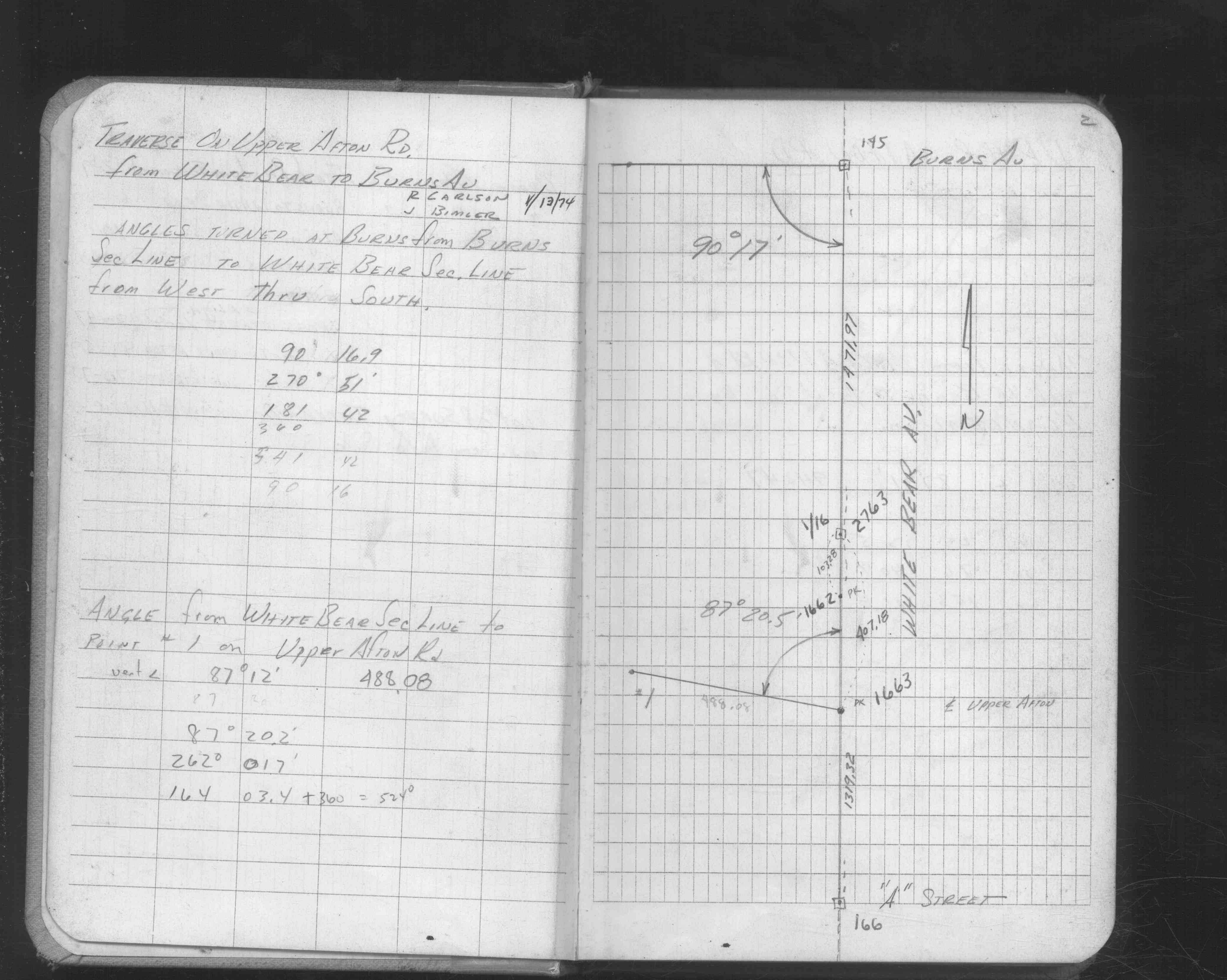
| 1/13/1974 | Located mon't by measurements. See FB 1646 p.2 |
| 1/1/1956 | (Unknown date Jan __, 1956 ) Placed ties. See CS 3162 p.6 |
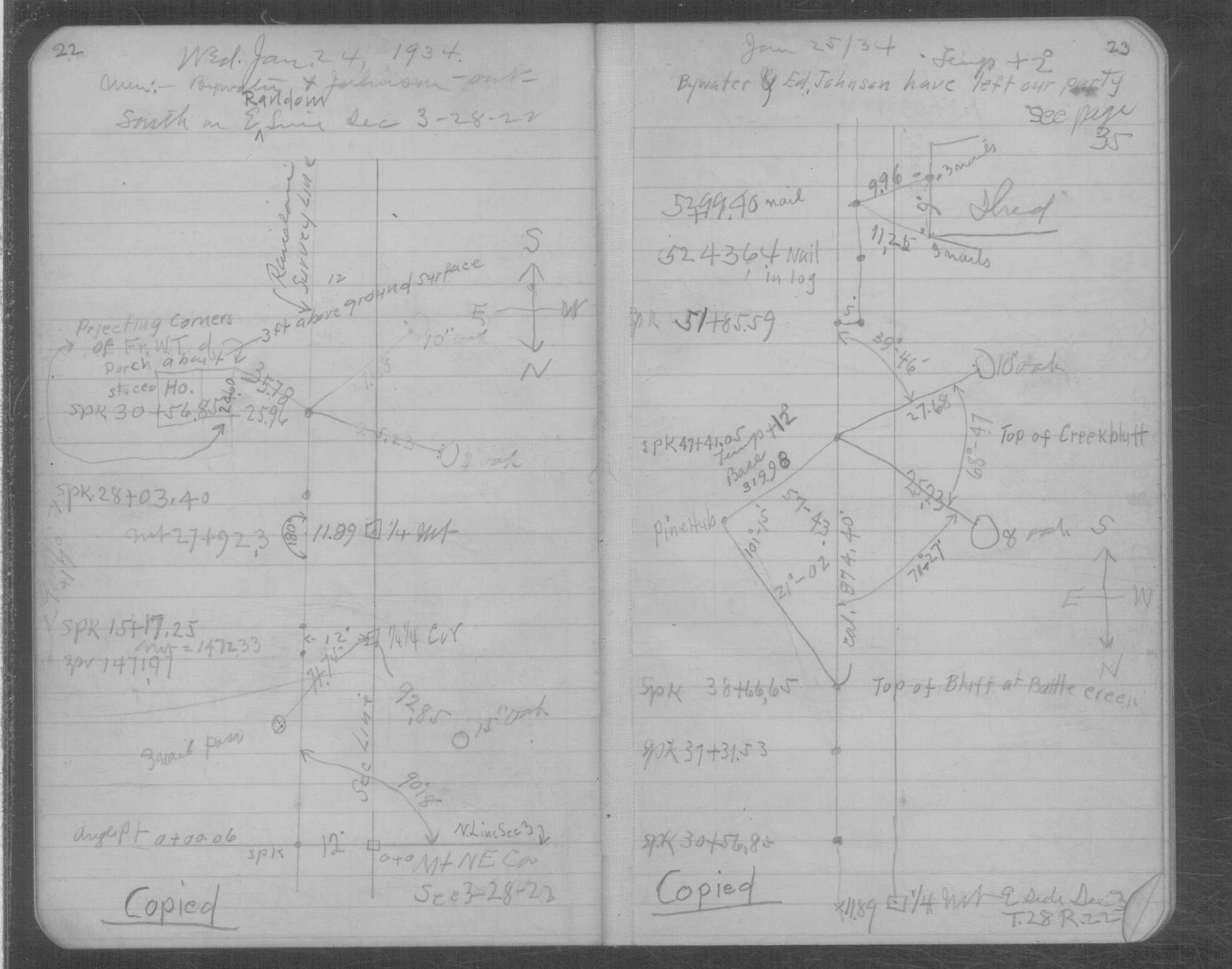
| 1/24/1934 | Placed ties on the Stone monument. See book MSX 6 p.22-23 |
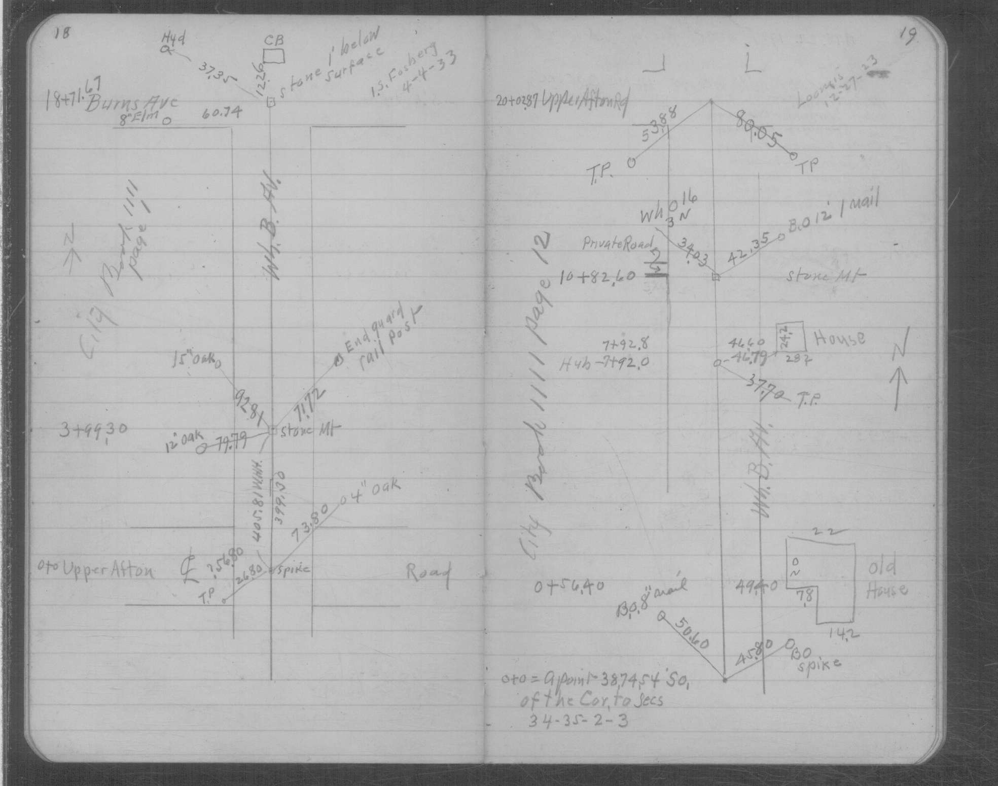
| 4/4/1933 | Placed ties on the Stone monument. See book MSX 6 p.18-19. |
| 2/1/1891 | (Unknown date Feb __, 1891 ) Monument set by J H Armstrong. See Std Map Sec 3-28-22 |
Above is NOT an all inclusive history of this point. Please review all the links below.
| PLS NOTES | Field | Cross Section | Sewer | J.B. Irvine | Monument | River Survey |
|---|---|---|---|---|---|---|
| FB 1646p.02 | CS 3162p.06 | MSX 0006 p.018-019 | ||||
| FB 1646p.02 | CS 3162p.06 | MSX 0006 p.022-023 | ||||
| FB 1689p.57 |
| FILE | SURVEYOR | LIC. NO. | DATE SIGNED | DATE TIED |
|---|---|---|---|---|
| 2763-2234-A.tif | Ronald F. Meyer | 9051 | July 16, 1996 | May 20, 1996 |
| 2763-2234-A.dwf | none | none | none | none |
| FILE | PHOTO DATE | COMMENTS |
|---|---|---|
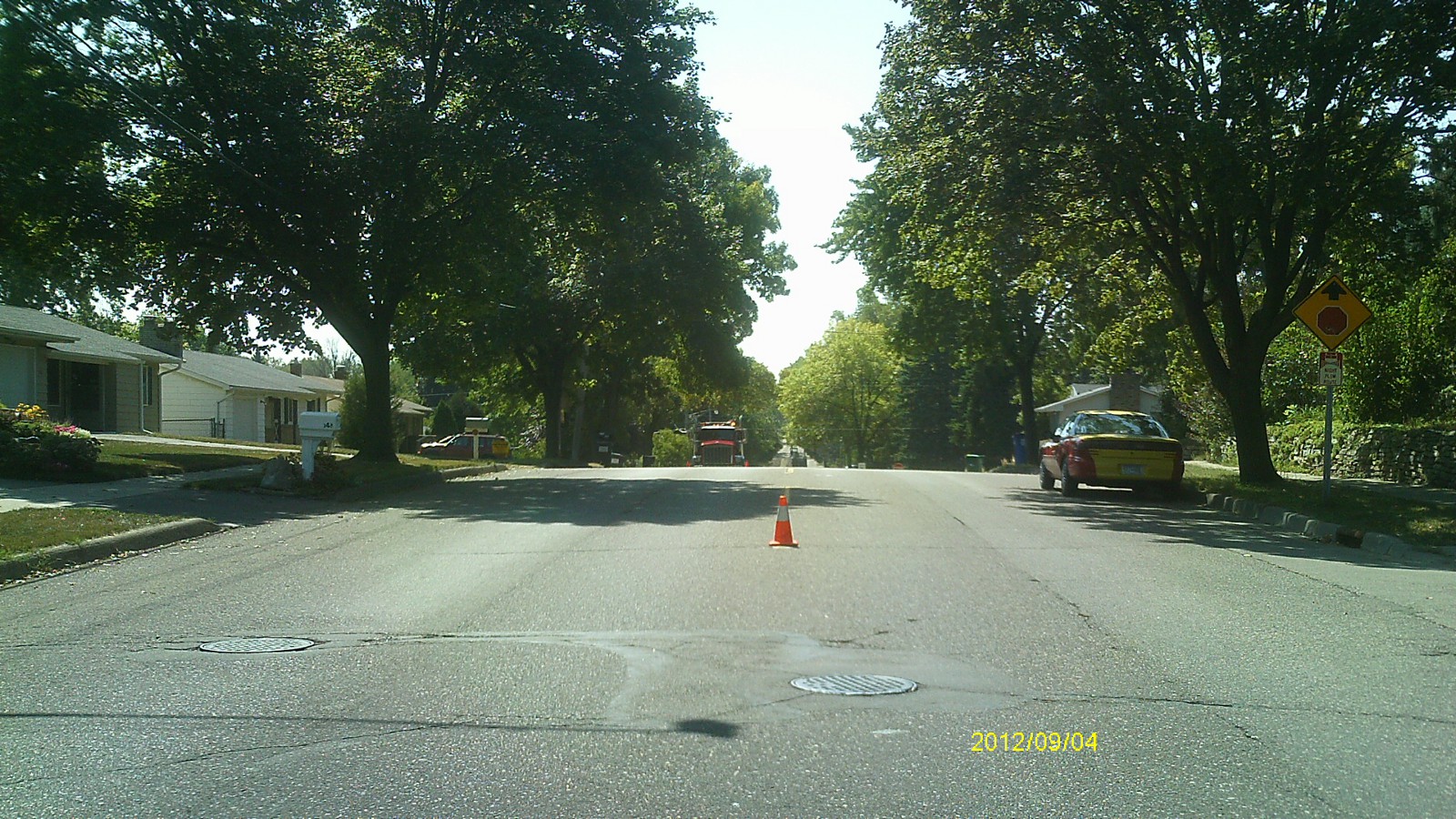
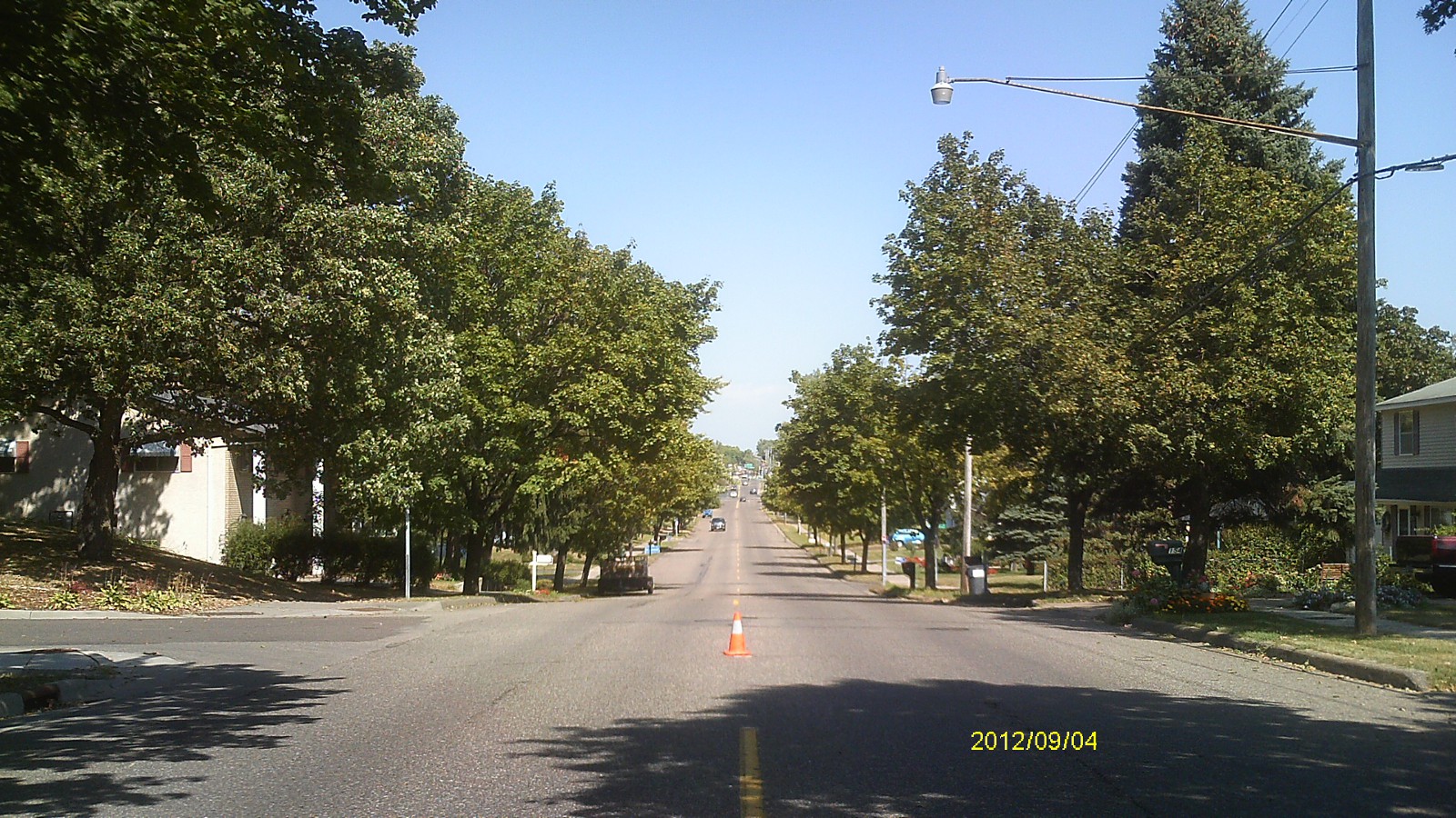
| 2763-2234-5.jpg | September 4, 2012 | Looking west along Rowe Pl. |
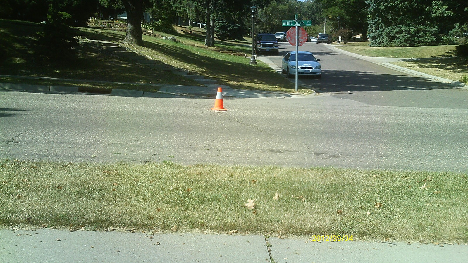
| 2763-2234-4.jpg | September 4, 2012 | Looking south along White Bear Ave. |
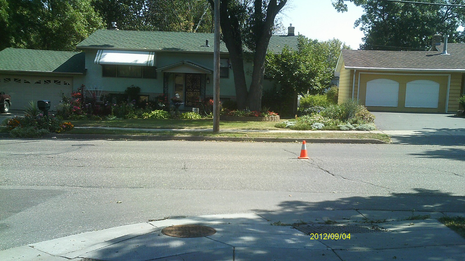
| 2763-2234-3.jpg | September 4, 2012 | Looking east. |
| 2763-2234-2.jpg | September 4, 2012 | Looking north along White Bear Ave. |
| 2763-2234-1.jpg | September 4, 2012 | Close up of monument. |