| NAD83 COORDINATES (1986 adj.): |
|---|
| X= 584067.853 Y= 157593.682 Z= 202.81 UAJ 07/07/1995 DBL |
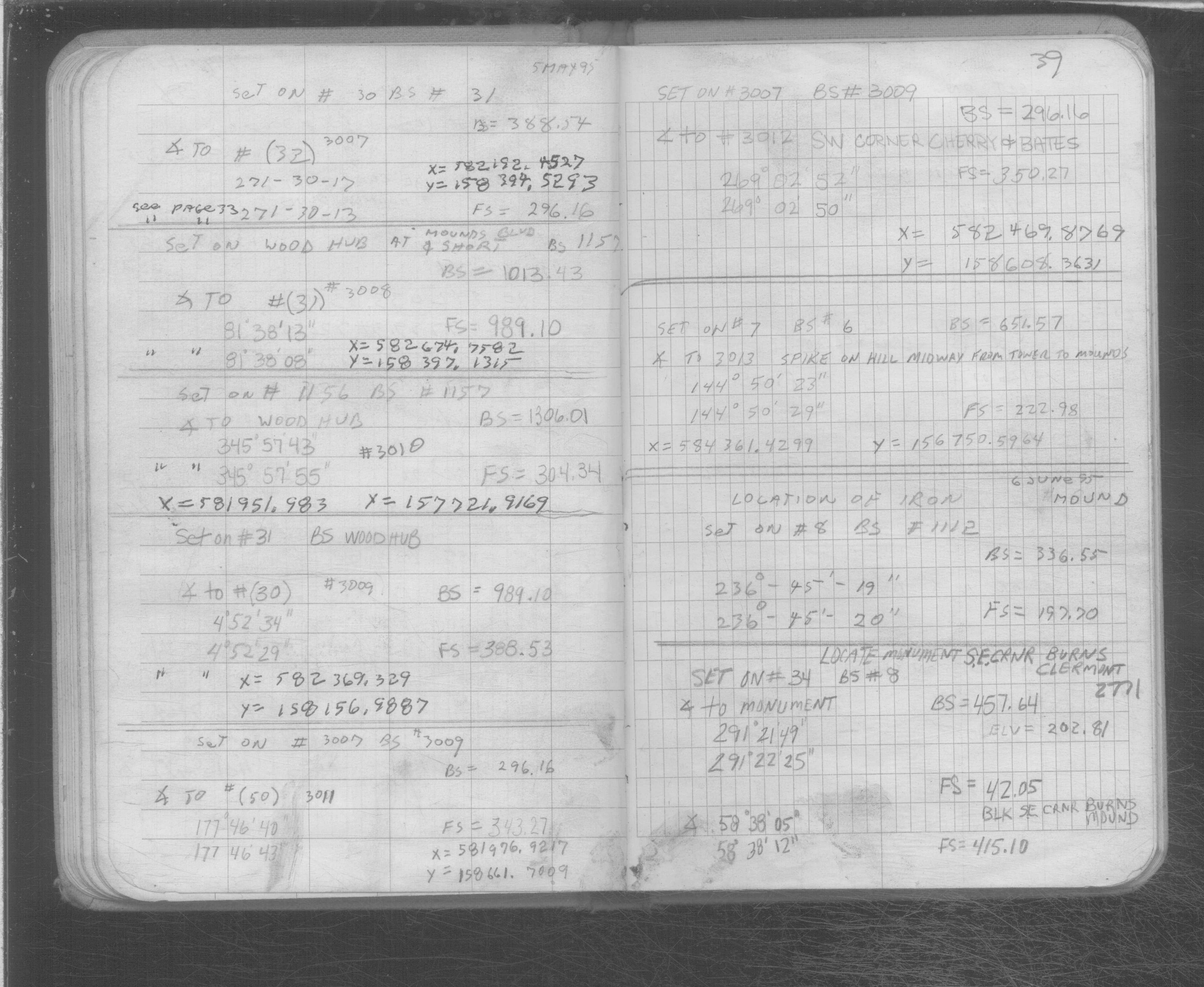
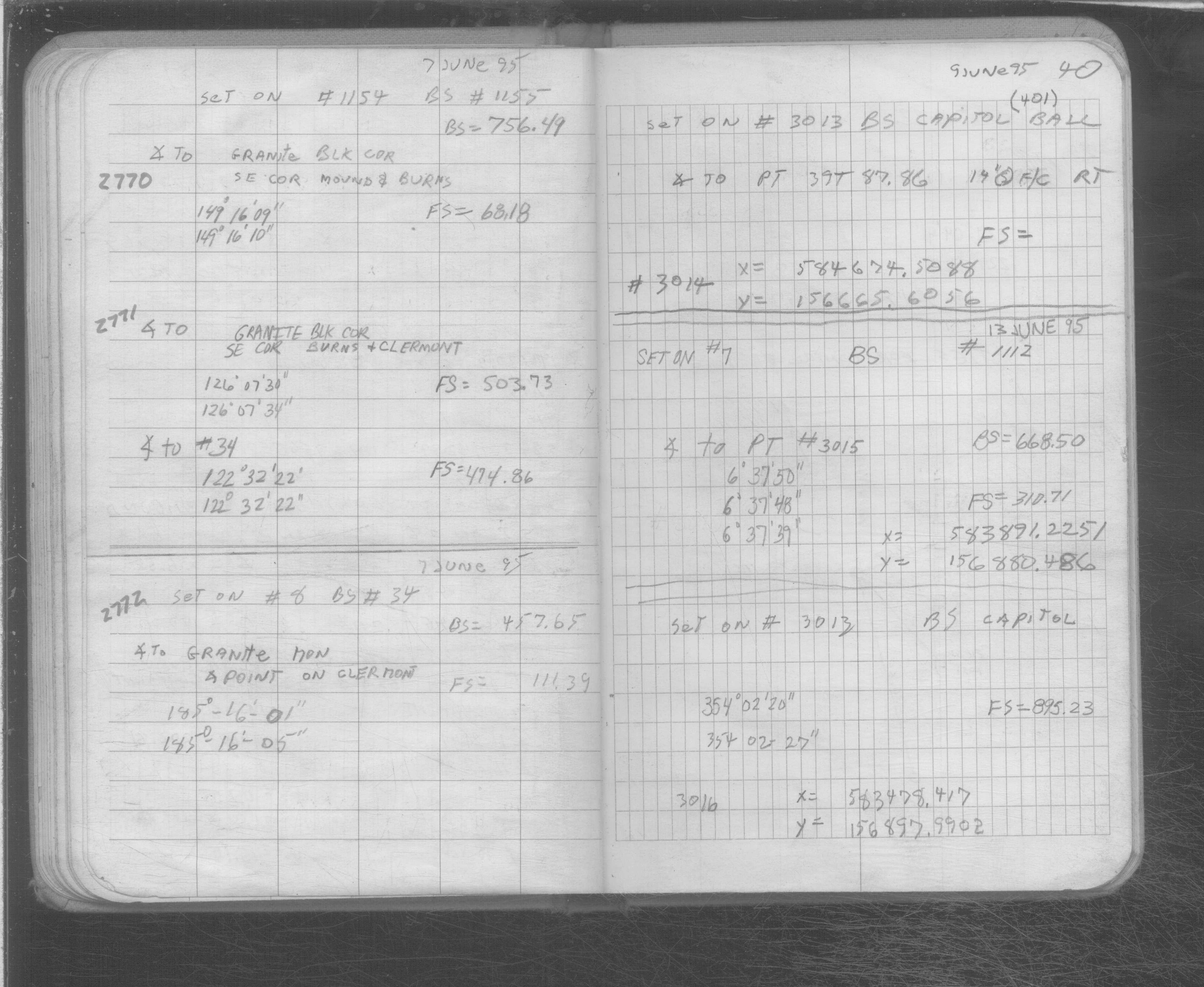
| 6/7/1995 | Located GM by traverse (single stub). See SB 566B p.40 |
| 2/16/1889 | Monument set by Chas Hunt |
Above is NOT an all inclusive history of this point. Please review all the links below.
| PLS NOTES | Field | Cross Section | Sewer | J.B. Irvine | Monument | River Survey |
|---|---|---|---|---|---|---|
| SB 0566Bp. 39 ,40 | ||||||
| SB 0566Bp.40 |