| NAD83 COORDINATES (1986 adj.): |
|---|
| X= 572959.284 Y= 155097.860 Z= 735.8 02/07/2006 RTK-VRS |
| X= 572959.400 Y= 155097.767 Z= 000.00 UAJ 10/23/1996 STB |
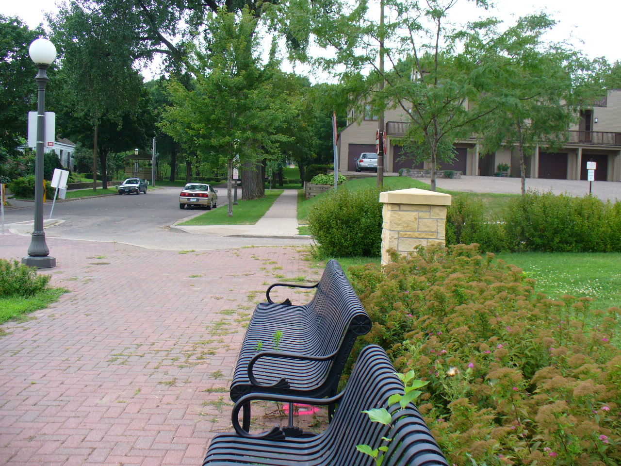
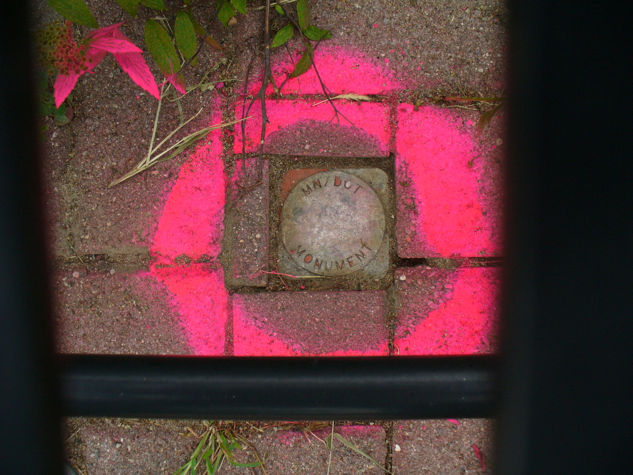
| 8/9/2006 | Fd Disc under metal park bench. Photos taken. |
| 1/27/2006 | Position on Disc established by RTK-VRS GPS Elev 735.8 ft. See CofL 2965-0547A-A |
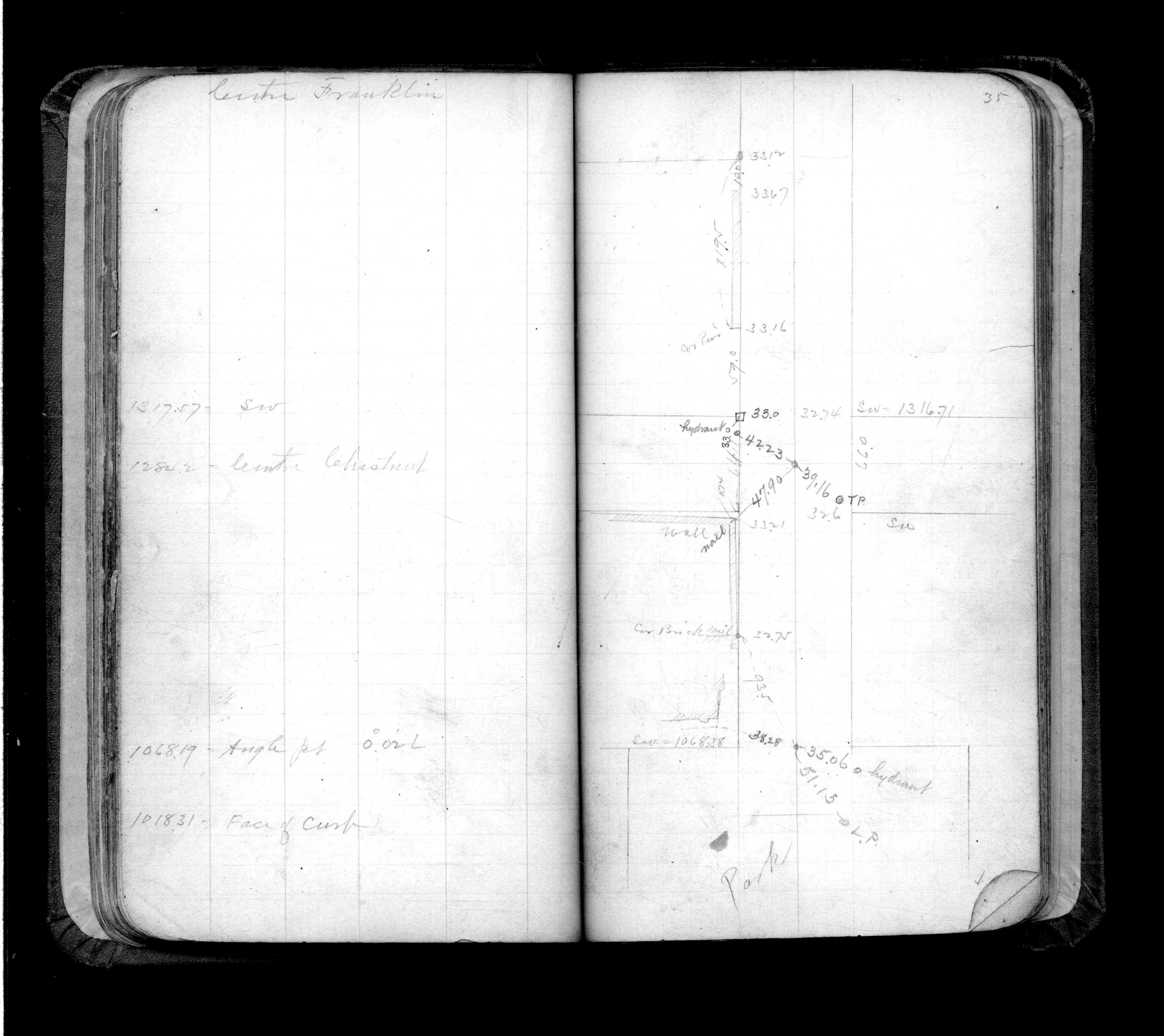
| 12/1/1999 | (Unknown date Dec __, 1999 ) Placed ties. See FB 325 p.35 |
| 11/18/1999 | Monument set over GM. |
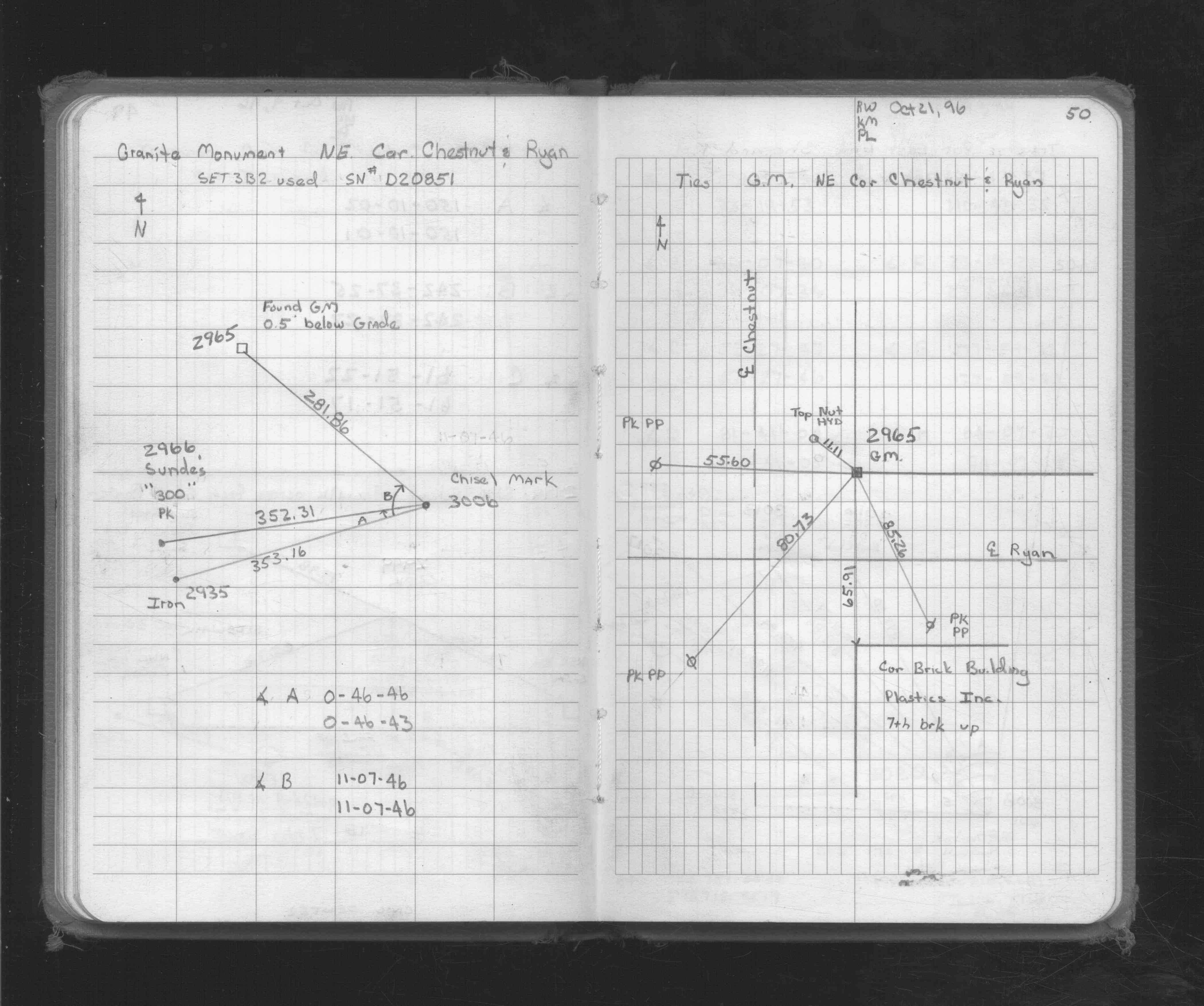
| 10/21/1996 | Located GM by traverse (single stub) & placed ties. See FB 1719A p.50 |
| 1/1/1996 | (Unknown date ___ __, 1996 ) Fall of 1996 recoved GM aprox .5 ft below sidewalk grade. |
| 11/1/1899 | (Unknown date Nov __, 1899 ) Monument set by J B Irvine |
Above is NOT an all inclusive history of this point. Please review all the links below.
| PLS NOTES | Field | Cross Section | Sewer | J.B. Irvine | Monument | River Survey |
|---|---|---|---|---|---|---|
| FB 0325p.35 | ||||||
| FB 1719Ap.50 |
| FILE | SURVEYOR | LIC. NO. | DATE SIGNED | DATE TIED |
|---|---|---|---|---|
| 2965-0547A-A.tif | none | none | none | none |
| FILE | PHOTO DATE | COMMENTS |
|---|---|---|
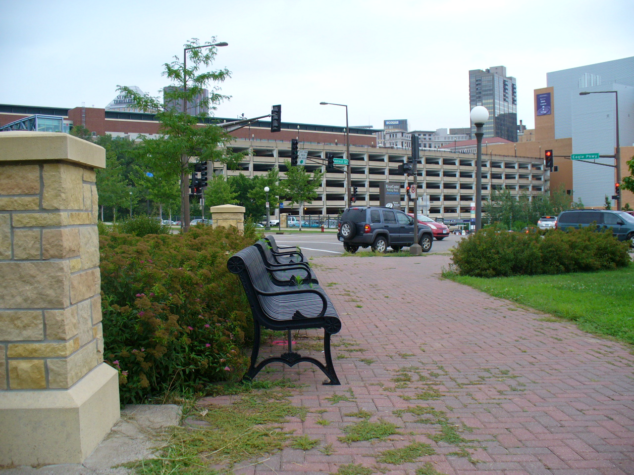
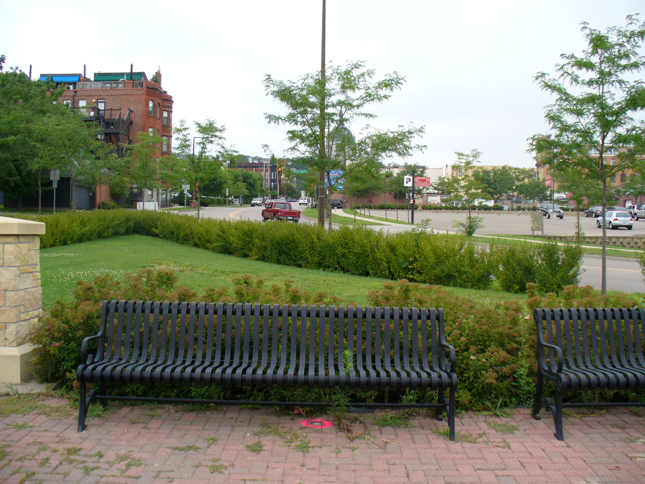
| 2965-0547A-5.jpg | August 9, 2006 | Looking Southwest along the North side of vacated Ryan. |
| 2965-0547A-4.jpg | August 9, 2006 | Looking Southeast along the East side of vacated Chestnut St. |
| 2965-0547A-3.jpg | August 9, 2006 | Looking Northeast along the North side of vacated Ryan. |
| 2965-0547A-2.jpg | August 9, 2006 | Looking Northwest along the East side of Chestnut St. |
| 2965-0547A-1.jpg | August 9, 2006 | Close-up of Disk. |