| NAD83 COORDINATES (1986 adj.): |
|---|
| X= 577061.908 Y= 148383.924 Z= 000.00 LSQ 10/10/1996 FLT |
| 5/3/2004 | Bohlen Surveying & Enginneering recoverd GM at Elev 107.93 ft. |
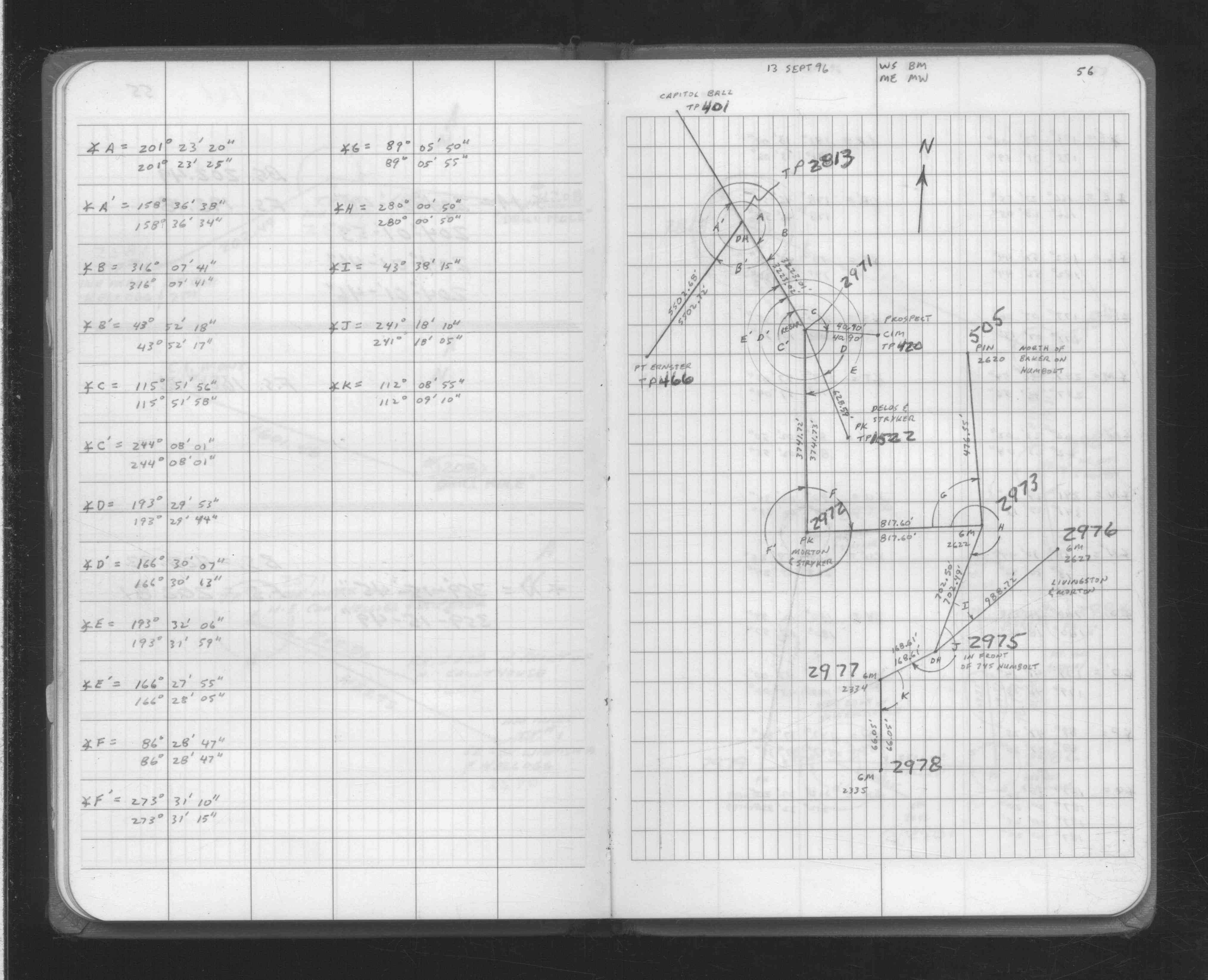
| 9/13/1996 | Fd GM. See FB 1708A p.56 |
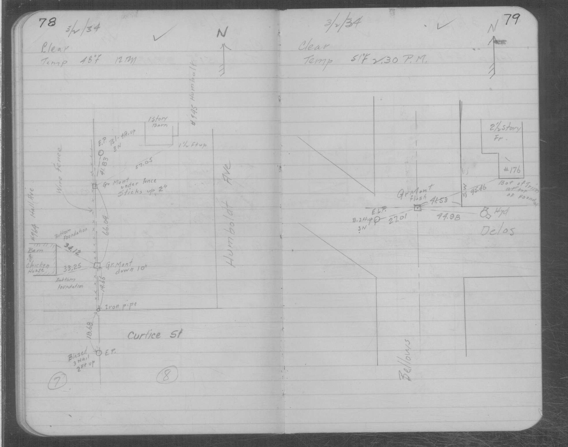
| 3/2/1934 | Placed ties on GM two inches above grade. See MSX 1 p.78-79 |
| 1/1/1891 | (Unknown date ___ __, 1891 ) Monument set by J H Armstrong |
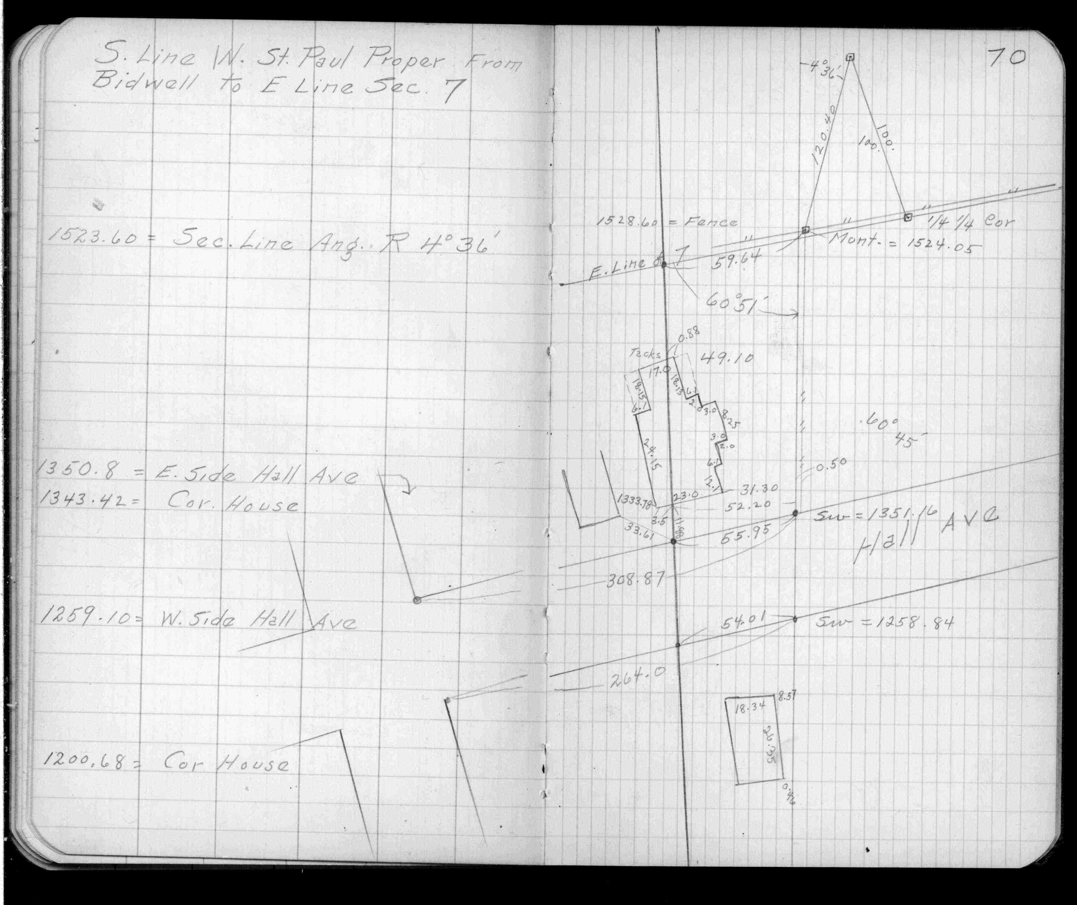
| 5/1/1890 | (Unknown date May __, 1890 ) Placed ties. See FB 320 p.70 |
Above is NOT an all inclusive history of this point. Please review all the links below.
| PLS NOTES | Field | Cross Section | Sewer | J.B. Irvine | Monument | River Survey |
|---|---|---|---|---|---|---|
| FB 0320p.70 | MSX 0001 p.078-079 | |||||
| FB 1708Ap.56 |