| NAD83 COORDINATES (1986 adj.): |
|---|
| X= 577065.264 Y= 147916.625 Z= 943.4 08/10/2005 RTK-VRS |
| X= 577065.191 Y= 147916.441 Z= 000.00 LSQ 10/10/1996 FLT |
| 8/11/2005 | Fd GM. Position established by GPS RTK-VRS. Placed ties. See CofL 2981-2342-A |
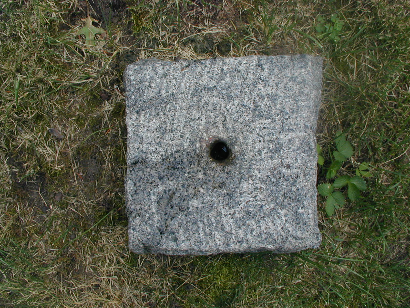
| 7/26/2005 | Placed magnet in hole of GM. |
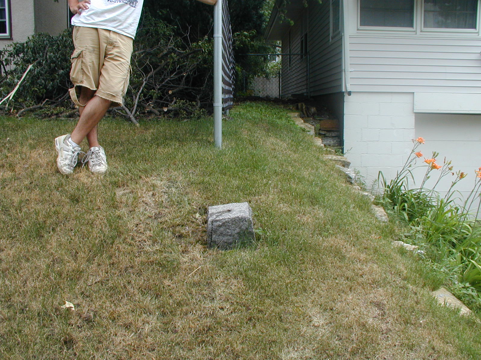
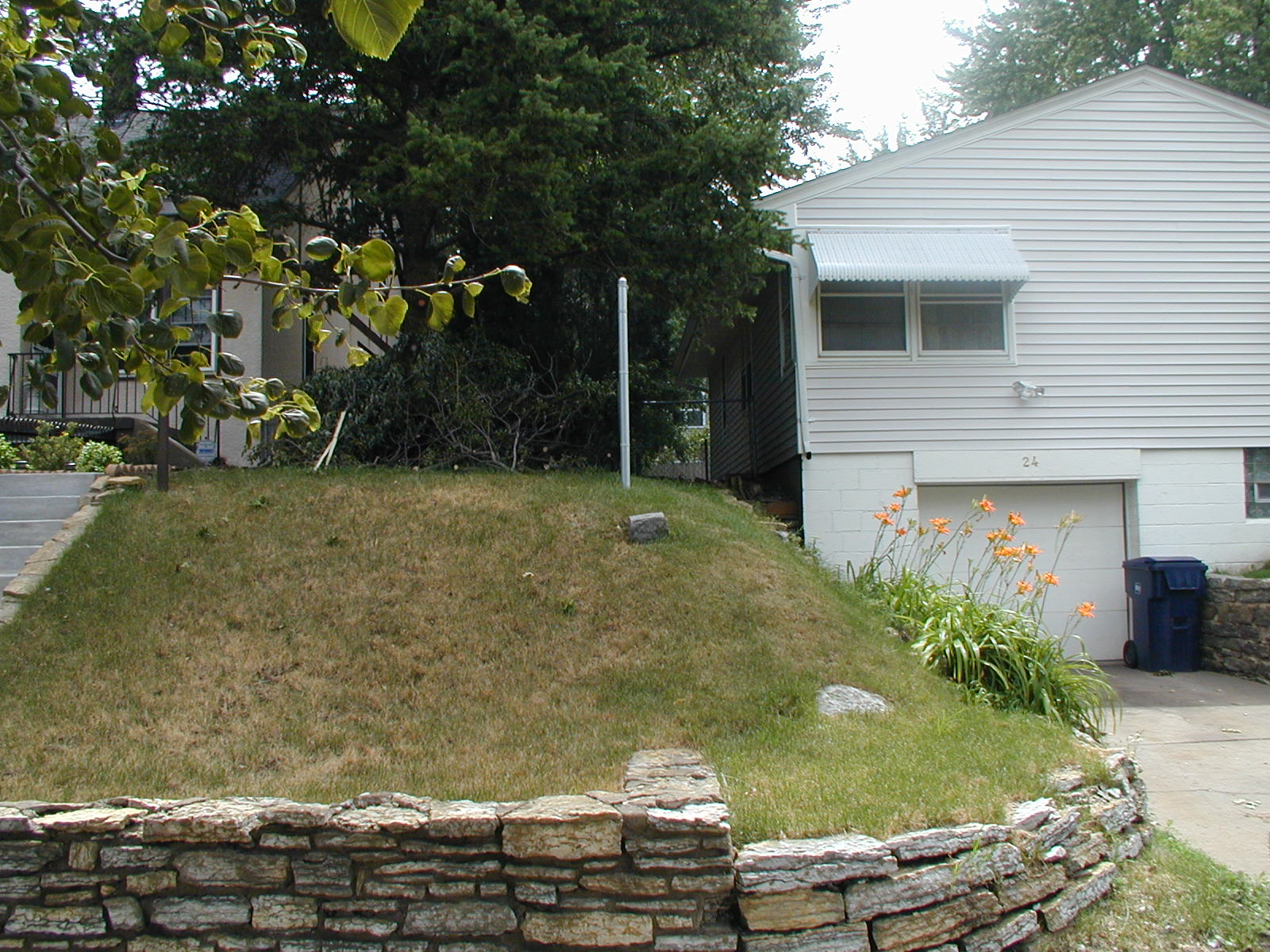
| 7/7/2005 | Fd GM. Photos taken. |
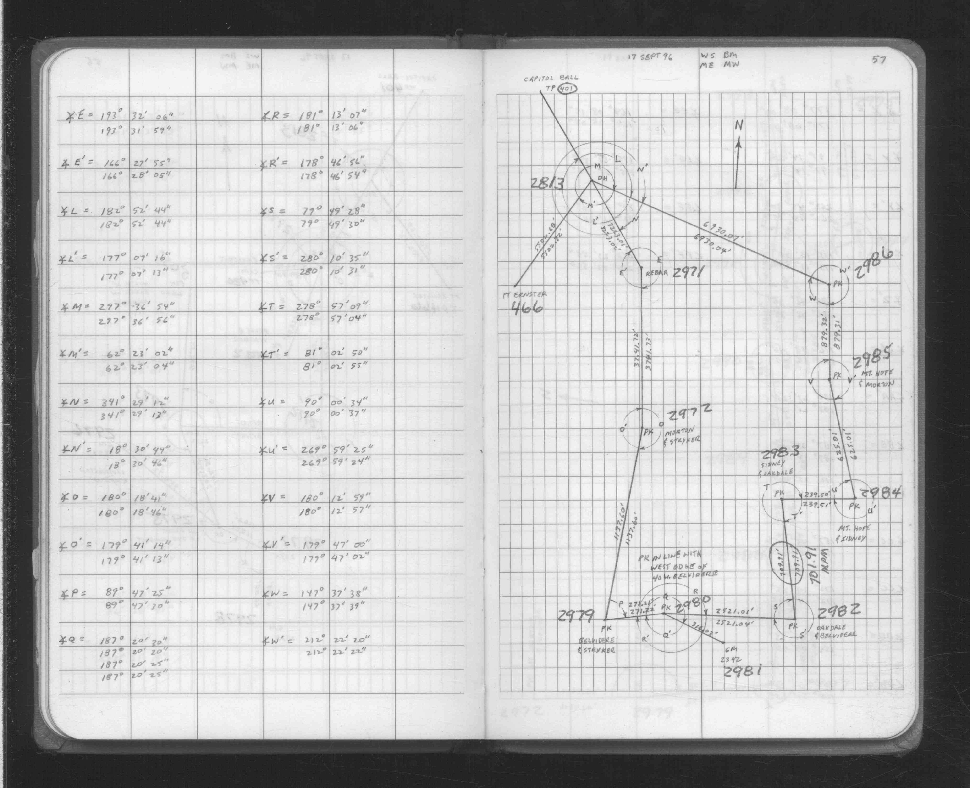
| 9/17/1996 | Located GM by traverse (single stub). See FB 1708A p.57 |
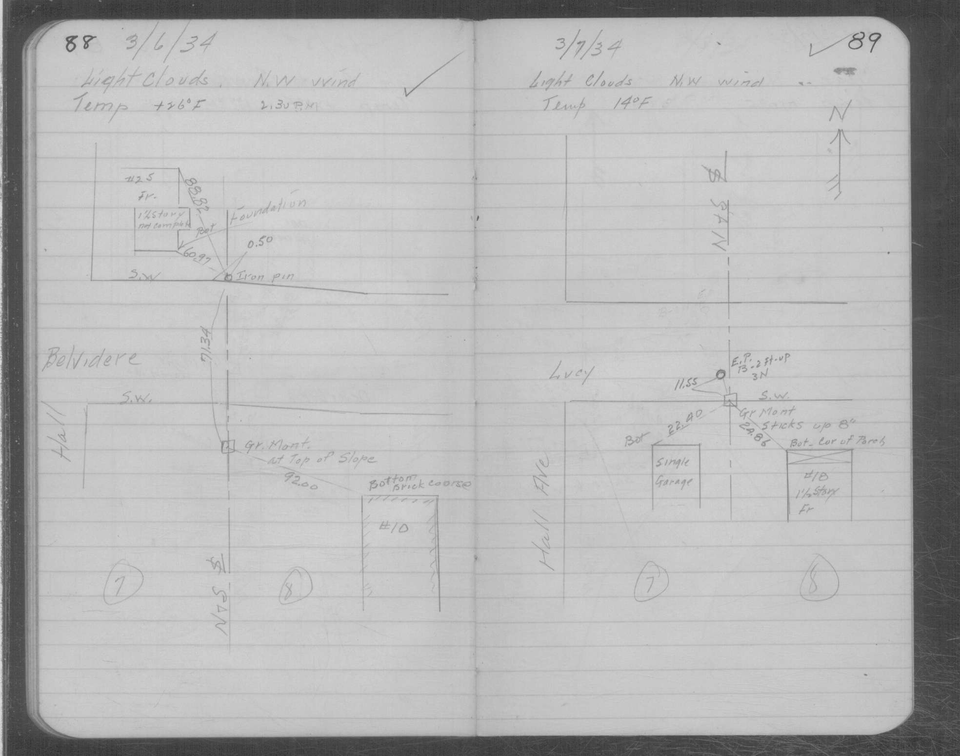
| 3/6/1934 | Placed ties on GM at top of slope. See MSX 1 p.88-89 |
| 1/1/1891 | (Unknown date ___ __, 1891 ) Monument set by J H Armstrong |
Above is NOT an all inclusive history of this point. Please review all the links below.
| PLS NOTES | Field | Cross Section | Sewer | J.B. Irvine | Monument | River Survey |
|---|---|---|---|---|---|---|
| FB 1708Ap.57 | MSX 0001 p.088-089 |
| FILE | SURVEYOR | LIC. NO. | DATE SIGNED | DATE TIED |
|---|---|---|---|---|
| 2981-2342-A.tif | Michael P. Murphy | 41001 | August 18, 2005 | August 11, 2005 |
| FILE | PHOTO DATE | COMMENTS |
|---|---|---|
| 2981-2342-3.jpg | July 7, 2005 | Looking South at GM on the hill near the fence line. |
| 2981-2342-2.jpg | July 7, 2005 | Looking South from Belvidere St. |
| 2981-2342-1.jpg | July 7, 2005 | Close-up of GM. |