| NAD83 COORDINATES (1986 adj.): |
|---|
| X= 578977.195 Y= 147326.175 Z= 000.00 LSQ 10/10/1996 FLT |
| 10/3/2013 | Probed 1.4 ft below sidewalk grade to probable GM at addition line. |
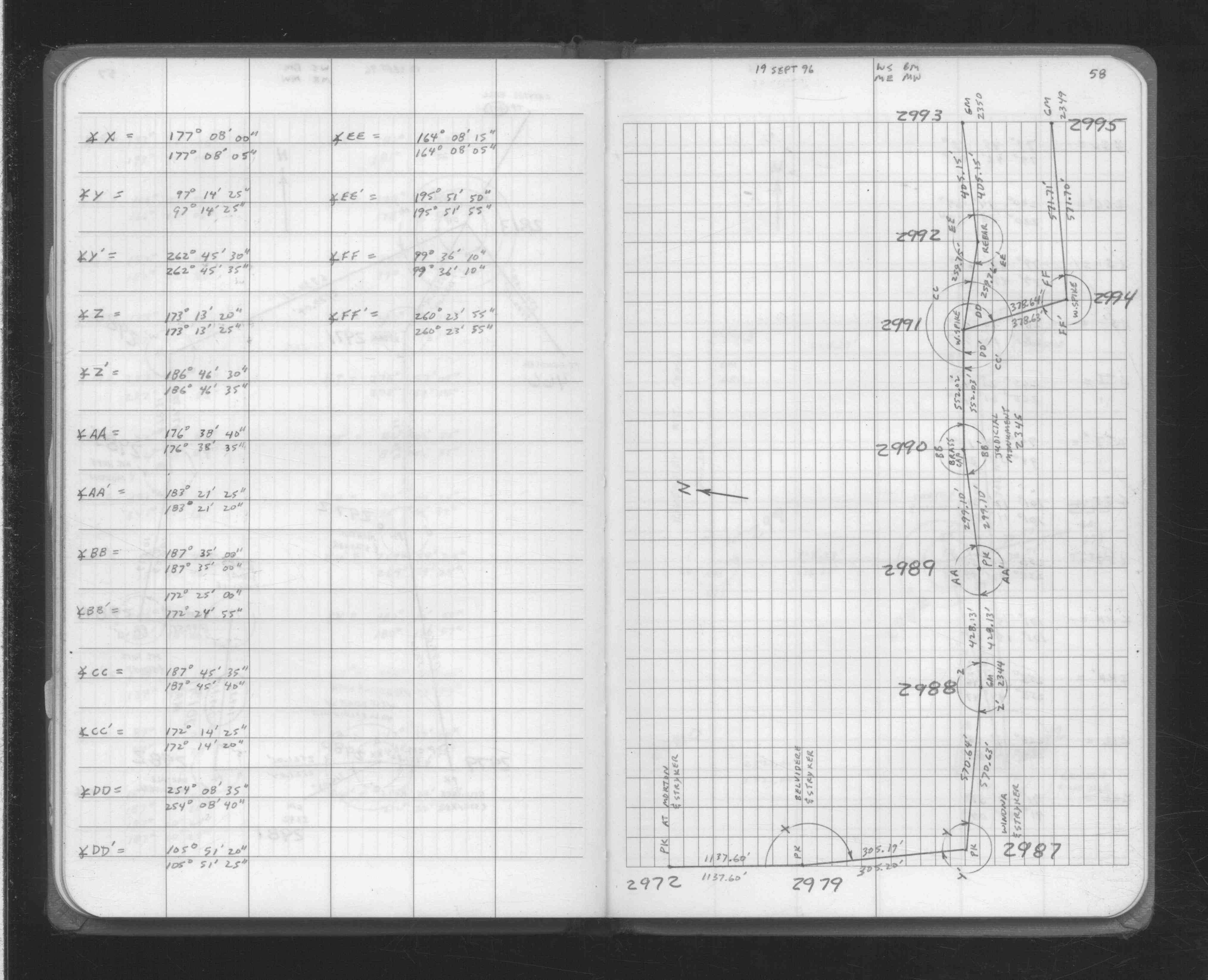
| 9/19/1996 | Traversed through GM. See FB 1708A p.58 |
| 1/1/1891 | (Unknown date ___ __, 1891 ) Monument set by J H Armstrong |
Above is NOT an all inclusive history of this point. Please review all the links below.
| PLS NOTES | Field | Cross Section | Sewer | J.B. Irvine | Monument | River Survey |
|---|---|---|---|---|---|---|
| FB 1708Ap.58 |